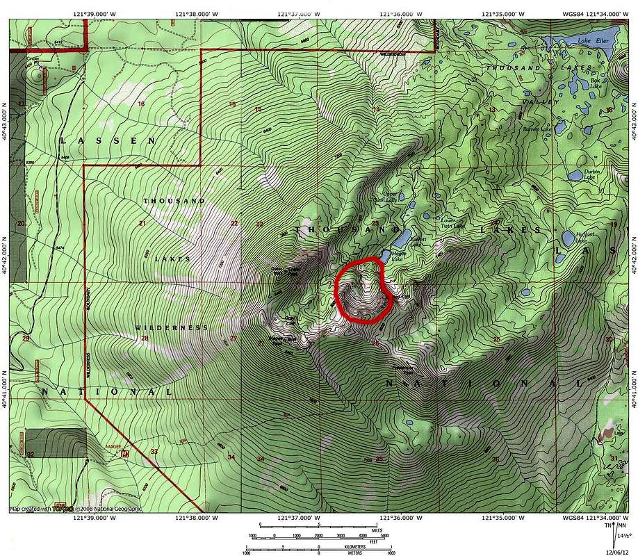
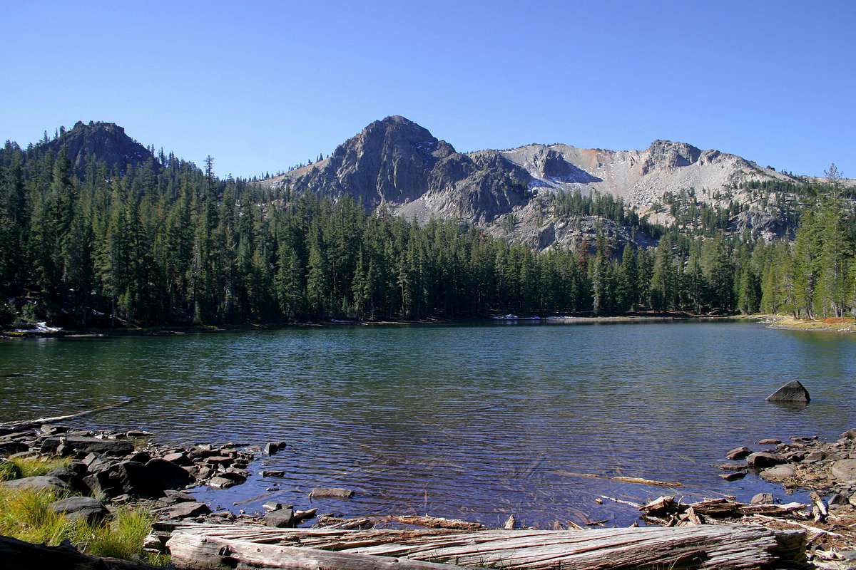
Ahhh, yes, the Red Cliffs; that bowl does look like a good ski suggestion based on the map and photo. Bubba, I forgot you had made a page for that spot and it's also nice to hear that there will be a go to page on SP for the wilderness area. I need to allow myself enough time to tag the Red Cliffs highpoint and also to visit the lakes via the Cypress Trailhead on one of my next visits to Thousand Lakes Wilderness. Freaner Peak sounds like a nice viewpoint as well. Maybe I'll be lucky and conditions will make a visit feasible late this month.
jibmaster wrote:It looks like the shortest distance from a road is on the south side.
By Aspan Butte. Are there any gates? Or can I drive in as far as the snow will allow?
Thanx for all the info!
There are no gates in the Ashpan area (not sure about the access roads on the north and east sides of the wilderness, but I doubt it). When there is enough snow, I recall seeing a roadblock plowed to keep people from trying to drive on what becomes snowmobile trails. The shortest (but not the most scenic) route to the rim from a trailhead is the Magee Trail mentioned above. Closed/snowed in access roads and/or cross country travel might make other approaches more appealing as far as distance, but off trail travel might not be easy going in very many areas. I'd guess that the major forest roads are not yet blocked by snow and are still seeing a small amount of traffic. The area is well signed. Checking my summit logs for Crater and Magee on SP, I did run into snow and downed trees that were worth stopping and parking for on the short spur road that leads to the Magee Trailhead last December. The main forest road from Ashpan ranged from snow free, to snow and ice that was manageable with 4 wheel drive and decent tires. I carried chains just in case. I'd guess that Cypress Trailhead is most likely to remain snow free the longest. These links might help with estimating likely current conditions, but beware the area northwest of Lassen you are aiming for was colder on my visits than the area pictured in the Caltrans Cam, besides not being paved, nor plowed:
1. You can click on the cam at 5,800 feet near Lassen's NW entrance south of Ashpan on HWY 44 near the junction with HWY 89--
http://www.dot.ca.gov/dist2/cctv/shastaco.html2. Lassen conditions & webcam at Manzanita Lake (5,850 feet), as well as higher spots (phone number provided for updated NP trail info.)--
http://www.nps.gov/lavo/planyourvisit/current_conditions.htm. -- it looks snow covered at 6,700 feet in SW Lassen and a sensor is indicating about 6 feet of snow on Lower Lassen Peak at 8,250 ft.