Page 11 of 22
Re: Beautiful SHASTA Current Conditions

Posted:
Thu Jun 12, 2014 5:38 amby yosemiteforlife67
how close to clear creek trail.....is mud creek?
Re: Beautiful SHASTA Current Conditions
Posted:
Thu Jun 12, 2014 7:54 amby Bubba Suess
yosemiteforlife67 wrote:how close to clear creek trail.....is mud creek?
The Clear Creek Trail follows the rim of Mud Creek Canyon. The confluence of the two creeks is visible from the trail:
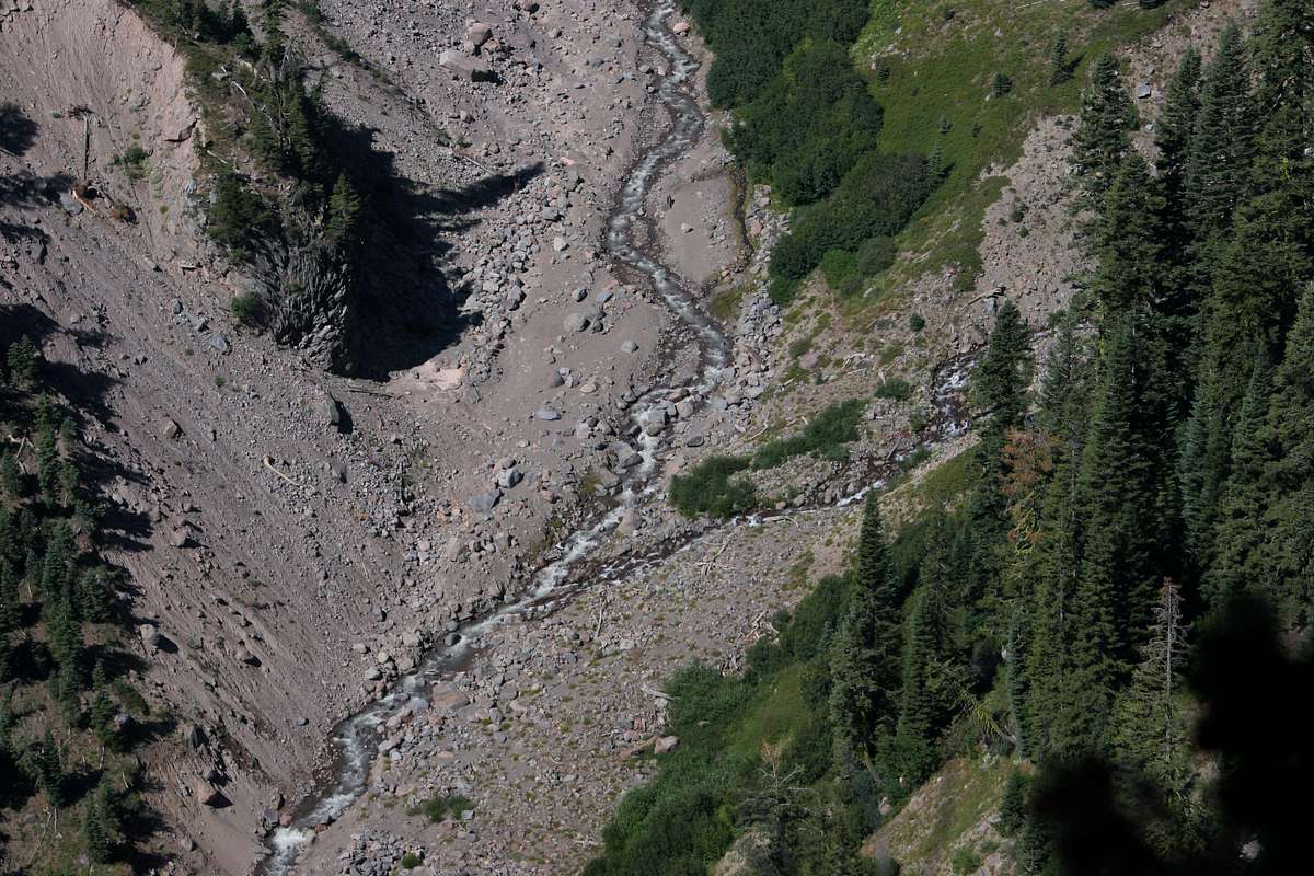
The trail is so named because it leads to the large complex of springs that is the source of Clear Creek.
Re: Beautiful SHASTA Current Conditions
Posted:
Mon Jun 16, 2014 6:20 pmby JHH60
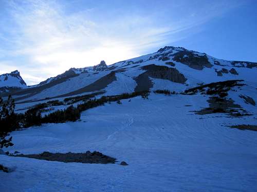
I finally found the USB connector for the camera I took up Clear Creek over Memorial Day. Bear in mind this photo is now three weeks old, but was taken a little closer to the start of the climb (from base camp at 8300') than Bubba Seuss' photo so may still be useful to someone. The route goes up the obvious glissade tracks.

Re: Beautiful SHASTA Current Conditions
Posted:
Mon Jun 16, 2014 7:22 pmby jibmaster
Was up at Shasta last week. Approached via the Gravel Creek TH.
Didn't make it up too far - the past 12 months haven't treated me well(not much skiing), so am
not in the best of shape.
Working on that...next year will be better.
Anyhoo - got some pics
https://www.flickr.com/photos/jibmaster/A couple videos are already up, with two more uploading showing the skiing.
:edit: vids are up
https://www.youtube.com/channel/UCDn6S5 ... frpoZ51OfA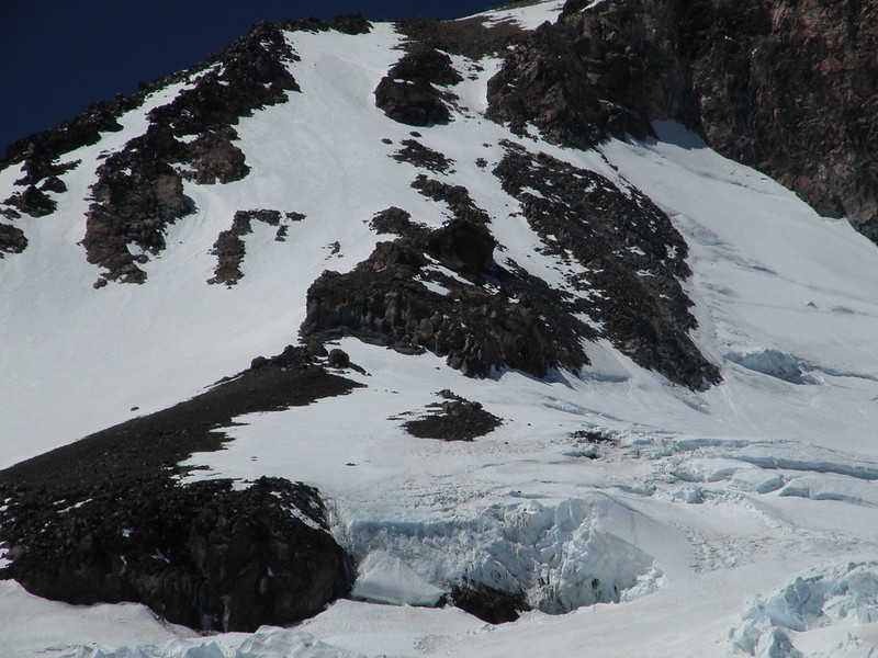
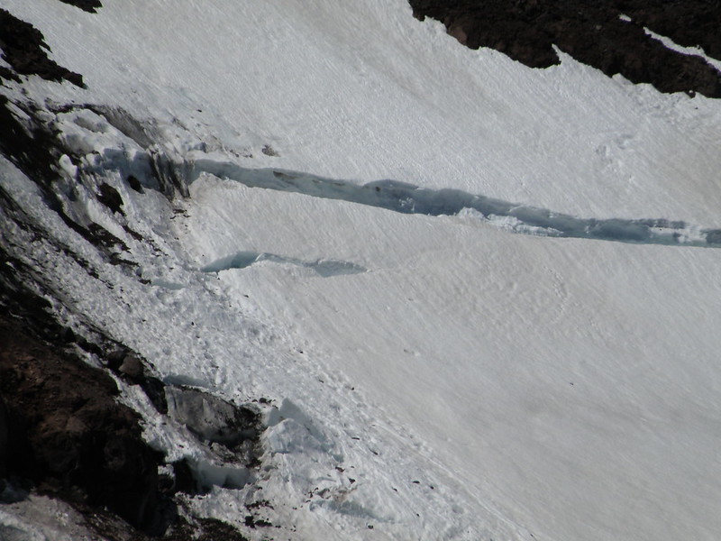
Hotlum
Bergschrund on the Chicago Glacier
Re: Beautiful SHASTA Current Conditions
Posted:
Mon Jun 16, 2014 9:45 pmby fruitflyman
Climbed Hotlum Glacier and the left Hotlum Gully (the route shown in Jibmaster's first photo above) on June 15. Very nice conditions in the gully - plenty of WI2-ish terrain mixed with hard snow. The ice is perfect. Very good route right now.
Re: Beautiful SHASTA Current Conditions
Posted:
Mon Jun 16, 2014 11:36 pmby clmbr
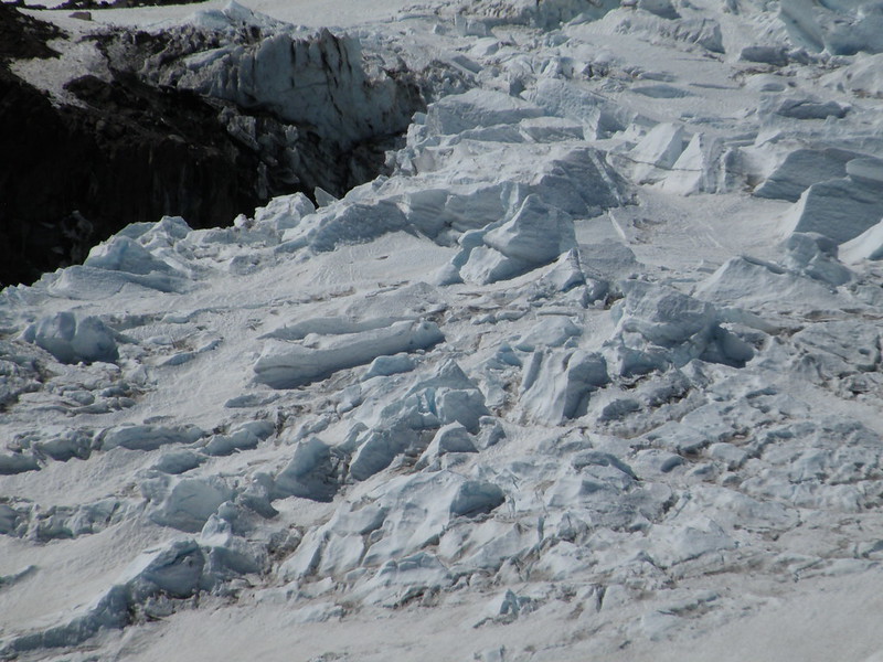
Mt Shasta, North Side (Hotlum Glacier and Hotlum/Bolam Ridge), June 14, 2014.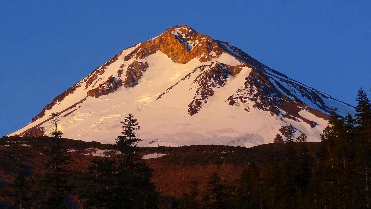
Re: Beautiful SHASTA Current Conditions
Posted:
Tue Jun 17, 2014 9:00 pmby ScottyP
fruitflyman wrote:Climbed Hotlum Glacier and the left Hotlum Gully (the route shown in Jibmaster's first photo above) on June 15. Very nice conditions in the gully - plenty of WI2-ish terrain mixed with hard snow. The ice is perfect. Very good route right now.
We summited on the 15th also on the left ice gulley. Party of three were you? We were the two ahead of you and thought you turned back. Scott. Btw, we had a rocking rent site at 11,700' favorite so far on the mountain. Scott
Re: Beautiful SHASTA Current Conditions
Posted:
Thu Jun 19, 2014 9:44 pmby fruitflyman
Yes, that was our group. We made it to the summit at noon. We camped at 10,700 on the eastern-most fork of the glacier. Not comfy, but good position.
Re: Beautiful SHASTA Current Conditions
Posted:
Sun Jun 22, 2014 9:09 pmby LesterLong
Is this something a beginner like me can do? How many hours of climbing? What's the crux of it?
You westerners have some beautiful mountains.
Re: Beautiful SHASTA Current Conditions
Posted:
Mon Jun 23, 2014 12:49 amby yosemiteforlife67
hey, just an additional inquiry regarding clear creek route......above clear creek meadow/camp area....are there spots up above that are good , in case i want to have a slightly shorter summit day? How far up, does the creek go, and how accessible, and how high can you set up camp?I would assume , i would probably have to bring all my water....depending on how high above the meadow the creek starts. Information on this would be very helpful. Thanks.
Re: Beautiful SHASTA Current Conditions
Posted:
Mon Jun 23, 2014 3:53 amby JHH60
yosemiteforlife67 wrote:hey, just an additional inquiry regarding clear creek route......above clear creek meadow/camp area....are there spots up above that are good , in case i want to have a slightly shorter summit day? How far up, does the creek go, and how accessible, and how high can you set up camp?I would assume , i would probably have to bring all my water....depending on how high above the meadow the creek starts. Information on this would be very helpful. Thanks.
The usual base camp area at around 8300' (where I shot the photo I previously posted) is where the creek starts. There are places higher up where you could bivy but they are smaller, more exposed, and require you to melt snow and/or bring your water.
Re: Beautiful SHASTA Current Conditions
Posted:
Mon Jun 23, 2014 5:14 amby ScottHanson
rookie questions:
I am interested in climbing Shasta first time up easy (cl 2 or easy cl 3), straight-forward approach in July 2014. One day push.
1) good guidebook?
2) good route (I have crampons)?
3) need permit? get day of climb? get at trail-head?
4) best to start at midnight to avoid slushy snow conditions?
Thanks for any tips!
Scott
Re: Beautiful SHASTA Current Conditions
Posted:
Mon Jun 23, 2014 7:06 amby yosemiteforlife67
JHH60 wrote:yosemiteforlife67 wrote:hey, just an additional inquiry regarding clear creek route......above clear creek meadow/camp area....are there spots up above that are good , in case i want to have a slightly shorter summit day? How far up, does the creek go, and how accessible, and how high can you set up camp?I would assume , i would probably have to bring all my water....depending on how high above the meadow the creek starts. Information on this would be very helpful. Thanks.
The usual base camp area at around 8300' (where I shot the photo I previously posted) is where the creek starts. There are places higher up where you could bivy but they are smaller, more exposed, and require you to melt snow and/or bring your water.
Hey thanks for the information. I was hoping for a little shorter day, but i am not sure if we may be able to do that. We would have to bring all our water(unless there is still some snow up there in the next 4-5 weeks......is that 5 miles as bad as it may sound...going up the ridge of clear creek, or not too bad? I have done the rocky canyon route up to the top of Pyramid peak(9983) in desolation wilderness, which is about 3+ miles,(one way) and you climb 4000 feet. Clear creek you climb 5800 feet in 5 miles. Any insight on this?
Re: Beautiful SHASTA Current Conditions
Posted:
Mon Jun 23, 2014 4:42 pmby JHH60
yosemiteforlife67 wrote:Hey thanks for the information. I was hoping for a little shorter day, but i am not sure if we may be able to do that. We would have to bring all our water(unless there is still some snow up there in the next 4-5 weeks......is that 5 miles as bad as it may sound...going up the ridge of clear creek, or not too bad? I have done the rocky canyon route up to the top of Pyramid peak(9983) in desolation wilderness, which is about 3+ miles,(one way) and you climb 4000 feet. Clear creek you climb 5800 feet in 5 miles. Any insight on this?
The hike up to 8300' is easy and on trail. I've only ever done the rest of the route when there was snow cover and it's a moderate, straightforward snow climb. If you are planning to climb it when the snow is gone then I gather the scree makes it more tedious, but have no personal experience there. I suggest you check the route page and trip reports for more information.
Re: Beautiful SHASTA Current Conditions
Posted:
Mon Jun 23, 2014 5:18 pmby mrchad9
yosemiteforlife67 it sounds like you haven't read the SummitPost page for Clear Creek.
I recommend you check it out.
: - )