My last gasp on this:
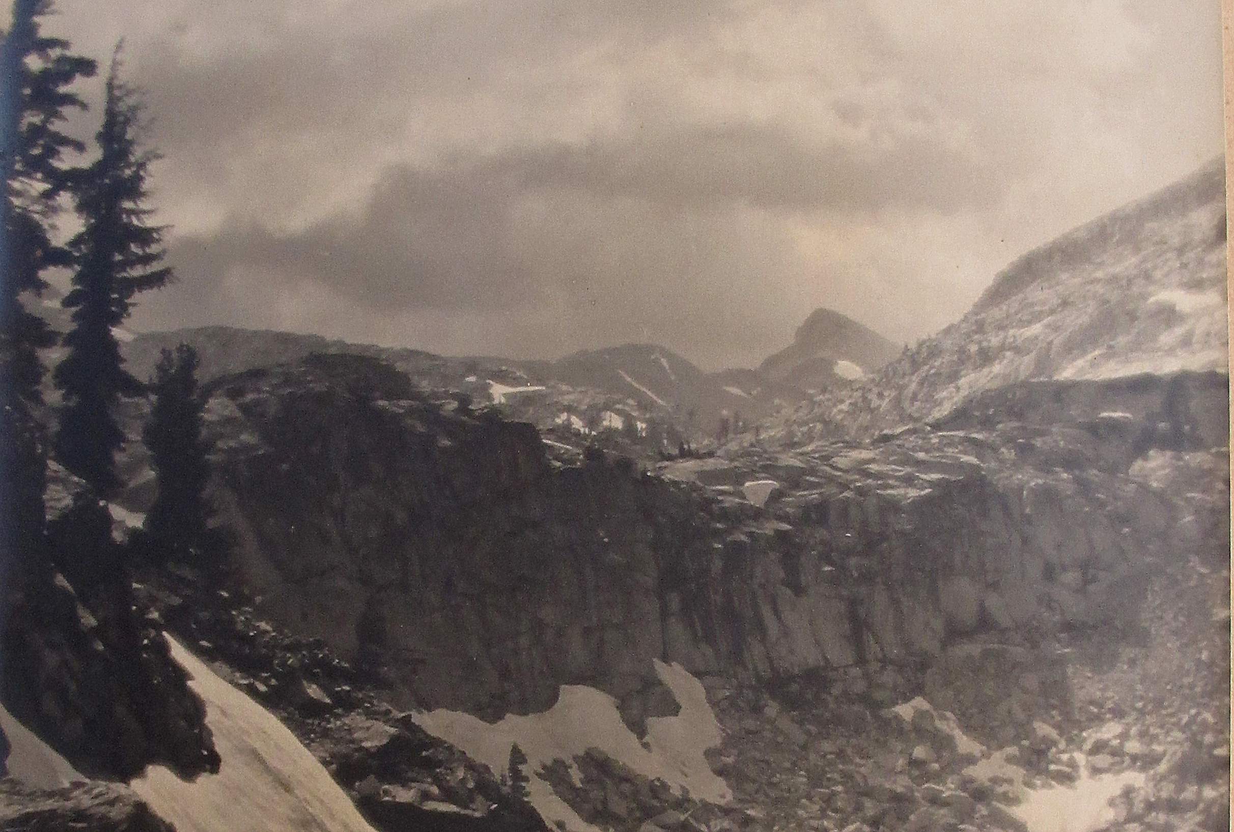
Here is a photo from the lower slopes of Dana looking a little north of west across the Tioga Road (a bit of which can be seen at the bottom left of the picture). Gaylor Peak is on the left, the highest thing in the picture; the ridge on the left of Gaylor runs down to Tioga Pass, up the road beyond the edge of the photo.

Here is part of the same photo, cropped to make things a little bigger. Roughly in the center, the ridge coming down from Gaylor to the left cuts across a lower ridge behind it, coming from the right. Just behind and to the right of the "V" where the ridges meet is a flat white area, which is part of the highest of the Gaylor Lakes. To the right of the lake, on the aforesaid lower ridge you can pick out a few trees, which would be somewhat above 10,600 ft.

The Edwards picture could maybe have been taken somewhere above/behind the ridge, in the general direction of the ruins of the Great Sierra Mine. The peak which forms the right edge of Edwards' image would be Gaylor, with one of its ridges leading down to the low cliff in the foreground center and toward the lake.
As you might guess from the snow in the picture, this is a spring skiing picture, so I have never seen this area without snow on most of it. As you might guess from the screen name, my memory has some years' wear on it and I don't have a memory of the low cliff. But the area is readily accessible from the road (there is a summer trail on the map that leads to the mine, and would historically probably have been a way to the mine). Though it would have taken some scrambling to line up a few convenient trees, the cliff, Dana (if that's Dana) and the slope of the peak to the right, that's the sort of thing a photographer would do.
Now time to get a life.


