Page 1 of 1

Wind Rivers snow report

PostPosted: Fri May 24, 2013 2:15 am
by WyomingSummits
Looks like the winds are getting an early melt out. Most readings below 9K are coming in pretty much snow free. Some passes at 9500 are only registering 6-12". Big Sandy trailhead is being shown at 0". In contrast, the Bighorns have locations at 9700 that have 40"+. Looks like most of the late snow moisture was to the north this year.

Re: Wind Rivers snow report

PostPosted: Fri May 24, 2013 3:11 am
by Teresa Gergen
Hi there,
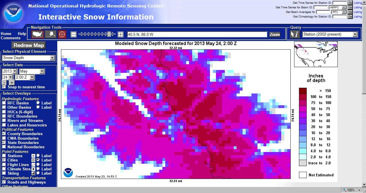
Just curious where you're getting your information? The current snow depth map I use shows a tremendous amount of snow in the Winds. This image is current and centered on Gannett:
Winds snow map.jpg
Winds snow map.jpg (160.37 KiB) Viewed 4619 times


It shows a good deal of color in the 100-150" range, mostly on the east side of the Divide.

Here is a list of WY 13ers:
http://listsofjohn.com/PeakStats/select ... R=13&P=300

Pick one in the Winds, then click on the "Snow Depth" link on the left side. The map will be centered on the peak you chose. You can play with the options on the left side of the NOHRSC map - clicking on "Hill Shading," "Lakes and Reservoirs," and "Rivers and Streams," then clicking on the "Redraw Map" button at the top left, and zooming in, makes it easier to tell what you're looking at.

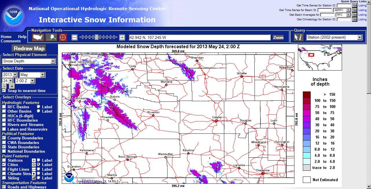
Here's a map zoomed out to show all of WY:
WY snow.jpg
WY snow.jpg (214.27 KiB) Viewed 4617 times

Re: Wind Rivers snow report

PostPosted: Fri May 24, 2013 4:30 am
by WyomingSummits
This was based on info from SNOTEL.com which uses official US climate data. There was no location that I saw much over 9,000ft. I thought the info was odd, but the info for the Bighorns (which is right next to me) was 100% correct. Not sure if they had updated info or not.

Re: Wind Rivers snow report

PostPosted: Fri May 24, 2013 4:36 am
by WyomingSummits
Here's a link to the daily snow depth report for Big Sandy opening, which is the primary entry into the Cirque of the Towers. It shows the max snow day being in the 42" range. Seems like they were on top of it all year. Snotel is now showing 0" while your map shows 30-40....something is screwy in dodge. :) Big Sandy is at 9,000ft.

http://www.wcc.nrcs.usda.gov/reportGene ... NWD::delta

Re: Wind Rivers snow report

PostPosted: Fri May 24, 2013 5:52 am
by Matt Lemke
I usually trust the snotel data over the experimental data analysis shown by Teresa on NOAA. They still have quite a bit of work on that project before it can be trusted yet.

Re: Wind Rivers snow report

PostPosted: Fri May 24, 2013 2:31 pm
by WyomingSummits
Matt Lemke wrote:I usually trust the snotel data over the experimental data analysis shown by Teresa on NOAA. They still have quite a bit of work on that project before it can be trusted yet.


The temps recorded by snotel substantiate the snow melt that has occurred at Big Sandy. The last 2 weeks have seen 40's to 60's for highs and barely below freezing for lows. That will cause a big snowpack to vanish quickly. They could get another ft next week, but looking a the mid term trend, it looks like the 8-9k range is going to be devoid of major snow for the rest of the summer. 10.5K + is prob still pretty packed.

Re: Wind Rivers snow report

PostPosted: Fri May 24, 2013 2:55 pm
by Teresa Gergen
I would absolutely love for you guys to be right. :) I've been in northern CO almost every weekend lately and the snow map for there has been pretty accurate. There is a ton of snow even down to 9000-9500 ft. Last weekend was the first it didn't get a hard freeze, so the melt will probably go more quickly now. Yes, I guess I'd be surprised if elevations in the Winds over 10.5K weren't still packed, but hopefully the melt is on!

I stopped using the CO Sno-tel site data because they never seem to have any sites close enough to where I'm headed to have an accurate picture.

Will definitely be looking forward to some early first-hand accounts -- thanks!

Re: Wind Rivers snow report

PostPosted: Sat May 25, 2013 5:07 am
by WyomingSummits
Teresa Gergen wrote:I would absolutely love for you guys to be right. :) I've been in northern CO almost every weekend lately and the snow map for there has been pretty accurate. There is a ton of snow even down to 9000-9500 ft. Last weekend was the first it didn't get a hard freeze, so the melt will probably go more quickly now. Yes, I guess I'd be surprised if elevations in the Winds over 10.5K weren't still packed, but hopefully the melt is on!

I stopped using the CO Sno-tel site data because they never seem to have any sites close enough to where I'm headed to have an accurate picture.

Will definitely be looking forward to some early first-hand accounts -- thanks!

Not really early, but we'll be on Gannett first weekend in July. I'll be doing two 10-11k peaks tomorrow in the Bighorns so I'll find out how accurate the snotel data is for that sector. I do agree that the snotel collection sites tend to be on the outer edges of ranges and at lower elevations. Your wind rivers map looks good for 11K +......but not sure if that data goes all the way to outskirts like Big Sandy. Anyway, I hope YOURS is right so we'll have a big fat bridge over the shrund on Gannet! :)