Page 1 of 1

Help me identify this Nepalese mountain

PostPosted: Wed Nov 17, 2010 11:50 am
by nattfodd
I am just back from a month of trekking and climbing in the Khumbu, and I have a request for Nepal experts in SP. Among many others, I took a photo of fluted snow faces of two mountains, and I am not certain of their names. Since I would like to include the image in my upcoming book, it would be much better to have proper caption information.

Here is the image:

Image

It was taken from a ridge above Lobuje East base camp, looking south. Those mountains were to the right of Ama Dablam. My map and google earth seem to suggest it might be Kangtega, but that mountain looks very different from other angles so I am in doubt.

Any help would be very appreciated!

Re: Help me identify this Nepalese mountain

PostPosted: Wed Nov 17, 2010 12:39 pm
by barrys
I was pretty sure I'd seen that view before....Image

here...

http://www.summitpost.org/malangphulang-group/482487

perhaps the contributor can confirm which exact peaks. If you have a shot of these peaks with Ama Dablam in the frame it should be easy to tell with Malangphulang being quite a bit smaller and set closer to where you took the shot from than Kangtega. Not that I am a real Nepal expert but from that I would suppose that the peak in front is Malangphulang with Kangtega set behind and to the right. Great shot in any case.

Re: Help me identify this Nepalese mountain

PostPosted: Wed Nov 17, 2010 1:58 pm
by nattfodd
That's great, thanks! I do have photos with Ama Dablam as well, I'll check them when I get home tonight.

Re: Help me identify this Nepalese mountain

PostPosted: Wed Nov 17, 2010 6:40 pm
by Petro
Yep, that's Malanphulan - the mountain itself is pretty popular here in Poland (sic!) as it has seen a few failed attempts by Voytek Kurtyka (therefore became a legend) and last year it was (almost...) climbed by a team of three. The team would receive a pretty prestigious prize for this climb but later it turned out that Kurtyka doesn't agree that the route is as hard as they claimed (ED+) and that they probably hadn't reached the ridge itself (that actually remains unclear). Anyway, the whole story ended up with a huge scandal in the climbing society and now almost everyone knows the details of the Ombigaichen north face ;-)

Here's one of the first news about the climb (no scandal yet ;-)). It's google translated from Polish but there is a nice panorama of the area that's worth seeing.

Re: Help me identify this Nepalese mountain

PostPosted: Thu Nov 18, 2010 1:11 am
by Damien Gildea
Yep that's Melanphulan from the northwest, but that is not Kangtega behind it, that is a lower summit of the same massif that Melanphulan is in. Kangtega is out of picture to the right.

Melanphulan is thought to have received an unauthorised ascent(s) years ago, but the first reported ascent was by Peter Carse and Supy Bullard in 2000 .

Petro - why are they calling it 'Ombigaichen' in those reports? Ombigaichen is a totally separate peak (now a Trekking Peak) to the northeast of Melanphulan, above the Mingbo La, joined to Ama Dablam. Did they only have a permit for Ombigaichen?

Re: Help me identify this Nepalese mountain

PostPosted: Thu Nov 18, 2010 7:28 am
by nattfodd
Thanks everybody, I really appreciate the help!

Re: Help me identify this Nepalese mountain

PostPosted: Wed Jan 05, 2011 12:37 pm
by GG
Hi everybody,

I. On the first (black & white) photograph there are (from the left to right):

Malanphulan (6573 m. a.s.l. on modern Nepali-Finnish maps 1:50 000 form 1992 aerial survey, 1996 field verification, edition ca. 1996-1998, “Sheet No. 2786 04, Sagarmatha”, and on further trekking maps 1:30 000 - 1: 100 000 basing on that survey, or 6571 m on Schneider map=DAV map=Berndt&Freitag=Kumbu Himal 1: 50 000, survey from 1955-1963, revised 1995, edition 1999 [however, glacier lakes are not appropriately depicted to the present reality]]; REMARK: Well known so called Washburn map 1:50 000 1988, aka National Geographic or Swiss map, as well as chinese 1:100 000 map do not cover the area, both of these maps have south margin somewhere on the middle between Ama Dablam and Malanphulan).

Col 6170 m (on Nepali-Finnish map) or 6153 on older maps (another DAV map of Mera group to the south), Hinku La Lho according to Kielkowski (see below)
Hinku Ri Central 6464 m (or 6467 m on Schneider map).

Below the Col 6170 m, in the foreground there is a
Peak 6005 (Schneider map: 5993) in the ridge running to Kangte[n]ga
(via three next peaks of height 5940-6100 m, including Omoga Ri 6070, or after Schneider map 6077 m, aka Minbgo Eiger thanks to its steep rocky north face 900-1000 m high).

Both dominant peaks on photographs above, 6573 and 6464, are commonly called Malanphulan Group (or simply "Malanphulans") and they are a heart-part of small, the Hinku Himal group (ridge dividing the Hinku Glacier to the south and Nare=Mingbo Valley and Khumbu Valley to the north; this ridge branches to the West from the peak of Rakpa Ri, 6420 m or 6413 on Schneider map)

II. On the second (color) photograph there are -

the same peaks with wider angle of view and with slightly rearranged foreground.
To the right on the foreground one can see double-summit 6004 (6000) and 5950 (5940) m (dark). To the left the ridge running from Malanphulan to Rakpa Ri has a snowy culmination 6300 m (on modern maps, on earlier maps much lower, there are discrepancies). Good insight on the Malanphulan-Rakpa Ri ridge is from the South, from the popular Mera peak, here: himalaya-info.org, http://www.himalaya-info.org/mera_peak.htm (more about the Mera Peak itself is here: http://www.summitpost.org/mera-peak/150229).

III. Some more remarks about the names (in/on most recent maps and sources):

The name Malanphulan is also competed by the name Melanphulan (especially in Anglo-American sources after the report of the first ascent of the peak in spring 2000)
or Malangphulang (sometimes Malangphutang)
or Hinku Ri Main
or Fluted Peak
(after Jan Kielkowski, experienced Polish climber and expert living from over decade in Germany, author of dozens of guidebooks on Himalayas and Karakorum in English, German, Polish. He is also one of the editors of big Polish Great Encyclopedia of Mountains and Mountaineering (WEGA, “Wielka Encyklopedia Gor i Alpinizmu”, appeared 5 volumes in 2003-2010, in Polish only, whole edition expected to have 7 volumes including supplement;
Exact references: Jan Kielkowski: Ama Dablam & Hinku Himal, part 2, Dusseldorf 1993, in Polish;
Malgorzata Kielkowska and Jan Kielkowski [editors]: entries Hinku Himal, Hinku Ri, WEGA, Vol 2, Mountains of Asia, Stapis, Katowice 2005, in Polish).

IIIA. The name Ombigaichen appeared in earliest reports of the team which climbed/attempted in autumn 2009 the north face of the 6571/6573 peak and is a kind of misunderstanding (as explained the team the mistake was on one official map, I saw some another usual, free, map with this mistake). The true Ombigaichen 6340 m (3 km to the East, SEE, from Ama Dablam, while Malanphulan stands 6 km directly to the south of Ama Dablam) was also called as a Pumo Dablam (the daughter of Ama Dablam, a “Mother”) (after Kielkowski brochure-guidebook, Ama Dablam & Hinku Himal, part1, Dusseldorf 1993, in Polish).

Re: Help me identify this Nepalese mountain

PostPosted: Wed Jan 05, 2011 5:56 pm
by dmiki

Re: Help me identify this Nepalese mountain

PostPosted: Wed Jan 05, 2011 6:00 pm
by sharperblue
This is off on a tangent but i'm curious - that's a lot of very detailed information about those peaks - where did it come from?

i know there are a few trekking guides to Nepal/Tibet, but nothing of which i am aware that has even rudimentary information on routes and peaks in the Khumbu Himal and surrounding areas (or in the karakoram, for that matter) - do you compile the information from the AAJ's or AJ's or is there another source - /

thanks!

Re: Help me identify this Nepalese mountain

PostPosted: Wed Jan 05, 2011 9:44 pm
by John Duffield
The map, showing location in lower right...

Image

Help me identify this Nepalese mountain: Hinku Himal,sources

PostPosted: Fri Jan 07, 2011 4:46 pm
by GG
Hi, Sharperblue and everybody:

sharperblue wrote:This is off on a tangent but i'm curious - that's a lot of very detailed information about those peaks - where did it come from?

i know there are a few trekking guides to Nepal/Tibet, but nothing of which i am aware that has even rudimentary information on routes and peaks in the Khumbu Himal and surrounding areas (or in the karakoram, for that matter) - do you compile the information from the AAJ's or AJ's or is there another source - /
thanks!


I. The most of relevant sources on Hinku Himal are given in my previous post (but in manner directed towards to be the references of the variations of names and heights). Here below the sources are rearranged (and with more details) as the more direct answer to your question:
Of course the first are reports in AAJ, AJ, Himalayan Journal, late Mountain, late High (Mountain Info section) or the German, English, Spanish, Italian, Polish leading magazines.

- Fortunately, all that is compiled up to 1994 in 35-pages guidebook-brochure
by Jan Kielkowski:
Ama Dablam & Hinku Himal, part 2, Mingbo Ri - Rakpa Ri - Hinku Ri - Kang Taiga - Tramserku,
Dusseldorf 1994, [in Polish, pages 7-10, with drawing of Malanphulan group from SW on the cover].

This copy / brochure was mentioned earlier and is more exactly referred below (section VIII.1).

- Other, updated, source is mountain Encyclopedia, WEGA, Vol. 2, 2005, entry Hinku Ri, Hinku Himal (see my earlier post).
- This is compiled with one note in AAJ 2001 on Melanphulan / Malanphulan (see below)
- and Polish and internet publications on the peak in 2009-2010.

Concerning, for example, Ama Dablam or Kantega, since 1993 changed quite much and one should search in further volumes of AAJ or Mountain/High (with some help of Alpine Club Himalayan Index or index of AAJ, links see below, section VII).

Concerning Malanphulan itself changed a little and the AAJ almost covers the topic of the recent years (after 1993):
The only report is in AAJ 2001 of the 1st (and still the only) ascent in the spring 2000 via W face (by Peter Carse and Amy = Supy Bullard),
There are also reports on N face in Polish: short report on 2005 attempt and widespread info on 2009 attempt (attempt, not ascent, see above, post by user Petro).

II. Widely, for Khumbu Himal climbing guidebooks there are more references by Jan Kielkowski, including 200-300 pages guidebooks in English on Everest or Makalu Himal (links below in section VIII.1). However, in fact, for climbing of significant difficulty degree and uncertainty, sources seem very scattered and probably there is no single, complete source or publication, updated to the half of the decade 2001-2010.
[I suppose that some serious, handy, compact guidebook for climbers to Khumbu region should appear... But - it needs some kind of support... ].
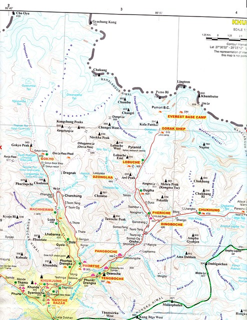
III. MAPS:
were also mentioned in my first post: Schneider map 1 : 50 000 and by Nepal-Finnish Survey series of maps, 1 : 50 000, 1992-1996, "Sheet No. 2786 04, Sagarmatha" (basing on which many modern trekking maps are produced, with better data on tourist objects and sometimes more names).

CLIMBING GUIDEBOOKS for OTHER REGIONS (answer for second part of the question by Sharperblue):

IV. There are also Jan Kielkowski guidebooks on Baltoro region in Karakorum / Karakoram, including guidebook in English on K2 and neighbor mountains (links below in section VIII).

V. Polish climbers also use photocopy-brochures systematically prepared by Jerzy Wala on rather remote regions, however including brillant map 1: 50 000 and topo of Nangmah and Charakusa Valleys in Hushe region) – his work is slightly more directed towards the general topography and cartography, identification of unfrequented peaks. Jerzy Wala is an Author of 1: 250 000 map of Karakoram (called “Swiss Map”, in two sheets, Swiss Foundation for Alpine Research (Schweizerische Stifung fur Alpine Forschungen, SFAF, Zurich 1990) and map of “The eight-thousand-metre peaks of the Karakoram” 1 : 50 000, 1994, The Climbing Company, Buxton, UK. The last one is accompanied the topo-guide to all main peaks covered by the map.

VA. Dozen illustrations by Jerzy Wala, and detailed maps, are included in monograph of Western Karakorum prepared by Wolfgang Heichel (published by DAV/OEAV, Munchen 2003, in German).

VI. Other compilations were prepared by Spanish climbers (directed to the cartography, but they also published guidebook to Tirich Mir), by the FEDME and Servei General d' Informacio de Muntanya (SGIM) in Sabadell, near Barcelona.

So, there are some compiled sources but for the not frequented peaks and climbs there are rather brochures than easy available books (contrary to the case of popular trekking routes and peaks).


VII. Existence, from a couple years, the indexes such as search engine for AAJ reduces the work needed to collect more information.

LINKS to search engines/indexes:
American Alpine Journal (AAJ) online, search engine:
http://www.americanalpineclub.org/aajsearch (pdfs in 10-15 pages sections)

Alpine Journal (AJ) on line:
http://www.alpinejournal.org.uk/Contents_All_Years.html
(thanks to post by user Borutb alpine-journal-on-line-t56629.html)

AC Himalayan Index:
http://www.alpine-club.org.uk/hi/index.htm


VIII. LINKS to some of Jan Kielkowski's ca. 40 guidebooks:

Guidebooks by Jan Kielkowski (in Polish, German and English – the English editions grouped a couple brochures and are the lasts and much thicker, ‘serious’ books, not guidebook brochures)

Description immediately on the reseller website:
http://www.antykwariat-filar.pl/index.php
<Rodzaj wydawnictwa> [ = kind of publication] => Przewodnik [means = guide, guidebook]
<Obszar> [= Area] => choose: <Himalaje> or <Karakorum>

Or with more convenient description, with cover visible:
Whole set after entry ‘Jan Kielkowski’: 51 items (6 pages, including Encyklopedia of Mountains, WEGA, see my first post above)
http://pl.gojaba.com/search/qau/KIE%C5%81KOWSKI+JAN

VIII. 1.
With Hinku Himal and Malanphulan / Melanphulan itself:
http://pl.gojaba.com/book/8196483/Ama-D ... KOWSKI-Jan
Ama Dablam & Hinku Himal, parts 1, 2, 3:

Ama Dablam & Hinku Himal, part 2
Przewodnik wspinaczkowy. [in Polish]
Zeszyt 2. Mingbo Ri - Rakpa Ri - Hinku Ri - Kang Taiga - Tramserku.
Düsseldorf 1994. s. [pages] 35. Nr katalogowy Sprzedającego: 12815

Etc. ...

Here one can find also similar guidebooks-brochures concerning Khumbu region (mountains in Solo Khumbu district) in German

VIII. 2.
More serious, widened editions in English, on most mountains more spectacular/ more popular than Hinku Himal:
(still Jan Kielkowski):
http://pl.gojaba.com/book/10409932/Moun ... KOWSKI-Jan
Mount Everest massif. Monograph-guide-chronicle.
Gliwice 2000/. Explo. wyd. 2. [edition 2] s. [pages] 312.
Nr katalogowy Sprzedającego: 20424

http://pl.gojaba.com/book/10409931/Maka ... KOWSKI-Jan
Makalu Himal. Monograph - guide - chronicle.
Gliwice 2001/. Explo. wyd.1. s. 123. Nr katalogowy Sprzedającego: 21107

http://pl.gojaba.com/book/640362/Kangch ... KOWSKI-Jan
Kangchenjunga Himal and Kumbhakarna Himal. Monograph - guide - chronicle.
Gliwice 1999/. Explo. s. [pages] 201. Nr katalogowy Sprzedającego: 12835

VIII. 3.
KARAKORUM / KARAKORAM:
In English:
http://pl.gojaba.com/book/10409930/K2-a ... KOWSKI-Jan
K2 and Northern Baltoro Mustagh. Monograph - guide - chronicle. [English]
Gliwice 1997/. Explo. wyd.1. s. 114. Nr katalogowy Sprzedającego: 12834

Detailed brochures (including Trango Goup, Baltoro Cathedrals, Lobsang):
http://pl.gojaba.com/book/8196514/Weste ... KOWSKI-Jan
Western Baltoro Mustagh, parts 1, 2, 3
Zeszyt 1. Przewodnik alpinistyczny. [in Polish]
Düsseldorf 1988. s. 55. Nr katalogowy Sprzedającego: 12863
Etc.

Re: Help me identify this Nepalese mountain

PostPosted: Fri Jan 07, 2011 6:19 pm
by sharperblue
I asketh, i reveiveth; thanks, GG - that's excellent info; tremendously appreciated!

Re: Help me identify this Nepalese mountain

PostPosted: Fri Jan 07, 2011 7:53 pm
by radson
sharperblue wrote:I asketh, i reveiveth; thanks, GG - that's excellent info; tremendously appreciated!


personally, I think GG is a bit slack, he/she could have spent a bit more time and provided some more detail....:p

Re: Help me identify this Nepalese mountain

PostPosted: Fri Jan 07, 2011 10:38 pm
by Petro
GG probably won't brag but he's a real authority when it comes to topography, especially of the Tatra mountains, but it seems that he has much wider interests than that.
Take a look at one of his photo topos:
http://mastertopo.pl/plakaty/ncom/elcap ... _index.htm

Ithink those are pretty cool.