
|
|
Mountain/Rock |
|---|---|
|
|
46.91965°N / 10.29557°E |
|
|
Hiking, Skiing |
|
|
Spring, Summer, Fall, Winter |
|
|
9226 ft / 2812 m |
|
|
Overview
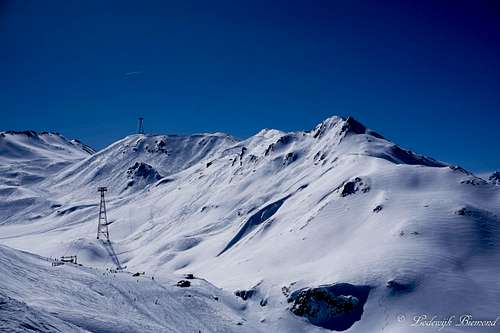
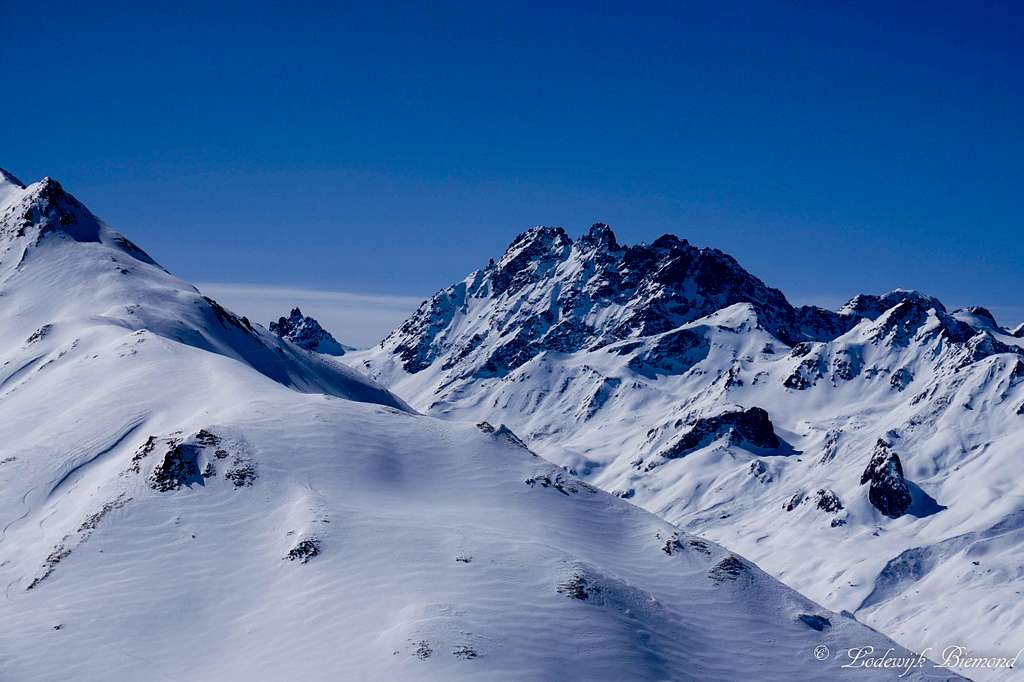 Piz Val Gronda (2812m, left) and Fluchthorn (3398m)
Piz Val Gronda (also Piz da Val Gronda) can be translated into “peak of the great valley”, a striking name for a mountain situated exactly on the border of Switzerland and Austria. Piz Val Gronda measures 2812 meters above sea level and is a popular objective for ski mountaineering in winter. In summer it is a popular hikers destination, mainly because of the vicinity of the Heidelberger Hütte.
There are 2 other mountains in the Alps carrying the name Piz Val Gronda. The highest one measures 2880 meters above sea level and is located along the Fallatschkamm / Cresta Vallazza, part of the Ortler-Alps in northern Italy. The second ‘’other’’ Piz Val Gronda is located in Obersaxen and part of the Bündner Alps in Graubünden, Switzerland. This mountain’s elevation is 2820 meters above sea level and has its own SP-page as well.
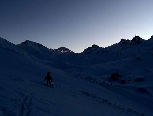 on the flanks of Piz Val Gronda by flow on the flanks of Piz Val Gronda by flow | 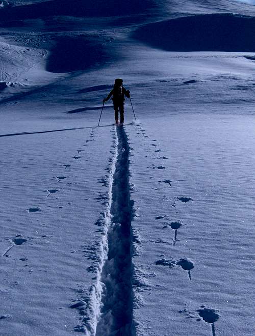 Ascending Piz Val Gronda Ascending Piz Val Gronda | 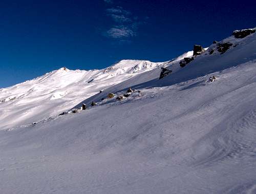 Ascending Piz Val Gronda by flow Ascending Piz Val Gronda by flow |
Piz Val Gronda is located on the southwestern tip of the Samnaun Group, almost at the border with the Silvretta Group. The mountain is situated to the east of the Fimbatal, a side valley of the Paznaunertal. To the south lies the Val Choglias, a side valley of the Engadin valley. The main mountains surrounding Piz Val Gronda are Vesilspitze / Piz Rots (3096m) to the east, Piz Davo Lais (3027m) and Piz Tasna (3179m) to the south and Fluchthorn / Piz Fenga (3398m) to the Southwest. Just south of the mountain is the weitwanderweg (long distance trail) number 712, connecting the Heidelberger Hut to the Hexensee Hütte.
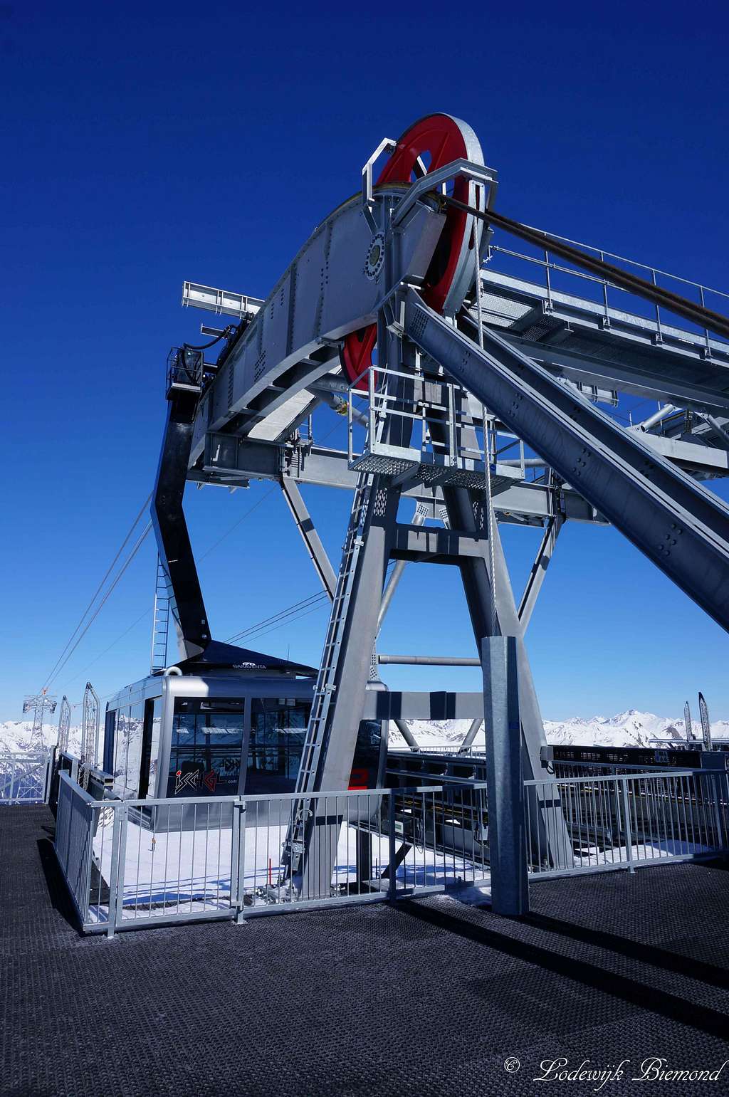
Piz Val Gronda has been the subject of a fierce discussion for over 3 decades. Already in 1976 the Ischgl ski resort presented plans for a cableway system around the summit of Piz Val Gronda. Many parties like the DAV, SAC, PAC and the International Commission for the Protection of the Alps (CIPRA) have tried to prevent the plans from becoming reality, but after all, in 2012 a plan for a gondola to the summit of Piz van Gronda was approved. In December of 2013, the gondola was opened. (also see the history section below)
 Piz Val Gronda (2812m) Piz Val Gronda (2812m) | 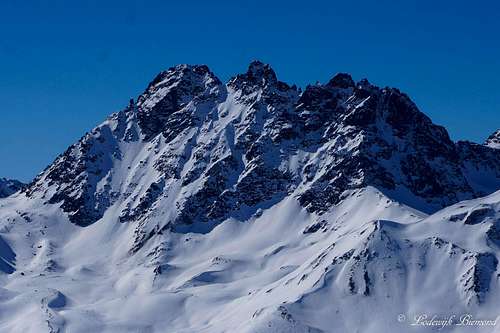 Fluchthorn / Piz Fenga (3398m) Fluchthorn / Piz Fenga (3398m) |
The Heidelberger Hütte is situated high in the Fimba valley and is the most important base for climbing the mountain. It also is the only DAV mountain Hut located on Swiss territory. From the Hut the summit can be reached in about two hours. A marked trail leads to the Fuorcla da Val Gronda (2752 m) locatedjust southeast of the summit. From here you can easily reach the summit over pathless terrain (T3). Alternatively From, the Fuorcla da Val Gronda can be reached from the east via a marked route in about one hour from the Zeblasjoch(2539 m).
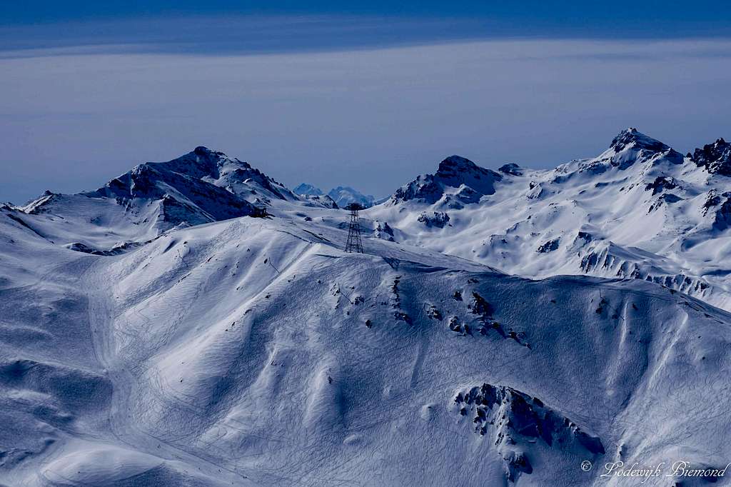
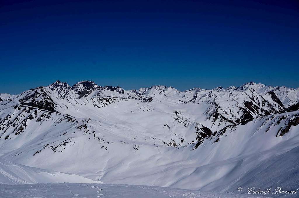
Annotated Summit Panorama
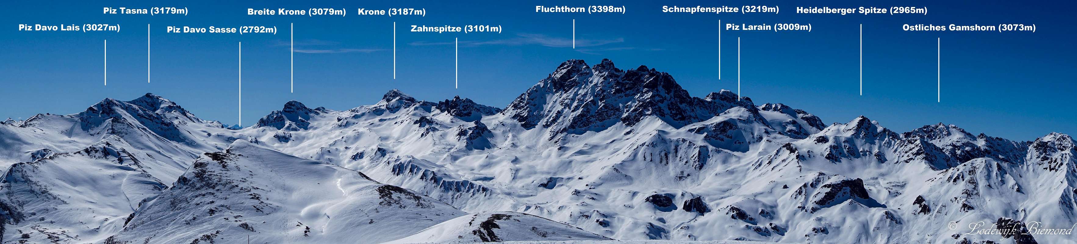  Annotated Piz Val Gronda Summit Panorama from South via West to NW |
Route

The base for climbing Piz Val Gronda is the Heidelberger Hütte. The mountain hut can be reached most easily from Ischgl (1376m). Follow hiking trail number 2 into the Fimbavalley (situated to the southwest of Ischgl). The trail follows the valley and is Always easy (T2). Along the trail from Ischgl one will pass (in this order) the Pardatcher See, Berggasthof Bodenalpe (1840m) and Gampen (1945m) before arriving at the Heidelberger Hütte at 2264 meters. The route from Ischgl takes 4 to 4,5 hours. It is possible to the Silvretta/Fimbabahn up from Ischgl to the Mittelstation. This will shorten the ascent by an hour to 3/3,5 hours.
Leave the Heidelberger Hütte in an eastern direction along trail 712, which is mostly referred to as the weitwanderweg (= long distance trail). This part of the trail connects the Heidelberger Hütte with the Hexensee Hütte. Follow the trail to the east to the Fenga Pitchna and after it the Fuorcla da Val Gronda at 2752 meters. There is a yellow signpost here. At this point you have to leave the 712 trail which continues towards the east. Instead go towards the north and ascend the south flank of Piz Val Gronda. This last part is only 50 vertical meters and is always easy, although pathless. After a short hike you are standing on the broad summit of Piz Val Gronda. This part of the route, from the Hut to the summit, takes about 2 hours. Return is the same way back.
An alternative to the standard route up from the Heidelberger Hütte is to use the cableway system of Ischgl and Samnaun. Use the cableway system from either Samnaun or Ischgl up to the Ausseres Viderjoch (2732m). Keep following the path that starts here towards the south (T2). This path more or less follows the ridge that also forms the border between Switzerland and Austria. The path passes the Greitspitze, Salaaser Kopf and underneath Palinkopf before arriving at the Zeblasjoch at 2539 meters. At the Zeblasjoch take a left onto trail 712.
Follow this trail to the Fuorcla da Val Gronda at 2752 meters. Ascend the south flank of Piz Val Gronda to the summit. A nice (but very long!) day tour would be to take this last route to the summit (starting from Ischgl) and the first route, passing the Heidelberger Hütte, back to Ischgl. This route can be done from Samnaun as well, since (in summer) the cableway system connects both villages to each other.
History
 Piz Val Gronda E5
The mountain has a long history of fierce debate between the operator of the Silvretta Arena in Ischgl, who for the first time published plans for the Piz Val Gronda through the Vesiltal valley and the connection to the Ischgl ski resort already back in 1976, and the Silvretta alliance, a combination of the Hüttensection Heidelberg, as well as the DAV, SAC, PAC and the International Commission for the Protection of the Alps (CIPRA), who have been trying to prevent the project ever since.
While the Silvretta Arena repeatedly came up with new proposals for the construction of a cableway to the responsible Tyrolean regional government, all of which were not approved, the Silvretta Alliance was unable to prevent the project on a permanent basis. For example, the attempt to set up a “ruhezone” south of the Gampenbahn, towards the Austrian-Swiss border, failed at the resistance of the local communities.
In 2012, a new request for the cableway was approved. Part of the deal was that the Ischgl ski resort cannot expand any further and that the ski run from the summit only goes along the eastern flank of the mountain and not along the western flank through the Fimba valley and Heidelberger Hütte. In this way, Piz Val Gronda remains an objective for ski mountaineering with the “unspoiled” Heidelberger Hütte as a base.
The cableway, 2452 meter long with two 150 seater cabins, was put into operation on 20 December 2013.
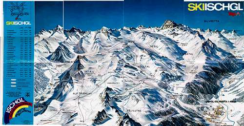 Ischgl Ski Map 1982: Piz Val Gronda already in planning Ischgl Ski Map 1982: Piz Val Gronda already in planning | 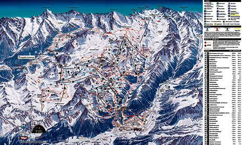 Ischgl Ski Map 2017: Piz Val Gronda a reality Ischgl Ski Map 2017: Piz Val Gronda a reality |
Mountain Hut
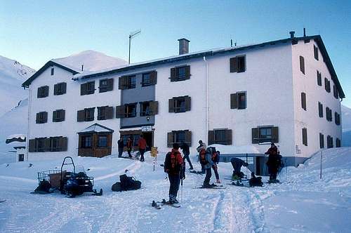 | Heidelberger Hütte Elevation: 2264m Official Internet Page: Here Telephone Hütte: +43-664-4253070 E-Mail: info@heidelberger-huette.at
|
Getting there
The Starting point for climbing Piz val Gronda is either Ischgl or Samnaun. You can use the ski lift facilities in summer and in winter to reach the base of the mountain.
There are 3 ways to get to Ischgl from Germany:
-First of all take the A7 in Germany or the A95 heading south. Then on the Fernpassbundesstraße (B179) via Imst and Landeck, on the A12 motorway and continue on the S16 (Arlberg clearway) to the Pians exit. From here it is 20 kilometers on the main Silvretta road (B 188) to Ischgl.
-First of all take the A 93 in Germany heading for Innsbruck. Then take the Inntal motorway in Austria (A 12) via Kufstein, Innsbruck and Landeck on the S 16 (Arlberg clearway) to the Pians exit. From here it is 20 kilometres on the main Silvretta road (B 188) to Ischgl.
-First of all take the A96 heading for Lindau in Austria on the A 14. Then continue via Bregenz, Feldkirch and through the Arlberg tunnel on the S16 to the Pians exit.= From here it is 20 kilometres on the main Silvretta road (B 188) to Ischgl. In summer you can also exit the motorway in Bludenz and get to Ischgl via the Silvretta high Alpine road.
Getting to Ischgl from Switzerland:
-First of all take the A 3 to Feldkirch or the A 1 to Lustenau and Dornbirn. Then in Austria take the A 14 toward Innsbruck and continue through the Arlberg tunnel on the S 16 to the Pians exit. From here it is 20 kilometres on the main Silvretta road (B 188) to Ischgl. In summer you can also exit the motorway in Bludenz and get to Ischgl via the Silvretta high Alpine road.
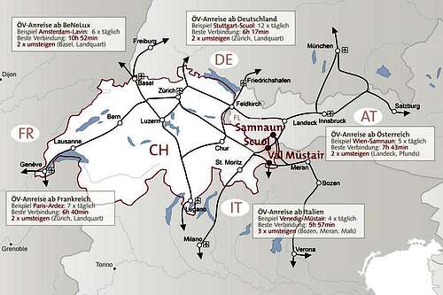 How to get there MAP: Samnaun How to get there MAP: Samnaun | 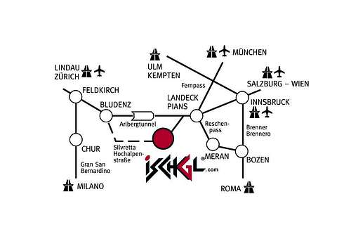 How to get there MAP: Ischgl How to get there MAP: Ischgl |
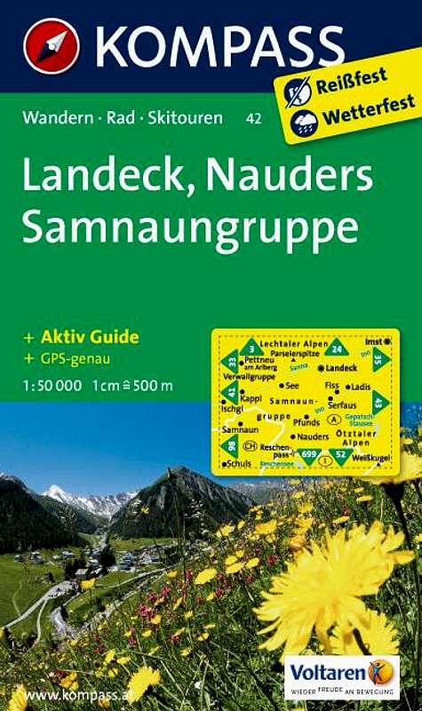
Maps & Books
Leichte 3000er – Dieter Seibert - Bruckmann Verlag - ISBN 9783765436772
Kompass 42- Landeck Nauders Samnaun Group – 1:50.000 - ISBN 9783850265423
 |  |
When to Climb
 Piz Val Gronda with Piz Tasna (3179m)
External Links
 Summit view towards the East
The Ischgl cableway prices and operating hours in SUMMER: Click here
The Samnaun cableway prices and operating hours: Click Here
Accomodation in Ischgl: Click Here
Accomodation in Samnaun: Click Here
Camping Sport Samnaun: Click Here