Toggle navigation
Mountains
Routes
Images
Trip Reports
Forum
What's New
People
Areas & Ranges
Articles
Trailheads
Canyons
Huts & Campgrounds
Albums
Logistical Centers
Fact Sheets
Lists
Custom Objects
Gear
Plans & Partners
WELCOME TO SUMMITPOST
SIGN IN
REGISTER
Tatoosh Traverse
Additional Parents
Image
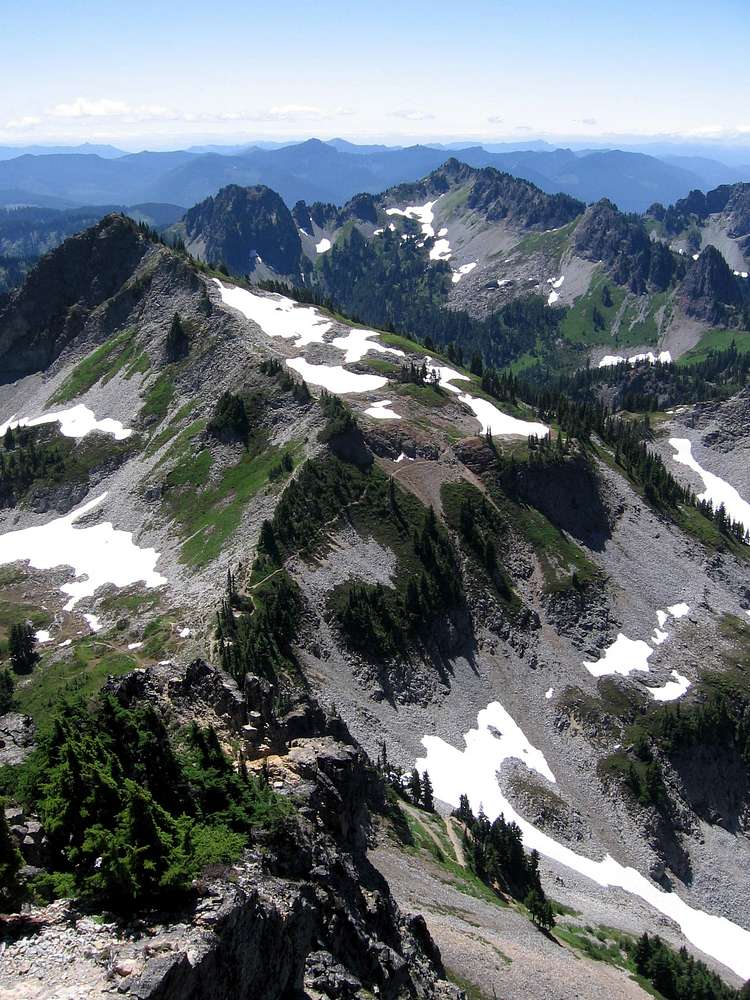
Plummer and Wahpenayo Peaks
View High-Resolution Image
Plummer and Wahpenayo Peaks
Notice the fat path heading over to Plummer. No such path exists to Wahpenayo in the distance, though the distinct giant boulders under the easiest chute are visible even from here, the summit of Pinnacle.
« PREV
NEXT »
darinchadwick
on
Feb 17, 2007 7:53 pm
Comments & voting
Other parents
Lat/Lon:
46.75830°N / 121.7314°W
Image ID:
270551
6350 Hits
75.81
% Score
6
Votes
Log in to vote
Comments
No comments posted yet.
to post!
Don't have an account?
Tatoosh Traverse
(Route)
You are at
the First
Image
Viewing
#1 of 7
GALLERY
NEXT »
darinchadwick's Image Gallery
« PREV
Viewing
#92 of 380
GALLERY
NEXT »
Plummer Peak
(Mountain/Rock)
Loading....
Wahpenayo Peak
(Mountain/Rock)
Loading....
×
You need to login in order to vote!
User Name
Password
Remember me
Forgot your password?
Log me out when I close my browser.
Keep me logged in all the time.
sign in as a user
Don't have an account?
Register now for FREE
Rating available
Suggested routes for you
People who climb the same things as you
Comments Available
Create Albums
Register Here


