


-
 1737 Hits
-
 79.78% Score
-
 11 Votes
|
|
Route |
|---|---|
|
|
45.63375°N / 7.46403°E |
|
|
Hiking, Mountaineering |
|
|
Spring, Summer, Fall, Winter |
|
|
A long day |
|
|
I |
|
|
Note
|
La montagna chiama i suoi figli, ed essi rispondono fedelmente al suo appello… Osvaldo Cardellina, Diario alpinistico, 1964-65 Page texts: @ OsvaldoCardellina "Osva", passed away on May 2, 2022. Page owners: Christian Cardellina e Osvaldo Cardellina. Any updates from September 12, 2022: Antonio Giani, page administrator, friend and climbing companion. Testi della pagina: @ OsvaldoCardellina "Osva", scomparso il 2 maggio 2022. Proprietari pagina: Christian Cardellina e Osvaldo Cardellina. Eventuali aggiornamenti dal 12 settembre 2022: Antonio Giani, amministratore della pagina, amico e compagno di salite. |
Leppy Overview Leppe
All pictures of this route are by Emilio Bertona, Marco Cossard, "Gigi" Gadin, Antonio Giani, livioz, marco87, pr18, Zed & Osw
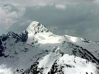
This large and rounded mountain, the ascent of which is inviting and easy if nothing else than for its landscape, has an older name than the current Leppe's Tip: it was the Leppy's Becca. A very ancient name, now forgotten by everyone with which you indicated the more Eastern part of the Valley, or better Vallon, of Laures, where the ridge rises from the Tour de Salé and Becca di Salì and then, jagged, reaches the small Mountain Chain of the three Roises (3.357m); from these then continues towards Noon with the same peculiarity first reaching Punta Ilario Antonio Garzotto (3.273/4m) and finally, after the rounded Leppe Hill, the triple Summit with the same name (3.305/6m). But one can also climb through the opposite ridge North-northeast with path just more challenging starting from Leppe's Hill (3.110m). This can in turn be achieved through one of two Valleys Northern Laures St. Marcel starting with the Municipality of Grand-Brissogne-Primaz towards Gremonenche Alpage or from that of St. Marcel passing through the Les Druges Alps. A long but easy enough trip, but it requires a lot of attention in the winter, due to the danger for snowslides and avalanches.
Questa grande e tondeggiante montagna, la salita della quale risulta invitante e facile se non altro che per il suo panorama, possiede un nome più antico di quello attuale di Punta di Leppe: era la Becca di Leppy. Un veramente antico toponimo, ormai pressocché da tutti dimenticato con il quale si indicava la parte Orientale del Vallone delle Laures, là dove il crestone risale dalla Tour de Salé e dalla Becca di Salì (come la chiamano gli abitanti di Grand Brissogne) per poi, frastagliato, raggiungere la Catena delle tre Roises (3.273 m la Nord o Petite Roise, 3.300 m la Centrale o Punte Gianni Junod e 3.357 m, la Sud o più elevata); da queste poi continua verso Mezzogiorno con le stesse peculiarietà raggiungendo dapprima la Punta Ilario Antonio Garzotto (3.273/4 m) ed infine, dopo l'arrotondato Colle di Leppe, la triplice Sommità con lo stesso nome (3.305/6 m). Però si può salire anche tramite la cresta opposta o Nord-nordest con percorso appena più impegnativo e partendo dal Settentrionale Colle di Leppe (3.110 m). Questo può essere a sua volta raggiunto percorrendo uno dei due Valloni delle Laures o di St. Marcel, entrambi diretti a Nord, partendo dal Comune di Grand-Brissogne oppure da quello di St. Marcel e transitando per le Alpi di Les Druges. Una abbastanza lunga ma facile gita, che richiede però molta attenzione in inverno, a causa delle slavine.
Getting There
BY CAR:
- From Turin or Milan: Motorway A5. Exit in Aosta Ovest. Drive to the near Aymavilles; follow in the direction of Cogne Valley. Or Exit Aosta East to Gr. Brissogne and St. Marcel. From Switzerland: through the Grand St. Bernard Tunnel or the homonym Pass). Drive to Aosta, then follow Courmayeur direction on SS.26. Just after Sarre, turn to the left, in the direction of Cogne Valley. Also continue East towards Grand Brissogne and Saint Marcel, turn to the right near the brige above Baltea, neighbor Quart-Villefranche. From France: through Mont Blanc Tunnel or Petit St. Bernard Pass). It isn't necessary to enter in Motorway A5, you can drive through SS.26 Aosta direction. Before arriving at the Village of Sarre, follow the sign and turn right towards Valle di Cogne; also passing the town continue East to Quart Municipality.
After Aymavilles, the RR.47 crosses the Villages of Vieyes, Epinel and Crétaz and after about 25 Km. arrives at Cogne (1.534m). Follow the road signs for Gimillan and Lillaz; arrived at a round-about, recently built in proximity of the St. Anthony Chapel, go left along the scenic route leading to the Villages of Montroz and Gimillan (1.787m); 1,5 and 3 Km. after Cogne. Usually no parking problem neeighbor the bell tower of a little chapel in center, also near the bridge above Gimillan Torrent (small parking).
BY PLANE:
Aeroporto "Corrado Gex" Saint Christophe (Aosta).
Route Description
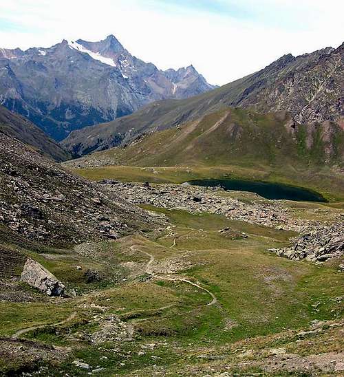
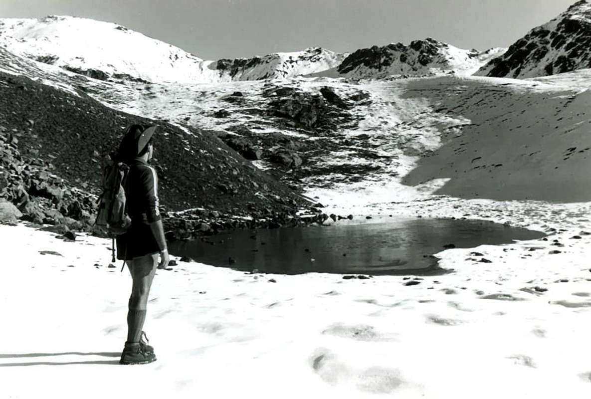
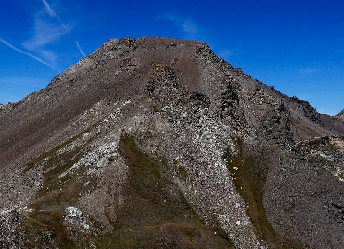
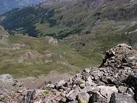
From Gimillan (1.787m), along the S-SE Arête: go right starting from the car park of Gimillan: after few meters the indications by panels for Lussert Lakes and St. Marcel Hill. Are found. The pathway is indicated by the yellow circle n° 9A and by always yellow strips marked on stones along the route. The path begins going immediately uphill on the private farms dirt road just after the wooden bridge above Gimillan Torrent (signal no transit with iron hurdle), then, after leaving right the pasture and the little Church of Tarabouc (closed and deconsecrated), the slope decreases as we go beyond a little Chapel dedicated to the Virgin (1.836m), immediately after the ruins of Ràventì Alp. Soon the path resumes to go up and splits in two branches, before it begins to penetrate into the Grauson Vallon: it's possible to continue following the right one that goes down as far as the Ecloseur's Bridge (1.904m), nearby Tzecheu Alp. But in such a case we must go up again; it's better to follow the left one that, in practice without losing height, arrives at the bridge under the Pila Pasture (2.025m), cross it and, following the stepped pathway, overcome the rocky bastion beside a fine waterfall (at the left). At this point the path turns right markedly, entering, high on the torrent, into a small walloon; by an alternation of steep and slight slopes, it reaches a panoramic cross, on the edge of a pleasant plateau (superb view of the far La Grivola!). The path goes through the meadows, with slight descent: after the Old Grauson Pastures (2.271m), crosses the two Torrents Money Grauson on the Pikaciù Bridge and by a steep trail beside the torrent, reach the wide upper part of the wide Grauson Valley. At the junction before Pralognan Alp (about 2.400m), instead of going straight ahead along the pathway n° 4 leading to the head of Grauson/Doreire Vallon, go left till to New Grauson Alpage (2.540m), where once there was the burned Tentori Bivouac. Turning Eastward, pass over a small torrent coming down from the small Lago delle Rane (Frog's Loch aka known as Lower Corona 2.641m) and, on the above promontory, remount to the Lago Corona (2.702m); a little before it turn o Northeast on the path of Saint Marcel Hill also Coronas till you easy get it (2.916m). Now, toward North, flanking some characteristic rocks get the easy Mont Vallonet (3.101m) and, after descending to the following small saddle or Vallonet Pass, go on along the easy South-southeast Crest, at the beginning along steep terraces with grassy then slightly under the edge till the Summit finding on the edge passages of I° e II°- with poor rock quality. (EE/F; 0h'30/0h'45 from the small Vallonet Pass; 1h'15/1h'30 from Saint Marcel Hill; 2h'30/3h'15 from Alp Grauson Nuove; 5h'30/6h'00 by Gimillan Hamlet).
Southern Approach from Gimillan Village, through Grauson Vallon
 |
 |
 |
 |
 |
Equipaggiamento ed attrezzatura adatti per trekking di alta montagna.
Normal Route through South-southeast Crest from the adjacent Hills of Vallonet or Saint Marcel to EE/F.
Via Normale dalla Cresta Sud-sudest dagli adiacenti Colli Vallonet o di Saint Marcel con EE/F.
Campings
Remember that free camping is forbidden (except for emergency reasons, over 2.500m, from darkness until dawn).Mountain Condition
- Meteo: you can find all the needed informations at the official site of the Valle d'Aosta Region:
- Valle d'Aosta Meteo
Webcam
- WEBCAM on Aosta Valley:
- Webcam
Books and Maps
BOOKS:- "Guida delle Alpi Occidentali", di Giovanni Bobba e Luigi Vaccarone C.A.I. Sezione di Torino Volume II (parte II), 25 Maggio 1896.
- "80 itinerari di Escursionismo Alpinismo e Sci Alpinismo in Valle d'Aosta", di Osvaldo Cardellina, Ed. Musumeci, Giugno 1977 (in Italian); seconda Ed. Luglio 1981; terza Ed. Luglio 1984; (in French), prima Ed. Febbraio 1978; seconda Ed. Marzo 1980.
- "Guida del Monte Emilius", di Osvaldo Cardellina Editore in collaborazione con il Club Alpino Italiano Sezione di Aosta, Dicembre 1978 (in Italian).
- "Rifugi e bivacchi in Valle d'Aosta di Cosimo Zappelli", aggiornata da Pietro Giglio, Musumeci Editore, Luglio 2002.
- "Guida dei Monti d'Italia–Emilius Rosa dei Banchi Parco del Mont Avic", di Giulio Berutto e Lino Fornelli - Club Alpino Italiano/Touring Club Italiano, Marzo 2005 (in Italian).
- "Il Parco Nazionale del Gran Paradiso", G. Berruto III°, volume 2° Ed. I.G.C. Torino 1981, 2000.
- "Diari Alpinistici" di Osvaldo Cardellina e Indice Generale accompagnato da Schedario Relazioni Ascensioni 1964-2019 (unpublished).
 |
 |
 |
 |
 |
 |
MAPS:
- Kompass "Gran Paradiso Valle d'Aosta Sentieri e Rifugi" Carta Turistica 1:50.000.
- Hapax Luglio 2000 "Les Sentiers" Comunità Montana Monte Emilius 1:25.000.
- Enrico Editore Ivrea-Aosta "Gruppo del Gran Paradiso" 1:50.000.
- I.G.C. Istituto Geografico Centrale Torino "Carta delle Passeggiate ed Escursioni in V.D.A. Conca di Pila-Gressan" 1:20.000.
- L'Escursionista Ed. "La Valle di Cogne" 1:25.000.
- L'Escursionista Ed. "Tour de la Vallée de Cogne Grand Paradis" Carta dei sentieri 1:25.000.
Important Information
- REGIONE AUTONOMA VALLE D'AOSTA the official site.
- FONDAZIONE MONTAGNA SICURA Villa Cameron, località Villard de la Palud n° 1 Courmayeur (AO) Tel: 39 0165 897602 - Fax: 39 0165 897647.
- SOCIETA' GUIDE ALPINE DI COGNE Tel. 347/9473526 – 328/1373728.
- A.I.NE.VA. (Associazione Interregionale Neve e Valanghe).
- A.IA.T. Cogne Gran Paradis via Bourgeois n° 34 Tel. 0165-74040. E-mail: aiat@cogne.org
- Ezio Sport articoli sportivi - via Bourgeois n° 64 Tel. 0165-74204.
Useful numbers
- Soccorso Alpino Cogne (SAR) Tel. 3482685406.
- Protezione Civile Valdostana località Aeroporto n° 7/A Saint Christophe (Ao) Tel. 0165-238222.
- Bollettino Meteo (weather info) Tel. 0165-44113.
- Unità Operativa di Soccorso Sanitario Tel. 118.