La montagna chiama i suoi figli, ed essi rispondono fedelmente al suo appello…
Osvaldo Cardellina, Diario alpinistico, 1964-65
Page texts: @ OsvaldoCardellina"Osva", passed away on May 2, 2022. Page owners: Christian Cardellina e Osvaldo Cardellina. Any updates from September 12, 2022: Antonio Giani, page administrator, friend and climbing companion.
Testi della pagina: @ OsvaldoCardellina "Osva", scomparso il 2 maggio 2022. Proprietari pagina:Christian Cardellina e Osvaldo Cardellina. Eventuali aggiornamenti dal 12 settembre 2022: Antonio Giani, amministratore della pagina, amico e compagno di salite.
Epinel Overview Pila
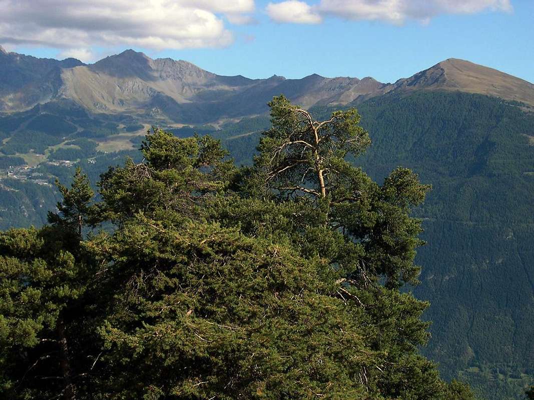
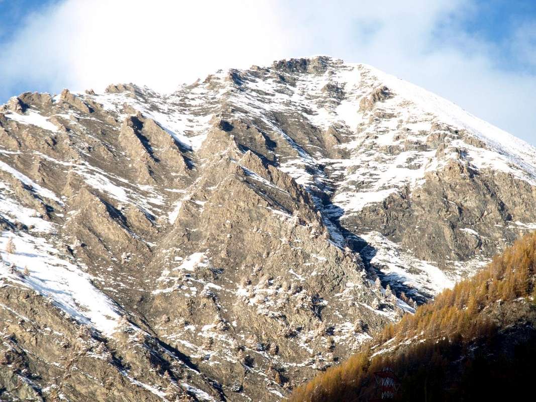
Pointes de Monpers & Tsavanis from Southeast 2016
This small Summit is located amidst Punta della Valletta (3.090m) Pointe Tsa Sètse (2.924m) between the Val de Lessert and the Southern Valley of Arpisson. Amongst these two valleys is located the small unnamed Collar or Saddle 2.777 meters, the not much known and less popular passage even in the past. Arranged on the Southesast/Southwest axis with respect to the Hill Tsa Setze or Chaz Sèche in the North (2.815m) also has esclusively two ridges with a third very brief and less in evidence above the Saddle (2.777m), always to the North. A fourth ridge, but more than a true ridge and its consists of a rocky rib, which branches off from the Southwest Ridge, dividing into two sectors the Southern Slope, formed by a series of small parallel bastionated and ramparts. Even the respective Eastern and Western sides do not offer interesting climbing routes but boring slopes and dangerous to go both in winter as in summer due to the presence of grassy layers. The first down with a great stony ground above the Arpisson Alp, while the second is divided by a steep slope towards descending in Southwest above Tavaillon Alpage (2.013m), located into the nearby and small Val Lessert. Both rarely frequented also by local hunters, they are definitely to be avoided, especially when the snow is not nicely transformed resulting in danger of landslides and avalanches. In return, beautiful diametrically opposed views towards Graian Alps to the South above the during of Grand'Eyvia and the entire Massif of Gran Paradiso, while to the North the view is limited by the imposing mass of adjacent Punta Valletta (3.090m), occluding the same in the direction of Pennine towards Monte Rosa.
Pointe du Tsavanis Southern Slope from Valnontey Valley, by Osw 2016
Piccola Sommità collocata tra la Punta della Valletta (3.090 m) e la Pointe Tsa Sètse (2.924 m) a cavallo della Val de Lessert con la Valle Meridionale dell'Arpisson. Tra queste due vallate é collocato il minuscolo Colletto o Sella Innominata 2.777 metri, non molto conosciuto e scarsamente frequentato anche in passato. Disposta sull'asse Sudest/Sudovest rispetto al Colle di Tsa Setze o Chaz Sèche, presenta esclusivamente queste due creste principali con una terza meno in evidenza e molto breve a Settentrione sempre verso la Selletta (2.777 m). Una quarta cresta, ma più che una cresta vera e propria costituita da una costola rocciosa, che si diparte dalla Cresta Sudovest, divide in due settori il Versante Meridionale, formato da una serie di piccole bastionate parallele. Anche i rispettivi versanti Est ed Ovest non propongono vie di roccia interessanti ma pendii noiosi e pericolosi da percorrere sia d'inverno che in estate per la presenza di strati erbosi. Il primo scende con un versante erboso con pietraie sopra l'Alpi di Arpisson, mentre il secondo viene diviso da una ripido versante, che scende in direzione Sudovest verso l'Alpe di Tavaillon (2.013 m), collocata nella vicina e piccola Val Lessert. Entrambi frequentati assai raramente anche dai cacciatori locali, sono decisamente da evitarsi, soprattutto in presenza di neve non ben trasformata con conseguente pericolo di slavine e valanghette. Compensano belle vedute diametralmente opposte verso le Alpi Graie a Meridione sul corso della Grand'Eyvia e sull'intera Catena del Gran Paradiso sin alla Grivola, mentre a Nord la vista viene limitata dall'imponente massa della Punta della Valletta (3.090 m) occludente la medesima in direzione delle Pennine insino al Rosa.
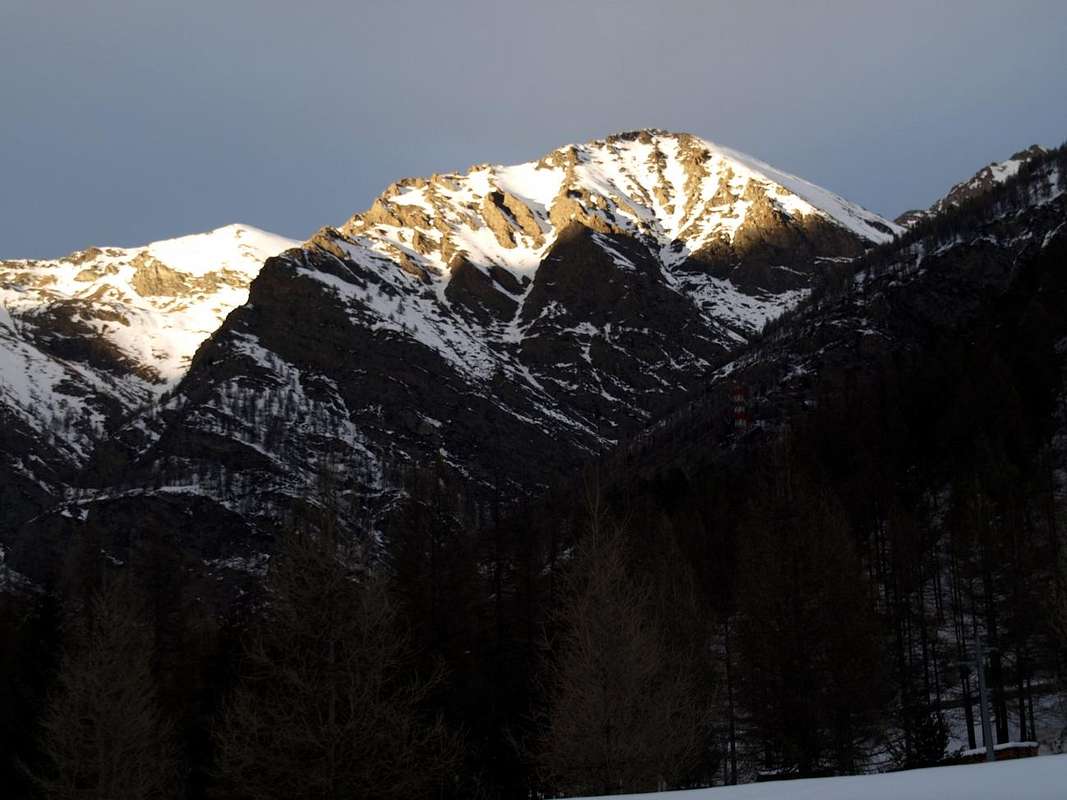
Punta di Tsavanis (2.815/6m) in the evening above Epinel Hamlet, by Osw 2016
Little notes to place names
This small Summit (2.815m) located between the Punta della Valletta Tsa Sètse did not have names on dell'I.G.M Charter (Italian Military Geographical Institute). Like other neglected peaks of the surroundings (Tips Tsa Setze, Pian Bessey, Lavà) have thus been baptized in "Monte Emilius Guide" in December 1978, see pages 58, 59, 68, 90) resulting from the place name extracted correctly from the locations immediately below. This choice, which is controlled in accordance with Law No 2.XI.1960. 68 and endorsed cleared to be broadcast in dell'I.G.M. Florence (28.XI.1978) was also confirmed in "Emilius Rosa dei Banchi of M.Avic Park" March 2005 (pages 69, 71, 91) Giulio Berutto and Lino Fornelli Edit. in "Guida dei Monti d'Italia" by C.A.I./T.C.I.. Finally in 2011 on the Charter "GRAN PARADISO Cogne - Valsavarenche MAP", Edit. L'escursionista (The hiker) sas, Rimini - Italy, 2011, properly report all of these names in the part facing the Municipality of Cogne. The same height is indicated in 2.816 meters.
Piccola Sommità (2.815 m) collocata tra la Punta della Valletta e la Pointe Tsa Sètse priva di nome sulle Carta dell'I.G.M. (Istituto Geografico Militare Italiano).Come altre neglette cime dei dintorni (Punte di Tsa Setze, Pian Bessey, Lavà) sono così state battezzate in "Guida del Monte Emilius" Dicembre 1978, vedi pagine 58, 59, 68, 90) derivando correttamente il toponimo dalle località immediatamente sottostanti. Questa scelta, controllata ai sensi della Legge 2.XI.1960 n. 68 ed avallata con nulla osta alla diffusione da parte dell'I.G.M. di Firenze (28.XI.1978) é stata confermata anche in "Emilius Rosa dei Banchi Parco del M.Avic Marzo 2005" (pagine 69, 71, 91) di Giulio Berutto e Lino Fornelli Edit. in "Guida dei Monti d'Italia" da parte di C.A.I./T.C.I.. Infine dal 2011 anche la Carta "GRAN PARADISO Cogne - Valsavarenche MAP", Edit. L'escursionista sas, Rimini - Italy, 2011, riporta correttamente tutti questi toponimi nella parte rivolta al Comune di Cogne. Nella medesima l'altezza viene indicata in 2.816 metri.
Getting There
BY CAR:
From TORINO, MILANO, etc: Motorway A5. Exit at IVREA or Quincinetto (PIEDMONT) AOSTA West/Aymavilles, Cogne Municipalities. From Gressan (alternaive Regional Road by the small square Chez-le Ru 610m) towards Leysettaz Dèsott, Tivet Villages and Pila-Resort up to Les Fleurs Fraction (1.414m). But in this case, then you must descend to the Regional Road from Charvensod to the junction 951 meters for Reverier du Tzat and Dessous Alpages.
From Aymavilles(646m) towards Cogne Valley: reaching Vieyes (1.132m), Epinel, Crétaz Hamlets to Cogne(1.534m); through Main Road. Or from this by Regional Road towards Montroz and Gimillan(1.785m) Villages; from the last in Northwest towards the above Arpisson/Tsa Sètze Vallons.
From FRANCE: through the Mont Blanc Tunnel to Entrèves-crossroads to Vény/Ferret Valleys - Mountain Guides of Courmayeur - La Saxe Rock Gym - Courmayeur. By Little Saint Bernard Hill, closed since November until half May to La Thuile Valley - Pré Saint Didier - Courmayeur.
It is not necessary to take Motorway A5: you can drive on SS.26, in the direction of AOSTA - IVREA - TURIN.
BY PLANE:
Aeroporto "Corrado Gex" Saint Christophe (Aosta).
Approaches & Routes
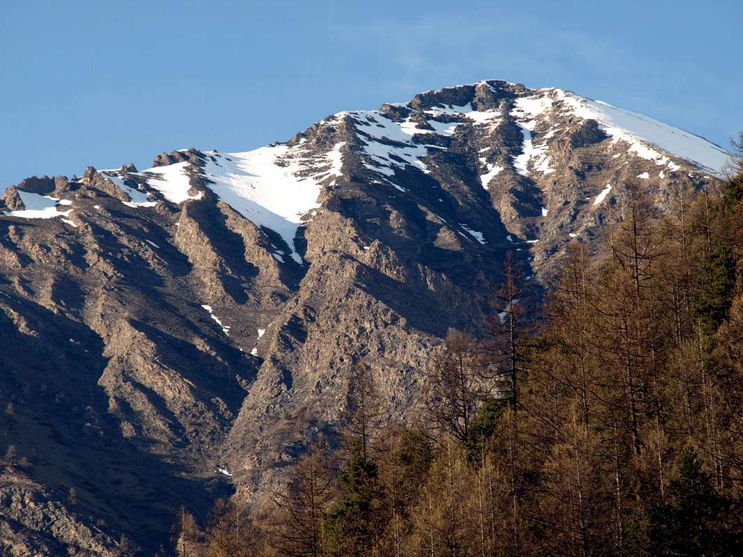
Pointe du Tsavanis Eastern Slope from Arpisson Valley, by livioz 2004
Starting from Pila Resort (Gressan Commune)
A) - Towards the Basin Plan de l'Eyve to the overhanging small Vallon Tsa Setze under the North Slope of Punta Valletta (3.090m) with descent to the Arpisson Vallon above the Valley of Cogne through the Saddle 2.777 meters at the Tip Tsavanis (2.816m). An itinerary "classic" that from Pila leads to Epinel or Gimillan passing on the Arpisson Pasture (2.328m), served by good footpaths (19C/22 to the North and 2A/2/3B towards Southeast) on both sides. Fell into gradual abandonment after the construction of the Shelter Arbolle, he has taken to be well attended after the installation of the Way Overview from Punta de la Pierre in crossing to the same and after the equipment of the Via Ferrata on the West-southwest Ridge Valletta. It also allows you to combine with the ascension of the homonymous and nearby Punta (2.824m) or just more to the Southeast with that of Tsavanis (2.815/6m). Great views in foreground of the nearby Grivola (3.969m) and over the entire Chain Gran Paradiso up to the Lavina Tower (3.308m), to the end of Eastern Graian on the border with Piedmont (E/F; 2h'45/3h'15). Easy traverse which can be performed in both directions starting from Pila or Epinel/Gimillan.
B) - Expanding the tour to the Southwest from Pila-Gorraz (1.850m) at the Grand Grimod Dessus (2.232m) and from there to Colle del Drinc (2.579m) both to close the Couìs (2.637m), both at the turn of Bivouac Simone Faccarello "Arno" (2.660m), with a long descent diagonally through the small path 1/TVC below the watershed between the Basin of Pila and Cogne Valley in the middle course of Grand'Eyvia up to go down to the Hamlet of Epinel (1.433/52m). Is a Hike very long and pretty tired that has generally the same as half the camp, especially from the Northern side of Pila where is seconded from the ski lifts for skiing, but is very rarely traveled into Cogne, where looks really as primordial and more than wild (E/F; 2h'45/3h'15). Instead wanting to reach the Punta Tsavanis it is necessary to continue from the Pointe du Couis (2.661m) on the watershed with Via Panorama or equipped path 23B/4A, with minor difficulties and workarounds to the Col Tsa Sètse and briefly off at Southeast with trail 2A diagonally up to the small saddle 2.777 meters concluding then easily on the summit where is placed a marble tumulus-altar with a dedication to a hunter Cogne (E/F+; 1h'30/2h'00 from Bivacco Arno; 4h'30/5h'00 by Pila). As understood this choice offers great views of the Gran Paradiso (4.061m) and the nearby Grivola (3.969m) that you can almost touch with your hand. The return to Pila can take place by combining the two routes with small ascent to the Col of Tsa Sètse otherwise complete the journey down to Epinel or Gimillan in Cogne Valley.
Starting from Epinel or Gimillan Hamlets (Cogne Commune)
C/D) - Starting from the Northwest, the entrance of the Valley, and continuing clockwise, after the appendices on the watershed Punta de la Pierre/Punta Valletta (see Pila Basin), we find the first great valley above the Village Gimillan. This opens up, like a large canopy tree, sending a first branch in the Northwest into the valley below Arpisson which in turn "gives birth" a smaller one on its edges towards the East Hill of Tsa Sètze (2.815m), more in the direction of the underlying Hamlet of Epinel (1.452m). The main branch or North up towards the Pian di Bessey, Franco Nebbia Bivouac, Lake Garin and namesake hill below the pyramid Pic Garin forming the Southern Vallon of Arpisson. This area offers climbing, hiking, walking and two equipped routes. The third branch opens more towards forming the Northeast Vallon of Grauson. But to climb the Punta Tsavanis from the junction of about 2.245 meters immediately after Arpisson Alpage (2.328m) you have to turn to the Northwest using the path 2A towards the Colle Tsa Sètse (2.815m). To find the third or Vallon Southern Arpisson they should, leaving the Central Valley of Dora Baltea, back entirely in the adjacent Cogne Valley, under the Gran Paradiso. Specific Regional Road towards Cogne Valley and Gimillan Fraction: from the Municipality of Aymavilles(646m) towards Cogne Valley: Vieyes Village (1.132m), Epinel(1.470m), Crétaz(1.494m) and Cogne Commune (1.534m) through the main Road and towards Montroz Village(1.707m) and Gimillan Hamlet (1.785m) by Regional Road; from this last towards the Franco Nebbia Bivouac (2.740m), with path n° 3/TVC in Arpisson Southeastern Vallon and with trail n° 2/3 more in South by Epinel small Fraction. Above the Hamlet of Gimillan or Dzimillan open two large vallons. The first, more to the East, goes up with the name of Grauson opening at the top, in the form of large leaf, towards the branches of Doreire-Tessonet (East) and Lussert the opposite. The second, to the West, is to Arpisson, which in turn splits "giving birth" even in the West Vallon of the secondary Tsa Setze, above Epinel. These two are among the congealed Buttress South-southwest of Punta Garin East and Tips Tsavanis and Vadaille or Vedaille West; the head of the vallon is closed by the watershed, this time from the Southwest to the Northeast, divides the Valley of Cogne from Vallone Arbolle (Charvensod) and by Basin Pila (Gressan Charvensod Municipalities). It stretches from Tsa Setze Hill forming the district of Punta Valletta (3.090m), Punta Pian Bessey towards the Col Garin, above the Franco Nebbia Bivouac (2.740m), before rising to Mont Valaisan and still conclude with the Pic Garin (3.451m). To walk to reach all these goals and also the beautiful and secluded Lake Garin (2.854m) using the route n° 3/TVC, starting from the Hamlet of Gimillan (1.785m) and n° 2/3 starting from Epinel Fraction (1.470m) or immediately below the junction with Cross 1.491 meters to Maison-Forte de Tarambel (+; 1.518m) through unnumbered small path that connects to the preceding, just before Crétaz Cogne (E/F; 2h'45).
Pointe du Tsavanis Southeastern Slopes towards West-northwest or Pointe de Monpers, Piatta de Grevon & Pointe du Drinc, by Osw 2016
Partendo dal Comprensorio di Pila (Gressan)
A) - Dalla Conca di Plan de l'Eyvie al soprastante Valloncello di Tsa Sètze sotto il Versante Settentrionale della Punta della Valletta (3.090 m) con discesa verso il Vallone di Arpisson a Cogne tramite la Sella 2.777 metri presso la Punta di Tsavanis (2.815/6 m). Un itinerario "classico" che da Pila porta ad Epinel o Gimillan passando per l'Alpe di Arpisson (2.328 m), servito da buoni sentieri (19C/22 a Settentrione e 2A/2/3B a Sudest) su entrambi i versanti. Caduto in progressivo abbandono dopo la costruzione del Rifugio di Arbolle, ha ripreso ad essere ben frequentato dopo la installazione della Via Panoramica dalla Punta de la Pierre in traversata verso lo stesso e dopo l'attrezzatura della Via Ferrata sulla Cresta Ovest-sudovest della Valletta. Consente inoltre di combinare con l'ascensione dell'omonima e vicina Punta (2.824 m) oppure, appena più verso Sudest con quella del Tsavanis (2.815/6 m). Grandiose vedute affronte sulla vicina Grivola (3.969 m) e su tutta la Catena del Gran Paradiso fino alla Torre di Lavina (3.308 m), verso l'estremità delle Alpi Graie Orientali ai confini con il Piemonte (E/F; 2h'45/3h'15). Facile traversata effettuabile in entrambi i sensi partendo sia da Pila che da Epinel o Gimillan.
B) - Allargando il giro verso Sudovest da Pila-Gorraz (1.850 m) al Grand Grimod Dessus (2.232 m) e da questo al Colle del Drinc (2.579 m) oppure al vicino del Couìs (2.637 m), entrambi a cavallo del Bivacco Simone Faccarello "Arno" (2.660 m), con lunga discesa in diagonale con sentierino 1/TVC al di sotto dello spartiacque tra il Bacino di Pila e la Valle di Cogne nel corso medio della Grand'Eyvia fino a scendere alla Frazione di Epinel (1.433/52 m). Escursione lunga ed abbastanza faticosa che ha in genere come metà il bivacco stesso, soprattutto dal lato di Pila dove é assecondata dagli impianti di risalita per lo sci, mentre viene assai raramente percorsa su quello di Cogne, dove si presenta veramente più che selvaggia (E/F; 2h'45/3h'15). Invece volendo raggiungere la Punta di Tsavanis é necessario proseguire dalla Pointe du Couis (2.661 m) sullo spartiacque con la Via Panorama o sentiero attrezzato 23B/4A, con piccole difficoltà ed aggiramenti fino al Col Tsa Sètse e scendere brevemente a Sudest con il sentiero 2A in diagonale fino alla selletta 2.777 metri concludendo poi facilmente sulla Sommità ove é posto un tumulo marmoreo con dedica ad un cacciatore di Cogne (E/F+; 1h'30/2h'00 dal bivacco; 4h'30/5h'00 da Pila). Sottinteso che questa scelta proponga grandi vedute sul Gran Paradiso (4.061 m) e sulla vicina Grivola (3.969 m) che sembra di poter toccare con la mano. Il rientro verso Pila può avvenire combinando le due vie con piccola risalita al Col di Tsa Sètse, altrimenti completare la traversata scendendo ad Epinel o Gimillan in Val di Cogne.
Partendo dalle Frazioni di Epinel o Gimillan (Cogne)
C/D) - Partendo da Nordovest, all'ingresso della Valle, e continuando in senso orario, dopo le appendici sullo spartiacque tra la Punta de la Pierre e la Punta della Valletta (vedi Pila Basin), troviamo il primo grande vallone sopra il Villaggio di Gimillan. Questo s'apre, a guisa di grande chioma d'albero, inviando un primo ramo a Nordovest verso il Vallone di Arpisson che, a sua volta ne "partorisce" uno più piccolo ai suoi margini Orientali verso il Colle di Tsa Sètze (2.815 m), più in direzione della sottostante Frazione di Epinel. Il ramo principale o Settentrionale sale verso il Pian di Bessey, il Bivacco Franco Nebbia, Lago Garin ed omonimo Colle al di sotto della piramide del Pic Garin (3.451 m), formando il Vallone d'Arpisson. Quest'area offre ascensioni, escursioni, passeggiate e due vie non da molto tempo attrezzate. Il terzo ramo s'apre maggiormente verso Nordest costituendo il Vallone del Grauson. Ma per salire la Punta di Tsavanis dal bivio 2.245 metri circa bisogna volgere a Nordovest utilizzando sentiero 2A pel Colle Tsa Sètse (2.815 m). Per trovare il terzo o Vallone Meridionale di Arpisson si deve, abbandonando la Valle Centrale della Dora Baltea, risalire interamente verso l'attigua e bella Vallata di Cogne. Strada Regionale specifica verso Cogne e Gimillan: dal Comune di Aymavilles(646 m) verso la Val di Cogne: Frazioni di Vieyes (1.132 m), Epinel(1.470 m), Crétaz(1.494 m) sino al Comune di Cogne (1.534 m) con la Strada Regionale; quindi in direzione Nord verso i Villaggi di Montroz(1.707 m) e Gimillan (1.785 m) sempre con la stessa. Da quest'ultimo al Bivacco Franco Nebbia (2.740 m), con sentiero n° 3/TVC nel Vallone più a Sudest di Arpisson o tramite sentiero n° 2/3 maggiormente a Sud di Epinel. Sopra alla Frazione di Gimillan o Dzimillan esistono due grandi valloni. Il primo, più ad Oriente, sale con il nome di Grauson aprendosi in alto, a guisa di grande foglia, verso i rami di Doreire-Tessonet (Est) e Lussert all'opposto. Il secondo, verso Occidente, costituisce quello di Arpisson, che a sua volta si sdoppia "partorendo" ancora più ad Ovest il secondario Vallone di Tsa Setze, sopra la Frazione di Epinel. Questi due sono rappresi tra il Contrafforte Sud-sudovest della Punta Garin ad Est e dalle Punte di Tsavanis e Vadaille o Vedaille ad Ovest; la testata della vallata é chiusa dallo spartiacque che, questa volta da Sudovest a Nordest, divide la Valle di Cogne dal Vallone di Arbolle (Charvensod) dalla Conca di Pila (Charvensod-Gressan). Si distende dal Colle Tsa Setze formando il circondario Punta della Valletta (3.090 m) e Punta di Pian Bessey fino al Col Garin, sopra il Bivacco Franco Nebbia (2.740 m), per poi risalire al Mont Valaisan e concludere ancora con il Pic Garin (3.451 m). Per percorrerlo raggiungendo tutti questi obiettivi ed inoltre il bel ed appartato Lago Garin s'utilizza il sentiero n° 3/TVC partendo dalla Frazione di Gimillan (1.787 m) e quello n° 2/3 iniziando da Epinel (1.470 m) o subito dopo dal bivio con Croce 1.491 metri per Maison-Forte de Tarambel (+, 1.518 m) tamite sentierino non numerato collegantesi al precedente, appena prima della Frazione di Crétaz e Cogne (E/F; 2h'45).
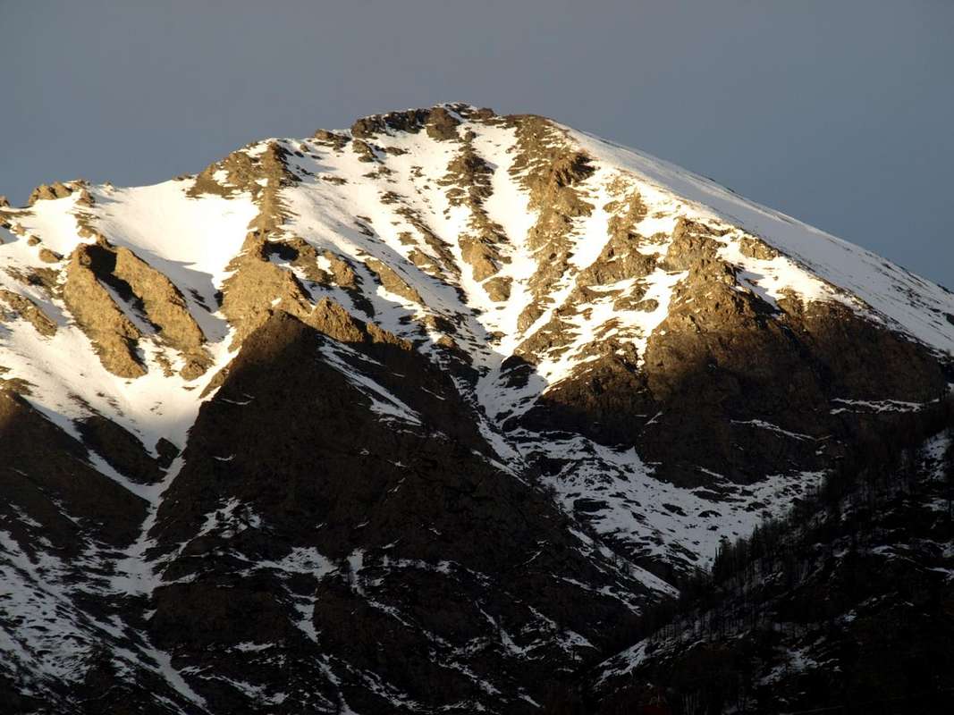
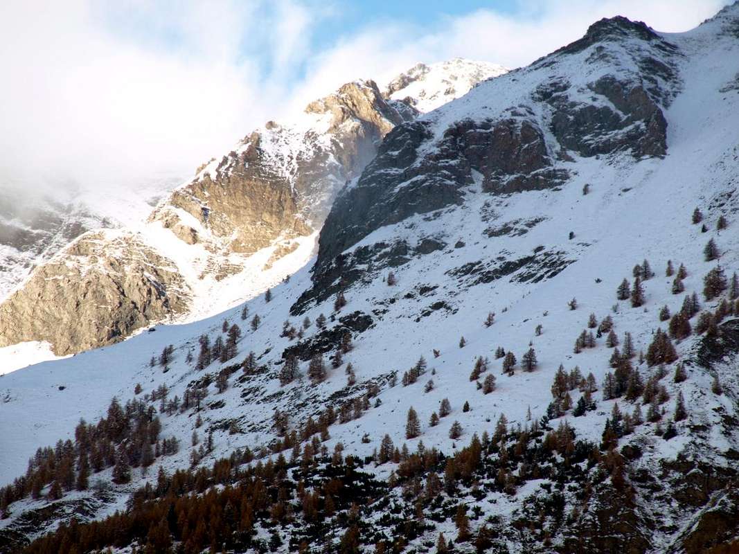
P. Tsavanis (occulted) after the North Slope Chaz Sèche Pass from Pila, by Osw 2015
Other Routes in the surroundings of Tsavanis Alpage
1) - Epinel Hamlet, Tavaillon, Pian de Seutse Alps (1.436m, 2.013m, 2.198m): Excursion with path in Northwest to Drinc Hill (2.565m), near Arno Bivouac (EE/F; 3h'00).
2) - Col Tsa Sètze (2.815m): Excursion from Gimillian with path in Northwest before to Arpisson Alp, after in a vallon under P. di Pian Bessey/P. della Valletta (E/F; 3h'00).
3) - Col Tsa Sètze - P. de la Pierre Traverse (2.653m): Excursion by hill on crest (Piatta Grevon-P. Monpers-P. Couìss-P. Drinc) equipped "Via Panorama" (EE/F; 2h'15).
4) - Col Tsa Sètze - P. della Valletta (3.090m): Climbing from hill on Southwest Ridge; equipped route "Via Ferrata" (EE/A/F+; 1h'15/1h'30).
5) - Bivouac Franco Nebbia (2.740m), Col Garin (2.815m), Lake (2.854m): Excursion from Gimillian with path Northwest towards Arpisson Alp, Pian Bessey (E/F; 3h'30).
Equipment & Difficulties
This route can be considered E or EE/BSA (Experts Hikers or Good Skiers-Montaineers) in winter by Ski-Mountaineering or Snowshoeing.
L'itinerario è classificato E oppure EE/BSA (Escursionisti Esperti/Buoni Sciatori Alpinisti) in inverno tramite Sci-Alpinismo od in Racchette da neve.
Hiking gear or in winter with ski and snowshoes (better with ARVA; in case of dangerous snow stop at Arpisson Alp from Epinel or Gimillan Villages and at Plan de l'Eyve or Eyvie from Pila Resort or by the surroundings as Chamolé Loch or adjacent Comboé's Vallon).
Da Escursionismo oppure in inverno tramite Sci oppure in Racchette da neve (meglio con ARVA; in caso di neve pericolosa fermarsi all'Alpe d'Arpisson dai Villaggi di Epinel e Gimillan ed al Plan de l'Eyve od Eyvie nonché dal Comprensorio di Pila e dintorni come Lago di Chamolé o adiacente Vallone del Comboé.
Mountain Condition
Meteo: you can find all the needed informations at the official site of the Valle d'Aosta Region:
Parents refers to a larger category under which an object falls. For example, theAconcagua mountain page has the 'Aconcagua Group' and the 'Seven Summits' asparents and is a parent itself to many routes, photos, and Trip Reports.


 2571 Hits
 81.18% Score
 13 Votes

 Pointe du Tsavanis Eastern Slope from Arpisson Valley, by livioz 2004


 P. Tsavanis (occulted) after the North Slope Chaz Sèche Pass from Pila, by Osw 2015