


Dundeel - Jul 8, 2012 6:11 pm - Hasn't voted
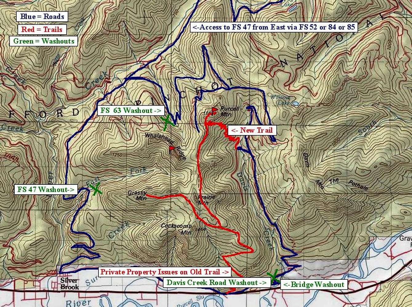
AccessOn July 6, 2012, FS 47 and 63 were both open. The road paralleling Hwy 12 no longer has a Davis Creek bridge. You must access from its west end. The spur to the "New" trail is washed out and abandoned.

ericnoel - Jul 9, 2012 5:20 pm - Hasn't voted
Re: AccessAh cool. It's always good to hear of access being restored. Did you come in via the SW on 47 or via the E via 52->47 or by some alternate path? I won't be repeating Purcell but there are a few other P1000s that I might access in that area.
It sounds like you guys did something somewhat similar to my route. I came in from a bit further NE and bushwhacked up to the 63 road which I then walked to the NW slopes which I ascended. Brushy and steep as I recall but that's the way it goes.
Dundeel - Jul 15, 2012 12:41 pm - Hasn't voted
Re: AccessWe drove up 63 from Hwy 12. A snow bank stopped us right near the saddle and we walked from there. Went around the north side to the southwest side and then up through a steep meadow. That's the best way. We came down the east side and it was steep and brushy.


Comments
Post a Comment