

yatsek - Sep 15, 2009 5:54 am - Voted 10/10
Extremely UsefulCan be real help - thanks!

kamil - Sep 15, 2009 6:49 am - Hasn't voted
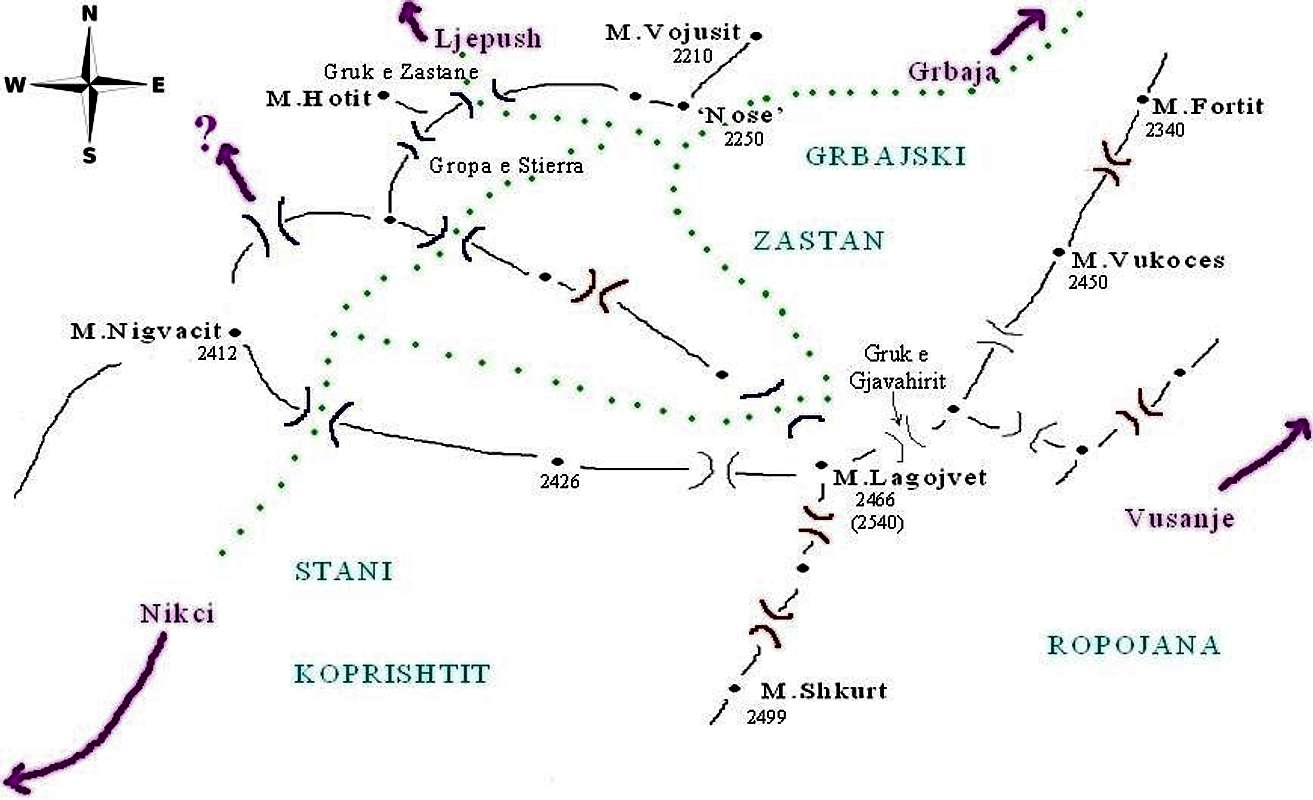
Re: Extremely UsefulDzieki! Ale nie polegaj na niej jak na Zawiszy, jest tylko dla ogolnego rozeznania... For general orientation only, lots of your own assessment necessary!
yatsek - Sep 15, 2009 7:07 am - Voted 10/10
Re: Extremely UsefulSure. You've put it clearly below the map.
Thank you for creating valuable resources, which refers to the other things - such as truly informative route descriptions - on your new (and old) page(s).

peterbud - Sep 16, 2009 5:47 am - Voted 10/10
NorthVery valuable beta, thanks for doing and sharing it! A N sign would come handy, plus maybe peak heights (I guess they're quite unfixed yet but anyway).
(I'd be so glad to be employed as field-worker doing a Prokletije-map, ha ha...)
kamil - Sep 16, 2009 6:07 am - Hasn't voted
Re: NorthThanks for your remarks, Peter!
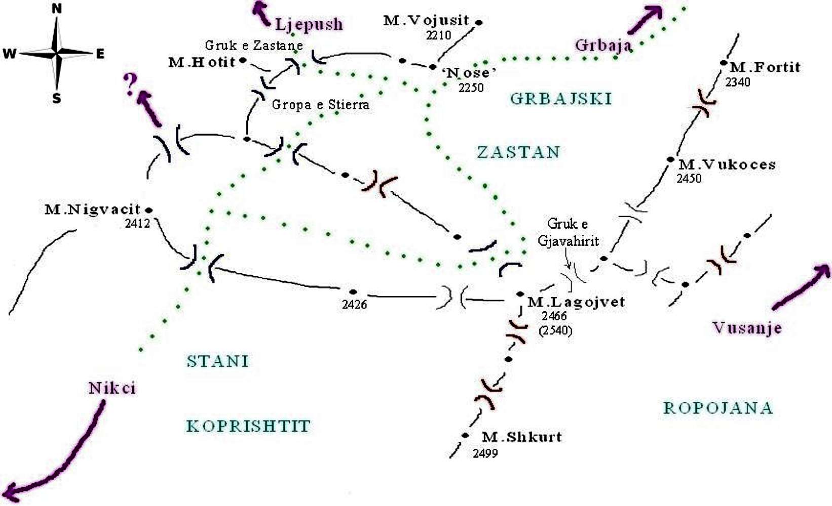
I drew it so that north goes up but I can add it, as well as the peak heights (which are far from reliable as you noticed :)
I haven't worked it out yet, can I replace a photo within the same 'photo page' on SP without changing all the settings?
cheers,
k
peterbud - Sep 16, 2009 6:56 am - Voted 10/10
Re: NorthYes, it's possible, click edit on the pic's page, and change the file, then submit. I used this method several times for updating the sketch maps for the Carpathians and High Tatras pages.
kamil - Sep 16, 2009 7:10 am - Hasn't voted
Re: NorthDone! Somehow I can't see the changes on the photo page but only when I click it to open.
peterbud - Sep 16, 2009 7:13 am - Voted 10/10
Re: NorthF5! :)
kamil - Sep 16, 2009 7:23 am - Hasn't voted
Re: NorthHahaha now I can see everything alright :)
yatsek - Sep 16, 2009 7:30 am - Voted 10/10
Re: NorthI've learnt sometimes it takes a good few hours for the changes to appear on the screen.
peterbud - Sep 16, 2009 7:36 am - Voted 10/10
Re: NorthIt depends on the caching behaviour (or more precisely: settings) of your browser.
peterbud - Sep 16, 2009 7:38 am - Voted 10/10
Re: NorthOk Kamil, next step: add the flag! :)
/just kidding/


Comments
Post a Comment