
|
|
Route |
|---|---|
|
|
39.98430°N / 112.5406°W |
|
|
Hiking |
|
|
Spring, Summer, Fall, Winter |
|
|
Half a day |
|
|
Class 3 |
|
|
Approach
See the Getting There section on the main page for driving directions. Drive your vehicle as far as you can into the canyon or until you reach the Southeast Ridge, about 7400 feet. The ridge on the far right in the photo is the class 3 route to the summit.Route Description
This route usually gets a lot of sunshine during the winter; therefore snow doesn’t accumulate too much on the southeast ridge. Although this route is entirely off trail, the brush is minor on this approach.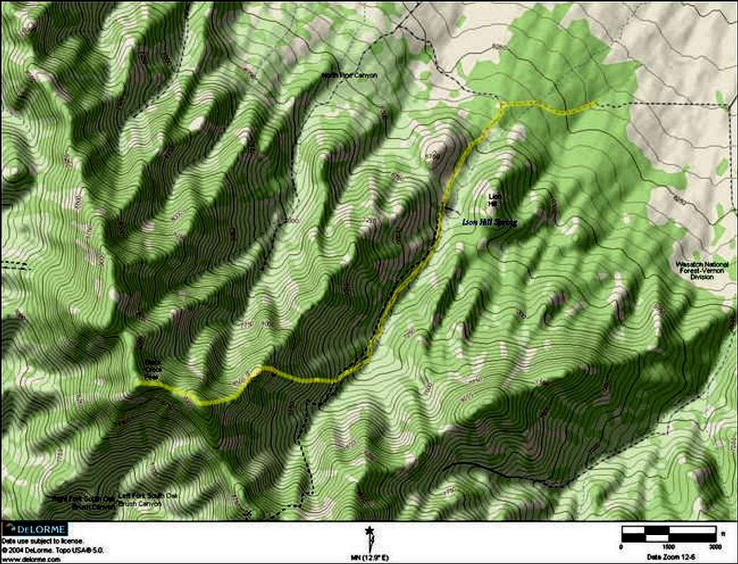
Round Trip Distance : 8 mi
Elevation Gain : 3000 ft
(Measured from the low clearance access point)
From the start of the southeast ridge, make your way through the Scrub Oaks to the bottom of the ridge, shown in the picture. Scramble up the rocks, the going will be mostly easy class 3 and the highpoint you see is one of two false summits. Continue upwards towards the highpoint, several occasions dropping down a little bit. After you reach the first false summit you will see the second false summit.
With the second false summit in view drop down a little bit and continue the scramble upwards to the second false summit. After arriving at the top of the second false summit you will have a have a good view of the real summit. The real summit in the previous picture is half a mile away. Make you way along the ridge shown in the picture to the rocks just below the summit. Scramble up the rocks to the summit; this section is a little steeper but is still easy class 3.
 |