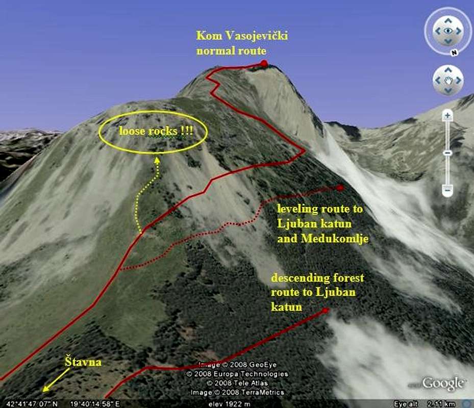
This image gives an insight of the "marked" routes involving
Kom Vasojevički starting from
Štavna.
The
normal route is generally well signed, except for a very important bifurcation, where the sign directs you towards a
scrambling/climbing route (marked by yellow dots).
Do not take this latter, unless you are experienced climber, because it leads through an area of very loose rocks ready to fall as you touch them. The normal route is safe.
There is a leveling path in the side of the mountain, which goes towards
Medukomlje, the area between
Kom Vasojevički and
Kom Kučki. This route is easy and safe at the start, but later there are some hazardous places, where it is like an "Inca path". Not recommended with boots with a tendency of slipping, especially when the ground is wet. Nevertheless, check it out and see for yourself.
The other route that approaches
Medukomlje (although somewhat below the previous one) leads comfortably through the beech forest, towards
Ljuban katun. Drawback of this route is that you will loose some elevation and will have to ascend again. Signs are not frequent, but the path is clear and wide. Warning: if you want to go to
Medukomlje, watch out eagerly for a very narrow and not often used path towards the left, when the "main path" takes a U-turn and starts to ascend again.


