Toggle navigation
Mountains
Routes
Images
Trip Reports
Forum
What's New
People
Areas & Ranges
Articles
Trailheads
Canyons
Huts & Campgrounds
Albums
Logistical Centers
Fact Sheets
Lists
Custom Objects
Gear
Plans & Partners
WELCOME TO SUMMITPOST
SIGN IN
REGISTER
Lurien
Additional Parents
Image
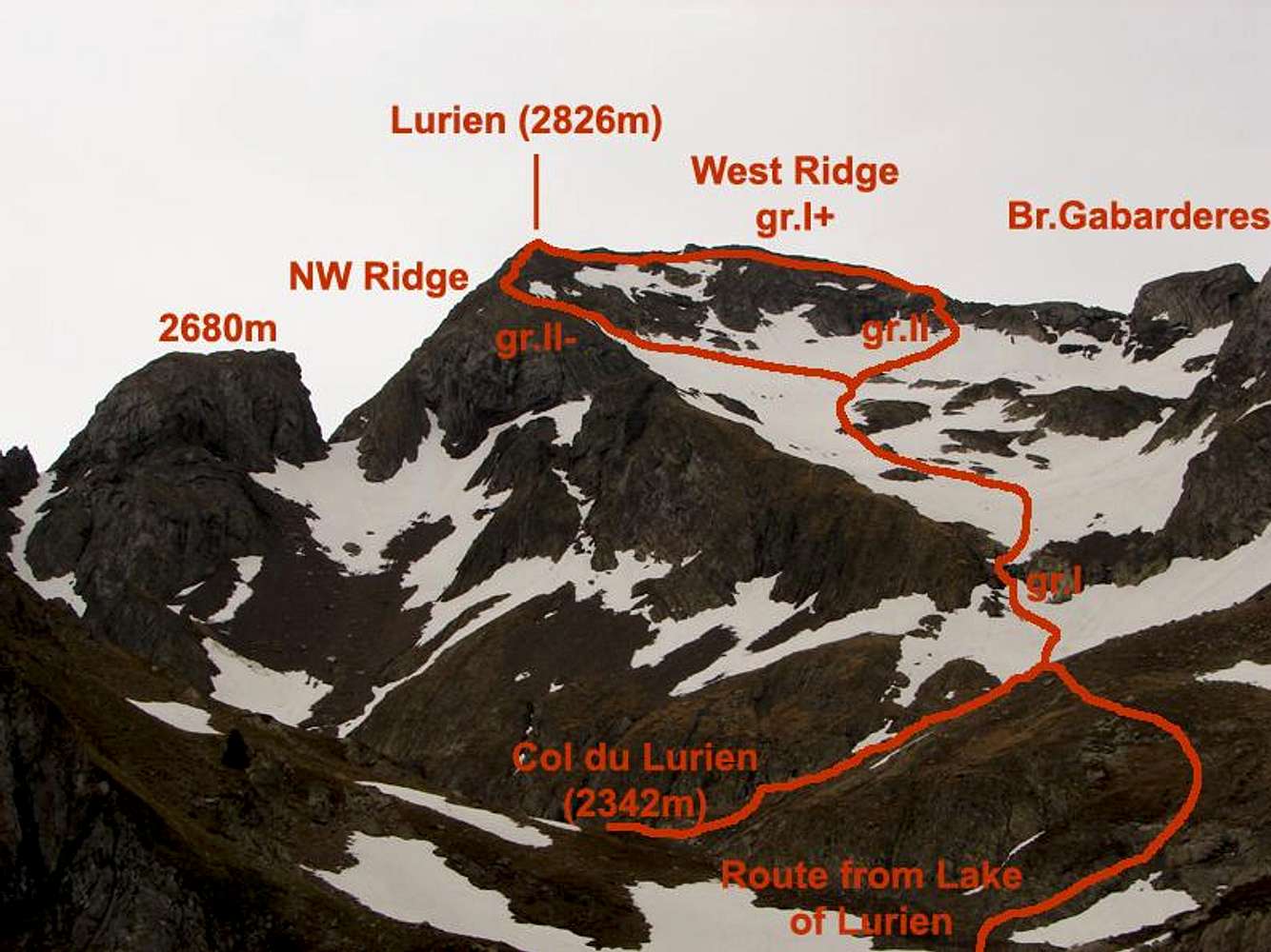
Routes to Lurien
View High-Resolution Image
Routes to Lurien
Sketch of the routes to climb the peak Lurien. The Col du Lurien it's the point of confluence of routes from Lac d'Artouste and Lac de Fabrèges. It can see the two possibles routes to reach the summit. May 2006.
« PREV
NEXT »
Rafa Bartolome
on
Nov 3, 2006 9:10 am
Comments & voting
Other parents
Lat/Lon:
42.85837°N / 0.35041°W
Image Type(s):
Alpine Climbing
,
Topo/Diagram
,
Informational
Image ID:
240992
2378 Hits
73.06
% Score
3
Votes
Log in to vote
Comments
No comments posted yet.
to post!
Don't have an account?
Lurien
(Mountain/Rock)
« PREV
Viewing
#9 of 37
GALLERY
NEXT »
Rafa Bartolome's Image Gallery
« PREV
Viewing
#1882 of 6100
GALLERY
NEXT »
×
You need to login in order to vote!
User Name
Password
Remember me
Forgot your password?
Log me out when I close my browser.
Keep me logged in all the time.
sign in as a user
Don't have an account?
Register now for FREE
Rating available
Suggested routes for you
People who climb the same things as you
Comments Available
Create Albums
Register Here


