Toggle navigation
Mountains
Routes
Images
Trip Reports
Forum
What's New
People
Areas & Ranges
Articles
Trailheads
Canyons
Huts & Campgrounds
Albums
Logistical Centers
Fact Sheets
Lists
Custom Objects
Gear
Plans & Partners
WELCOME TO SUMMITPOST
SIGN IN
REGISTER
Muntanitz
Additional Parents
Image
selfmade outline of the...
View High-Resolution Image
selfmade outline of the...
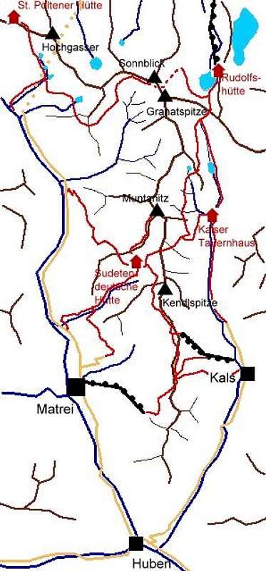
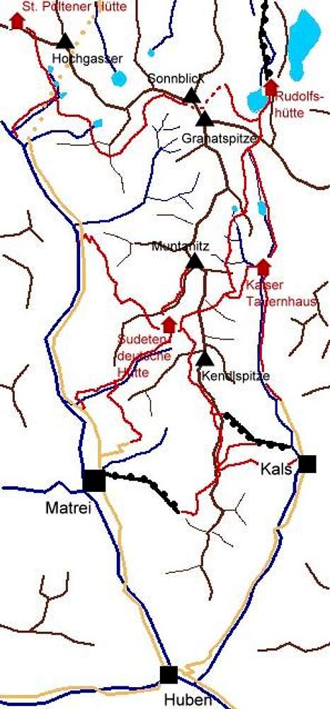
selfmade outline of the hiking possibilities of the southern Granatspitz Group. yellow: roads ; red: marked hiking trails
« PREV
NEXT »
Mathias Zehring
on
Aug 31, 2003 2:35 am
Comments & voting
Other parents
Lat/Lon:
47.07360°N / 12.58880°E
Image ID:
26622
3267 Hits
74.19
% Score
5
Votes
Log in to vote
Comments
No comments posted yet.
to post!
Don't have an account?
Muntanitz
(Mountain/Rock)
« PREV
Viewing
#52 of 87
GALLERY
NEXT »
Mathias Zehring's Image Gallery
« PREV
Viewing
#1160 of 1879
GALLERY
NEXT »
×
You need to login in order to vote!
User Name
Password
Remember me
Forgot your password?
Log me out when I close my browser.
Keep me logged in all the time.
sign in as a user
Don't have an account?
Register now for FREE
Rating available
Suggested routes for you
People who climb the same things as you
Comments Available
Create Albums
Register Here


