
-
 14171 Hits
-
 75.81% Score
-
 6 Votes
|
|
Route |
|---|---|
|
|
Via Ferrata |
|
|
Half a day |
|
|
Medium Via Ferrata |
|
|
Classification
Starting Point : Rifugio Tuckett - 2270m
Ending Point : Rifugio Brentei - 2175m / Rifugio Alimonta - 2580m
Highest Point : Plateau below Punte di Campiglio - 2573m
time requested : 3h one way
signs : 305B (can be combined with Galleria Bogani: 318)
Difficulty : medium
Hardness : medium
Exposure : medium
Approach
There are several possibilities to reach Rifugio Tuckett:
- Go to Passo Grostè via cablecar and take trail no. 316 to Rifugio Tuckett
- Again from Passo Grostè along trail 305, the Ferrata delle Bocchette Alte to Bocca del Tuckett. This is a difficult day tour in itself
- From Madonna di Campiglio through Vallesinella to Rifugio Vallesinella (either by car or on foot). Take trail 317 to Rifugio Casinei, then onwards on the same trail to Rifugio Tuckett. Alternatively from Casinei along 318 and 328 over Passo Casinei towards Rifugio Tuckett.
 |  |  |
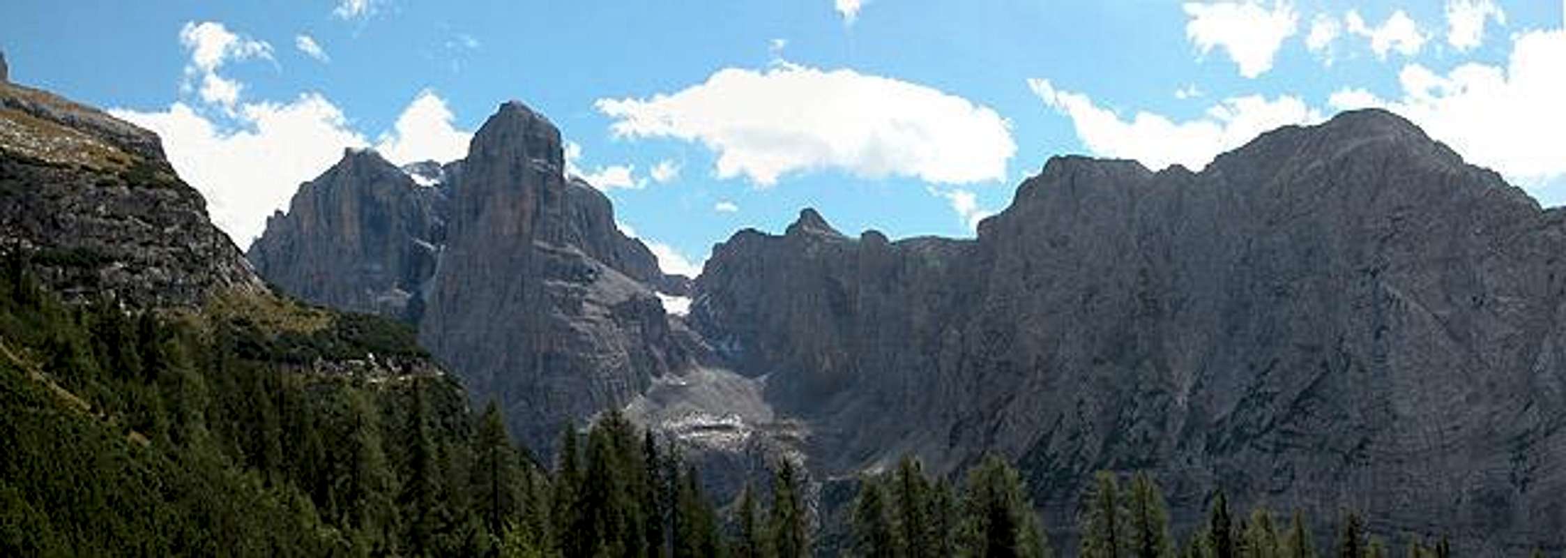
Overview
The Sentiero attrezzato S.O.S.A.T runs along the bases of Punta Massari and Punte di Campiglio from the Valesinella valley towards Val Brenta Alta. There it traverses the south wall of Cima Mandron. The most difficult part is the southwest shoulder below Punte di Campiglio where long ladders secure a couple of ascents and descents. At one place the ledge narrows to a tunnellike overhang through which you have to scramble on hands and knees. Endpoints are either Rifugio Brentei at the foot of Crozzon di Brenta or Rifugio Alimonta below Cima Molveno.
 |  |  |  |  |
1st Stage: Rifugio Tuckett – Punte di Campiglio
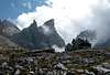
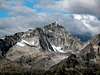
Start out from Rifugio Tuckett along trail 303 in the direction of Bocca del Tuckett. After some ten minutes turn right on 305B, which already is Sentiero SOSAT. It turns westward and leaves the upper Vallesinella valley along the shoulders and ledges below Punta Massari. At this place the sentiero is rather easy and virtually unsecured. After some time it heads further south and turns the corner around Punte di Campiglio, steadily ascending. You reach a platform with a gorgeous look at Crozzon di Brenta (and Cima Tosa behind). To the west you can admire the Adamello- and <PresanellaGroups Here you should rest a while in order to prepare for the difficult part of the ferrata.
 |  |  |  |
2nd Stage: Punte di Campiglio – Rifugios Brentei / Alimonta
From the platform you can already see a gully which has to be traversed. The trail does so by climbing down along a long series of ladders for about 150m. There you reach a ledge which leads you directly into the gully. Again some 10m downwards and then you stand in front of the big 50-step ladder, that leads you back upwards to the old ledge (but on the other side of the gully). From here on the trail gets easier you have to scramble below an overhang on hands and knees and later need to descend a chimney (again beautifully secured by cables and ladders).
In the next pass (about 500m after the chimney) you need to decide whether to climb down to Rifugio Brentei (323) or head on- and upwards to Rifugio Alimonta. In the former case there is a beautiful trail, the Galleria Bogani, which takes you back to Rifugio Casinei and Rifugio Vallesinella.
 |  |  |  |  |
Essential Gear
You can do the ferrata with just hiking gear (we did). But I would strongly advise you to use a ferrata set with harness, helmet and two short ropes with biners. The descent along the ladders south of Punte di Campiglio requires pretty much experience.
 |  |