


-
 2197 Hits
-
 79.04% Score
-
 10 Votes
|
|
Area/Range |
|---|---|
|
|
45.70989°N / 7.44987°E |
|
|
Hiking |
|
|
Spring, Summer, Fall, Winter |
|
|
6070 ft / 1850 m |
|
|
Note
La montagna chiama i suoi figli, ed essi rispondono fedelmente al suo appello… Osvaldo Cardellina, Diario alpinistico, 1964-65 Page texts: @ OsvaldoCardellina "Osva", passed away on May 2, 2022. Page owners: Christian Cardellina e Osvaldo Cardellina. Any updates from September 12, 2022: Antonio Giani, page administrator, friend and climbing companion. Testi della pagina: @ OsvaldoCardellina "Osva", scomparso il 2 maggio 2022. Proprietari pagina: Christian Cardellina e Osvaldo Cardellina. Eventuali aggiornamenti dal 12 settembre 2022: Antonio Giani, amministratore della pagina, amico e compagno di salite. |
Miners Paths Overview
But what were the "tracks" of the miners worked and in which area? Mount Corquet (2.531m) is the Mother of all these Battles ". Dure struggles for survival involving the people living on the slopes of this mountain, in turn" brought forth "from the long watershed that originates from Punta Tersiva (3.515m) and then bypassing over the two Averts (2.935m, 2.991m). Always amongst the Vallons Fénis-Clavalité (East) and that of Saint Marcel "true owner". At least fictitiously, because before the Romans, and then the Nobles finally Entrepreneurs Mining were the real masters, relegating the poor inhabitants at the hard work, first as Slaves and later with the rank of Miners or "Mineurs". A hard life and difficult to deal with day to day and throughout the year, with cold winters and the temperature more than rigid to bear and with only the support of poor shacks of stone and wood, there hung over the precipice dug by the passage in centuries of the Torrent de Saint Marcel. That sometimes overflows putting itself in competition with avalanches and alone with the company of the old mule and trusty pickaxe. Almost suspended in another world, as unreal but real. Listening to the icy wind whistling into the forest and sheltering into caves of the mines. Their daily bread and that of their families, anxious, waiting down there at the "Factory" where the ore would come. To get off to find them, there were no roads but steep mule to deal on foot, by mule and, for some stretches, by great sleds ...
![]()
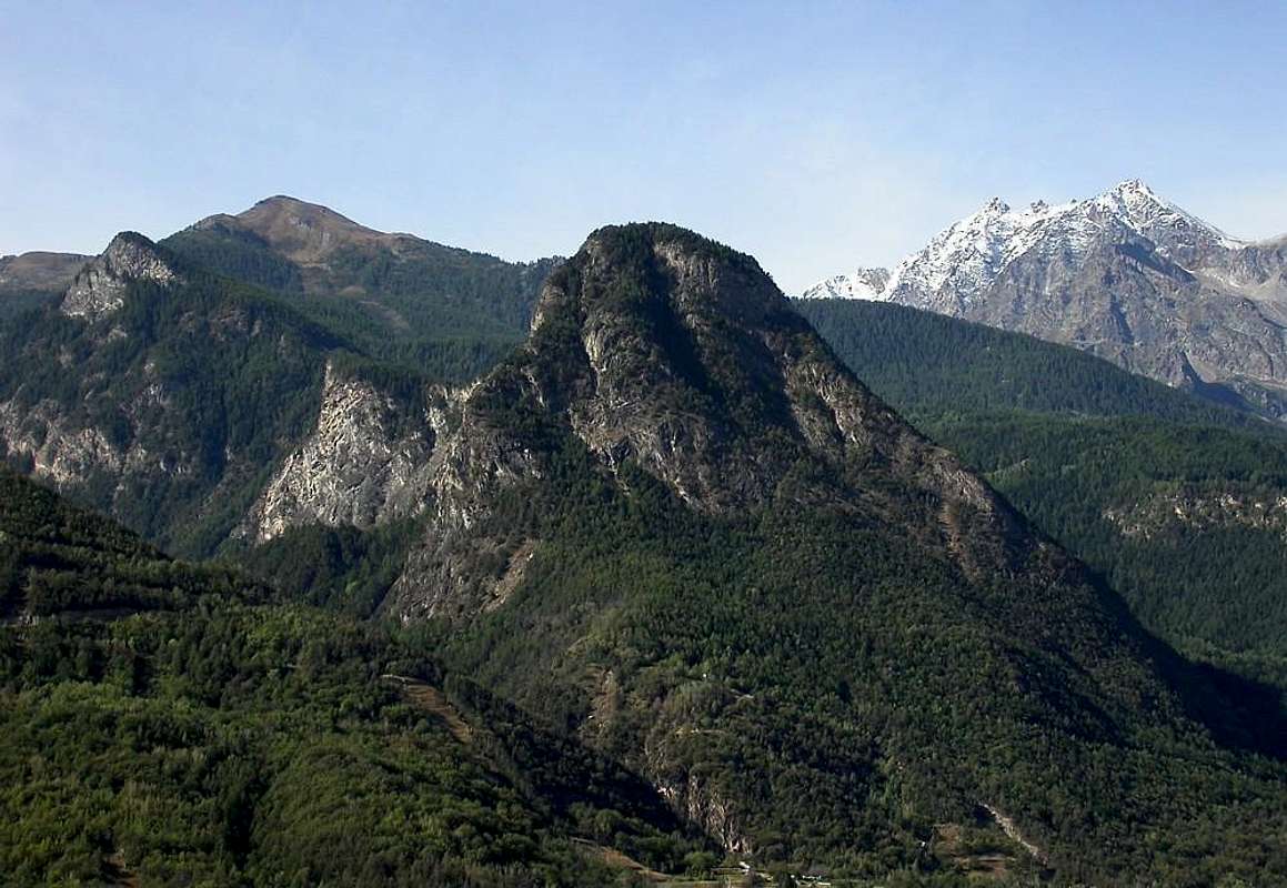
Ma quali erano le "piste" dei Minatori ed in qual zona operavano? Il Mont Corquet (2.531 m) è la Madre di tutte queste Battaglie". Dure lotte per la sopravvivenza che coinvolgevano le popolazioni residenti alle pendici di questa Montagna, a sua volta "partorita" da quel lungo spartiacque che si origina dalla Punta Tersiva (3.515 m) per poi scavalcare i due Averts (2.935 m, 2.991 m). Sempre tra il Vallone di Fénis-Clavalité (Oriente) e quello di Saint Marcel "proprietario". Almeno in modo fittizio, perché prima i Romani, poi i Nobili ed infine gli imprenditori Minerari sono stati i veri padroni, relegando i poveri abitanti al duro lavoro, prima come Schiavi ed in seguito con la qualifica di Minatori o "Mineurs". Una vita dura e difficile da affrontare giorno per giorno e per tutto lo anno, con inverni freddi e dalle temerature più che rigide da sopportare e con il solo appoggio di povere baracche in pietra e legno, lassù appese sopra il precipizio scavato dal secolare scorrere del Torrent de Saint Marcel. Che ogni tanto esondava mettendosi in concorrenza con le valanghe e con la sola compagnia del vecchio mulo e del fidato piccone. Quasi sospesi in un altro mondo, tanto irreale quanto vero. Ascoltando il gelido sibilo del vento dentro la foresta e riparandosi dentro le caverne delle miniere. Il loro pane quotidiano e quello delle famiglie che, ansiose, attendevano in basso, là presso la "Fabbrica" dove il minerale sarebbe arrivato. Per scendere a trovarli, non strade ma ripide mulattiere da affronare a piedi, a dorso di mulo e, per qualche tratto, sugli slittoni ...
Getting There
BY CAR:
- From TORINO, MILANO, etc: Motorway A5. Exit at IVREA or Quincinetto (PIEDMONT)
- From IVREA Town: in West (Southern side) to Pont Saint Martin, Donnas, Bard, Champdepraz, St. Vincent, Châtillon, Pontey, Fénis, Saint Marcel.
- From Fénis Commune (537m) on Pieiller small Vallon towards Le-Pieiller-de-Sermaz, Maison Longue, Le Plany Hamlets (1.075m, 1.112m, 1.174m); through asphalt road) and subsequent connection with La Morgetta(z), Pressunettaz, alternative before Champremier (1.383m) at Les Druges Lower and Upper small Villages (1.567m, 1600m).
- From Saint Marcel Commune (630m) to Saint Marcel Vallon and Turati Reserve up to the Mulàc and Grande Chaux Hunting Houses and Alp (1.937m, 2.370m). Specific Road By SS.26, 15 Km by Aosta Town, crossing the stonebridge over the Dora Baltea, just after the Country of Nus (output Motorways A5), arriving at the junction 539 meters, and immediately after the field of Football, leave the roundabout to the left on the same (various large signals), and go up to the Chief Lieu.
- From FRANCE: through the Mont Blanc Tunnel to Entrèves-crossroads to Vény/Ferret Valleys - Mountain Guides of Courmayeur - La Saxe Rock Gym - Courmayeur. By Little Saint Bernard Pass, closed since November until half May to La Thuile Valley - Pré Saint Didier - Courmayeur. It is not necessary to take Motorway A5: you can drive on SS.26, in the direction of AOSTA - IVREA - TURIN.
BY PLANE:
- Aeroporto "Corrado Gex" Saint Christophe (Aosta).
Base Trail into St. Marcel Valley towards the mines
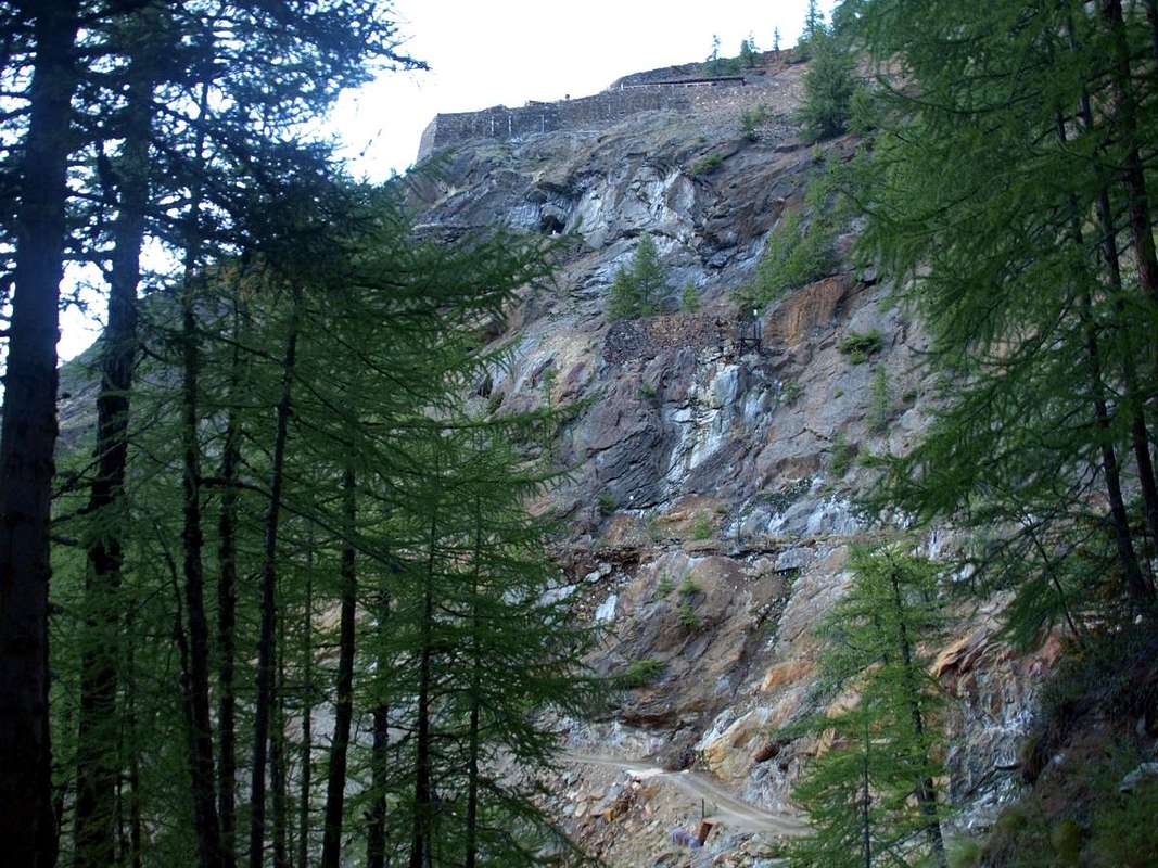
From Les Druges "Alte" (Upper) towards Praborna Manganesemine nearby Mulàc. Deliberately by choice, here we limit the description to the base path, which passes close to the mines by returning the most specific information in relation to small paths leading to the houses of the miners and the entrances to a subsequent specific page.
![]()
![]()
Da Les Druges "Alte" verso la Miniera di manganese di Praborna presso la Casa di Caccia di Mulàc. Per scelta voluta, limitiamo qui la descrizione al percorso di base, che passa nelle vicinanze delle miniere rinviando quella più dettagliata nei confronti dei sentierini adducenti alle case dei minatori nonché agli imbocchi a successiva specifica pagina.
From Les Druges Upper towards Servette, Praborna & Mulàc
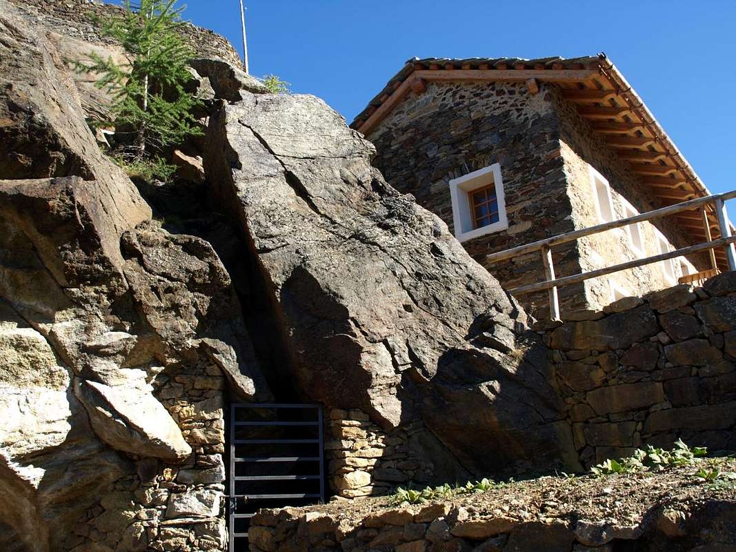
By Les Druges towards Grande Chaux: By Les Druges "Low" (1.567m) a last bend in the road asphalt leads to the "High", where shortly afterwards becomes paved farm road not more (signs in brown at the last house). From Les Druges "Alte" suddenly into the forest leads to the Picnic Area beyond which a short descent leads to the cartel prohibition for the cars just before the Pouria Pasture (1.586m; no more than three cars). Continuing uphill the private dirt road reaches, with soft ascent, a grassy esplanade at the edge of the forest with to the North an ancient ruined alp and in South the construction known as "Garages" below the ruins of the "Trèves Furnace", just before the fork in the torrent (still many yellow signs up at the furnace in left and down at Viplana Village in right (1.346m) with path n° 3). Continuing on the farm road to the West through a long diagonal leading to the location Vargney (1.676m) at some dumps of ore burned. Leave South the small path n° 16/18 addressed to the Coppermine of Servette and then to Lavanche Pasture (2.071m; suggestive way to transport the mineral with high stone walls and connecting with the Mines Praborna) and Crotey Dèsott Alp (2.348m), under Mont Corquet (2.531m). Starting from the small and last lay-by beyond the rocky-wooden dump of the above abandoned Coppermines Chuc-Servette, and after rounding the cape entering the real vallon, walk, instead through the trail n° 15 concomitant with the dirt road, "suspended" on the left (East) along the entire Vallon St. Marcel. A short descent leads to the base of a small trickle of water (not drinking dirty because with the sour taste of soil and copper) with the foot a rocky escarpment that rushes to the Torrent de Saint Marcel. Keep going towards South flexing a little to the right (South-southwest) with beautiful views of the overlying dry stone walls and the stone buildings designed to house the miners. Pass a new short ascent with beautiful views of the Group of Rouèses and wild Vallon Arpisson; another descent, after leaving to the left (East) deviation n° 16 for Servette, leading to the end of the same. After passing a small gate (signals of private property and border of the Reserve by Marquis Turati of Turin ex Baron Giuseppe Antonio Beck Peckoz of Gressoney) and after a short descent bypassing Eteley Pasture (1.750m) and abandoning Northwest the crossroads with path n° 4G towards the Alp Choulet and Arpisson Vallon, remount passing through Mulàc Hunting House (1.937m; beautiful fountain with wooden steinbock) boarding on the right (Northwest) the ancient Manganesemine of Praz Bornaz also Prabor(g)na, reached from alternative 1.836 meters through deviation not numbered and abandoned for years now (1.882m; E/F; 2h'00/2h'30). This must be considered the Basic Itinerary from which branch all variants for Mines Servette and Praborna, they exclude the Mine Chuc. This can be achieved by starting from Hamlets Plout and Seissogne or down by two forks (one, the first in ascent, reported) located between the localities Servette and E'teley.
![]()
Da Les Druges "Alte" verso Servette, Praborna & Mulàc
Da Les Druges "Basse" (1.567 m) un ultimo tornante della strada in asfalto conduce a quelle "Alte", dove poco appresso diventa strada poderale non più asfaltata (cartelli in colore marrone presso l'ultima casa). Da Les Druges "Alte" un tratto nella foresta con discesina conduce all'Area Pic Nic, oltrepassando la quale un'altra breve discesa conduce al cartello di divieto per i mezzi appena prima della località Pouria (1.586 m; non più di tre posti auto). Continuando in leggera salita la strada poderale raggiunge una spianata erbosa ai limiti della foresta con a Settentrione, oltre la poderale, un'antica alpe diroccata ed a Sud una costruzione cosiddetta "Garages o Magazzino" appena prima della biforcazione del torrente (ancora vari cartelli gialli, in alto in direzione della soprastante Fornace Trèves" nonché delle abitazioni dei minatori ed in basso verso il Villaggetto di Viplana (1.346 m) con sentiero n° 3). Continuando sulla poderale verso Occidente un lungo diagonale porta alla località Vargney (1.676 m) presso alcuni piazzali sovrastati dalle discariche del minerale di rame combusto nelle due prime miniere. Lasciare a Sud il sentierino n° 16/18 indirizzato dapprima alla Miniera di Servette e poi agli Alpeggi Lavanche o Lavanché (2.071 m; suggestiva strada per il trasporto del minerale con alte mura in pietra su di un ponticello e collegamento con le Miniere di manganese di Praborna) e Crotey Dèsott (2.348 m)), con percorso sempre al di sotto del Versante Occidentale del Mont Roux (2.271m) e del successivo Mont Corquet (2.531m). A partire dalla piccola piazzola al di là dell'ultima discarica dell'abbandonata miniera di rame Chuc-Servette, e dopo aver doppiato il promontorio roccioso-boschivo entrando nel vero e proprio Vallone di Saint Marcel, invece tramite il sentiero n° 15 concomitante alla poderale, camminare "sospesi" sulla sinistra (Est) lungo l'intera valle. Una breve discesina conduce alla base di un rivoletto d'acqua proveniente dalle miniere di rame (non bere perché sporca di terriccio e con il sapore acidulo del rame) con ai piedi una scarpata rocciosa precipitante verso il Torrent de Saint Marcel. Proseguire ancora verso Mezzogiorno flettendo un poco più a destra (Sud-sudovest) con bella vista sui soprastanti muraglioni di pietra costruiti a secco e sulle abitazioni in pietra atte ad alloggiamento dei minatori. Superare una nuova breve risalita con bella vista sulla Catena delle Rouèses e sul selvaggio Vallone di Arpisson; un'altra discesa, dopo avere lasciato a sinistra (Est) la deviazione n° 16 per le Miniere di Servette, porta al termine dell'area medesima. Dopo aver superato un cancelletto (segnalazioni di proprietà privata e confine della Riserva di proprietà del Marchese Attilio Turati di Torino, nonché ex Riserva di proprietà del Barone Giuseppe Antonio Beck Peckoz di Gressoney) e dopo una breve discesa superando l'Alpe di Eteley (1.750 m) e lasciando a Nordovest il bivio con sentiero n° 4G per l'Alpe Choulet ed il Vallone d'Arpisson, rimontare passando affianco alla Casa di Caccia di Mulàc (1.937 m; bella fontana con stambecco in legno), con immediatamente sulla destra (Nordovest) l'antica miniera di manganese, raggiungibile dal bivio con deviazione non numerato ed abbandonata ormai da molto, di Praz Bornaz o Praborna od ancora Praborgna (1.882 m E/F; 2h'00/2h'30). Questo deve esser considerato l'Itinerario di base dal quale si dipartono tutte le varianti per le Miniere di Servette e Praborna, esclusa quindi quella di Chuc. Quest'ultima può esser raggiunta partendo dai Villaggi di Plout e Seissogne oppure in discesa dai bivi consecutivi (uno segnalato) collocati tra le località di Servette e d'E'teley.
 |
 |
 |
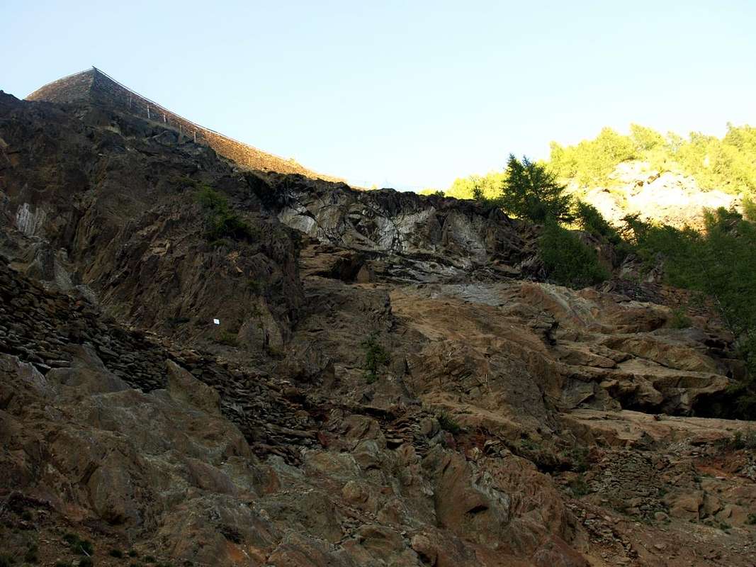
Specific paths to the various entrances
But what were the "streets" of the miners worked? A long trail up towards the South and near the Château de Paquier and the Village of Crétaz (609m, 653m) dated back to the Sanctuary of Plout (968m), where, as usual, they went up on foot to the famous Procession of "Notre Dame des Tous Pouvoir" ("Our Lady of all Powers"). From here it reached the Village Seissogne (1.066m) and then, leaving the East and those of Sazailland and Ronc, was reached the small Village Viplana (1.346m), where the trail went into the forest to reach the path from Les Druges "High" leads into the vallon. But to do before left this last forever in the East along with the underlying Pastures of Champremier (1.383m) and Leycher or Leyché (1.506m). So it came on the trail (today a dirt road) immediately to the West of Les Druges and the Alps of Pouria (1.586m) and Vargney (1.676m) at the foot of the large dumps and at the paths that led to the "Furnace Treves" and the first mine, further West immediately over the landfill. Here the trail with steep climb was rounding the headland after entering the valley. A short descent led in the resort of Servette (1.819m), topped by all other entrances and private dwellings of miners. A brief detour leads to the second mine in Northeast (trail n° 16, while just came over the trail n° 4 from the mine below Chuc (1.418m) and Water Green or Eve Verda (1.205m), where it was a first washing ore and the mineral tinged with bleu-turquoise-green and coloring the Torrent de St. Marcel. But here you could also arrive from below, starting with the Villages of Faverge and Moulin (632m, 669m), while along the valley bottom always with the path n° 4 until it meets the connection with the n° 13 from Echedzen (1.253m), before the latter continues as n° 4G more in the South-southwest to the wild Vallon of Arpisson the foot of the Chain of the Roises. But in the second mine moreover is reached via the trail n° 16/18 which, starting from the landfill shortly after Vargney goes up first in the Southwest and then Southward into the forest remaining just above the farm dirt road concomitant with the basic path n° 15 and just above a brook of irrigation. This turn well to the Northeast first, reaching the area called "Warehouse or Garages" (third input to the same reported in yellow but actually unnumbered; from here, with the same color on a pole as n° 3 marked trail down towards the Villages Seissogne and Plout) to finally reach halfway up the area "Picnic", where there are the first two entries in the same (panels and messages in yellow). From this a trail restored but not numbered and currently protected dates back to the houses of the miners, to the third mine (a main entrance, a neighboring horizontal and a very narrow "taste") at the start of the cable car, while from the penultimate hairpin bend and just to the right of the houses is possible the downhill to the South-southeast path a rather exposed and unnumbered, currently closed with barrier reaching a last or most Southern entrance, it also barred by a gate "nestling". Soon after he begins to climb the trail n° 18 to Southeast first reaching the altitude of about 2.050 meters to then turn decisively in the Southern direction towards the Alps Crotey Dèsott (2.348m) and Lavanche or Lavanché (2.065m), always below the rocky-wooded Western Slopes of the overhanging Mont Roux (2.271m; attention at the presence of wild boars). This last is a little path unnumbered addresses to Northwest down at the fork 1.836 meters onto a private dirt road to Praborna Pasture (1.891m) with the same name and immediately below manganese mine. Further on the farm private dirt road continues for Mulàc Saint-Louis (1.940m) and the House of Hunting by Marquis Attilio Turati, but now this is no longer interesting because we are going from one exclusively mineral area to an area favored but protected for hunting into the magnificent, wild but private "Preserve of the Grand Avert". Anyway. For completeness, we note that this "poderale" concomitant trail n°15, passing through the Alps Plan Rué, Emonin, Layet with its pond, along the entire valley reaching the Pastures of Pt. and Gr. Chaux (2.419m, 2.439m) and the next House Hunting Marquis Turati, former Baron Antonio Beck Peckoz Gressoney Valley.
 |
 |
 |
 |
 |
Ma quali erano le "strade" dei Minatori? Una lunga mulattiera montava verso Mezzogiorno e dai pressi del Castello di Paquier e del Villaggio di Crétaz (609 m, 653 m) risaliva fino al Santuario di Plout (968 m), dove, tanto per cambiare, si continuava a piedi per la famosa Processione di "Notre Dame des Tous Pouvoir" ("Nostra Signora di tutti i Poteri"). Da qui si raggiungeva il Villaggio di Seissogne (1.066 m) e poi, lasciando ad Oriente quelli di Sazailland e Ronc, si arrivava al piccolo Villaggio di Viplana (1.346 m), dove la mulattiera proseguiva dentro la foresta raggiungendo il sentiero che da Les Druges "Alte" conduce nel vallone. Ma per far prima si lasciava quest'ultima sempre ad Est insieme ai sottostanti Alpeggi di Champremier (1.383 m) e Leycher o Leyché (1.506 m). Si giungeva così sulla mulattiera (oggi poderale) subito ad Occidente di Les Druges e tra le Alpi di Pouria (1.586 m) e Vargney (1.676 m), ai piedi delle grandi discariche e presso i sentieri adducenti alla "Fornace Trèves" nonché alla prima miniera, subito al di sopra della discarica più ad Ovest. Qui la mulattiera doppiava con ripida salita il successivo promontorio entrando nel vallone. Una discesina conduceva nella località di Servette (1.819 m), sovrastata da tutti gli altri imbocchi e relative abitazioni dei minatori. Una breve deviazione a Nordest conduceva alla seconda miniera tramite sentiero n° 16, mentre poco oltre giungeva il sentiero n° 4 dalla miniera più in basso di Chuc (1.418 m) e dall'Acqua Verde o Eve Verda (1.205 m), dove avveniva un primo lavaggio del minerale che colorava di blù-verde-turchese il Torrent de St. Marcel. Ma qui si poteva arrivare ancor da più in basso, partendo dai Villaggi di Faverge e Moulin (632 m, 669 m) e percorrendo il fondo del vallone sempre con il sentiero n° 4 insino ad incontrare il collegamento con il n° 13 da Echedzen (1.253 m), prima che quest'ultimo continuasse come n° 4G più a Sud-sudovest verso il selvaggio Vallone dello Arpisson ai piedi della Catena delle Roises. Ma alla seconda miniera si giunge anche tramite il sentiero n° 16/18 che, partendo dalla discarica poco dopo Vargney sale dapprima a Sudovest e poi verso Sud dentro la foresta restando un poco alto sulla strada poderale concomitante con il sentiero di base n° 5, nonché appena al di sopra d'un ruscello di irrigazione. Questo con largo giro verso Nordest raggiunge dapprima la zona detta "Magazzino o Garages" (terzo ingresso al medesimo segnalato in giallo ma attualmente non numerato e, sempre da qui, con lo stesso colore sentiero segnalato in giallo su palina come n° 3 in discesa verso i Villaggi di Seissogne e Plout) per infine raggiungere a mezzacosta l'Area "Picnic", dove esistono le prime due entrate nel medesimo (pannelli e paline di segnalazione sempre in giallo). Da questa una mulattiera ristrutturata ma priva di numerazione ed attualmente protetta risale alle case dei minatori, alla terza miniera (un ingresso principale, uno secondario orizzontale ed un "assaggio") nonché alla partenza della teleferica, mentre dal penultimo tornante ed appena a destra delle case scende verso Sud-sudest un sentiero piuttosto esposto e non numerato, attualmente chiuso con sbarramento che raggiunge un'ultimo o più Meridionale imbocco, anch'esso sbarrato tramite una cancellata "adagiata". Subito dopo inizia a salire verso Sudest il sentiero n° 18 dapprima raggiungendo la quota di 2.050 metri circa per poi ripiegare decisamente a Mezzogiorno in direzione delle Alpi Crotey Dèsott (2.348 m) e Lavanché (2.065 m; attenzione ai cinghiali!); da questa ultima un sentierino non numerato si indirizza verso Nordovest scendendo al bivio 1.836 metri sulla poderale per Praborna (1.891 m) con appresso l'omonima miniera di manganese. Più in là la poderale prosegue per Mulàc-Saint Louis (1.940 m) e la Casa di Caccia Turati, ma ormai questo più non c'interessa, poiché stiamo andando da una zona esclusivamente minerararia ad un'area prediletta ma protetta per la caccia nella magnifica, selvaggia ma privata "Riserva del Grand Avert". Comunque. per completezza d'informazione, segnaliamo che questa poderale concomitante al sentiero n°15, passando attraverso le Alpi Plan Rué, Emonin, Layet col suo laghetto, percorre l'intero vallone raggiungendo gli Alpeggi di Pt. e Gr. Chaux (2.419 m, 2.439 m) e la successiva Casa di Caccia Turati, ex Barone Beck Peckoz.
 |
 |
 |
 |
 |
Finally simplifying
But what and how many "access" for the Miners? Bearing in mind that at present all the old poles with the signs were removed so that there is no numbering among the various links to mines, for clarity we list them with winding path from the Northeast (Picnic Area) to the Southwest (entrance in the Valley of St. Marcel) always taking as a basis the farm dirt road, concomitant with the trail n° 15, towards the private "Preserve of the Grand Avert". The same in practice are nine, including any variants:
1) - From the Picnic Area you can go up at the panel illustrating the mines through a path with a short wooden fence; the same passes just above the private dirt road always skirting the brook of irrigation to reach the area "Warehouse or Garages" in a zone decidedly "more open" with prairies neighboring the remains of the old Trèves Furnace".
2) - With variant just fifty metres after the entrance of the Picnic Area with a small diagonal ramp from right to the left that connects to the previous entry.
3) - The resort "Warehouse or Garages" across the lawn to the edge of the woods to the West reaching the point where the channel is divided (pole with reports in yellow); some wide turns lead comfortably to the "Trèves Furnace"" after advancing in the forest with long diagonal first to the West-southwest and then to the South.
4) - From dirt road below the previous entrance continue for a short time over the pole, with reports in the yellow trail n° 3 for the descent to the Villages Seissogne and Plout, until you reach a diagonal ramp that joins the previous three hairpin bends first of the remains of Trèves Furnace"", then in Southwest towards the Third Mine.
5) - Always from the dirt road but immediately below the large square goes up a little path diagonally right to left among the poor remains below the "Furnace Treves" that is reached, passing among them, on its West side. From these first 5 inputs towards the houses of the miners and the 3rd Mine with two entrances and one "hole test".
6) - Continue through the farm road past the first dump ore and reaching the second; from this small track, seeds and bumpy with reports in yellow on the rocks, zigzagging reaches a platform on the ground, where it opens the mouth of the First Mine and to the right (Southwest) path connecting with the next or second Servette Coppermine.
7) - Always through the trail n° 15 continue in the Southwest and, after a rise, meet the detour to altitude of 1.702 meters for mines, reported the edges of the input from two pointed boulders and which coincides with the old path n° 16/18. With this directly the Second Mine to subsequent or, returning to the North, towards the first Servette.
8) - Down from the previous triple crossroads with the private dirt road or trail n° 15 to a small waterfall over reddish rocks and past the next bend, when it starts to climb, take the deviation in altitude 1.733 meters, not very clear, with the path n° 18 which with a long diagonally through the rocks it leads first to the entrance "tilted" of the Fifth or more South-southwestern Mine and then to the Miners Village at the above Fourth Mine. This route at this time has been cordoned off because actually quite dangerous.
9) - Logically you can reach Mines Servette also by more high altitude, reaching them down with the same path n° 18 which comes from the Alps Crotey or by Lavanché and reaches the start of the cable car at the entrance of the last or Fourth Mine. This was the link with the Manganesemines of Praborna starting from the fork 1.836 meters.
 |
 |
 |
 |
 |
Ma quali e quanti sono gli "accessi" dei Minatori?
Tenendo presente che attualmente tutti i vecchi cartelli son stati rimossi per cui non esiste alcuna numerazione tra i vari collegamenti per le miniere, per maggiore chiarezza li elenchiamo con percorso sinuoso da Nordest (Area Picnic) fino a Sudovest (ingresso nel Vallone di St. Marcel) sempre tenendo come base la poderale, concomitante con il sentiero n° 15, in direzione della privata "Riserva del Grand Avert". In pratica risultano nove, varianti comprese: 1) - Dall'area Picnic si può salire presso il pannello illustrante le miniere tramite un sentiero con staccionata in legno; lo stesso transita appena sopra la poderale sempre fiancheggiando il ruscello d'irrigazione sino a raggiungere il "Magazzino o Garages" in una zona decisamente "più aperta", presso ciò che rimane dell'antica "Fornace Trèves".
2) - Con variante appena una cinquantina di metri dopo l'ingresso all'Area Picnic con una piccola rampa in diagonale da destra a sinistra collegantesi al precedente ingresso. 3) - Dalla località "Magazzino o Garages" attraversare il prato al limitare del bosco verso Ovest raggiungendo il punto dove il canale si divide (palo con segnalazioni in giallo); alcuni larghi tornanti conducono comodamente alla "Fornace Trèves" per poi inoltrarsi nella foresta con lungo diagonale dapprima ad Ovest-sudovest e poi a Mezzogiorno.
4) - Dalla poderale sottostante il precedente ingresso continuare per breve tempo oltre il palo, con segnalazioni in giallo del sentiero n° 3 per la discesa verso i Villaggi Seissogne e Plout, fino ad incontrare una rampa in diagonale che si ricongiunge al precedente tre tornanti prima dei resti della "Fornace Trèves", donde a Sudovest alla Terza Miniera.
5) - Dal largo piazzale subito appresso sulla poderale sale un sentierino in diagonale da destra a sinistra in mezzo ai miseri resti sottostanti alla "Fornace Trèves", che si raggiunge, passando in mezzo ai medesimi, sul suo lato Ovest. Da questi primi 5 ingressi si raggiungono le case dei minatori e la 3° Miniera con due imocchi ed un'"assaggio". 6) - Proseguire sulla poderale oltrepassando la prima discarica del minerale e raggiungendo la seconda; da questa una piccola traccia, semi sconnessa e con segnalazioni in giallo sulle pietre, zigzagando raggiunge una piattaforma in terra, dove apresi l'imbocco della Prima Miniera nonché a destra (Sudovest) il sentiero di collegamento con la successiva.
7) - Sempre col sentiero n° 15 proseguire a Sudovest e, dopo una risalita, incontrare la deviazione a quota 1.702 metri per le miniere, segnalata ai bordi dell'ingresso da due massi appuntititi e che coincide col vecchio sentiero n° 16/18. Con questo direttamente alla Seconda Miniera nonché alle successive oppure, rientrando verso Nord, alla prima.
8) - Dal precedente trivio scendere con la poderale verso una cascatella sulle rocce rossastre e superata l'ansa successiva, quando la medesima riprende a salire, prendere la deviazione in altitudine 1.733 metri, non molto evidente, per il sentiero n° 18 che con lungo diagonale attraverso le rocce conduce dapprima all'imbocco "inclinato" della Quinta Miniera o Meridionale e poi al Villaggio dei Minatori presso la Quarta. Quest'itinerario in questo momento é stato transennato poiché effettivamente alquanto pericoloso.
9) - Logicamente si può pervenire a Servette anche dall'alto raggiungendole in discesa con stesso sentiero n° 18 proveniente dalle Alpi Crotey o Lavanché e raggiungente l'inizio della teleferica all'imbocco dell'ultima o Quarta Miniera. Questo era il collegamento con le Miniere di Manganese di Praborna con partenza dal sottostante bivio 1.836 metri.
![]()
Mountain Condition
- You can get meteo information at the official site of the Regione Valle d'Aosta:
- Valle d'Aosta Meteo
Important Information
- REGIONE AUTONOMA VALLE D'AOSTA the official site.
- FONDAZIONE MONTAGNA SICURA Villa Cameron, località Villard de la Palud n° 1 Courmayeur (AO) Tel: 39 0165 897602 - Fax: 39 0165 897647.
- A.I.NE.VA. (Associazione Interregionale Neve e Valanghe).
Useful numbers
- Protezione Civile Valdostana località Aeroporto n° 7/A Saint Christophe (Ao) Tel. 0165-238222.
- Bollettino Meteo (weather info) Tel. 0165-44113.
- Unità Operativa di Soccorso Sanitario Tel. 118.