
|
|
Mountain/Rock |
|---|---|
|
|
37.83920°N / 107.991°W |
|
|
Dolores |
|
|
Hiking, Mountaineering, Mixed, Scrambling, Skiing |
|
|
Spring, Summer, Fall, Winter |
|
|
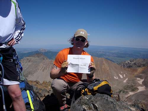
14250 ft / 4343 m |
|
|
Overview

Mt.Wilson is part of a trifecta of Fourteeners roughly 16 miles southwest of Telluride (by car). The other two Fourteeners are, "El Diente" (quotation marks because the name is unofficial) and Wilson Peak. As part of what's called, The Wilson Group', other peaks in the immediate area: San Bernardo Mountain, Lizard Head Peak, Black Face and Cross Mountain. These three Fourteeners are generally attempted last because of their isolation and distance from the Front Range (think population).
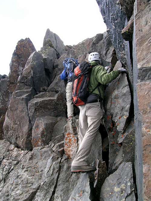
Like most peaks in the San Juan Mountains, the rock of the Wilsons is lose, crumbly and untrustworthy. Another aspect of Mt. Wilson is that the standard route to its summit is class-4. Among the 57 Fourteeners (or whatever list one ascribes to, there's heated debate over the exact number), there are only a few peaks that have standard routes graded as 4th class or higher. The crux that gives Mt. Wilson its rating comes near the end of the climb, near the summit. Fortunately, the rock at this point is fairly solid. It's blocky, white granite but will get your attention as it is also very 'airy.' The summit is small but offers what I think of as the best views of the lot. The ridge line over to “El Diente” is amazing and the singularity of the ridge line from Wilson Peak to Gladstone Peak (named for a British PM, William E. Gladstone, 1809-1898 by a small group of four climbers of whom three were British) is head-spinning. As a side note, William Gladstone presided a bit over the Whitechapel Murders of London, AKA: The Jack the Ripper Case.
Named for the chief topographer on the 1874 Hayden Surveys, A.D. Wilson, Mt. Wilson is Colorado’s 16th highest peak at 14,246 ft (4,343m). It is the second highest peak in the San Juan Mountains eclipsed only be Uncompaghre Peak and is the highest point in the Lizard Head Wilderness and San Miguel Mountains (mini-range). A.D. Wilson went on to climb his namesake mountain via the South Ridge (a difficult & exposed ridge) later that same year.
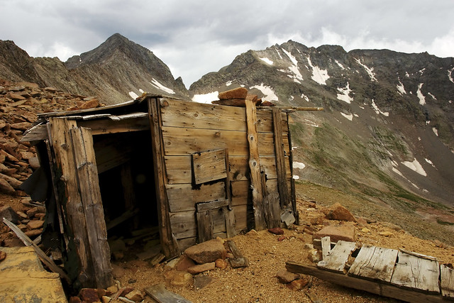
Mining existed pretty much everywhere around Mt. Wilson from 1856 up to the early part of the 1900’s. The Silver Pick Mine and Champion Belle Mine were two of the better known ore loads in the general vicinity. Granted, there were mining towns dotting the landscape but none could hold a candle to Telluride. Considering this reclusive town lies at the end of a box canyon, I find it interesting that not even Ridgeway or Ouray could muscle enough inhabitants to grow larger with their easier access.
Mt. Wilson claims an impressive 4,025 ft of prominence from a low saddle at Lizard Head Pass (10,222 ft) that stretches for almost 33 miles to its’ line parent (proximate), Uncompaghre Peak. It is also one of Colorado’s western-most
Fourteeners and consequently, furthest from Denver.
Mt. Wilson and the surrounding wilderness pose massive vertical relief from the thick aspen forests of the low valleys to the almost near vertical cliffs of the alpine. The Lizard Head Wilderness, especially in the autumn is a thing to behold. Because of the sheer area of the aspen coverage, the hills simply explode in every hue of yellow, orange, red and ochre imaginable. In 1932, the National Forest Service recognized the astute beauty of this area and protected it. In 1980, it received (officially) ‘wilderness status’ and has since retained that designation.

The Lizard Head Wilderness area is roughly 41,193 acres (16,670 ha). Because of the frequent, heavy winters which, is typical for the San Juan’s (2011/2012 was a bit of an exception), the wildflowers come late spring into summer is astounding! Of all the wilderness area’s and mountains have to offer the climber, this small, secluded corner of Colorado has to be hands down one of the most scenic and rewarding.
Norwood Ranger District
Uncompaghre National Forest
1150 Forest Street
Norwood, Colorado 81325
#970.327.4261
USGS Maps: Mt. Wilson, Dolores Peak, Little Cone
USFS Maps: San Juan National Forest, Uncompaghre National Forest
Trail Illustrated: Map #141 Telluride-Silverton-Ouray-Lake City
Wilderness Shots by: Bryan Maltais
Getting There
Mount Wilson can be approached from a number of different trailheads. Because of its location to El Diente and Wilson Peak, any one of four possible approaches won’t involve any significant additional mileage. The main portal however is from Kilpacker Trailhead via Navajo Basin/Lake. The second is from Kilpacker Trailhead via Kilpacker Basin located to the west of the peak. There are other approaches but generally speaking, they are used predominantly for Wilson Peak.
In terms of proximity and ease of access, Kilpacker and Rock of Ages will be explained. For additional information on the other possible approaches, please visit the Wilson Peak and El Diente pages.
ROCK OF AGES
Also known as the Silver Pick approach stemming from the mine located at the head of Fall River Creek, the Silver Pick Mine, this is the most efficient and direct route to gain the summit of Wilson Peak. It is class 2 the entire way to the Rock of Ages Saddle (13,000 ft) and thanks to some very hard and ongoing work by the CFI in surmounting the obstacles that local land owner, Rusty Nichols made difficult for the climbing community, this approach can be considered a viable avenue again with some minor detours along the way including an entirely new trailhead (opened in August of 2011). This approach is roughly 3.75 miles roundtrip to the saddle.
The new approach directions as listed below are taken from 14ers.com with Bill Middlebrooks’s permission. For a more detailed description that includes associated pictures, please visit Bill’s page on this subject.
“From Ridgway, leave U.S. 550 and take Colorado 62 towards Telluride. Drive over Dallas Divide and down to the town of Placerville. Turn left onto Colorado 145. Drive 6.5 miles and turn right on the Silver Pick road. It is 6.8 miles from here to the trailhead. From the start of the road, drive 3.1 miles to an intersection. The sign says "Silver Pick Basin - 5". Stay left. After another 0.7 mile, there is a confusing intersection. Do not continue on the road that goes straight. Turn right a bit to see the road that you want. Do not take the road that takes a hard right (it has a Private Property sign). Drive into the National Forest after another 2.2 miles (6.0 miles since you left Colorado 145). After another 0.1 mile, turn right onto FR 645 and continue approx. 2.25 miles (there are some possible campsites along the way) to the new Rock of Ages trailhead near 10,350’.
From the new Rock of Ages trailhead, hike south and then southeast on the Rock of Ages (#429) trail to enter Silver Pick Basin near 11,300'. Continue southeast up into the basin. Continue on the road as it climbs south into the basin.
Near 11,500', cables (on the ground) from an old ariel tramway become evident. The road parallels the cables for a while and briefly turns right (west) near 11,800'. The road soon leads back to the center of the basin. Stay on the road as it climbs east and then south to the top of a small hill with the remains of a rock house. From the rock house, you will need to do some brief route finding. Look directly south up on the steep slope to see the remnants of the Silver Pick mine. Just to the left of the mine, locate a dirt "trail" that leads up to the mine. From the rock house, walk across and then up some talus. There's not a great trail here, just continue south up talus until you spot the best way to reach the base of the slope. Locate the loose trail and climb approximately 450' to the left side of the mine. Near the mine, find a better trail that heads left (southeast). Follow the trail across the steep slope to reach the "Rock of Ages" saddle near ~13,000'.”
KILPACKER TRAILHEAD
Sitting at a respectable 10,060 ft, Kilpacker is the trailhead of choice for El Diente and Mt. Wilson ascents. This is because of its relative proximity to both mountains. The Kilpacker Trailhead provides access to the southern side for El Diente and the southwestern (western) slopes for Mt. Wilson. Kilpacker is the closest approach one can expect for Mt. Wilson.
I do believe Sunshine Mesa (Bilk Basin) is just a tad closer in terms of mileage but the trail is much rougher and harder to follow. The trail went into a state of disrepair in 2008 due to a bridge on FR 623 being washed out from spring snowmelt.
Launching out south from Lizard Head Pass, drive on Co. 145 for roughly 5.5 miles. Turn right (west) onto FR 535 (also signed as Dunton Road). The drive from the trailhead from this point can be a bit complicated to follow. Just make sure your odometer is set and pay attention to the side roads.
The dirt road will slowly climb in a northwestern direction. There will be a bit of a ‘rough intersection’ at mile 4.2. Keep driving straight through this and at 5.0 miles, turn right onto FR 207. The trailhead is only another 0.3 miles further. Dunton Road is NOT plowed or maintained in winter but the frequent snowmobilers will make life easier for a short while! Parking can be tight.
When to Climb
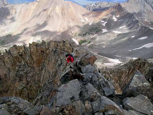
Crux Move on Mt. Wilson
Among the Fourteeners in Colorado, The Wilsons and El Diente are some of the hardest to reach. They are far away from everything, no major city lies anywhere within the vicinity (unless you count Telluride or Ridgeway). The Lizard Head Wilderness is unspoiled and pristine.
Having said that, most people climb the Wilson Massif in the summer or late Fall.
On occasion, people will venture into the backcountry for spring ski descents. The North Face of Mt. Wilson provides a fantastic trip down as does the warmer South Face.
Navajo Lake stays iced up well into mid-summer. However, water can always be obtained from the outlet stream.
Winter ascents on these peaks are rare. The winter road closures are typically far from summer trailheads. Avalanche danger is high on these peaks due to the overall pitch/steepness. Combine that with early snowmelt on the loose rocks on the ridge crest and you have the recipe for potential and unannounced avalanches. However, posessing the fortitude and experience to venture into these mountains in the winter, will reward the brave traveller with unparalled vistas rarely seen outside of July-September.
These are summer mountains. People have died on these three peaks with most recently, being 3 individuals on the Mt. Wilson-El Diente Traverse due to rock fall.
Mt. Wilson should be approached with caution and respect. Needless to say, a climbing helmet and axe would be 'essential' to have along.
Mining
From the great Sierra’s and the plateau’s,
From the mine and from the gully, from
The hunting trail we come.
Pioneers! O Pioneers!”
--Walt Whitman
There are multiple words instantly associated with Colorado: Outdoors, skiing, John Denver, climbing, hunting, Aspen and Vail, Pikes Peak and of course, mining.
Colorado owes its expansion and pioneering envelopment to the miners and fortune-seekers that trekked into the unknown valleys and on high looking for the future. The industry of mining opened up Colorado to a far larger extent than other places than say, California, Nevada or even Alaska.
There are over 300+ ghost and mining towns sprinkled over the Rockies and another ~212 give or take, over the eastern plains. One could probably make the case that mining is a “gateway industry” of sorts in that the digging, blood, whisky and tears of failed and half-realized dreams paved the way for other industries such as ranching (cattle & sheep), general commerce, the Railroad and homesteading. Through this progression, the unknowns of Colorado became, known.
Other than the staple ores of gold and silver, other minerals were mined throughout Colorado’s history: nickel, lead, molybdenum, uranium, iron, tellurium and marble to name a few. However, it was gold and silver and that eventually uplifted some on the broken backs of others.
Many towns and cities like: Silverton, Silverplume, Silver Dale and Argentine took their name from the element that was by the late 1860’s, in short supply. Roughly ten years later around 1870, gold was starting to come into its own and in 1874, the San Juan Mountains experienced a sizeable gold rush that lasted well neigh of 30 years. Most mining towns saw their birth between 1858 and 1902. Most however, died quietly and faded back into the mountain sides like strewn Aspen leaves. The only life remaining in these lonely places is the barks of curious marmots or the occasional throttle of an ATV or Jeep. Nature is slowly taking back what was always rightfully hers.
Rising costs, weather, declining profits from supply and demand and two World Wars effectively ended Colorado’s mining era. The skeletons of these orphaned dreams and lost passions however, still remain. Of all the mountain ranges and sub-ranges in Colorado that supported mining (keep in mind, not all areas are pocked and torn from mining), the San Juan Mountains were unequivocally of the largest.
Below is just a small sample of what lies within the vicinity of the Wilson Peak, Mt. Wilson and El Diente.
SAWPIT
A Blacksmith was the driving reason why Sawpit came into existence. The ‘smithie’, James Blake, found relatively high-grade ore in the placer and further up on the mountainside while on a scouting trip in 1895. Once a mine was dug and validated, he named him stake the “Champion Belle”. The first three loads of ore alone netted him almost $1,800 to say nothing of the following 35 loads. The floodgates opened once word got out and other would-be prospectors permeated the valley. By 1896, another major mine was opened within shooting distance of the Belle…the Commercial Mine. Saw Pit became incorporated.
I’ve read how Saw Pit was named for a nearby creek but I’ve also read how the name was derived from a rather ‘larger than usual’ saw pit on site. Saw Pits were used by the miners to basically half felled trees and lumber. One miner would hold one end of a large saw atop the pit while the other would jump down into the hole and grasp the other end and hope he didn’t get crushed. The fortune days of Saw Pit last until roughly 1905 before things started to dwindle. Now, all that’s left is some rag-tag buildings and perhaps the odd, covered foundation.
PLACERVILLE
Placerville was named for the obvious placer gold found here. Even after the gold dwindled and disappeared from the creek, the small town kept battling for life through the years, holding onto its name; fact, a small contingent of people still live here.
A prospecting party in 1876 from Del Norte led by Colonel S.H. Baker is generally credited with finding gold here. Come 1877, the rudimentary beginnings of a mining camp began to take hold. But Placerville’s start wasn’t as cut and dry as most other mining towns. If anything, the growth and movement of Placerville illustrated how flexible the miners could be gold, whisky and supplies were on the table.
Even though some cabins and various foundations were either already built or laid down, the progenitor of the saloon and general store didn’t like the original location. There was a better spot about 1.5 miles further up-valley that this gentleman liked better. So he tore what infrastructure he had down and moved his businesses up-valley. Ordinarily, this wouldn’t have been a problem since more than one individual usually built a saloon or gaming hall. However, this was Placerville’s ONLY saloon and General Store. So since going without supplies or libations simply wasn’t an option, the miners pulled up their stakes and relocated 1.5 miles further up-valley to be in the vicinity of the saloon and commerce.
Placerville grew slowly but steadily throughout the late 1800’s. Another odd twist is that Placerville’s ‘growth spurt’ didn’t come for nearly another 10-12 years and it wasn’t gold that spurned the influx but rather, ranching. 
Cattlemen came first seeing the potential in the area’s fields, meadows and high plateau’s. A few years later, the real problems began…sheep herders came to town. The cattlemen hated the sheepherders. There were about 3-4 years in the early 1900’s where the violence between these two groups threatened to override the town. Fighting became a daily occurrence over the pastures. Eventually, the two learned to live with one another.
In 1904, a massive flood nearly wiped out the entire town (probably due to spring snowmelt). To give you a small comparison, this same year, 1904, F.O. Stanley and his wife (Flora) had just moved to the small town of Estes Park for the summer. The Stanley Hotel would come after another five years.
A fire nearly destroyed much of Placerville in 1919 but resiliency took over and the town was rebuilt. Due to the large parcels of private land that surround Placerville now, expansion is guaranteed to never happen. The town will never grow beyond its current borders. There are a few stragglers whom still call Placerville home and slightly more ramshackle buildings and ghosts of buildings that dot the valley.
FALL CREEK
Also referred to as Seymore and Silver Pick, during the 1890’s, Seymore was a busy mining camp located on Fall Creek. It served as the main hub for all the ore coming out of the Silver Pick Mine further up Fall Creek near Wilson Peak. It supported multiple buildings including a post office, a few saloons, general mercantile and even a small hotel. For whatever reason in 1894, the post office was actually moved TO the Silver Pick Mine. Two years later, it was relocated to the town of Saw Pit.
The officially changed its name to Fall Creek in 1922. The name, ‘Fall Creek’ is simply a general term for a river or creek that seems to have an overabundance of waterfalls.
SAN MIGUEL
Located a few miles down-valley from Telluride, San Miguel (Spanish for Saint Michael) rivaled Telluride for a short spell in terms of rowdiness, population and popularity. The town had a very decent gold and silver mine located nearby and cattle were a daily aggravation that just had to be tolerated. Telluride never really suffered this problem at least, not to the extent that the lower altitude towns did. What San Miguel did have going for it were excellent foundations. The town was laid down very smartly and conservatively. Not too many trees were cut down nor was the creek diverted. However, in the end, Telluride won out. San Miguel was a bit too much on the quieter side and placid.
OMEGA
A one-time and short lived settlement located near Placerville but its exact location is sketchy at best. The town’s odd name (for a mining camp) came from some of the settlers opinions that “this was it”.
Being the last letter in the Greek alphabet, the connotations that Omega was the last town for riches was a bit of fore shadowing. It lasted roughly 10 years.
VANADIUM
Located up-valley from the Belle Champion Mine, Placerville and Fall Creek, Vanadium was little more than a rag-tag, rough mining camp. The town grew around a huge mill operated by the U.S. Vanadium Corporation. Like Omega, it too experienced a tragically short lifespan but buildings still exist including the old post office.
I’ve seen other town names mentioned in some of my readings like: Hangtown and Dry Diggings but I have yet to actually come across any information on these ‘towns’. This is a common theme in the mining years throughout Colorado. Towns will literally spring up overnight only to disappear after 6 months to a year, give or take. Usually the gold will play out, the claim(s) end up proving unfruitful, weather or snow will force people out or distances needed to travel to attain supplies is too great. In such instances, I’m inclined to think that these homesteaders/miners set up nothing more than small encampments.
Camping
 Without making this section needlessly too long based on which approach one is going to use since Wilson Peak, Mt. Wilson and El Diente can all be day-tripped from every trailhead, I’ll explain a little about the most centered/convenient or oft-used areas for camping.
Probably hands down the one area most people use to camp for these three peaks is Navajo Lake located at 11,120 ft. This pristine lake located just below treeline is situated 0.3 west of El Diente and 0.45 miles west of Mt. Wilson. Wilson Peak (and the Rock of Ages saddle) is roughly 0.7 miles from Navajo Lake.
There are ample sites available to camp at around the lake with additional sites located 0.1 mile ‘up-valley’ from the lake on its’ northern fringe. Most of the sites are located across the outlet where the trail first meets Navajo Lake on its western end. Just look for and utilize existing fire rings to avoid degradation of the forest since this is a wildly popular destination in summer. A few camping sites don’t allow fires but these, the last time I was up there were signed as such. Just remember to practice ethical camping habits so future campers can equally enjoy this beautiful and sheltered basin.
Camping of course is also an option at Woods Lake Campground. Hiking and climbing these Fourteener’s in a day from Woods Lake will be a bit of a stretch but is quite doable as a long day.
The campground, located 0.4 miles from Woods Lake and 0.75 miles from Lizard Head Wilderness is situated in multiple thick stands of Aspen. It is comprised of three loops, one of which is designed for horses. This horse loop has a corral with five paddocks and a watering trough. A large parking lot is available for parking horse trailers. The campground is an excellent base camp for hikers and horses to access Lizard Head Wilderness. There are incredible views looking south from the campground of mountains in Lizard Head Wilderness. And, of course, the "quaking" leaves and majestic fall colors from the Aspen, add to the draw of this campground.
The campground is $14.00 per day with a 2 week maximum stay. This is a seasonal campground opening its gates around late May and closing mid-September. Tables and grilles are available, vault toilets and fishing is allowed (Cutthroat and Rainbow). There are four water spigots but no public phone or flush toilets. This is a first come- first serve campground.
There is also car-camping at the Kilpacker Trailhead but this is limited to the spaces available. But I’ve yet to run into a problem doing this.
Red Tape
“A wilderness, in contrast with those areas where man and his own Works dominate the landscape, is hereby recognized as an area where The Earth and community of life are untrammeled by man, while man Himself is a visitor who does not remain.”
This was written in 1964 and has come to stand for the importance and signifigence of keeping the wilderness wild and virgin. The wilderness act when signed into law by President Lyndon B. Johnson on September 3rd, 1964, legally defined what exactly constitutes a wilderness area. This act protected at its’ onset, some 9.1 million acres…Lizard Head Wilderness is but a pence in a huge coffer of coin. There are four distinct Federal agencies that have, to varying degrees, jurisdiction over the existing wilderness areas and the new ones waiting to be established. These agencies are in order of scope: National Park Service, U.S. Forest Service, U.S. Fish and Game and the BLM.
Since the laws governing wilderness areas are typically more strict and cumbersome than National Forest or BLM Lands, the following regulations pertain to climbing, camping, hiking and simple visits specific to Lizard Head:
1.) Motorized equipment is not allowed.
2.) In 1986, regulators expanded the definition of ‘motorized’ to include mountain bikes.
3.) Hang Gliders, carts or any vehicle with wheels are not allowed.
4.) Groups can be no more than 15 people in size, 25 with livestock.
5.) It is prohibited to build a fire within 100 ft. of Navajo Lake, near any source of water or above tree line.
6.) All domesticated pets must be in control whether that means via voice command or leash.
7.) It likewise, is prohibited to camp within 100 ft of Navajo Lake or any water source.
And of course, as a compliment to future campers and hikers, please be considerate and remember to practice “Leave no Trace” ethics while backcountry.
Other than that, all the red tape is pretty much non-existent!
Topographic Map
View Larger Map
External Links
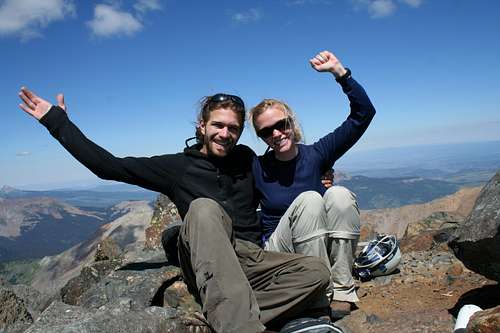
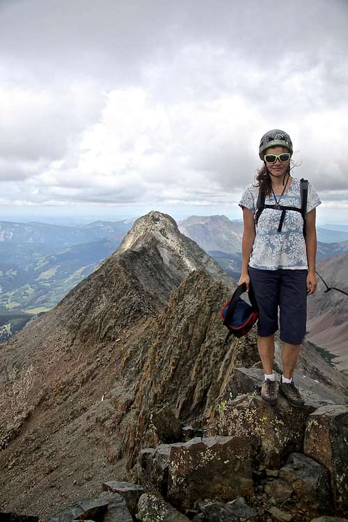
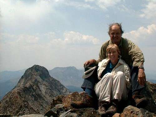
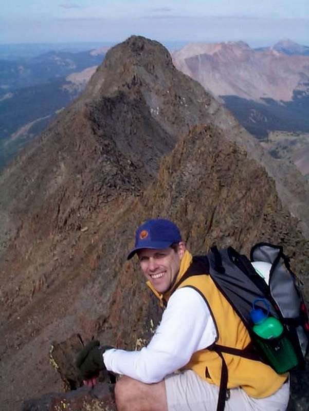
Summit Shots!
|
|
|
|

|
|