
-
 20849 Hits
-
 85.87% Score
-
 21 Votes
|
|
Mountain/Rock |
|---|---|
|
|
45.79460°N / 6.80570°E |
|
|
Mountaineering |
|
|
Summer |
|
|
12860 ft / 3920 m |
|
|
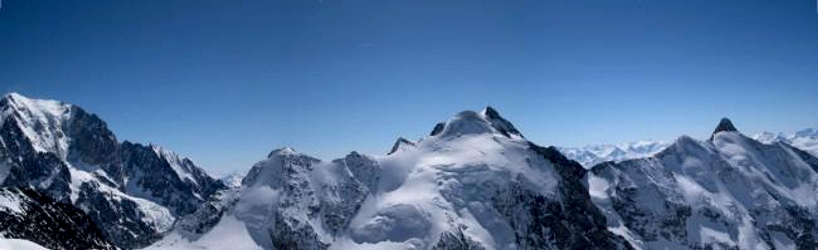
Overview
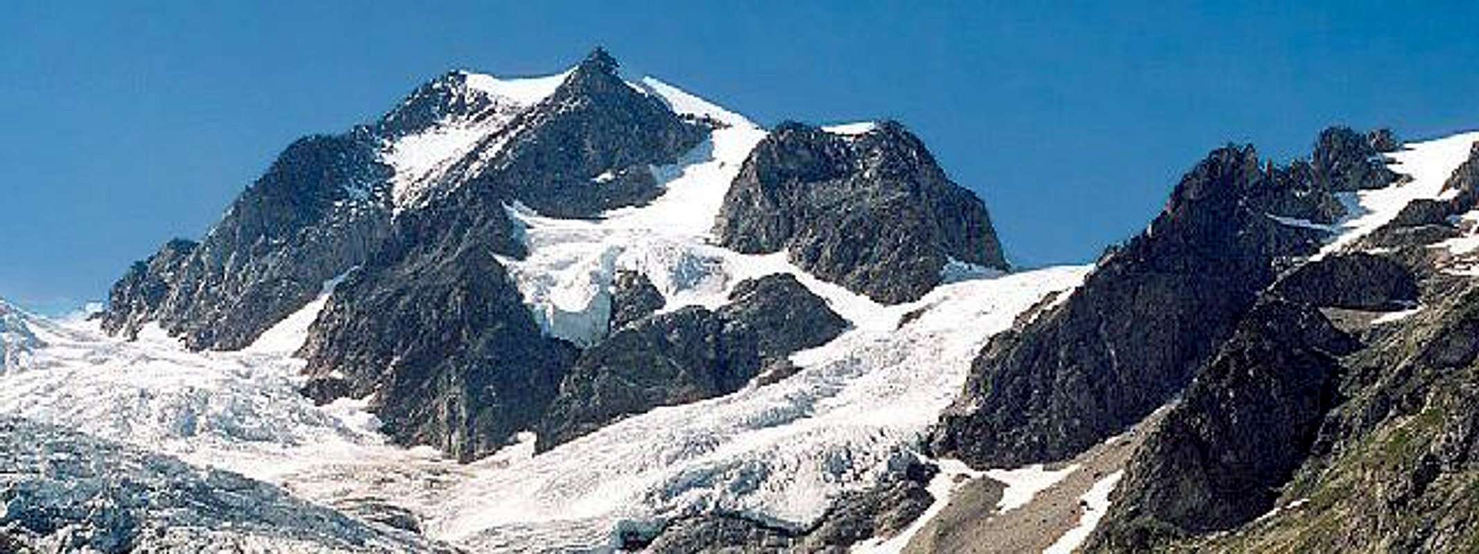
At the western limit of the Mount Blanc group we can find this important summit.In 19th century Mount Blanc was considered having less summits than now : they were (from west) Aiguilles de Trélatête, Mount Blanc, Grandes Jorasses, Mont Dolent and ... some dared to add Aiguille Verte and Aiguille d'Argentiére.
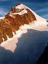
It is a very elegant high ridge with 4 summits : Central (3908m) . Southern (3917m) - Eastern (3892m) . Northern (3884m)
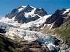
Its drop is about 1000m over Trélatête (France) and Lex Blanc (Italy) glaciers and 1400m over the Miage (Italy) glacier.
Climbed almost exclusively using the easy normal route from Italian side, this summit is the best belvedere on the west side of the Mont Blanc, this mountain could be intended as one of the best summits to start breathing the Mount Blanc air, making a good training in an amusing environment.
As for at west there are no higher summits here you can see very early the arriving of the bad weather (Atlantic perturbations come from west) and escape without risks.
At the beginning of 80' on his southern summit there was built a radio station that has recently been removed.
(I climbed it in 1980 and remember a strange construction under the snow and thought was a war blockhouse ....)
 |  |  |  |  |
Getting there and accomodations
Italian side :from Courmayeur through the Val Veny till Arp Vielle (2073m)
starting from here you can reach the
Bivacco Giovane Montagna (near the Petit Mont Blanc),
the only hut that allows to climb this mountain without making thousands of drop ... along the normal route.
Getting here is some long and heavy and with snow or ice, in the beginning of the season, can give some difficulties.
Rifugio Elisabetta Soldini (2200m)
useful for some routes on the Lex Blanche side and for the normal route from Col de Trélatête to The Central summit.
Getting here is easy and comfortable, by a white wide road
all the (forgotten) routes starting from Miage must be done directly from Arp Vielle or, at most, using a tent to bivouac on the western side of the glacier (at about 2450m)
French side :
from les Contamines-St. Gervais to the Hotellerie de Trélatête (1876m)
this is the one point to start all french routes (Trélatéte glacier)
all routes from this side are for trained climbers who, of course, don't choose to spend time on this mountain :)
 |
Routes overview
All routes require complete high mountain gear !The summits can be climbed almost everywhere and anywhere, so, more than speaking about defined routes here we can speak about guidelines to the summits ..
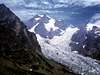
Best way to climb these summits are the ridges, walls are often dangerous and good snow conditions are very important to reduce risks.
Crossing the whole summit ridge is a very fine high-walk, takes no short time and requires to be already trained.
As normal route from Italy I suggest the one that, coming from bivacco Giovane Montagna, crosses the Petit Mont Blanc and gets the NE slopes ot the eastern side.
Some big crevasses can require turning around and some steep but short slopes can require attention if in ice, but it's the fastest way to get the Eastern summit where you can start the crossing.
Lex Blanche glacier can be difficult to cross, so, the best way to get down after crossing (or to start it in opposite direction) I think is the SW ridge of the Central summit till Col du Trélatête.
From Miage you can reach the Eastern summit or the Northern summit using the big spur and the channel that make the north wall - these routes are dangerous for stone and ice falls.
From Trélatête no difficult routes (except for Greloz route) , but all very long and, in some points, dangerous for seracs.
 |  |  |  |  |
Red Tape
no problemsWhen To Climb
june - septemberExternal Links
- Aiguilles de trélatête sketches
- Traverse of the Lex Blanche horseshoe
A magnificent slideshow of the traverse of the Petit Mont Blanc, Aig. De L'Aigle, Trelatete, Lex Blanche and Aig. Des Glaciers until the Col De La Seigne, made in 18h30m of continuos climbing. With music!