
-
 10033 Hits
-
 79.04% Score
-
 10 Votes
|
|
Mountain/Rock |
|---|---|
|
|
46.89570°N / 12.74890°E |
|
|
Mountaineering, Scrambling |
|
|
Summer, Fall |
|
|
9527 ft / 2904 m |
|
|
Overview
What's New On This Page?
> Dec 5th, 2022: Interactive map embedded.
> Jan 23rd, 2019: Design corrections.
> May 22nd, 2017: pictures attached/detached.
> SP V3 design updates.
> Aug 16th, 2004 - Additional routes information added.
> August 14th, 2004 - Initial setup of the page.
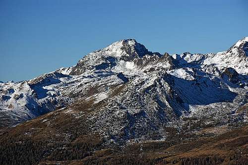
Schleinitz Gets Presented


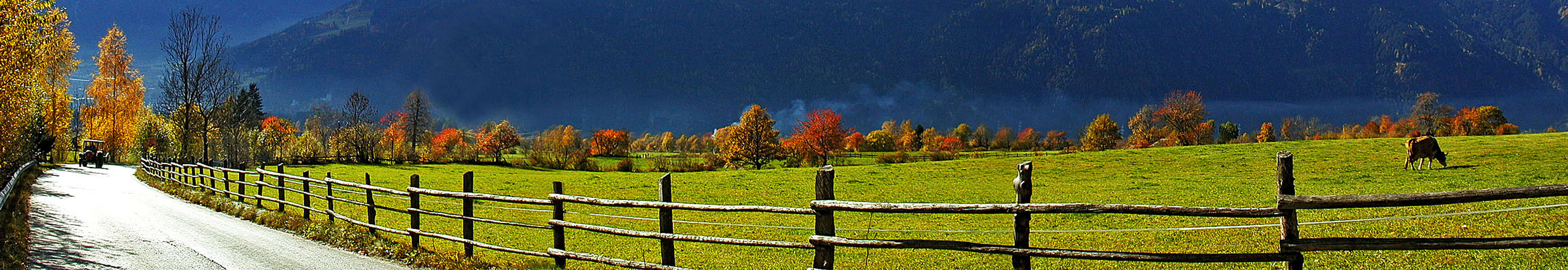
Schleinitz is a home mountain of Lienz. Above the town there's a mountain terrace, named Zettersfeld, where once farmers kept herds of cattle and sheep, nowadays there are terrains for tourism, in a first place skiing. The area is really nice - some 1200 m above the sunny valley of Drau, offering a great panorama on Lienzer Dolomiten, a limestone mountain group on the other side of the valley. Schleinitz summit is another 1000 m higher - so, rather don't go on the mountain all the way from Lienz. Zettersfeld can be reached by a cable-car and by a road, which was some years ago still toll-free.
So towards the south, with Schleinitz summit the Schober group ends - at least its highest peaks. Towards the north, a strong ridge goes towards other high peaks of Schober group - Prijakt, Hochschober and others. Towards the west, Schleinitz's slopes are falling down to Isel valley and towards the east to Debanttal. On the eastern side, from below the summit, a marked path goes also towards Lienzer hut in Debanttal, so the summit can be ascended also from this side. Above Zettersfeld, on the other side of a long ridge of Neualplschneid, descending from the summit of Schleinitz towards south-east, there is a nice area of small, picturesque mountain lakes, called Neualplseen. For those, who opt not to reach the summit of Schleinitz, these lakes can also be a valuable hiking objective.
The path from Zettersfeld to Schleinitz summit is not difficult. In ice or snow some passages on the northern side of Neualplschneid can require some carefulness, and also the final ascent is steep - but it is not hard. All in all - a nice hike, that's why this mountain stands here. In winter, of course, the ascent could be more demanding.
Getting There
We can reach Zettersfeld from Lienz (688 m) by the road or cable-car. The road is payable and above you can park on some 1880 m. Debanttal can be reached from Lienz by car till the altitude of 1686 m, where the road is closed for public traffic. For the long and high western approach, the trailhead starts in Ainet (747 m) or in Unteralkus (1051 m) above it. |
Routes Overview
1. From Zettersfeld
The majority of visitors will hike to the summit from Zettersfeld, 1830 m (Rottmann-Alm, 1894 m). From there we hike towards the north on the point 2370 m below the Goiserlemandl, 2433 m, then go further towards the NW to Neualplseen, 2455 m, then through the broad valley, full of boulders, steep to the southern summit ridge and by it to the cross, standing even before the highest point of the mountain. 3-3.5 h.
2. From Lienzer hut
The ascent from Lienzer hut, 1974 m, in Debanttal is longer. The marked Lienzer Hohenweg goes towards the SE to Trelebitschalm, 1976 m (can be also reached by a marked path from the end parking place in Debanttal), from there towards the south to Nealplseen, 2436 m and like in #1 to the summit. 3.5 h.
3. From the west
From the west many paths lead through the woods and over alpine meadows up to the Alkuser See, 2432 m, from there to Alkuser Scharte, 2633 m and over the western slope to the summit. Some 2000+ meters of elevation would mean a good six hours hike.
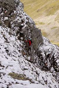
4. Ferrata/Klettersteig
Mathias Zehring reports that over Sattelkoepfe to the summit there's a new medium hard (B/C) ferrata/Klettersteig.
If arriving from Zettersfeld, we can also cross the mountain. We ascend by route #1, descend towards the west to Alkuser Scharte and return back on Zettersfeld by crossing the south slopes of Schleinitz. The return from Alkuser Scharte back to Zettersfeld is not just an easy hike, but because of many stone blocks quite time-consuming (around 2 h 30 min).
If coming from Lienzer hut to Trelebitschalm (see #2), we can also continue towards the west on Trelebitsch Toerl, 2710 m, descend some 160 m on the other side (towards the south) and ascend Alkuser Scharte and the summit from the west. So we encircle 3/4 of the mountain - and can return by the route #2 back. There can be many combinations.
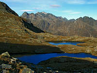 At Neualplseen |
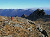 Returning on Zettersfeld |
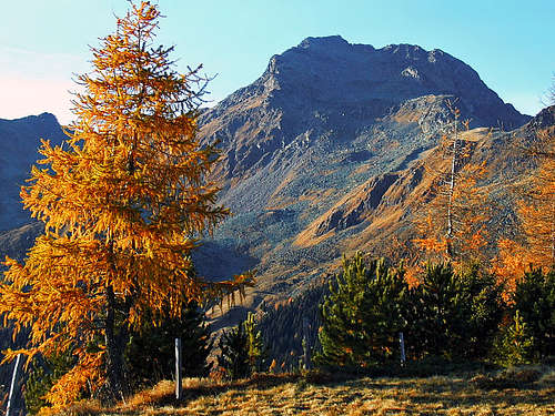
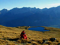 Above Zettersfeld |
Red Tape
No limitations.
The Schober group is part of National Park Hohe Tauern.
When To Climb
In summer and autumn, weather is most stable approximately from July to October.
Current weather conditions can be seen by a webcam here.
Camping
The tour can be done in one day, so no camping is needed. In the neighbourhood of Schleinitz there are the following huts:
- Lienzerhuette, 1977 m. Opened from mid June till end September. 37+58 beds + 10 in winter room (key: Alpine Club). Tel. 04852/69966. From the end of the road in Debanttal 1 h.
- A. V. Jugendheimhuette on Zettersfeld, 1903 m. Tel. 0043 1 563420.