
-
 9797 Hits
-
 79.78% Score
-
 11 Votes
|
|
Mountain/Rock |
|---|---|
|
|
28.22580°N / 16.6988°W |
|
|
Hiking, Scrambling |
|
|
Spring, Summer, Fall, Winter |
|
|
7431 ft / 2265 m |
|
|
Overview
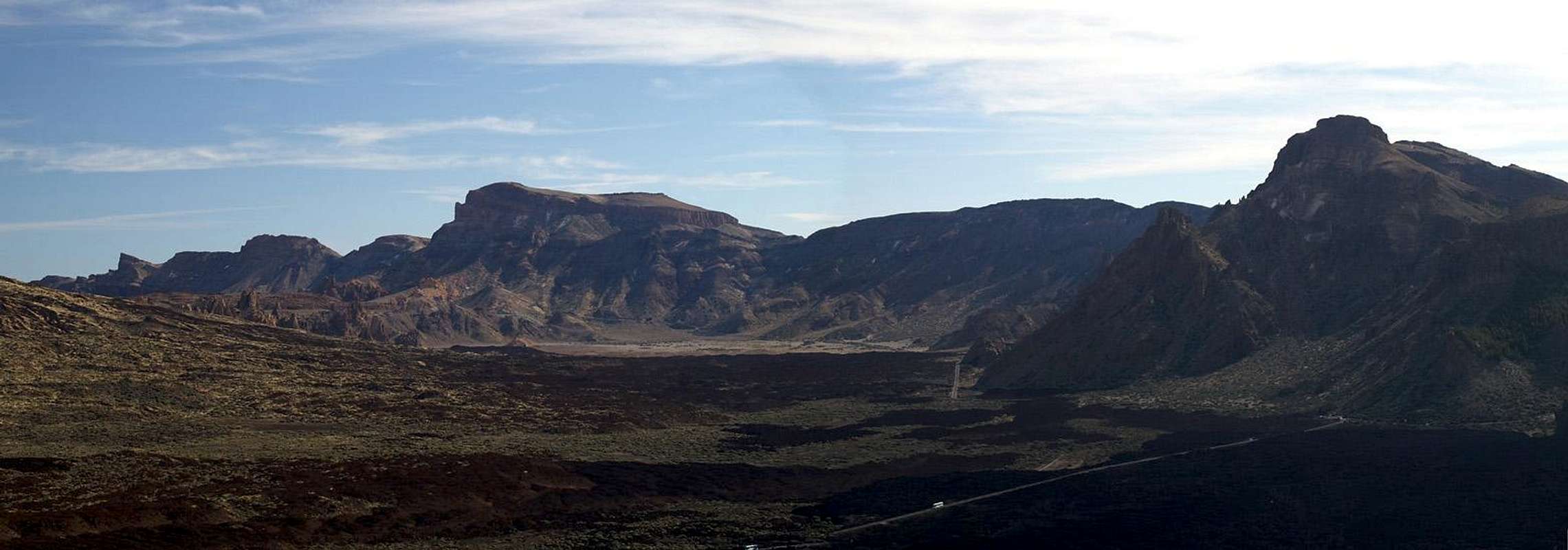
 Montaña del Cedro seen across the lava desolation beneath Pico Viejo Montaña del Cedro seen across the lava desolation beneath Pico Viejo |
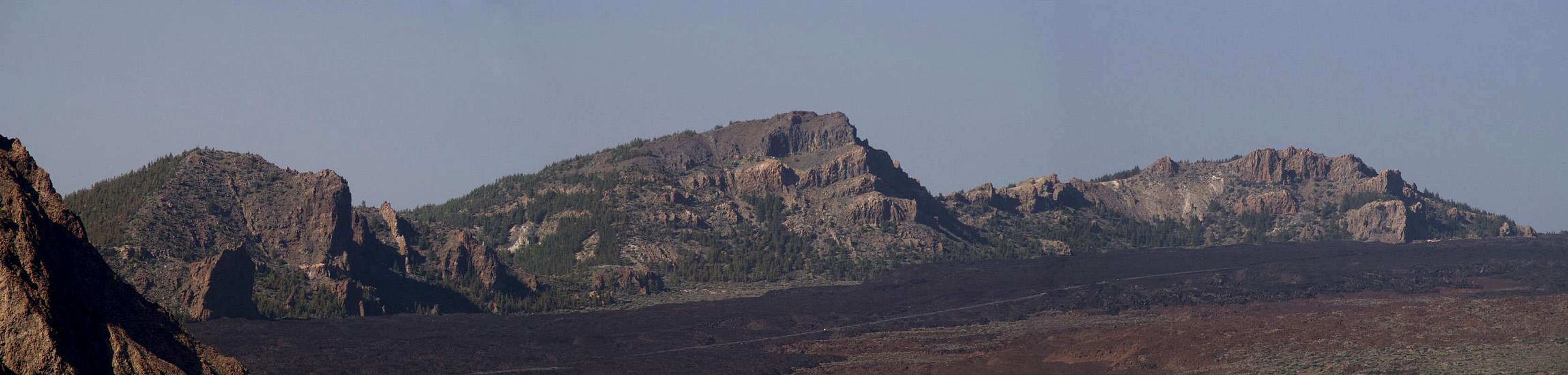
Montaña del Cedro is one of the mountains in the crater walls of the huge crater, which forms the Cañadas del Teide on Tenerife. It is located at the southwestern end of the Cañadas and thus (see Weather Condition section) very rarely gets any rainfall any time of the year. Its proximity to Tenerife's highest mountains, Pico Teide and its older side crater Pico Viejo makes it a perfect spot to study the volcanic history of the island. On the flanks of Pico Viejo there are a number of smaller craters, the "Narices del Teide" (= Teide's nostrils), where the last outbreaks took place. From Montaña del Cedro you can follow the lava flows, which stop near to the base of the mountain. Part of the ascent route winds through these bizarre black lava fields.
The real ascent as well as the descent is rather difficult scrambling with some climbing patches of UIAA I+. It is not the scrambling itself that poses the challenges, it is the orientation. You climb through rock fields which obstruct your view and thus make path finding really difficult. Moreover, once on top of the caldera walls you'll find the trail crisscrossing from one summit to the next without keeping a single direction. The caldera wall is not a single ridge but rather an accumulation of peaks and summits in lose order. Descending from Montaña del Cedro is at least as difficult as getting up. Depending on your choice of way you can encounter climbing patches up to UIAA III and IV. The normal trail however is a simple hiking trail.
Once on Montaña del Cedro enjoy the views of Teide and Pico Viejo as well as the one along the southern Caldera walls. To the south - on clear days - you'll be able to look down upon the neighbouring island of La Gomera. Most times, however it is shrouded in clouds.
Finally: don't forget to bring water! The whole Cañadas del Teide are VERY dry. Though more than 2000m high, the summer temperatures can still exceed 35°C, so that dehydration can become a major problem. A friend of mine just returned from neighbouring La Gomera and suffered intensely in the afternoon heat.
|


Summit Views
  |
Montaña del Cedro and its neighbours are among the best viewpoints you can get on the island of Tenerife. Not only do they offer nice views across the Cañadas del Teide, they offer the best views of Pico Viejo and the Narcises del Teide, the craters where the last eruption on Tenerife occurred in 1798. To the west and south the Teno mountain range and Roque del Conde can be seen and on clear days the islands of El Hierro, La Gomera and La Palma are stretched out in the sea beneath you.
|


Getting There
 |
As one of the major European vacation getaways Tenerife can be reached from all major European airports. From Spain there are regular flights from the rest of Europe you can book lots of charter flights. On Tenerife there are two international airports, one at Santa Cruz in the east, one at Los Abrigos in the south.
You can reach the Cañadas del Teide from all four directions. Just drive as far upwards as you can and you'll be there. From the south there is a road from the airport via Villaflor to the Cañadas, from the West you must head for Chio either from Playa de las Americas or from Santiago del Teide. The northern road starts from Puerto de la Cruz and the eastern ascent starts from the capital Santa Cruz del Tenerife and crosses the mountain range Cumbre Dorsal.
Alternatively you can take the bus either from Playa de las Americas (Line 342) or from Puerto de la Cruz (Line 348). Both buses depart at about 9:00 a.m., the return buses go around 4:00 p.m.
The trailhead for Montaña del Cedro is at Bocca Tauce, the south western corner of the Teide National Park. There is ample parking space and a bus stop.
Red Tape
Montaña del Cedro is part of the "Parque Nacional del Teide" which is composed of a giant volcanic crater the "Cañadas del Teide" with 48km circumference. In fact the Cañadas were created by two craters which over the time (and due to erosion) blended into each other. The central range of the Roques Garcia formed the boundary between these craters and you can still see how the earth was tormented to form these bizarre rocks. To the south and west the crater walls of the Cañadas del Teide are still standing. They form a number of distinctive summits, the highest of which is Guajara at 2715m. The northern and most of the eastern crater walls have disappeared below the huge Pico Teide and Pico Viejo volcanoes.Activities in the national park are limited as in every park. You are requested not to leave the trails - and from your own judgement - you shouldn't. The lava sometimes piles up to heights of 5 - 10m and makes orientation VERY difficult. Climbing is only allowed at the base of Guajara at the Piedras Amarillas. Also, camping is not allowed in the park.
When we climbed Montaña del Cedro we learned that marking trails is also restricted. We met a man who did the marking (green dots) but who got pretty nervous and hid the paint beneath a rock when we approached. When he found out we were Germans, he relaxed and told us that what he did was strictly forbidden but that in his opinion a couple of green dots were better than hordes of hikers scrambling losing their way and lumbering through the (scarce) bushes. I think he had a point there.
When To Climb
Climbing is possible all year round on all islands of the Islas Canarias. There are only a couple of days when there can be snow (don't be fooled - Teide with its 3718m gets snow more often). I would recommend toskip Montaña del Cedro on such days because orientation is difficult enough in normal weather. With the appropriate gear, however, it should not pose any problemsAccommodation
Of course you can find a lot of hotels, fincas and casas on the island which you can book from any travel office. The Cañadas del Teide are a natural park so there is no camping allowed. You might use the Parador Hotel which is supposed to be quite expensive, however. Better stay at one of the hotels at sea level and drive up by rental car or bus.Weather Conditions
There are several sites on the web which give you information on the weather on Tenerife. However, they all show the weather for the coastal regions (Puerto de la Cruz) which significantly differs from the weather in the Cañadas del Teide which are 2000m of elevation higher. The following table shows data for Puerto de la Cruz on the coast.| Month | Jan | Feb | Mar | Apr | May | Jun | Jul | Aug | Sep | Oct | Nov | Dec |
| Avg. day temp.[°C / °F] | 19 / 66 | 19 / 66 | 20 / 68 | 21 / 70 | 22 / 72 | 23 / 73 | 24 / 75 | 26 / 79 | 26 / 79 | 24 / 75 | 22 / 72 | 20 / 68 |
| Avg. night temp.[°C / °F] | 13 / 55 | 13 / 55 | 14 / 57 | 14 / 57 | 16 / 61 | 18 / 64 | 19 / 66 | 20 / 68 | 20 / 68 | 18 / 64 | 17 / 63 | 14 / 57 |
| Water temp.[°C / °F] | 19 / 66 | 19 / 66 | 19 / 66 | 19 / 66 | 20 / 68 | 20 / 68 | 22 / 72 | 23 / 73 | 22 / 72 | 22 / 72 | 21 / 70 | 20 / 68 |
| Rainy days | 10 | 7 | 8 | 4 | 3 | 2 | 1 | 1 | 3 | 5 | 7 | 9 |
The Canarian Islands (as well as Madeira) are located in the trade wind zone. You almost always encounter northeastern winds which carry a lot of humid air. Being forced to climb to higher altitudes this moisture condenses into clouds. This in return means that most of the time the northeastern part of the islands is covered in clouds from altitudes of 1000m through 2000m.
The mountains themselves - being mostly of the same altitude -finally stop the clouds so that on their southeastern slopes the clouds "run out". In the case of Tenerife the Cañadas del Teide are so high that rarely ever do you encounter fog or clouds. This on the other hand means that the whole area is very dry so be sure to bring your own water.
The southern part of Tenrife rarely gets any rain which is why most of the beaches have been established there. The best hikes on the Island are in the Cañadas or in the northwestern (Teno mountains) or eastern (Anaga Mountains) part.
Maps 'n' Books
Out of the Multitude of maps and books I have been using the following:- Maps
- Teneriffa
Kompass Map WK233
Kompass Verlag
ISBN: 3-85491-038-X
Books
- Teneriffa, Tenerife
K.Wolfsperger, C. Ade
Rother Walking Guide
Rother Verlag
English - ISBN: 3-7633-4809-3
German - ISBN: 3-7633-4016-5