
|
|
Mountain/Rock |
|---|---|
|
|
40.47510°N / 105.6237°W |
|
|
13425 ft / 4092 m |
|
|
Overview
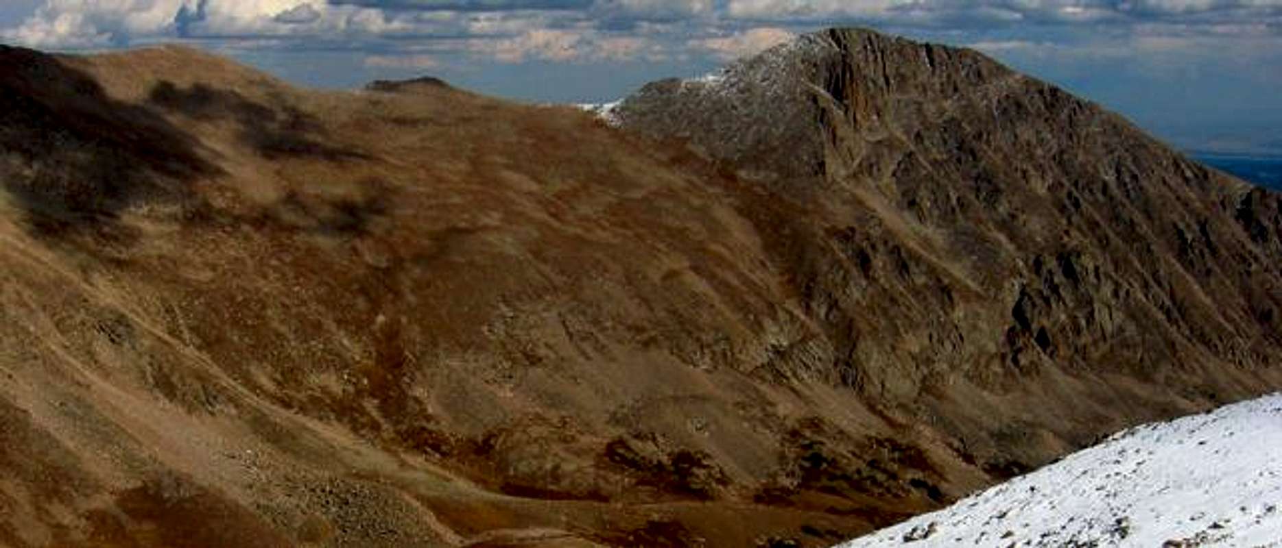
Mummy Mountain as seen from Fairchild...deep in the Mummy Range, Rocky Mountain National Park.
Mummy Mountain is located in the heart of the Mummy Range and is the 8th highest peak within the borders of Rocky Mountain National Park. Because of this mountains long approach, it is not visited nearly as often as other Peaks in the National Park. This is a good summit if you are looking for relative solitude. While you are likely to see other people, it will be few. From the Lawn Lake trailhead, climbing this mountain requires nothing more than a tundra walk when approached from it's southeast slopes, and nothing more than class 2+ to 3 when climbing its northwest slopes. See the routes section for more details!
Being a prominant mountain, viewed from Trail Ridge Road and seen peeking over Lumpy Ridge from downtown Estes Park, it had always stirred my interest. It is a wonderful climb on a well established trail, through all types of terrian you could possibly expect from the National Park. Not only is there classic scenery, the area also provides a habitat for many types of wildlife, including Bighorn Sheep, Elk, Mule Deer, Mountain Lion, and Bobcat.
Round Trip: 16.5 miles
Elevation Gain: 4,885feet
Follow the well established trail for 6.3 miles to Lawn Lake. This is the origin of a large flood on July 15, 1982, when the Lawn Lake Dam failed and released a wall of water that, literally, ripped away the river banks, and washed tons of debris into the town of Estes Park, leaving it buried in up to six feet of mud. House sized boulders were tossed around like pebbles, and the force of the water, sadly, left its mark on the banks of the Roaring River forever.
Near Lawn Lake is where you decide to ascend via the southeast or northwest slopes. See the route descriptions for more info.
Maps
There are some wonderful campsites at Lawn Lake. Call the Backcountry Office, 970-586-1242, for details on camping.
Fees for admission.
Basic Rules/Regulations
Being a prominant mountain, viewed from Trail Ridge Road and seen peeking over Lumpy Ridge from downtown Estes Park, it had always stirred my interest. It is a wonderful climb on a well established trail, through all types of terrian you could possibly expect from the National Park. Not only is there classic scenery, the area also provides a habitat for many types of wildlife, including Bighorn Sheep, Elk, Mule Deer, Mountain Lion, and Bobcat.
Round Trip: 16.5 miles
Elevation Gain: 4,885feet
 |
 |
 |
 |
 |
Getting There
The most common trail used to Summit Mummy Mountain is the Lawn Lake Trail. To get to this trailhead, enter the National Park through the Fall River Entrance, Hwy 34. About 2 miles into the park, take a right where the signs point you to "Old Fall River Rd." and "End o' Valley." Once on this road, you will take your first right, where signs clearly point you to the "Lawn Lake Trailhead."Follow the well established trail for 6.3 miles to Lawn Lake. This is the origin of a large flood on July 15, 1982, when the Lawn Lake Dam failed and released a wall of water that, literally, ripped away the river banks, and washed tons of debris into the town of Estes Park, leaving it buried in up to six feet of mud. House sized boulders were tossed around like pebbles, and the force of the water, sadly, left its mark on the banks of the Roaring River forever.
Near Lawn Lake is where you decide to ascend via the southeast or northwest slopes. See the route descriptions for more info.
Maps
 |
Red Tape
The only permit required is a pass to get into the National Park. You can buy a week pass for $15, or an annual pass for $30.There are some wonderful campsites at Lawn Lake. Call the Backcountry Office, 970-586-1242, for details on camping.
Fees for admission.
Basic Rules/Regulations
When To Climb
This mountain, along with most others in Colorado, is most often climbed during the summer months (June through September). The only difference with a winter climb would be having to use snowshoes resulting in a more tiresome approach. You may want to bring crampons and an ax if you planned on summiting the northwest slopes, but could leave that gear behind for the longer, gentler southeast slopes. |
 |
Camping
There are some wonderful campsites at Lawn Lake. Book these early, because they are popular!Call the Backcountry Office, 970-586-1242, for specific details.