
-
 16407 Hits
-
 87.76% Score
-
 25 Votes
|
|
Mountain/Rock |
|---|---|
|
|
42.59430°N / 0.65710°E |
|
|
10062 ft / 3067 m |
|
|
Overview
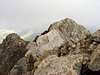
Vallibierna, Ballibierna or Malibierne (in France) is a double summited mountain in The Aragonese Pyrenees wich closes the valley of Vallibierna to the east. It's a very interesting viewpoint over Brecha de Tempestades (to the N), the ridge betweenFirst Climb
Vallibierna could be climbed first by anybody but the first registered ascent was by Charles Packe, Barnes with the guides Firmin Barrau and Charles... In July 1865. The first winter climb was by Roger de Monts and Célestin Passet in January 1900.
 |  |  |  |  |
Getting There
There are two main bases of the mountain: Pla (or Plan) de Senarta and Estany de Llauset.Pla de Senarta (1.375 m)
It's a flat area located 6.6 Km over Benasque (Huesca), on the left shore of Río Esera. There is a municipal (not free) camping there. Walk up 8.8 Km or take a bus of Alarsa at the camping entry to Refugio de Coronas (1.990 m). Timetables - Ascent: 5:15, 7:30, 9:15, 11:15, 15:15 and 17:15; descent 6, 8:15, 10, 12, 16 and 18.
From S, W and Central Spain; reach Huesca, then take N-240 passing Barbastro, N-123 to Embalse (reservoir) de Barasona and A-139, passing Benasque to Pla de Senarta.
From N and NW Spain, reach Pamplona (Navarra), then NN-240 passing Embalse de Yesa and Jaca (Huesca); N-330 passing Cartirana (2 Km before Sabiñánigo); N-260 passing Biescas, Puerto (pass) de Cotefablo (1.423 m), Ainsa and Puerto de Foradada (1.020 m); A-139 5 Km after Foradada de Toscar to the left; and pass Benasque to Pla de Senarta.
From E and NE Spain, reach Lleida, take N-230 to Benabarre (Huesca), N-123 to Embalse de Barasona and as "From S,W and Central Spain".
You could also take a bus of Compañía de Transportes Alto Aragonesa (tel: 974 22 70 11) to Benasque from Monzón (Huesca), Barbastro or Huesca.
The nearest train station is in Monzón (Huesca), 96 Km from Benasque.
Estany de Llauset (2.200 m)
It's a reservoir (estany) wich could be reached on a forest trail from Aneto (Huesca).
From S, W, E, NE and Central Spain; proceed as "From E and NE Spain" (to Pla de Senarta) to Benabarre, follow N-230 passing Puente de Montañana (Huesca) and El Pont de Suert (Lleida) to Aneto.
From N and NW Spain, reach Embalse de Barasona as "From S, W and Central Spain" (to Pla de Besurta), follo N-123 to Benabarre and as "From S, W and Central Spain" (to Estany de Llauset) to Aneto.
The easiest way to come from France is crossing the frontier pass between Saint-Beat (France) and Canejan (Spain) to Viella (Lleida), then follow N-230, cross Tunel de Viella to Aneto. Or advance to Villaller (Lleida), turn right taking a little road to Noales, pass Coll d L'Espina (1.407 m) and Coll de Fadas (1.470 m) and Castejón de Sos, and take A-139 passing Benaque to Pla de Senarta.
 |  |
Red Tape
The valley of Vallibierna and Vallibierna itself are in the Natural Park of Posets-Maladeta, having numerous summits that surpass 3.000 meters and up to 13 glaciers in the groups of Posets, Perdiguero and Maladeta, they are most southern of Europe. The first zone covered by the law in the area was the glacier of Maladeta-Aneto, on 21 March 1990, when it was named (together with the glaciers of Balaitous, Infierno, Vignemale, la Munia, Monte Perdido, Posets and Perdiguero) Monumentos Naturales de los Glaciares Pirenaicos. However on 23 June 1994 Parque Natural de Posets-Maladeta was created, including Macizos de Maladeta and Posets so the protected valleys were: Añes Cruces, Cinqueta, Eriste, Ésera, Estós, Pez, Salenques and Vallibierna. The total surface is now 33.267 Ha / 82,203 acres. Among the flora riches there are 56 endemic plants and 5 high altitude species like Edelweiss, Papaver Alpinum, Saxifraga bryoides and Silene acaulis. In the fauna, otters, chamoises (know as sarrios in the area), moutain goats, squirrels, marmots, many species of eagles, bearded vultures, capercaillies, Tengmalm owls, ptarmigans, newts...No permits are required to visit the Natural Park of Postes-Madaleta or to climb Aneto. But there are some prohibitions because of the crowds. It's forbidden to drive on the forest trail of Vallibierna from Plan de Senarta. There are regular buses from Benasque with stops in Plan de Senarta.
 |  |  |  |  |
When To Climb
In 1858 a thermometer was left on the summit during a year, it showed a minimum of -24ºC / -11F after the winter. In July it registered 3 ºC / 37F during the day but other measurement taken in 1863 was 11ºC / 52F.The yearly precipitation on Benasque is 1.239 mm and the monthly distribution: J (73.7), F (79.4), Mr (101.2), Ap (90.7), My (132.3), Jn (112.8), Jl (86.3), Ag (95.3), S (115), O (126), N (123.5) and D (103.8). So there is not a real dry season. Total rainy days per year: 71. Total snowy days per year: 21. On the high mountains like Aneto the weather is very thought and there is still no precise data about it. What it's true is that the fog, blizzard, snow and ice are common factors in winter and spring. The autumn also could be bad, at least from October to December, with many rainfalls, hail and even snow. In summer be cautious with evening storms and always be informed at the hut or in Benasque until the climb. Summer is the season with more electric storms. The number of storms per month in Benasque (average) are Jn (3), Jl (4) and Ag (4).
INM weather forecast and snow conditions for The Aragonese Pyrenees.
Get informed of winter road conditions in pages 601 and 611 of "Teletexto" TVE.
 |  |  |  |
Camping
Cabaña de Llosás (2.200 m): in Pleta de Llosás, unguarded, 2-3 places.Refugio de Coronas (1.990 m): unguarded, 20 places.
Cabaña del Quillón (1.785 m): next to the forest trail to Refugio de Coronas, non guarded.
Municipal camping in Plan de Senarta, cheap.
Refugi d'Anglos (2.220 m): near Estanys d'Anglos, 4 places, made of wood.
Hospital de Benasque (1.758 m)
Hotel Turpí, near Camping de los Baños
Baños de Benasque (1.680 m)
Little and old spa placed on the forest trail taken from the road A-139, has thermal waters at 30-70ºC / 86-158F and a pool with sulphurous water at 37ºC / 99F (6.50 euro + 3 euro the bathing cap). Private, 47 rooms (single and double), opens from June 15th to October 5th.
 |
Mountain Conditions
BenasqueGuides: Compañía de Guías Valle de Benasque