
-
 17062 Hits
-
 85.87% Score
-
 21 Votes
|
|
Mountain/Rock |
|---|---|
|
|
40.71830°N / 110.6443°W |
|
|
Hiking, Scrambling |
|
|
12708 ft / 3873 m |
|
|
Overview
Explorer Peak is located deep in the heart of the High Uintas Wilderness Area of northeastern Utah. The mountain is located on the north-south ridge which divides the Rock Creek drainage to the west from the Lake Fork Drainage to the east. The peak is located in the Ashley National Forest.Although not a technically challenging mountain to climb, Explorer Peak is one of the more remote peaks in the Uinta Range, requiring 13+ miles of one-way hiking to reach via the shortest route. The area surrounding the peak contains many open meadows and small lakes, making it an excellent destination for a multi-day backpacking trip.
The peak is a nearby neighbor of Squaw Peak, located ±1.23 miles along the ridge to the south, and Cleveland Peak, ±2.25 miles to the south.
With 688 feet of prominence, the peak ranks as #31 on the list of Utah 12,000+ foot peaks with 300+ feet of prominence, as compiled by Scott Patterson.
USGS 1:24,000 Quads:
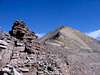
 South Ridge of Explorer
Getting There
The shortest route for an ascent of Explorer Peak appears to be by way of Squaw Basin, which can be reached via East Fork Rock Creek. This trail begins from the Rock Creek Trailhead at Upper Stillwater Reservoir, approximately 40 miles north of the town of Duchesne, Utah. Refer to the South Ridge via Squaw Basin / Rock Lakes route description for complete details on getting to the trailhead and ascending the peak from this route.A somewhat longer approach would begin from the north at the West Fork Blacks Fork Trailhead, which may be used to access the above basins via Dead Horse Pass or Red Knob Pass.
A still longer approach may be made from Ottoson Basin-Cleveland Pass via the Lake Fork Creek Trail, beginning from the Lake Fork Trailhead at Moon Lake. Cleveland Pass may also be reached via East Basin, which would also be accessed from the Lake Fork Trailhead, but this would be longer than the Ottoson Basin approach. From Cleveland Pass it is then possible to traverse the long ridge over the summits of Cleveland Peak and Squaw Peak, following the ridge all the way to Explorer Peak.
These and other longer approaches may be added to this page by future climbers.
 |  |  |  |  |
Red Tape
Explorer Peak and the various trails used to approach the peak are located within the High Uintas Wilderness Area, but no reservations, fees, or permits are required to climb the mountain.Refer to the High Uintas Use Restrictions for a comprehensive list of prohibited activities when traveling in the Wilderness Area.