
|
|
Mountain/Rock |
|---|---|
|
|
41.77230°N / 23.39300°E |
|
|
9540 ft / 2908 m |
|
|
Overview
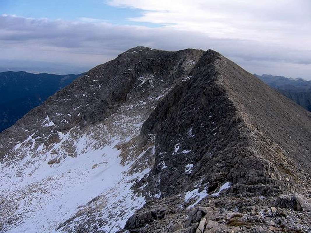
West Face of Kutelo (2908 m) from Kutelo Ridge
41°46'34.39"N, 23°23'58.02"E -> copy/paste this value (like it is, with comma) to Google Earth’s ‘Fly To’ and you’ll be taken there!
Kutelo (2908 m) is 2nd highest peak of PIRIN and 5th highest peak of Balkan. Geologically, Pirin, Rila, Karpati & Rodopi belongs to group of very old mountains. Together with Vihren (2914 m) peak, Kutelo create beautiful mountain scenery of Pirin National Park. Kutelo and Vihren are separated by Saddle (2600 m) which is placed belowe eastern side of Kutelo and western side of Vihren. Kutelo has two peaks, Kutelo I (2908 m) and Kutelo II (2906 m) which are connected by ridge called Koncheto Ridge. Kutelo I is on NE side from Kutelo II and on W side from Vihren (2914 m).
This beautiful and impressive peak offer a wonderful chance for extraordinary mountain trip. Walking on Koncheto Ridge is really something unforgetable. Also, the deepnes of Kutelo's western side is breathtaking.
LOCATION:
Kutelo (2908 m) is placed on E from Kutelo II (2906 m), Banski Suhodol (2884 m), Gljrbec (2597 m), Pleski (2546 m) and Kameniski Vrh (2532 m), on W from Vihren (2914 m), Polezan (2851 m), Kamenica (2822 m), Malek Polezan (2822 m), Strazite (2800 m), Jalovarnika (2763 m), Voivodski Vrh (2761 m), Izvorec (2753 m), Todorin Vrh (2746 m), Banderiski Cukar (2731 m), Samodivski Vrh (2730 m), Momin Dvor (2725 m), Malka Todorka (2712 m), Krivec (2709 m), Disilica (2700 m), Kameniska Kukla (2690 m), Kuklite (2686 m), Kraljev Dvor (2680 m), Malka Kamenica (2679 m), Zeleznik (2673 m), Orlovec (2668 m), Valijaviski Cukar (2664 m), Zboljt (2650 m), Golem Tipic (2645 m), Golemata Strana (2644 m), Golena (2633 m), Vljezela (2620 m), Vasilaski Cukar (2615 m), Prevalski Cukar (2604 m), on NW from Glavniski Cukar (2720 m), Graniten (2669 m), Hvoinati Vrh (2635 m), Spanololski Cukar (2576 m), Goli Vrh (2484 m), Kocov Grob (2462 m), Stefanov Vrh (2407 m), Cerni Vrh (2349 m) and Boikov Vrh (2045 m), on N from Gredaro (2605 m), Georgica (2598 m), Sini Vrh (2516 m), Momin Vrh (2480 m) and Vlahinski Ezera (lakes), on SE from Mt Rila massif and Crna Magila (2682 m), and on S from Bansko (936 m) town and Razlog town.
SUMMIT VIEW:
View from Kutelo (2908 m) summit is very attractive. You can see all highest peaks of Pirin massif and few beautitufully lakes, specially Vlahinski Ezera below southern side of Vihren massif. Also, Rila massif is nicely visible. All summit view are nice and special, but more impressive are W view to Banski Suhodol (2884 m) peak and amazing deepnes of Koncheto Ridge. Also, very attractive is E view to Vihren (2914 m) peak and all others highest peaks of Pirin massif and N view to Cerna Mogila (2682 m) (Cherna Mogila) and it's beautiful rocky piramid.
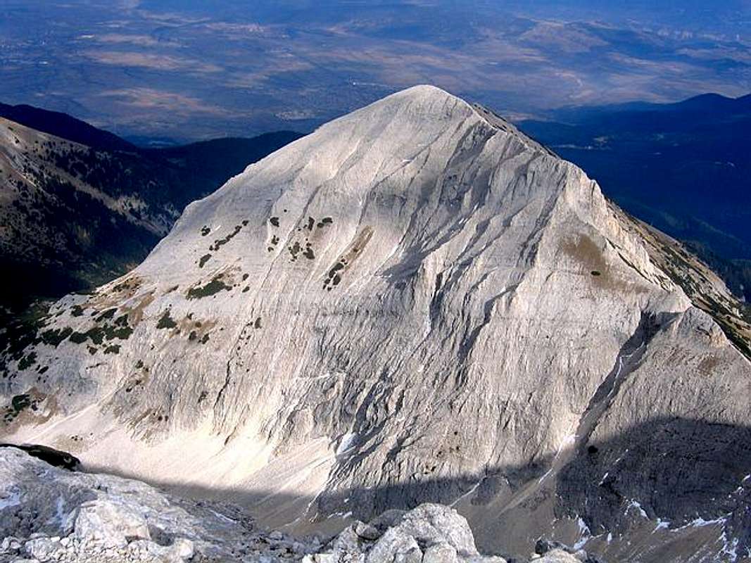
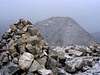
Cherna Mogila (2682 m) from Kutelo (2908 m) summit
W: Kutelo I (2908 m), Kutelo II (2906 m), Banski Suhodol (2884 m), Gljrbec (2597 m), Pleski (2546 m) and Kameniski Vrh (2532 m).
E: Vihren (2914 m), Polezan (2851 m), Kamenica (2822 m), Malek Polezan (2822 m), Strazite (2800 m), Jalovarnika (2763 m), Voivodski Vrh (2761 m), Izvorec (2753 m), Todorin Vrh (2746 m), Banderiski Cukar (2731 m), Samodivski Vrh (2730 m), Momin Dvor (2725 m), Malka Todorka (2712 m), Krivec (2709 m), Disilica (2700 m), Kameniska Kukla (2690 m), Kuklite (2686 m), Kraljev Dvor (2680 m), Malka Kamenica (2679 m), Zeleznik (2673 m), Orlovec (2668 m), Valijaviski Cukar (2664 m), Zboljt (2650 m), Golem Tipic (2645 m), Golemata Strana (2644 m), Golena (2633 m), Vljezela (2620 m), Vasilaski Cukar (2615 m), Prevalski Cukar (2604 m).
SE: Glavniski Cukar (2720 m), Graniten (2669 m), Hvoinati Vrh (2635 m), Spanololski Cukar (2576 m), Goli Vrh (2484 m), Kocov Grob (2462 m), Stefanov Vrh (2407 m), Cerni Vrh (2349 m) and Boikov Vrh (2045 m).
S: Gredaro (2605 m), Georgica (2598 m), Sini Vrh (2516 m), Momin Vrh (2480 m) and Vlahinski Ezera (lakes).
N: Bansko (936 m) town and Razlog town.
NW: Mt Rila massif and Crna Magila (2682 m).
 |  |  |  |  |
Routes Overview
From Bansko (839 m) town to Vihren Hut (1950 m) is asphalt road (18km) and a well marked mountain path (4 h). You can use public transport (minibuses) near Bunderitza Hut (40 min from Vihren Hut).
Start from Vihren Hut (1950m) and follow the red marks.
1. Eastern approach:
Classical route to reach Kutelo (2908 m) summit is from it's eastern side, starting from Vihren Hut (1950 m) on right side of eastern Vihren massif. During this route you can see impressive N and also W side of Vihren. Going on marked mountain path you meat Saddle which separate Kutelo (2908 m) from Vihren (2914 m) peak, on 2600 m, more than 300 m belowe the summit, from where start final ascent on E side to Kutelo summit. From the saddle the trail continues to the right and in 40 min reaches the summit.
Route: Vihren Hut (1950 m) – Vihren/Kutelo saddle (2600 m) – Kutelo (2908 m) summit: 4h
2. Koncheto Shelter approach:
If you stay in Koncheto Shelter (shelter on high Koncheto ridge, 2850 m), you can reach Kutelo I (2908 m) via Koncheto ridge and Kutelo II (2908 m) peak. This route is very attractive and most impressive because you can see incredible deepness of Pirin massif and it’s amazing peaks.
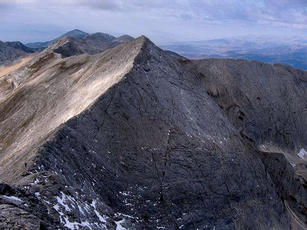
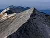
Impressive Koncheto Ridge (2850 m) and Banski Suhodol (2884 m) peak from Kutelo (2908 m) summit
Route start from Koncheto shelter, continue on Koncheto ridge till Banski Sudodol (2884 m) summit, after that to Kutelo II (2906 m) summit and finally to Kutelo I (2908 m) summit. Extraordinary mountain trip!
Route: Koncheto Shelter (2850 m) - Koncheto ridge (2850 m - 2900 m) - Banski Suhodol (2884 m) summit - Kutelo (2908 m) summit: 1.30h - 2h
3. Eastern approach via Vihren summit:
Main route start from Vihren Hut (1950 m), below eastern side of Vihren massif where is also a water spring. During whole route you go on open space, without any forest. This main and classical route is very nice. After 30 min you meat lower rocky part of Vihren massif and soon also a south side of Vihren and beautifully Vlahinjski Ezera (Lakes) below. Than, you reach Vihrenski Preslap plateau. After more one hour of hiking you reach the pass, from where start final ascent to Vihren summit. The path to the summit is not dangerous, without any special exposed place. After reaching Vihren (2914 m) summit you can descent on it's western side to Kutelo/Vihren Saddle (2600 m) and than climb Kutelo on it's eastern side, reaching Kutelo II (2906 m) and soon also Kutelo I (2908 m) summit.
Route: Vihren Hut (1950 m) - Vihren Southern Pass - Vihren (2914 m) summit - Kutelo/Vihren Saddle (2600 m) - Kutelo II (2906 m) - Kutelo I (2908 m): 5h - 5.30h
If you come from western side of massif (Koncheto Shelter), you can easy reach Kutelo (2908 m) summit which is connected with Koncheto ridge. Koncheto ridge is secured but anyway be careful, specially when rocks are wet or snow is on the ridge.
Also, after that (if you want) you can descend to Vihren/Kutelo saddle (2600 m) and climb Vihren (2914 m) on it's western side and descend on it's southeastern side. That's extraordinary trip because you can reach three highest peaks of Pirin massif - Kutelo II (2906 m), Kutelo I (2908 m) and Vihren (2914 m).
 |  |  |  |  |
Getting There
Gateway to Pirin National Park and Kutelo (2908 m) peak is Bansko (936 m) town.
Look Bansko Webcam!
By plane:
To Sofia Airport, Sofia town - capital of Bulgaria. Information about flights to Sofia on Balkan Bulgarian Airlines.
By train:
To Sofia. Than from Sofia to Blagoevgrad, which is located near Bansko town. From Blagoevgrad to Bansko by local bus.
Information about train on Bulgarian Railway timetable. Combine Sofia - Blagoevgrad. Approximately time of this train distance: 2:30 h - 2:45 h.
By bus:
Sofia - Radomir - Dupnica - Bansko
informations about bus lines and tickets.
By car:
Sofia - Radomir - Dupnica - Bansko
 |  |  |  |  |
When To Climb
Kutelo (2908 m) peak and other peaks of Pirin massif you can climb during whole year, but of course, the optimal period is from mid June - mid September, out of the season of snow on the mountain.
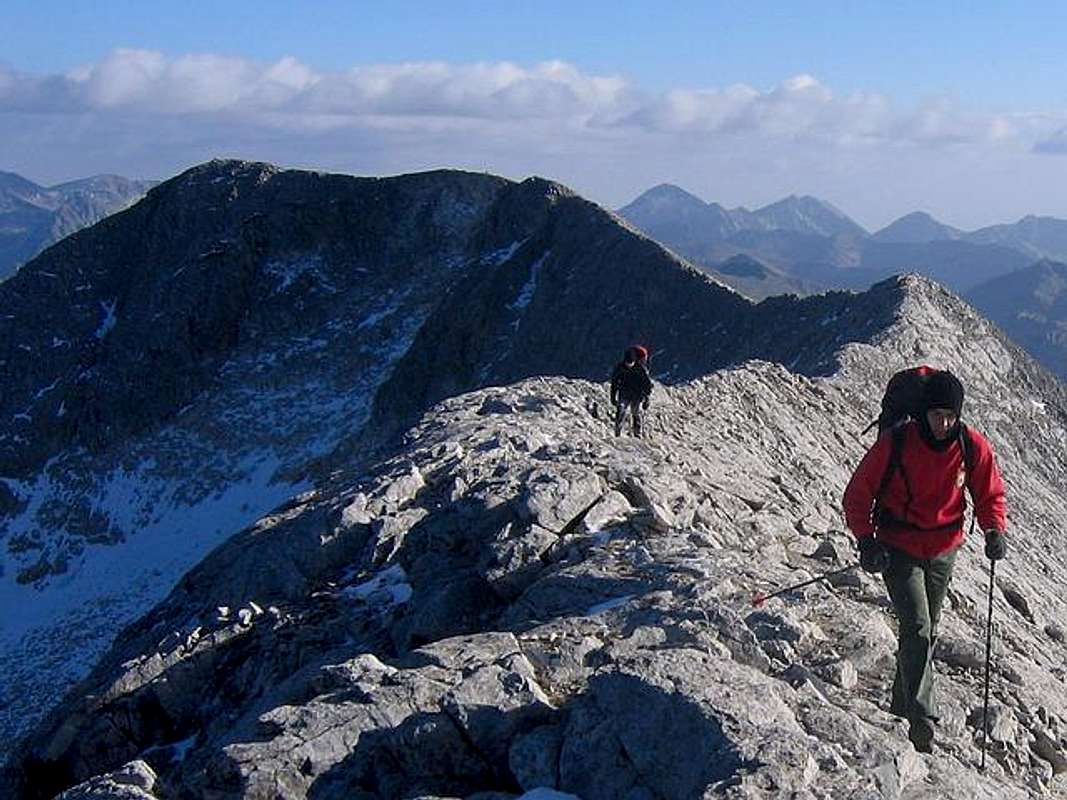
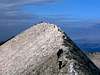
On Kutelo Ridge, leaving the Kutelo (2908 m) summit
 |  |  |  |  |
Camping
You can stay in private appartments and rooms in Bansko town, which is 18 km far from the Vihren Hut, or you can stay directlly in Vihren Hut, belowe eastern side of Vihren massif. Vihren Hut (1950 m) and Koncheto Shelter (2850 m) are two optimal places for Kutelo (2908 m) climbing routes.
Inside of Pirin massif exist few huts and shelters:
1. Vihren Hut
2. Yavorov Hut
3. Tevno Ezero Shelter
4. Kamenica Hut
5. Pirin Hut
6. Koncheto Shelter
Only huts (like the Javorov, the Banderica or the Pirin Hut) close to civilisation might be guarded in winter time.
 |  |  |  |  |
Mountain Conditions
1. 10 day WeatherOnline forecast for Kutelo (2908 m) area - look for Sandanski - town at the foot of the Pirin.
2. 6 day Bansko Forecast.
 |  |  |  |  |
Maps
Pirin Map - 1:55000
Editor: Kartografia EOOD Sofia, 1998.
 |  |
Red Tape
No fees or extra fees for entering the National Park.
No permits needed either.
Usual rules of behaviour for NP's do apply.
 |  |  |  |