-
 8650 Hits
-
 86.37% Score
-
 22 Votes
|
|
Mountain/Rock |
|---|---|
|
|
45.86660°N / 9.34480°E |
|
|
Hiking, Trad Climbing, Sport Climbing, Bouldering |
|
|
Spring, Summer, Fall, Winter |
|
|
4186 ft / 1276 m |
|
|
Overview
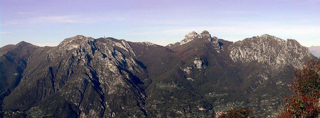
In its southern part, the Como lake (Lario) is divided into two branches by a big triangle made of hills and mountains.The most important summit here is the Monte San Primo where from two main ridges come down, toward south-east and south-west directly to the lake.
The SE branch ends with some remarkable mountains that, despite their low altitude, rise for about 1000m (3300-3400ft) above the plan and the lakes : these summits are well known to Lombardic climbers and hikers as they are good destinations for "out of season" climbing activities, walking, hiking, climbing, sport climbing and .. paragliding :)
They are : from south : the Cornizzolo, the Corno Rai, the Corni di Canzo and, in the eastern part, bordered by Lecco branch of Como Lake, the Moregallo
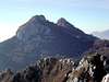
Moregallo, is a strange name ... giving a look to it I can imagine its name is coming from old latin language : more (like) gallo (cock) because when seen from the plane its skiline looks just as a cock crest ... pinnacles, rugged ridges, steep channels full of grass, bushes and small trees, and, first of all, some rocky spurs made of good white limestone offering any kind of difficulties. Its wide summit hosts a Cross, a Madonna statue, a topographic sign and, on the NE border, a fine wood where to relax in the warm spring or autumn days and try to survive in the hot summer days. 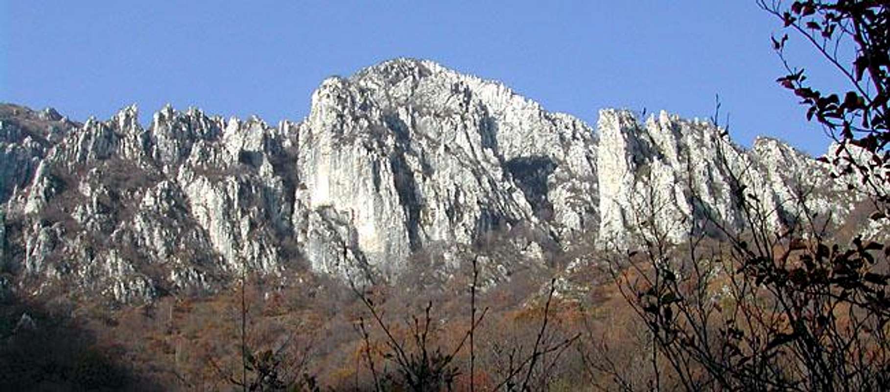 From its summit some very fine views of Prealpi, of Como Lake and, of course, of the whole Alps ridge from Monte Rosa (west) to Adamello (east) 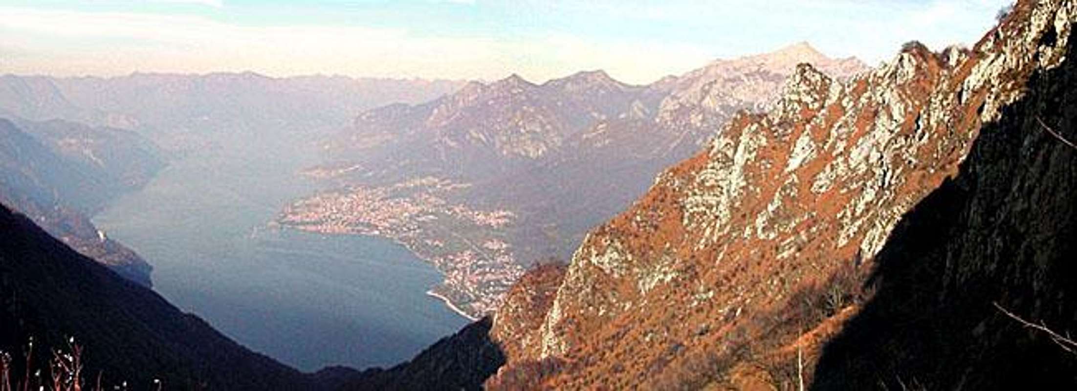
Getting ThereNormal approach for the most used paths are from ValmadreraFrom Milano - SS 36 (Spluga) till Valmadrera. You must leave the SS 36 before the first tunnel, having on your right side a small lake, when on the old road to Lecco, at the first traffic light you have to turn to the left, and go straight along till a square (newspaper kiosk), now on the left and suddenly to the right (via Leopardi), at the fork, to the right (Via S.Carlo Borromeo) then along the road that leads you to Belvedere (290m) when you can park (if you're lucky) your car. From here the starting point of paths 6 and 7 that lead toward the mountain, 1000 m above you. Other approaches can be used,   Routes overviewNo very easy way to the summit, that is normally got along 3 different routes : 2 hours from Belvedere - for hikers, good for going on, not so much for coming down if you have any problem with your knees.  - -  - -  - -  3 hours from Belvedere - for expert hikers, the best route for coming down
some more picssomeone voted them low but I think they' re useful
When To Climbavoid hot sunny days of summer ....
Campingno need, all routes can be done directly from the car parkingsMountain Conditionsmountain is always in conditions to be climbed ...for meteo here you can find the local forecasts External Links
|