
|
|
Mountain/Rock |
|---|---|
|
|
38.69580°N / 109.5401°W |
|
|
5653 ft / 1723 m |
|
|
Overview
Elephant Butte is the highest point or peak in Arches National Park. The peak is a flat-topped cap surrounded by many towers and fins forming one big butte. The fins and towers of the butte contain many arches, including the very famous Double Arch. Elephant Butte is also next to and east of the popular climb of Owl Rock, its much smaller neighbor.
The peak is a fantastic ascent with one of the best views anywhere in the world. The easiest route is mostly a class 3 and 4 scramble, but with a few 5th class pitches thrown in for added excitement. The easiest route to the summit will take you through a maze of fins and canyons, and is a nice adventure.
Even though the route has a few pitches up to 5.4 in difficulty, this is still the easiest of the major summits in Arches National Park. It is a fun, but not dangerous ascent in dry weather.
The butte receives its name from a huge elephant-shaped-monolith. See this photo.
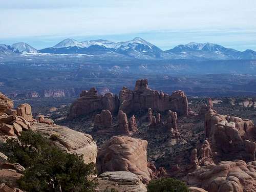 View east from the summit. The La Sal Mountains are in the background.
Getting There
From Moab, drive northwest along US 191 for a few miles to the Arches Nation Park visitor center. Turn right into the park and drive 8.9 miles to the sign for the Windows Area (just beyond Balanced Rock). Turn right and drive this road for 1.2 miles and turn left at a sign for the Garden of Eden Viewpoint. This is the trailhead.
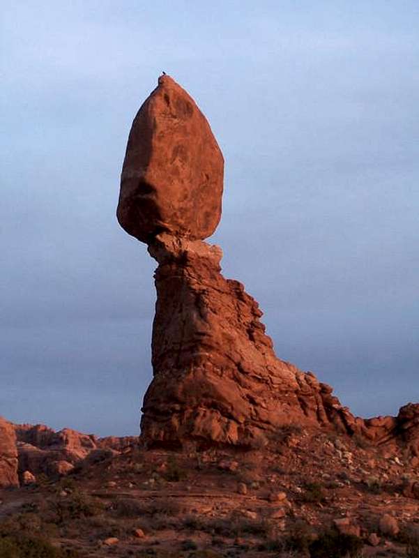 Balanced Rock, just west of Elephant Butte and near the trailhead.
Routes Overview
West Fins Route
Climbing this route is an absolute blast if you like exploring. It is something much different from the average “climb up and climb back down” desert rock climb. The route weaves in and out of fins, has several short 5th class pitches, flowing different little slot canyons, much scrambling, a rappel on the ascent route, and an interesting finish. The descent route is quicker and interesting as well. See the Route Page for details.
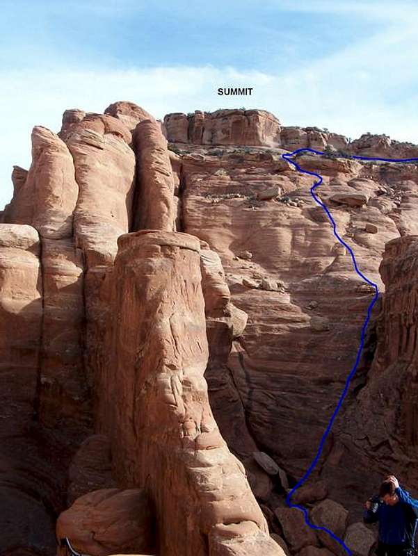 Final section of the route to Elephant Butte, as seen from the top of the ascent rappel, showing our route up the last section of the butte. Just to the right of this picture is the crack we used to attain the summit block.
Other Routes
There must be technical routes all over this the butte on all sides, but the route described is the only one I’ve done. If you do another route, feel free to post a route page.
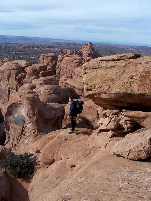 On the bench just below the summit. Photo shot looking west.
Red Tape
From the NPS website (slightly edited):
Regulations:
Use of motorized drills is prohibited.
Climbing is prohibited on any arch identified on current USGS 7.5 minute topographical maps.
Climbers are encouraged to employ clean-climbing ethics, leave dull-colored webbing when recovery is impossible, and access climbing routes via established trails, slickrock or sandy washes.
When To Climb
Spring or Fall. Winters are usually sunny, but can be a bit cold in winter, but it can still be a good time to go. Summers are brutal with temps 100F (38C) or much higher; 110F (44C) is possible. Since the route only takes half a day, you could climb it in the morning hours in the summer.
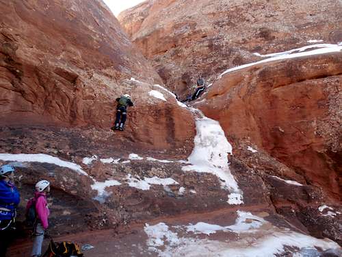 Climbing Elephant Butte on an icy January day.
Camping
From the NPS website (slightly edited):
The Devils Garden Campground is located eighteen miles from the park entrance and is open year-round. Facilities include potable water, picnic tables, grills, as well as both pit-style and flush toilets. There are no showers. Bring your own wood or charcoal for the grills. Some sites will accommodate RV's up to 30 feet in length.
Devils Garden is part of the National Recreation Reservation System (NRRS), which offers telephone and on-line reservations for both group and individual sites. Reservations are not accepted by the park, and the park does not maintain information about site availability.
The campground has 52 individual sites which are $10 per night and will accommodate up to ten people. Up to 28 of the individual sites may be reserved through NRRS for nights between March 1st and October 31st. Reservations must be made no less than 4 days and no more than 240 days in advance. There is an additional $9 booking fee for reservations. To make a reservation, visit www.ReserveUSA.com, or call NRRS at (877) 444-6777, (877) 833-6777 (TDD), or (518) 885-3639.
The remaining 24 campsites are available on a first-come, first-served basis each day beginning at 7:30 a.m. at the park entrance station or visitor center.
Outside the park, there are additional campsites around Moab, along the Colorado River, and in Onion Creek.
Mountain Conditions
CLICK HERE FOR WEATHER FORECAST FOR THE ELEPHANT BUTTE AREA
Weather and climate data for Moab. *National Weather Service Data 1889-2004.
| MONTH | AVE HIGH | AVE LOW | REC HIGH | REC LOW | AVE PRECIP (in) |
| JAN | 42 | 18 | 67 | -24 | .67 |
| FEB | 51 | 25 | 78 | -13 | .61 |
| MAR | 62 | 33 | 88 | 8 | .82 |
| APR | 72 | 41 | 96 | 15 | .81 |
| MAY | 82 | 48 | 105 | 27 | .72 |
| JUN | 93 | 56 | 113 | 36 | .43 |
| JUL | 98 | 63 | 114 | 43 | .78 |
| AUG | 95 | 61 | 110 | 40 | .86 |
| SEP | 87 | 51 | 108 | 28 | .85<TD |
| OCT | 73 | 39 | 95 | 15 | 1.02 |
| NOV | 57 | 28 | 82 | 2 | .70 |
| DEC | 44 | 20 | 69 | -18 | .75 |
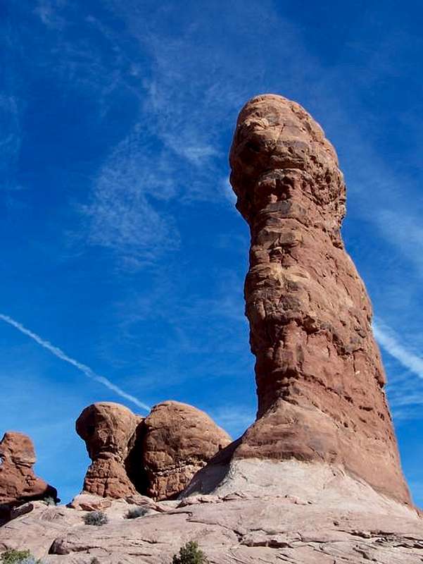 Just one of the many towers seen on the approach to Elephant Butte.
Other Attractions
There is a whole lot to do in this little area. There are hundreds of miles of canyons and hiking trails, as well as an unlimited number of rock towers to climb. There is some good canyoneering in the area as well.
One good source of information on the area is http://climb-utah.com/. The site has many adventures described in this area.
Moab also claims to be the river rafting and biking capital of the world, and those activities are popular.
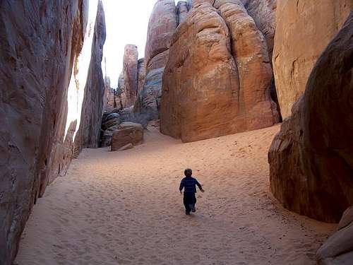 Kessler in the bluffs and fins just north of Elephant Butte. Christmas Day, 2005.
External Links
- Climb-utah.com
Many climbs in the area are on this site. Best source of info for the area. - Arches National Park Service Website
National Park information, including camping and climbing regulations.