
-
 2938 Hits
-
 79.78% Score
-
 11 Votes
|
|
Route |
|---|---|
|
|
46.36594°N / 9.92532°E |
|
|
Skiing |
|
|
Spring, Winter |
|
|
Most of a day |
|
|
BSA |
|
|
Overview

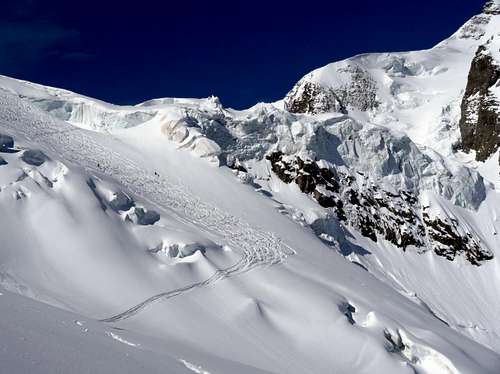
Skiing through the seracs
What's New on this Page?
* Jan 6, 2023 - Ownership switched by Antonio Giani
* Jan 6, 2023 - Page under review
PIZ ARGIENT SKI ROUTE
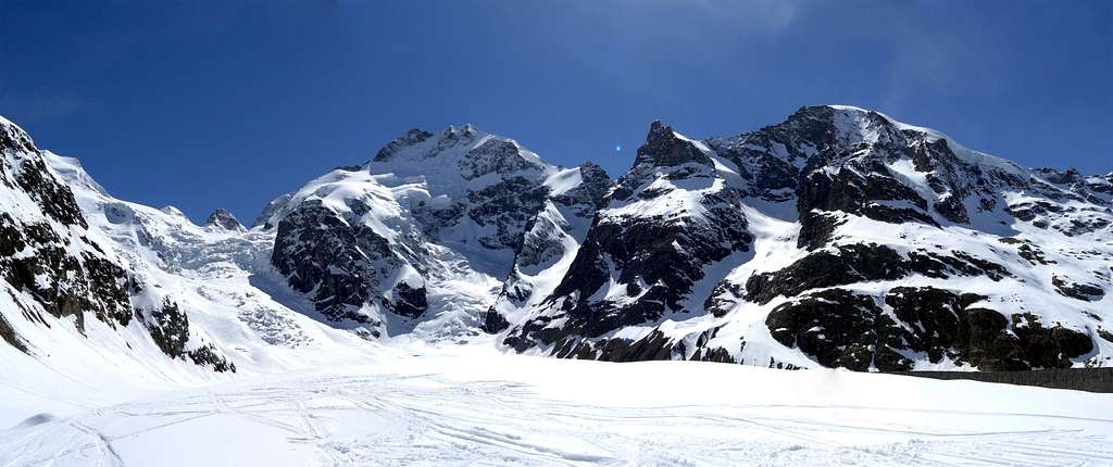
Classic and very long itinerary of ski touring in the Bernina group. One of the finest. Placed in the swiss side of the group.
The route runs across the entire length of the "Vadret da Morteratsch", passing through spectacular ice seracs and near the perpetual outstanding presence of Piz Bernina. There are several points of approach to this glacier, and several peaks that can be achieved. But all the routes have in common the crossing of a section of many crevasses, known as the "Labyrinth", to be faced with caution, among the numerous cracks in the ice that are constantly changing.
During the winter and spring months, the amount of snow (in good years), allows its crossing quite easily. During the summer months, it is often too dangerous and sometimes even impossible to cross it.
The Piz Argent is the third summit in height of the Bernina group and second after Piz Zupò in the area of the Vadret da Morteratsch.
The ascent starts:
From the Rhaetian train station "Morteratsch" (1.896m). Overall the length is more than 10 km and difference is between 2.200/2.300m, due to the changes of the glacier which require various detours. For anyone who does not feel to do so many meters, it’s possible to stay overnight at the "Chamanna Boval" (2.495m), the refuge "Diavolezza" (2.900m), or the refuge "Marco e Rosa" (3.609m); shortening the long distance. Overall the route is not difficult. The slopes never exceed 30°/35°. The difficulty are the length, the danger of crevasses and the altitude nearly of 4.000m.
The location on the north side of the massif, ensures a good stability of the snow and it is accessible until early June. Absolute presence of good visibility conditions, otherwise the identification of the crossing could be really critical.
 The Morteratsch glacier
Getting There
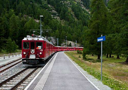
The Raethian railway
From Italy:
SS 36 dello Spluga to Chiavenna - SS 37 - Italy/Switzerland boundary - St.Moritz - Pontresina - Morteratsch, Raethian railway.
Good possibility of parking. Payment in summer or winter.
From Switzerland:
From Chur to Davos/Klosters. In Klosters through the Vereina tunnel until Susch. Next drive to Pontresina - Passo del Bernina
By train:
This part of switzerland is well connected by the famous red train
Railway pricelist and timetable here: www.sbb.ch
Route Description
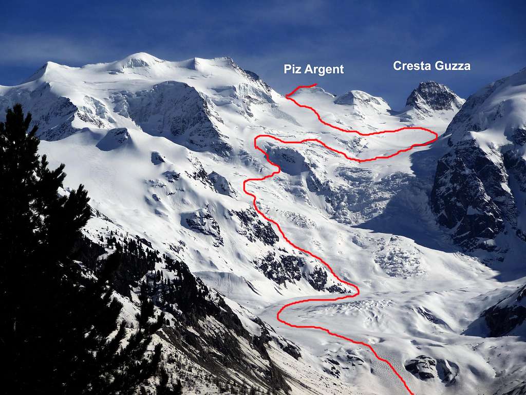 Ski route
From theparking of the rail station, take the wide and well-marked path leading to thefront of the glacier (do not confuse to the path that takes to the Boval hut). The first 2km are almost completely flat andviable also walking. The path ends to a “belvedere” at the feet of the front of the glacier. Overcome the front not in the center (crevasses!), but possibly on the right side where the slope is smooth.
Cross the glacier in the direction of S until the altitude of 2.500/2.600m wherefrom the slope increase in steep (right up to an area dominated by large seracs). From here, point to the left (E) to the rocky spur that bounds to the left of the glacier.
The Morteratsch glacier
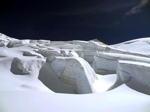
Seracs
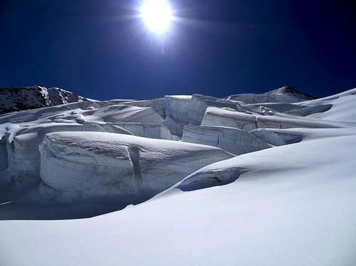 Seracs
To exceed it from the point previously reached, you must first go down for about 50/100m (depending of the year) to W direction, then up again to an other steep slope always in the direction SW. From this point usually the route takes to the refuge Marco e Rosa and not directly to the obvious slope in front of you. Before the hut, with a wide traverse in the opposite sense, point to the plateau placed at the foot of Piz Zupò.
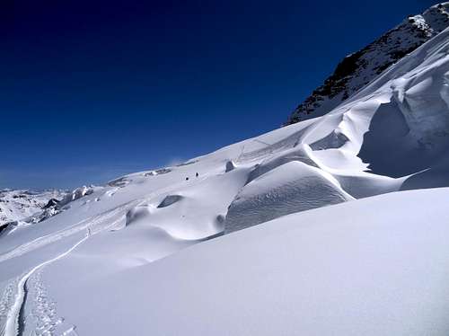
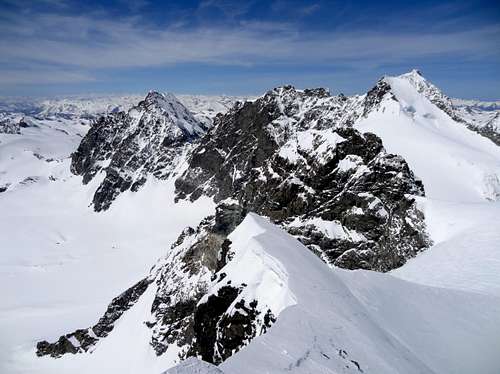
Climb the steep slope around the base of this bastion until his term, characterized by a clear rock that has left on your right (altitude 3.087m). At this point begins the most difficult part of the route, as the glacier in this area is characterized by the presence of many crevasses and seracs. Now enterthe area of the famous “Labyrinth” (this point is also called “buuch”).
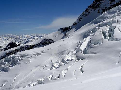
The Labyrinth
Seracs
 The Morteratsch glacier
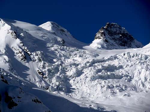
The plateau ends at the saddle between the Zupò and Argient that protrudes on the Italian side over a precipice. From the saddle, follow the ridge (W) quite easely that leads to the summit of Piz Argient (3.945m). Piz Argient is also climbed from Italy from opposite side, crossing the "Fuorcla di Cresta Guzza". The approach is harder, and also the environmet is very far from the scenery of the Morteratsch glacier.
The summit and the Bernina group
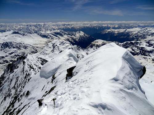
The summit
Suggested overnight
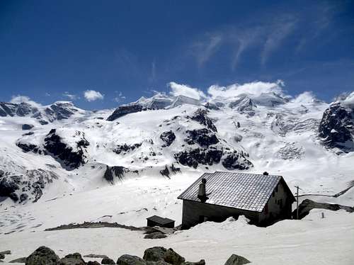
The "Chamanna Boval"
Refuge Chamanna Boval
Area: Val Morteratsch
Altitude: 2.495m
Route: From Morteratsch rail station 1896
Time: 2 hours
Difficulty: E
Opening period: Mid march to mid may - mid june to end of september
Owner: SAC Sektion Bernina CH - 7512 Champfèr
Keeper: Roberto Costa, Via Mulin 66, 7502 Bever
Refuge telephone: +41-818426403
Places: 100
Winter room: 12
Climbs: Piz Bernina, Piz Zupò, Piz d'Argent, Bellavista, Piz Palù
Excursions:
-Refuge Diavolezza 2.973m (F 2.30 hours)
-Refuge Marco e Rosa 3.597m (PD 5 hours)
-Refuge Tschierva 2.583m across "Fuorcla da Boval" 3.347m (F 3 hours)