Made for Wandering
Between Boulder and Deer Creek, the Burr Trail (a paved road for most of its length and not a real trail anymore) twists for about six miles through a wilderness of slickrock domes, mesas, and buttes. A few are named-- including
Sugarloaf and
Durffey Mesa-- but almost all are not. These formations present wanderers with delightful opportunities.
This trip report photographically documents an ascent of Point 6507-- 37.86988 N and 111.36869 W-- and highlights the scenery one will experience out here.
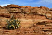
A sampling of the area--
|
|
![Point 6507]() Point 6507 Point 6507 |
Small hoodoos on Point 6507--
Sand and sandstone...
Volcanic signs--
Are you an amateur geologist or just someone who thinks rocks are cool? On the slopes out here, there are hundreds of minerals to check out. Don't take them, though; as this is a national monument, collecting is illegal.
Comments
No comments posted yet.


 Point 6507