
|
|
Mountain/Rock |
|---|---|
|
|
31.94392°N / 112.85042°W |
|
|
Pima |
|
|
Hiking, Scrambling |
|
|
Spring, Fall, Winter |
|
|
2313 ft / 705 m |
|
|
Overview
The Sonoyta Mountains are a small, rugged mountain range within the Organ Pipe Cactus National Monument only a few miles north of the Mexican Border. The highpoint itself is not a named summit, at least not as far as I was to find out in my research by looking at maps. Even though the highpoint only has an elevation of 2313 feet with only 543 feet of prominence it is not an easy task to reach the summit as the range does not have any trails and it is very rugged with steep, loose slopes and rocky ridges. However, solitude and real wilderness feeling are guaranteed as not many people seem to venture into this part of the National Monument let alone try to attain the highpoint.
The Sonoyta Mountains lie in an absolute stunning part of the National Monument and are surrounded by a very lush and diverse desert which also features the rare Senita cactus. This is the only area in Arizona where this cactus can be found which typically grows in north-western Mexico, particularly Baja California and Sonora.
From the summit itself you have great views over the National Monument including the Puerto Blanco Mountains with its prominent highpoint Pinkley Peak in the North, the Diablo Mountains to the West and the bulky Ajo Mountains to the Northwest. You will also enjoy great views into Mexico towards the South where you can see the town of Sonoita and the Sierra Cubabi mountains further south.
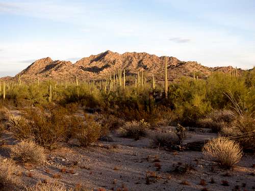
View at the Sonoyta Mountains from the trailhead (courtesy of Scott Peavy)
Getting There
Drive South on AZ-85 from the town of Ajo following the sign for Organ Pipe Cactus National Monument. It is about 175 miles to get there from Phoenix. Stop at the visitor center to pay the fee and then continue on another 3 miles south on AZ-85. Less than a 1 mile before you reach the Mexican border (you will pass a signs which says 1 mile to international border) in Lukeville turn right (West) onto Puerto Blanco Road. This well graded dirt road suitable for any vehicle (except in bad weather conditions) initially winds around a smaller hill and then runs parallel to the border within 50 feet. You will see the Mexican Interstate 2 on the other side of the border. After about 6 miles from AZ-85 you will come to the well signed turn-off to Senita Basin. Turn right (North) here and follow the also well graded Senita Basin Road until it ends in a loop at the Senita Basin picnic area. Park here. This is the trailhead.
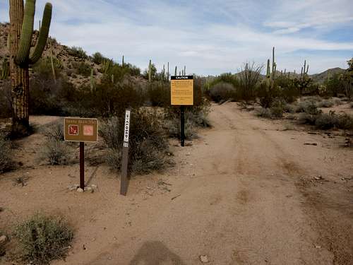
The trailhead (courtesy of Scott Peavy)
Route
From the trailhead start hiking on the Senita Basin Loop Trail. After a couple hundred yards the trails splits, take the right loop here. Follow the trail around a couple of smaller hills until you get to the east side of the mountain. You will pass a marked mine shaft and then a prominent wash. Shortly after the wash when you have a good view at the eat ridge of the peak leave the trail and hike towards the base of the ridge.
On our ascent we scrambled up the gully next to the ridge which is actually fairly steep, loose and brushy in places but on our descent we stayed on the ridge itself as much as possible and found mainly larger and very stable rocks which made progress much easier. Therefore I would recommend to use the east ridge for both ascent and descent. Either way you will get to a saddle; from the saddle continue to scramble along the ridge to a prominent rock pinnacle. You can't see the actual summit from here and it is a little to the north of the pinnacle.
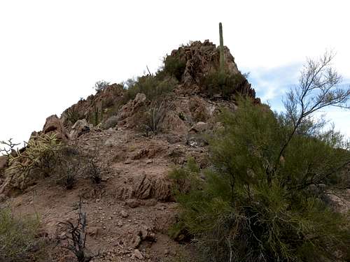
The prominent rock pinnacle (courtesy of Scott Peavy)
Once you reach the pinnacle you can either skirt around it to the left though that slope is quite loose in place or do a class 3 scramble with minimal exposure up and over it; I personally preferred the scramble over it. Once you are passed the pinnacle it is a short scramble along the now more narrow ridge until you reach the highpoint. We did not see any benchmark or summit register.
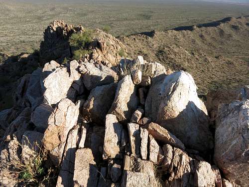
View back down the ridge from the summit (courtesy of Scott Peavy)
The round trip mileage is 3.6 with about 700 feet of elevation gain. The off-trail part of the route is mainly class 2 with short low class 3 moves.
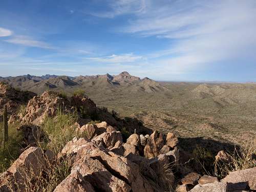
View north towards Pinkley Peak (courtesy of Scott Peavy)
Red Tape
Since the hike is within the Organ Pipe National Monument you have to buy a pass at the visitor center which is $12 and good for one week; this fee includes one motorcycle and rider, or all occupants of a vehicle. The Kris Eggle Visitor Center is open daily from 8:00 a.m. to 5:00 p.m.
The area sees a fair amount illegal border crossers and also smugglers. This can easily be seen in the form of trash in the desert but also some use trails. Though this doesn't mean there is any immediate danger for the hiker, one should still be aware of the surroundings
When to Climb
Best time to climb is November through March. Summer gets very hot here. On our hike in mid January we experienced very pleasant conditions with temperatures in the mid 60s.Camping
Organ Pipe Cactus National Monument has a very nice campground about 1.5 miles away from the main visitor center, called Twin Peaks Campground. As of 2016 the fee is $16 per night. There are restrooms with running water and plenty of RV parking as well.
Background camping is limited within the National Monument and only allowed in certain zones. I do not believe it is allowed in the Senita Basis where the trailhead for this hike is. For further information on backcountry camping you should ask at the Visitor Center or call 520-387-6849 ext. 7302.
External Links
Organ Pipe Cactus Nationa Monument website
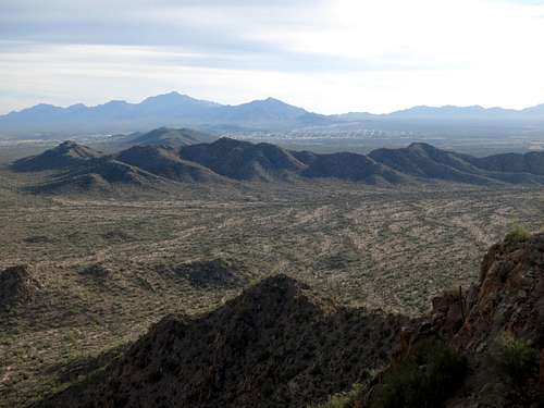
View south towards the town of Sonoita and the Sierra Cubabi range (courtesy of Scott Peavy)