Just know how to look, exploring hidden valleys or even "rubbed" the eyes of some Geographical Map; perhaps ancient, since it is already happened to find out what these
do not carry much less reported. So goes a piece of mountain culture, where in the past were known lawn grass for the fields, stone by stone, small valley small valley, refuge for shelter, a place sacred or cursed. If only to utilities and grazing to protect livestock. We who we are instead of
", the more we look, explore and love, perhaps because we were not allowed to conquer other more beautiful and fascinating. But the fact of exploring these semi abandoned valleys allows you to discover a new and very ancient at the same type of mountain environments so long since fall into the oblivion, but that, perhaps for this reason, have been preserved in a genuine and intact mantenenendo all their primordial and natural features. A passionate pursuit that binds very often the knowledge of the environment and of the territory, for which demand is passion and perseverance in a long time. Those that make the heart beat faster at the Mountaineer
Ancora qualche foto, poi s'apre un nuovo Sipario. Non é rivolto alle Vette più importanti, conosciute da tutti ed ammirate, bensì a quelle neglette ed abbandonate da Dio e dagli Uomini, che eppur esistono ma sono semiconosciute o proprio quasi del tutto dimenticate e quindi ancor meno frequentate. Anche lor però possiedono caratteristiche e delle peculiarietà proprie e ben definite, capaci, per chi ama questo tipo di montagna, di dispensare ed elargir emozioni, sensazioni e panorami diversi ed insoliti. In genere son
"nascoste" in valloni remoti, quasi alla fine del Mondo, oppure "
soffocate" da altre più alte, belle, famose o semplicemente più in vista; non per questo non possiedono dell'attrattive. Basta saperle cercare, esplorando valli recondite od anche
"strabuzzando" gli occhi su qualche Mappa; magari antica, poiché é già capitato di trovare su queste ciò che le
"moderne" non riportano e tanto meno individuano e segnalano. Così scompare un pezzo di cultura montana, laddove nei tempi passati eran cononosciuti prato per prato, sasso per sasso, valloncello per piccolo vallone, ricovero per riparo, luogo sacro o pur maledetto. Se non altro per utilità di pascolo e per proteggere il bestiame. Noi che invece siamo dei
"Vagabondi, Barboni, Clochards delle Alpi", le abbiam sempre cercate, esplorate ed amate, forse perché non c'era concesso di conquistarne altre più belle ed affascinanti. Comunque il fatto di esplorare questi valloni semi abbandonati consente di scoprire un nuovo e nello stesso molto antico modo di andar in montagna con ambienti sì obliati da lungo tempo, ma che, forse proprio per questo motivo, si sono conservati in modo genuino ed integro mantenenendo tutte le lor caratteristiche e peculiarietà primordiali e naturali. Una ricerca appassionata che si lega molto spesso alla conoscenza dell'ambiente e del territorio, per la qual vien richiesta
passione e costanza nel lungo tempo.
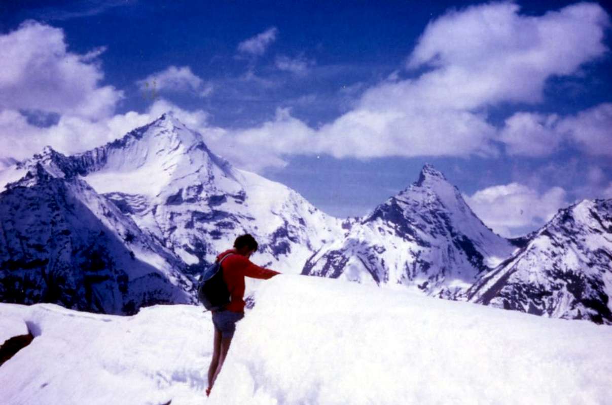
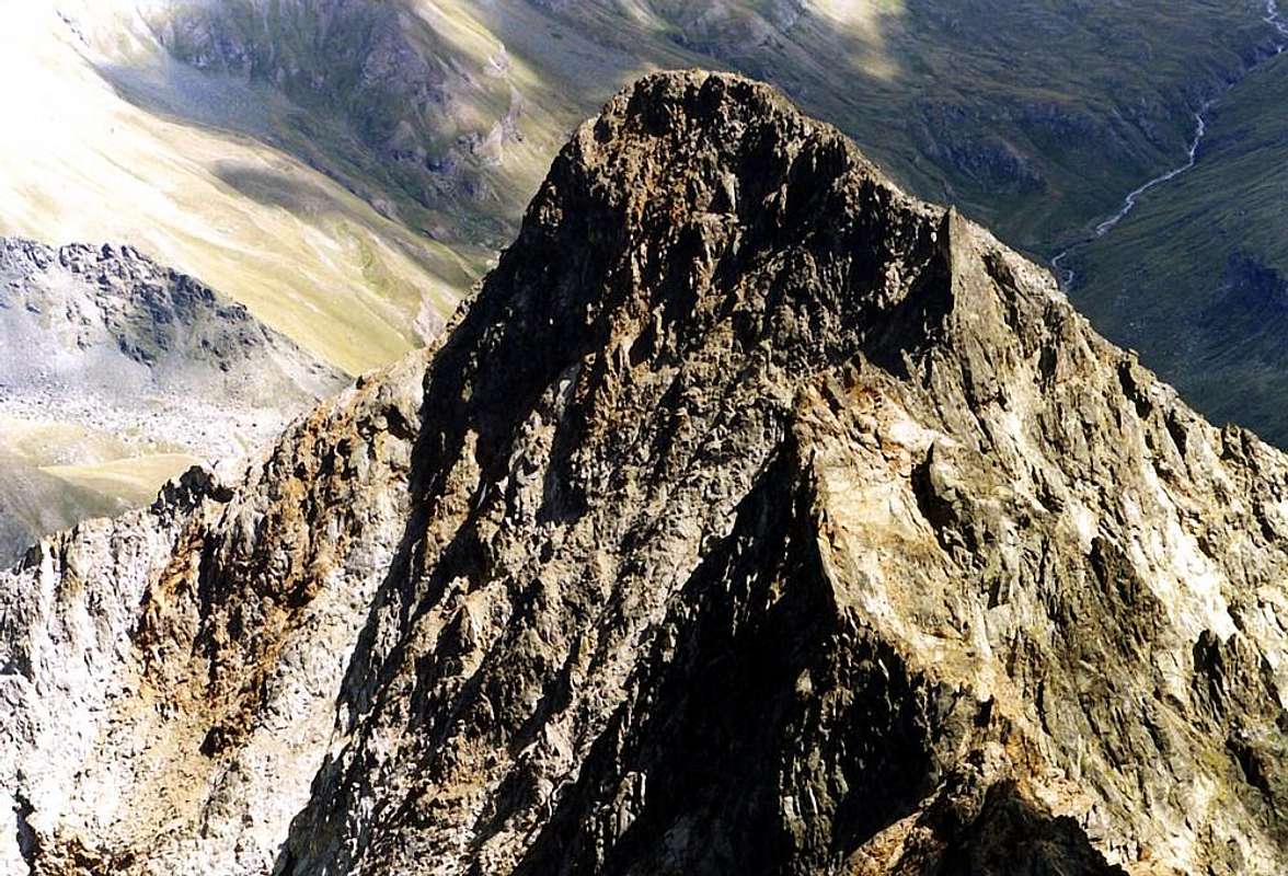
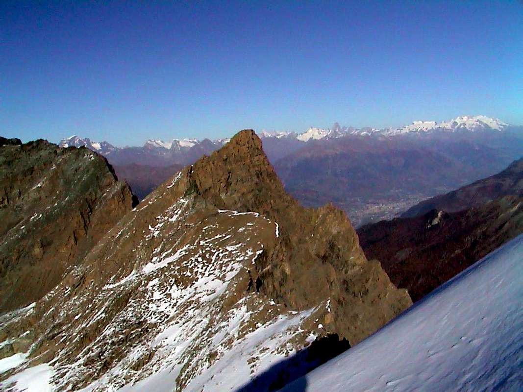
![]() "... The Punte Gianni Junod also Central Rouèse ..."
"... The Punte Gianni Junod also Central Rouèse ..."
by Antonio
But do not expect to come here and make a "Walk". You might regret very, very bitterly. Because even women who are not so nice they have a
"Dignity", which at times, know how to defend even with the fingernail. Here you do not write the History of Mountaineering or of the Alpinism, but if you
"try grits" you find how many you want. Never trust anonymous! Or, as my friend General Star, the kind of
"Low Profile". And these mountains are ... However we proceed with some order dividing a priori this Album in two parts: all that's left to South of Dora Baltea (here is our case that
First Part) and anything which stands in the North (we will see in the near or
Second Part). Moreover we divide each of these two Parties in many areas, namely Southeast and Southwest to the South, as well as Northwest and Northeast to the North. Still following the clockwise rotation from East to West and vice versa with an outward journey and return, as for all other work on the Valley of Aosta, taking as a central reference point the City of Aosta.
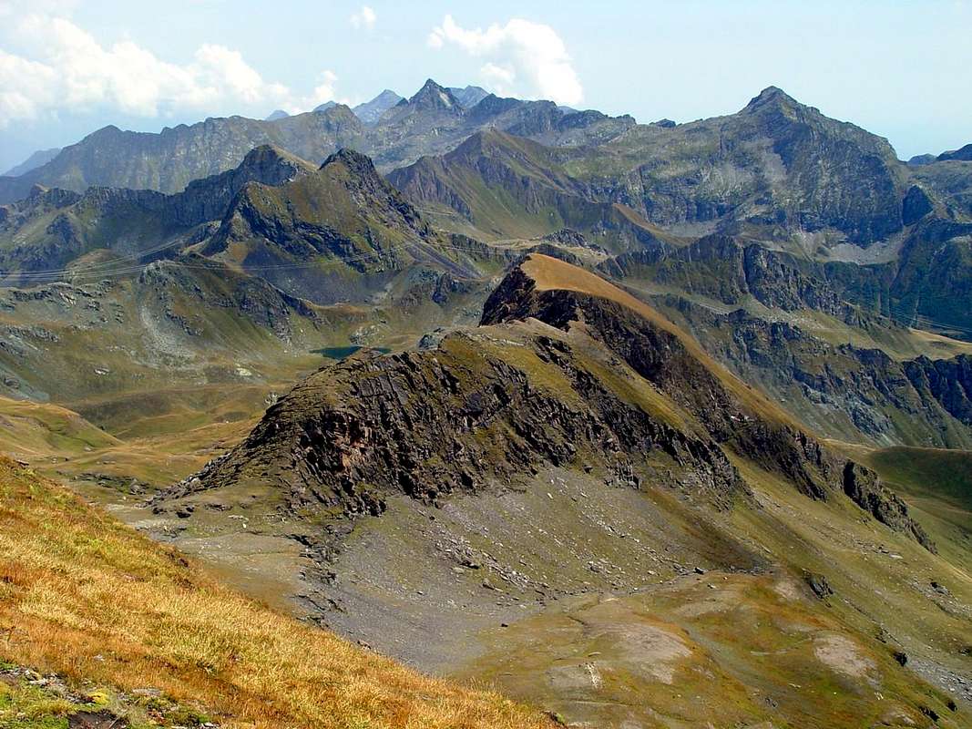
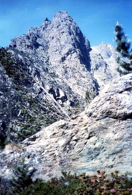
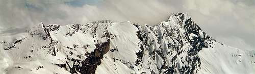
![]() "... The Tour Grauson ..."
"... The Tour Grauson ..."
by Osw
Ma non crediate di venire qui a fare una "Passeggiata". Potreste pentirvene molto ma molto amaramente. Perché anche le donne che non son bellissime possiedono una loro
"Dignità", che a volte, sanno difendere anche con l'unghia. Qui non scrivete la Storia dell'Alpinismo, ma se
"cercate grane" ne trovate quante ne volete. Mai fidarsi degli anonimi! O, come dice il mio Amico Generale Stella, di quelli di
"Basso Profilo". E queste montagne lo sono ... Comunque procediamo con un pò d'ordine dividendo a priori l'Album in due parti: tutto quello che resta a Sud della Dora (é qui il nostro caso, cioé
First Part) e tutto ciò che stà a Settentrione (lo vedremo nel prossimo o
Second Part). Inoltre dividiamo ognuna di queste due Parti in altrettanti settori, ovvero Sudest e Sudovest per quello Meridionale, nonché Nordovest e Nordest per il Settentrionale. Sempre seguendo la rotazione oraria da Est ad Ovest e viceversa, come per tutti gli altri lavori concernenti la Valle di Aosta, tenendo come punto di riferimento centrale la Città di Aosta.
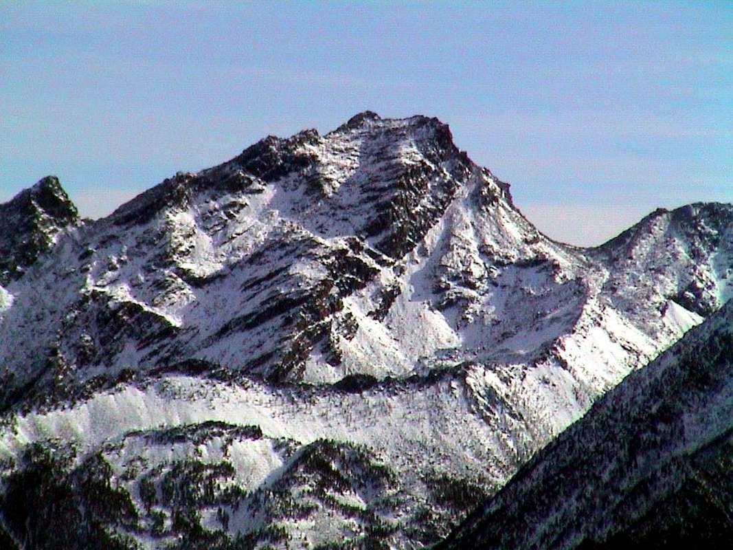
"... Hemi Known Ranges ..."
by emilius & Gino Bolfo East-southeastern sector
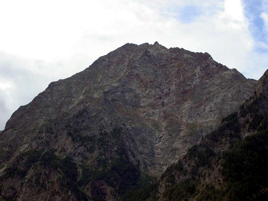
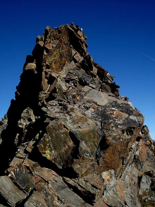
![]() "... Bec l'Espic above Chalamy Torrent ..."
"... Bec l'Espic above Chalamy Torrent ..."
by Osw
But do not expect to come here and make a "Walk". You might regret very, very bitterly. This area covers the most in the Southeast Valley of Aosta, limited to the North by the Dora Baltea, to Southeast from the border with Piedmont and South from the Valley of Cogne-Urtier (Grand'Eyvia and Urtier Torrents). It includes the extreme offshoots of the Gran Paradiso Group, which open like a fan towards the Groups of Monte Emilius, Punta Tersiva, Glacier, Avìc and Rosa dei Banchi. Rather are modest Summits which rise average of
2500/3400 metres and that, as you move away from major population centers, are less known and popular. Also because of the approaches very long stressful and sometimes
"mysterious": a pitch fascinating but that with which we must know how to measure often without great landmarks. Sometimes with great toil and little immediate gratification. At least in appearance. But then we understand that we have entered a
"New World", slightly if at all explored and still somewhat different from the slopes of standardization, where just
"to herd together as a load of sheep" one behind the other. A new way to know the
Mountain, seeking out old footsteps now erased by time and the tracks, at times, of
Pioneers, Hunters, Poachers and Smugglers. Seeing is believing, otherwise you can hardly understand these choices a bit
"queer and odd".
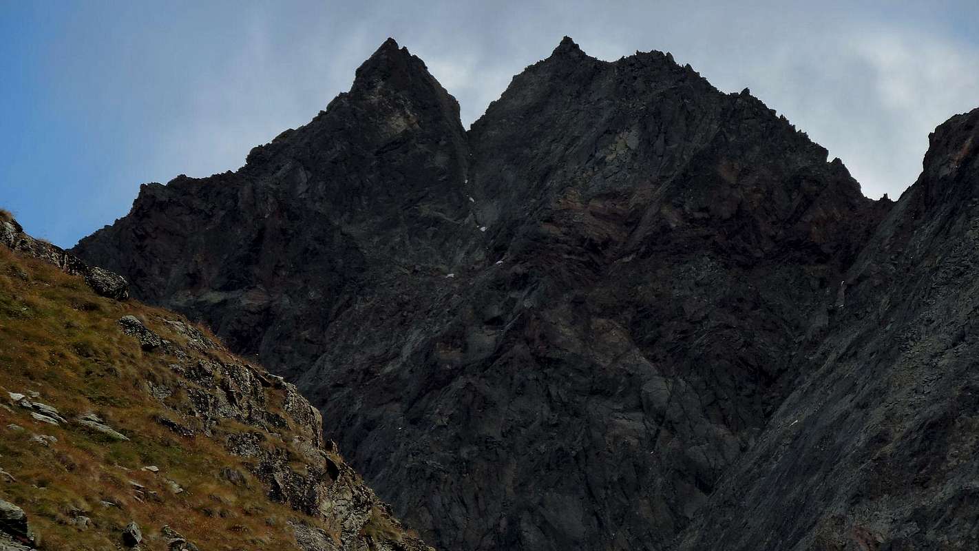
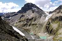
![]() "... Mont Rouvìc or Revì over Ponton wild Valley ..."
"... Mont Rouvìc or Revì over Ponton wild Valley ..."
by Emilio Bertona
Questo settore riguarda la parte più a Sudest della Valle di Aosta, limitato a Settentrione dalla Baltea, a Sudest dal confine con il Piemonte ed a Sud dalla Valle di Cogne-Urtier (Torrenti Grand'Eyvia ed Urtier). Comprende le propaggini estreme del Gruppo del Gran Paradiso, che si aprono a ventaglio verso i Gruppi di Monte Emilius, Punta Tersiva, Mont Glacier, Mont Avìc e Rosa dei Banchi. Ma al di fuori di questi nomi poco rimane di famoso e molto invece di sconosciuto, o quasi. Sono Sommità modeste che si elevano alla media di
2500/3400 metri e che, man mano che ci si allontana dai centri abitati importanti, sempre men vengono conosciute nonché frequentate. Anche a causa degli avvicinamenti molto lunghi stressanti ed a volte
"misteriosi": un terreno di gioco affascinante ma che col quale bisogna sapersi misurare spesso senza grandi punti di riferimento. A volte con grandi faticate e scarse gratificazioni immediate. Almeno in apparenza. Poi però si comprende d'esser entrati in un
"Mondo Nuovo", scarsamente se non del tutto esplorato e comunque alquanto diverso dalle piste della massificazione, dove basta
"intrupparsi" pecorilmente un dietro l'altro. Un modo nuovo di conoscere la
Montagna, andando alla ricerca di vecchie orme ormai cancellate dal tempo e sulle tracce, a volte, di
Pionieri, Cacciatori, Bracconieri e Contrabbandieri. Provar per credere.
Bec Mulère, Cime Beccher, Cima delle Fontane, Rosa dei Banchi, Tersiva, Punta Plan Rué, Pointe & Mont des Laures, Punta del Tessonet & Costa South-southwestern sector
![]() "... Punta Fenilia Vertex ..."
"... Punta Fenilia Vertex ..."
by OliettiPaolo
This area covers the most in the Southwest of the Valley of Aosta. It is to extend the partition with the Piedmont region in the South until you reach the Valley of the River Isère at the Galisia Hill, immediately after the Punta Basei. To the North towards the Dora Baltea down instead in succession Valleys of Cogne, Savara, Rhêmes, Valgrisa and La Thuile, while from the South-southwest to the North-northwest unfolds along the watershed between Italy and France, after the Tsantelèina, reaches for the Grande Sassière then decline to the Valley of the Little St. Bernard and the Col de la Seigne next to the Tarentaise Valley, around the corner of Mountain Chain Mont Blanc. An area full of famous peaks stretching from the Gran Paradiso
(4061m), the highest elevation of this whole
Southern Part, until the extended Glaciers of Rutor Head; but there are also in the folds of these valleys the Summits little known and frequented or simply fallen into disuse with the passing of years and the end of the wonderful
"Epic of Classic Alpinism".
![]() "... Punta Luetta also called Pointe de Tzaboc ..."
"... Punta Luetta also called Pointe de Tzaboc ..."
by emilius
Questo settore concerne la parte più a Sudovest della Val d'Aosta. Consiste nel prolungamento del divisorio con la Regione Piemonte a Mezzogiorno fino a raggiungere la Valle del Fiume Isère presso il famoso Passo della Galisia, subito dopo la Punta Basei. A Settentrione verso la Dora Baltea scendono invece in successione le Valli di Cogne, Savara, Rhêmes, Valgrisa e La Thuile, mentre da Sud-sudovest a Nord-nordovest si dispiega il lungo spartiacque italo-francese che, dopo la Tsantelèina, raggiunge la Grande Sassière per poi declinare verso il Vallone del Piccolo San Bernardo ed il successivo Col de la Seigne verso la Tarentaise, ormai alle porte della Catena del Monte Bianco. Un'area ricca di cime famose estendentesi dal Gran Paradiso
(4061 m), massima elevazione di tutta la
Parte Meridionale, fino ai vasti Ghiacciai del Rutor; ma non mancano anche tra le pieghe di queste vallate le Cime poco conosciute e frequentate, oppur semplicemente cadute in disuso col passare degli anni e la fine della splendida
"Epopea dell'Alpinismo Classico".
Becca di Suessa, Becca di Cére, Pointes Valeilles and Scatiglion, Pointe Loydon and Grande Assaly, Grande Tête du Mont & Bec de l'Âne
Comments
No comments posted yet.