Space Station View

Space Station View

This view of the Cucharas Valley and the Sangre de Christos was captured from the International Space Station May 18, 2005 at 3:01:09pm Mountain Time from an altitude of 216 statute miles with a 400mm lens on a Kodak DCS760C Electronic camera. To prevent the image from being too cluttered, I left off the notation for Blue Lake which is located just to the right (north) of the point where FR 436 cuts off from FR 422. The remainder of FR 436 which winds around the base of Trinchera Peak above timberline is buried under the snow. FR 415 runs from Cucharas Pass to Cordova Pass and then on to Aguilar and I-25. The abandoned Cuchara Ski Resort is also visible. Click on image to ENLARGE!!!
billokc
on Aug 17, 2007 11:37 pm
Image ID: 325212

Comments

Post a Comment
Viewing: 1-1 of 1
slowbutsteady

slowbutsteady - Feb 20, 2011 9:26 pm - Voted 10/10
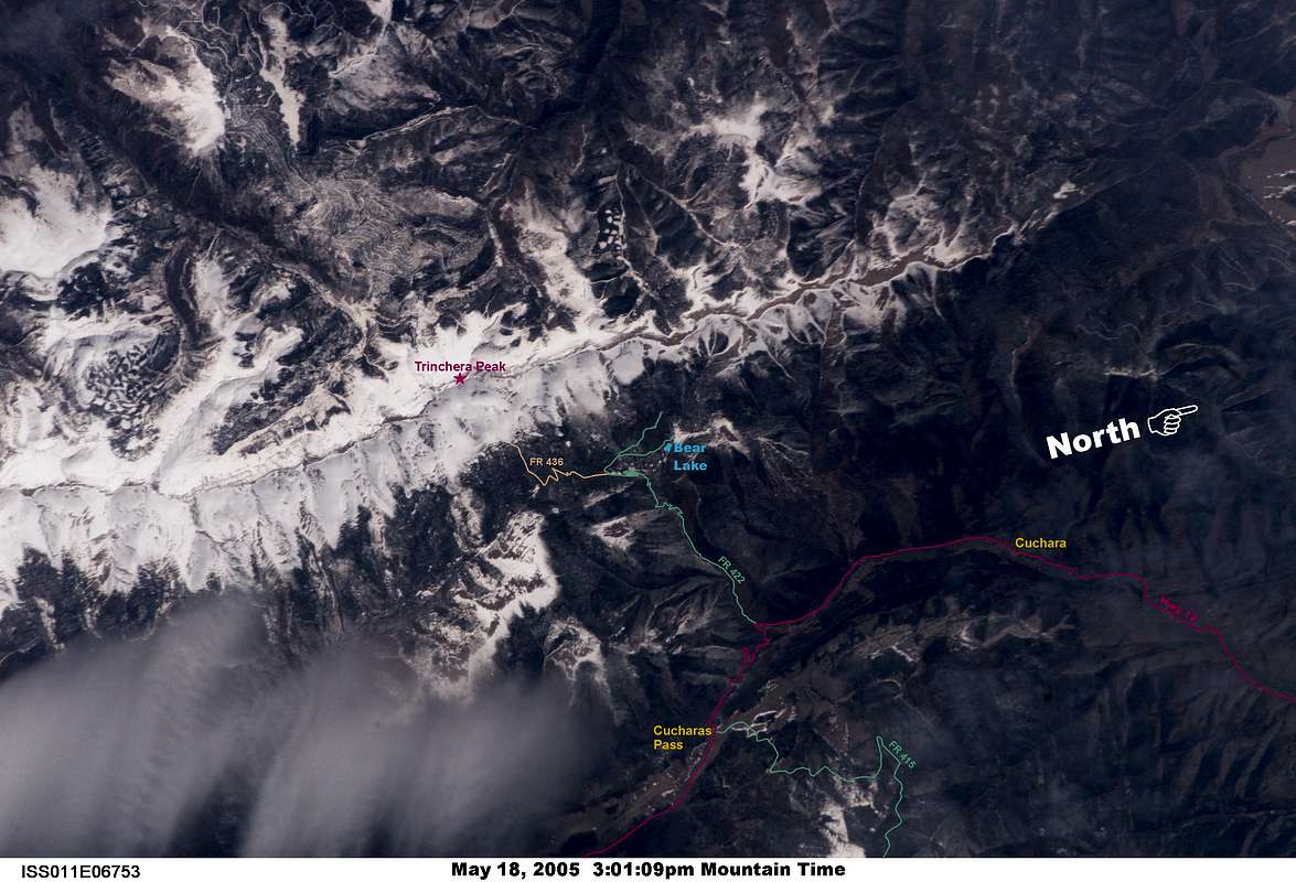
such a joy!

A real pleasure to gaze down on real estate over which I have hiked so many times. I can clearly see the meadow area north of Bear Lake CG leading to the old coral fence posts where I would either go left, up over Steep Mt. or right, up the gentle slope to the overlook. I haven't been to Teddys in over two years because of knee replacement having done the peak 19 times. Thanks again for posting. I would vote again if I could. slowbutsteady (Charles Baxter)

Viewing: 1-1 of 1