Split Mountain 2015 Day Hike via Red Lake
As they say it: the third time is a charm! I wish it did not take me three attempts to get to the summit of Split Mountain, but it did. The first time, I was at the top of the last chimney getting on the back side of the mountain but had to turn around because of a thunderstorm and hail. The second time, I got started on the wrong trail and ended up on Stecker Flat, having no idea what I did wrong or how to get on the right trail to Red Lake. The third time, had a 30 minute bushwhacking adventure but I made it.
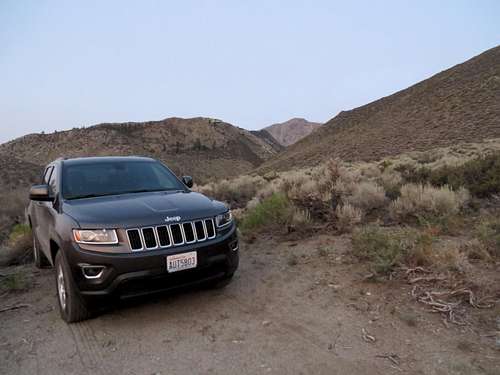
![Red Lake trailhead]() At Red Lake trailhead
At Red Lake trailhead
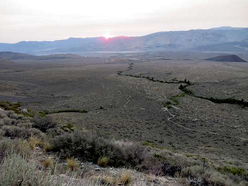
| ![Sunrise on Red Lake trail]() Sunrise on Red Lake trail. McMurry Rd in all its glory
Sunrise on Red Lake trail. McMurry Rd in all its glory
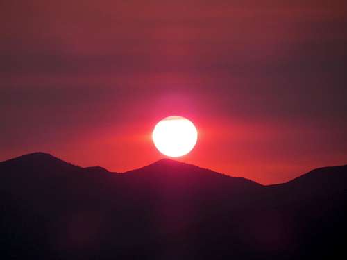
| ![Split Mountain]() Sunrise on Split Mountain trail
Sunrise on Split Mountain trail
|
About the approach to the trail head, I always was a fan of the following route: from I-395 take Fish Springs Rd (goes West only), to Tinemaha Camp Ground / Tinemaha Rd. At the split with Big Creek Rd make a left continuing on Tinemaha Rd. At Tinemaha Campground make a right on Fuller Rd. Follow Fuller Rd until the asphalt ends and the road splits: either road will go in the same spot, but I'd recommend keeping right toward the gravel factory. That road is in a little better condition for about .5 mile. Continue until reaching McMurry Meadows Rd and take an immediate left. From McMurry Rd there are lots of side drives, but all of them dead end in the bushes. Follow signs for road 10s111. From last year I noticed there are a few new signs that will point to RL TH (Red Lake Trail Head). Google Maps will help with directions on this route, but not entirely since the directions will take one through a private property that has a closed gate. However, I continued North, along the fence, until I found two other gates that were opened. Bing Maps will show the road better than Google Maps. I have to admit that if I did not have the GPS when I went there the first time, I would have never found the trail head. Not that the GPS will give accurate directions, but it will show the roads and location of the car, making it easier to navigate.
Since I hiked this trail twice, I'll not get into much detail. However, I still stick to my opinion that this trail is well under maintained and it doesn't have to be. First off, the big sign about the Red Lake is on the South side of the parking area, where the trailhead is located at the North point (at least a 1/4 mile away,) with no sign at all. In the beginning the trail is obvious, although I think that other hikers are cutting switchbacks, creating shortcuts, when coming down. This creates new trails which if hiked up, make for an unnecessary tiring workout.
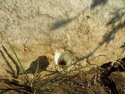
![On Red Lake trail]() White Flower On Red Lake trail
White Flower On Red Lake trail
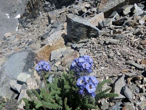
| ![Split Mountain chimney]() Blue Flower on Split Mountain chimney
Blue Flower on Split Mountain chimney
|
About 1.5 - 2 miles into the hike I came close to the Tinemaha Creek. I knew I did not have to cross the creek (thanks to Cab), but I was getting so close, I got nervous. I was sure I lost the trail again. I ended up bushwhacking, going up a hill I should have by-passed at the bottom, jumping over rocks and battling bushes, until finally I saw the trail again, going up on the opposite hill. From there on everything was just uneventful (but rather joyfull) hiking. I left the trailhead at 5:20 AM. I got to the lower lake at 8:20 AM. At Red Lake I spent some time getting water, eating and taking some pictures. I left Red Lake at 9:05AM and from there, up to the summit at 12:05 PM.
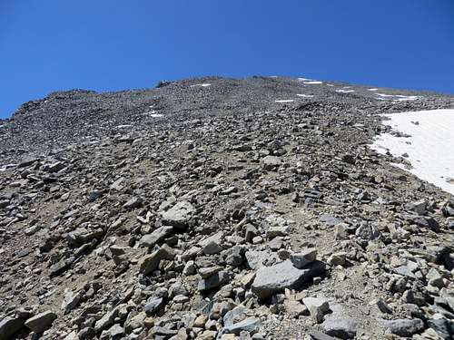
![Split Mountain]() The hike up to Split was on the patches of snow
The hike up to Split was on the patches of snow
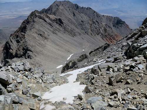
| ![Split Mountain]() From the chimney to the summit of Split
From the chimney to the summit of Split
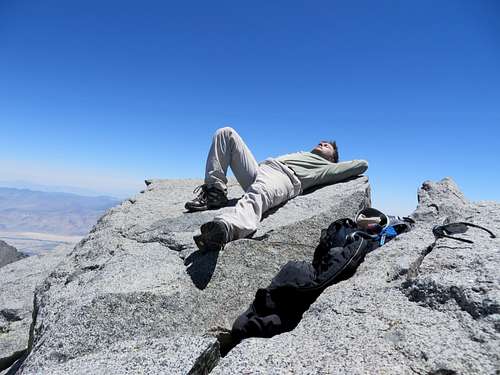
| ![Summit of Split Mountain]() Summit of Split Mountain
Summit of Split Mountain
|
One strange thing was that there was not one other person on the mountain. I did not see any other cars at the trailhead and there were no tents at Red Lake. For being the middle of summer, a 14er to hike and such a beautiful lake to camp around, I found that very strange. It was also strange to come across two snakes: one was less than a foot long, very thin, gray like the sand, in the middle of the trail, and I almost stepped on it. I saw this one going up. The other one was about 2 feet long, about a half dollar size thick, black with two yellow lines running down its back (Gartersnake?) I saw this on the hill at the trailhead while running back to the car, at the end of the day. I almost stepped on this one too, since I was running and my foot landed where the snake was. But the snake moved incredibly fast into some bushes. I consider myself lucky since if I would have stepped on the snake, I would have probably been in trouble.
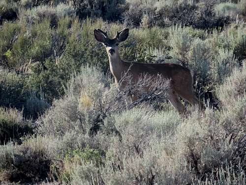
![Red Lake trailhead]() Deer at Red Lake trailhead
Deer at Red Lake trailhead
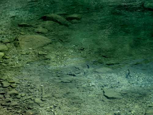
| ![Trout in Red Lake]() Trout in Red Lake
Trout in Red Lake
|
Coming down, it took me 4.5 hours to make it from the summit to the car. A few minutes to 6:00 PM I was driving away. I am very glad I summited Split Mountain, finally. The whole trip took 11.5 hours. The actual hiking time was 9 hours and 5 minutes. This was my 6th 14er.
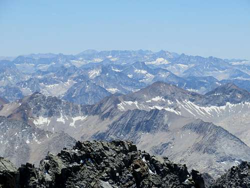
![View from Split Mountain]() View SW from Split Mountain
View SW from Split Mountain
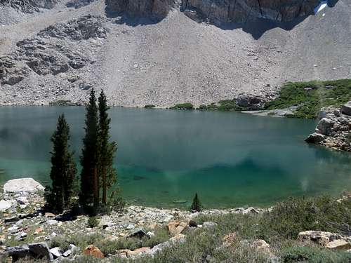
| ![Red Lake]() Red Lake
Red Lake
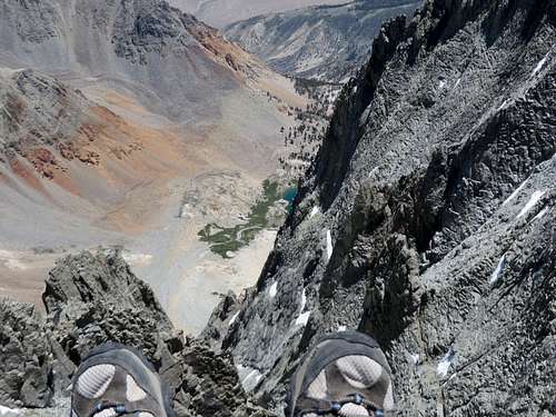
| ![Summit of Split Mountain]() Red Lake from Summit of Split Mountain
Red Lake from Summit of Split Mountain
|
Many thanks go to summitpost's member Cab for telling me what I did wrong on my 2014 attempt and giving me some great advice on following the trail to Red Lake.


Comments
Post a Comment