As part of my ongoing effort to get back into hiking, I have been attempting to gradually climb slightly more difficult peaks near my home in Southern California. Last year, my efforts culminated in an assent of
Mount Baden Powell on October 19, 2014. My first hike this year was to the summit of
Echo Mountain via the Sam Merrill trail on March 21, 2015. That trail is about 5 miles round-trip with about 1400 elevation gain. According to my sources, Strawberry peak was about 6.6 miles round-trip with about 1500 elevation gain. So, it sounded like a nice step up from Echo Mountain in terms of difficulty. I considered climbing San Gabriel Peak instead, but that sounded a little too short and a little too easy (less than 5 miles round-trip and about 1000 elevation gain), as I want to work my way up to Mt. Baldy, San Jacinto, and possibly San Gorgonio. So, I thought Strawberry Peak would be a nice effort. Plus, Strawberry is right next to Mt. Lawlor. If I had time and energy, I thought I could bag Lawlor on the way back. I only had about 5 hours to complete the hike (from home to home), so I would attempt Lawlor only if I had time.
Strawberry Peak had been closed up through at last early 2014 due to the Station Fire, and I confirmed that the trail was now open again before starting.
When I hiked to the top of Echo Mountain, the traffic was so intense that I felt like I was on the 5 or 101 freeways. I must have passed at least a hundred people that day, many of them trail-runners or marathoners. In contrast, the hike up Strawberry Peak was much more of a true wilderness experience, especially for being so close to Los Angeles. I probably saw only 20 or so people that day, and, once I got far enough in to get away from the noise of the traffic on the Angeles Crest Highway, I felt like I was in a true wilderness. That experience was interrupted by a couple of mountain bikers (who must have only gone as far as the saddle between Lawlor and Strawberry, as I don't see how they could have gotten to the top of, or ridden down from, Strawberry), but it still felt nice to be more in the wild. The hike felt more wild than any other hike I have done so far in the San Gabriels, even trails going much higher such as the one to the summit of Baden-Powell.
The hike, though, was hard, much harder than the the distance and elevation gain made it sound. I would rate it as harder than Baden Powell, despite the fact that the trail to the summit of Baden Powell climbs almost 1,500 feet more than the trail to Strawberry.
Beginning The Hike
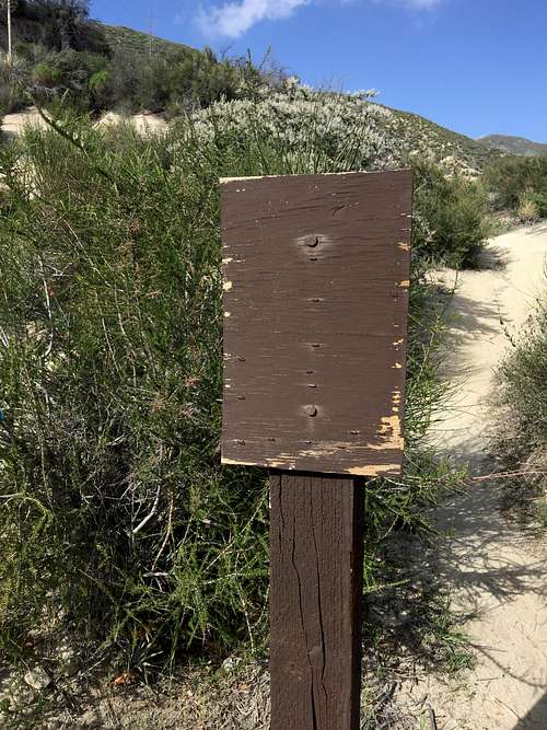
I reached the trailhead around noon. As instructed by my guidebooks, I walked across the Angeles Crest Highway from the Red Box campground, looking for a fire access road. Instead, I found a well-used path with a blank sign. I thought that this must be the trial (and I was right) and began following it.
![Blank Sign at Beginning of Trail]() Blank Sign at Beginning of Trail
Blank Sign at Beginning of Trail
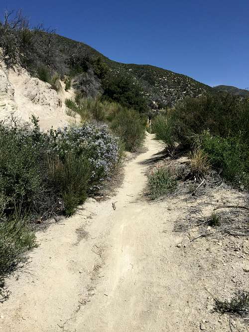
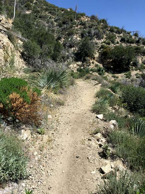
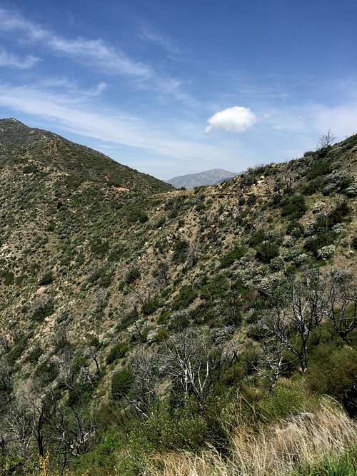
The path was most definitely a trail, and not a fireroad. In the early stretches, the trail gradually ascended north to the base of the massive south face of Mt. Lawlor.
![Beginning of trail]() Beginning of trail
Beginning of trail
![Along the beginning of the trail]() Along the beginning of the trail
Along the beginning of the trail
![Early stretches of trail]() Early stretches of trail
Early stretches of trail
![About 3/4 of a mile in]() About 3/4 of a mile in
About 3/4 of a mile in
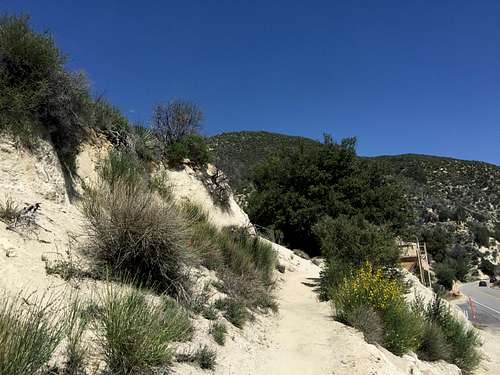
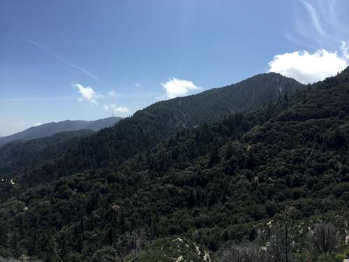
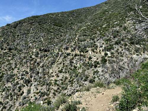
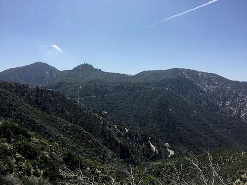
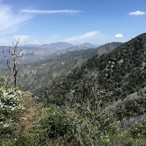
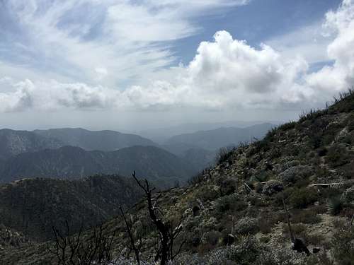
The front range of the San Gabriel Mountains is full of contrasts. The north-facing slopes are lush and covered with beautiful evergreen trees. The south-facing slopes look bare and dry, albeit coated with chaparral. Compare the south face of Mt. Lawlor with the view to the south:
![South Face of Mt. Lawlor]() South Face of Mt. Lawlor
South Face of Mt. Lawlor
![Front Range of San Gabriels]() Front Range of San Gabriels
Front Range of San Gabriels
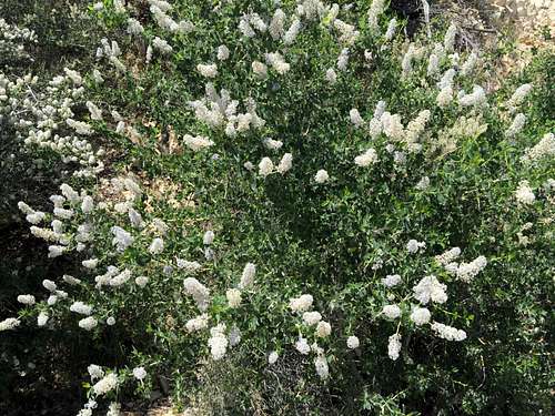
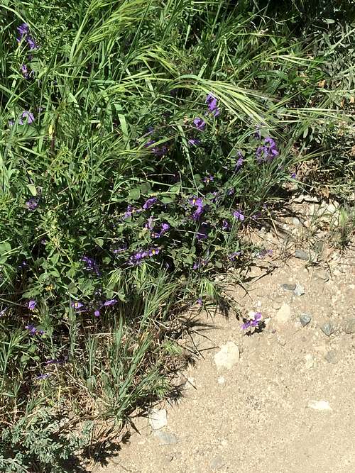
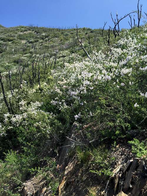
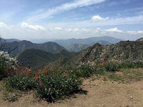
On closer inspection, however, even the south-facing slopes are covered with wildflowers and other green vegetation, at least in spring. I enjoyed these wildflowers immensely, along with a few shady spots.
![Wildflowers along early part of trail]() Wildflowers along early part of trail
Wildflowers along early part of trail
![More wildflowers along the early part of the trail]() More wildflowers along the early part of the trail
More wildflowers along the early part of the trail
![More wildflowers]() More wildflowers
More wildflowers
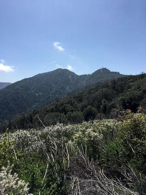
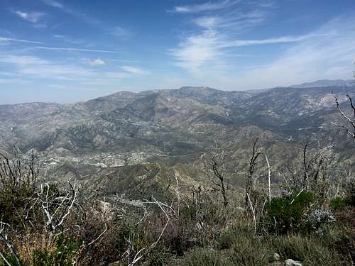
To the south, I could see views of San Gabriel and Mt. Disappointment, and eventually what I believe is Mt. Deception.
![San Gabriel Peak]() San Gabriel Peak
San Gabriel Peak
![San Gabriel Peak]() San Gabriel Peak
San Gabriel Peak
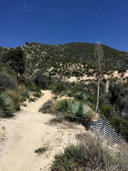
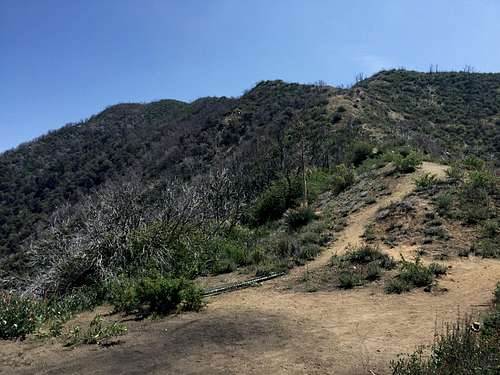
After about 3/4 of a mile (according to my very unreliable "Health" App on my iPhone), the trail split to the left. Again, I thought it might be difficult to find the trail based on the guidebooks, but it was easy to know when to turn left: the trail heading straight was blocked off by rocks. No signs, but not difficult for even a novice like me to find the right trail.
Hiking Toward the Saddle
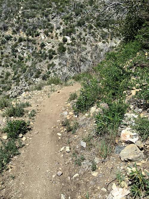
At this point, the trial began winding along the south face of Mt. Lawlor, like a snake, very gradually heading uphill, but with occasional (but minimal) downhill stretches. I was not yet able to see my goal, Strawberry Peak, but I felt great and energized, and continued to enjoy the views to the south.
![Strawberry Peak Trail]() Strawberry Peak Trail
Strawberry Peak Trail
![Strawberry Peak Trail]() Strawberry Peak Trail
Strawberry Peak Trail
![Wildflowers on trail to Strawberry Peak]() Wildflowers on trail to Strawberry Peak
Wildflowers on trail to Strawberry Peak
![San Gabriel Peak and Mt.Disappointment]() San Gabriel Peak and Mt.Disappointment
San Gabriel Peak and Mt.Disappointment
![San Gabriel Peak, Mt. Disappointment, and Mt. Deception]() San Gabriel Peak, Mt. Disappointment, and Mt. Deception
San Gabriel Peak, Mt. Disappointment, and Mt. Deception
![Josephine Peak]() Josephine Peak
Josephine Peak
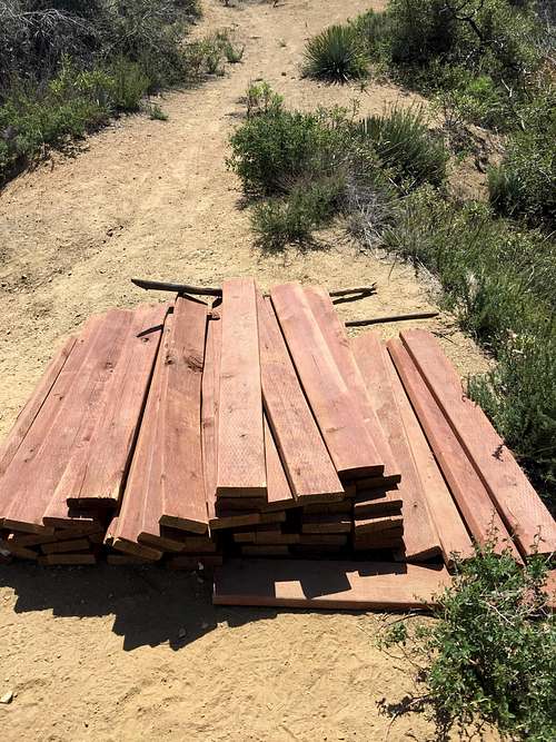
At one point, I reached a junction with an unsigned use path to a small, and apparently unnamed hill to the south of the trail. The ascent was only a hundred feet or so. I decided to pass on climbing it, wanting to be sure I least had time to make it to the top of Strawberry, and, hopefully, Lawlor. There were obvious signs of the continuing effort to rebuild the trail after just recently reopening it.
![Trail repair]() Trail repair
Trail repair
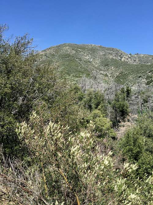
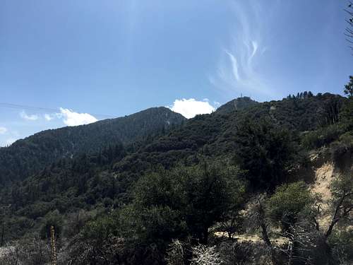
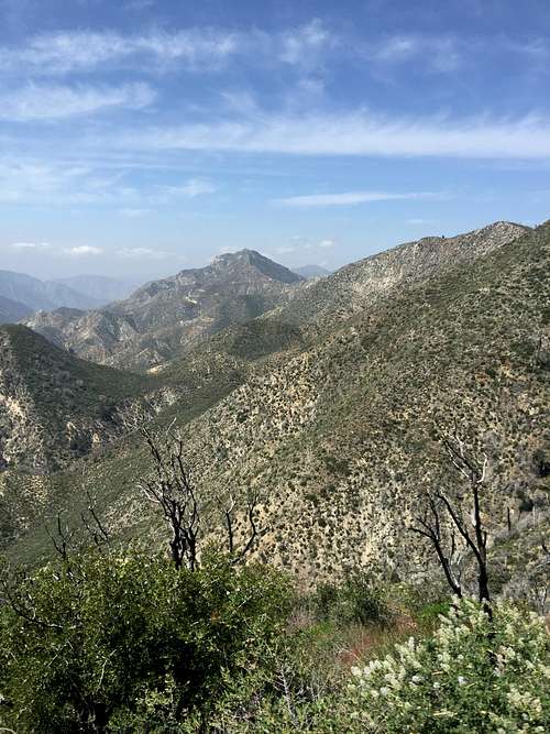
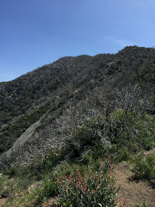
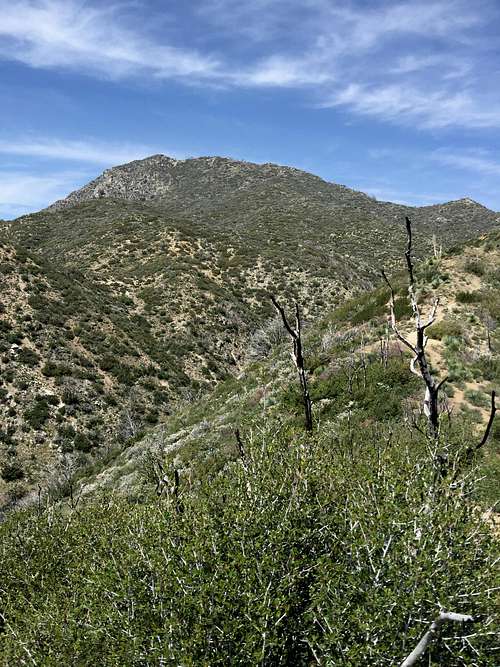
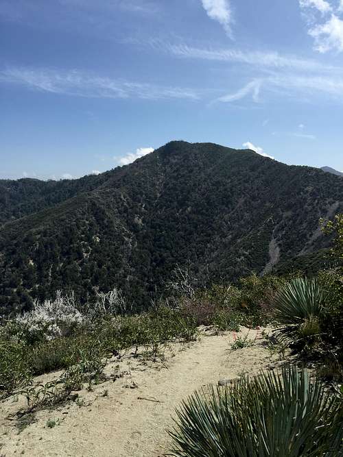
Eventually, nearly two miles in, the trial turned to the north, and the very evident saddle between Mt. Lawlor and Strawberry Peak. I could finally see my destination, Strawberry Peak. It still looked quite high up. Even though I had now walked about two miles, it was clear that I had not gained that much elevation.
![Strawberry Peak]() Strawberry Peak
Strawberry Peak
![Saddle between Strawberry and Lawlor]() Saddle between Strawberry and Lawlor
Saddle between Strawberry and Lawlor
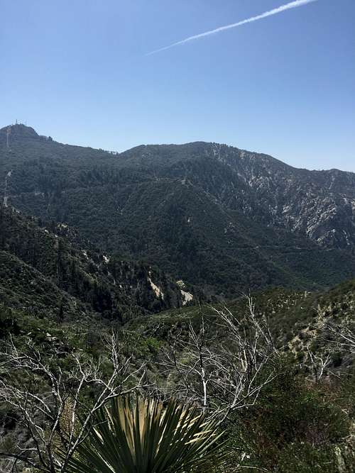
At the saddle, views of the San Gabriels to the north and northeast opened up. In the distance, I could see Waterman Mountain and Twins Peak. I was not able to see Baldy, either because it was too hazy or my position was wrong. Clouds and fog were starting to billow in from the ocean, but it remained sunny if cold, and I didn't expect any weather problems (and indeed, there weren't any).
![View north from saddle]() View north from saddle
View north from saddle![Waterman Mountain and Twins Peak]() Waterman Mountain and Twins Peak
Waterman Mountain and Twins Peak
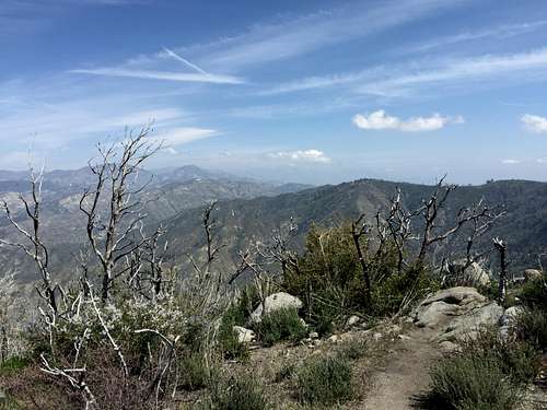
Once again, the contrasts in the San Gabriels were remarkable. The south face of Lawlor was steep and dry. The north face, however, was covered with pine trees and vegetation, and looked much more inviting.
![Mt. Lawlor]() Mt. Lawlor
Mt. Lawlor
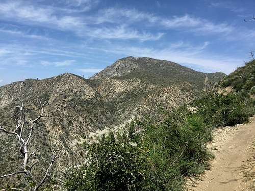
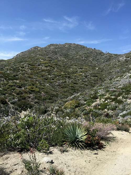
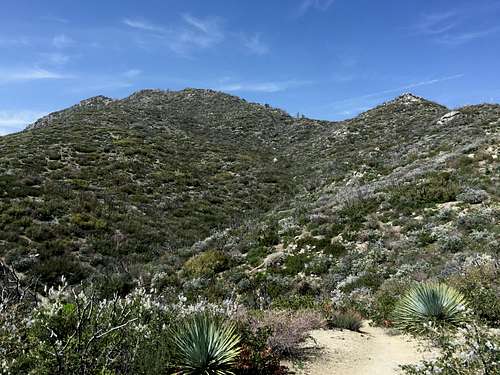
I expected to see a sign indicating the way to Mt. Lawlor, but no sign could be found. I did see a trail up Lawlor, but it looked hard and difficult. The way up Strawberry also looked hard and ominous. I concluded that I probably wouldn't be able to climb Lawlor that day, but held off on making a final decision until reaching the summit of Strawberry.
![Trail up Mt. Lawlor]() Trail up Mt. Lawlor
Trail up Mt. Lawlor
![Strawberry Peak]() Strawberry Peak
Strawberry Peak
![Strawberry Peak]() Strawberry Peak
Strawberry Peak
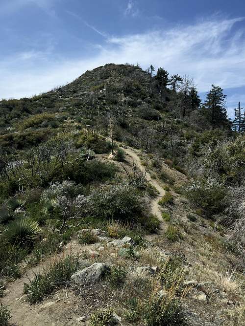
The final stretch toward the top
I knew this last stretch would be hard -- around 800 feet in just .75 miles according to the Trails of the Angeles. And it was hard -- very hard. So far, all of the hikes I have taken in the San Gabriels have been full of switchbacks and steady (if relentless) assents. Baden Powell is emblematic in that regard. That hike climbed 2800 feet but never felt steep, since the entire route was on switchbacks.
The hike up the east ridge of Strawberry, in contrast, went straight up the mountain. I felt more like I was back hiking the Idaho trails of my youth. In places the trail was sandy and rocky and I found myself using my hands to scramble up a couple of sections. I'm sure the trail is easy for veteran mountaineers, and does not qualify as even class two. Even so, it was hard for me.
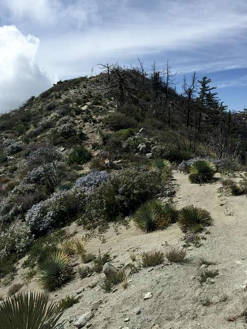
Even more annoying, the hike would go up hill only to go back down. I knew climbing back up those stretches would be irritating on the trip back.
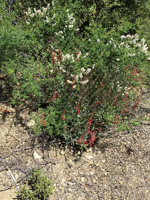
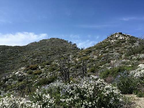
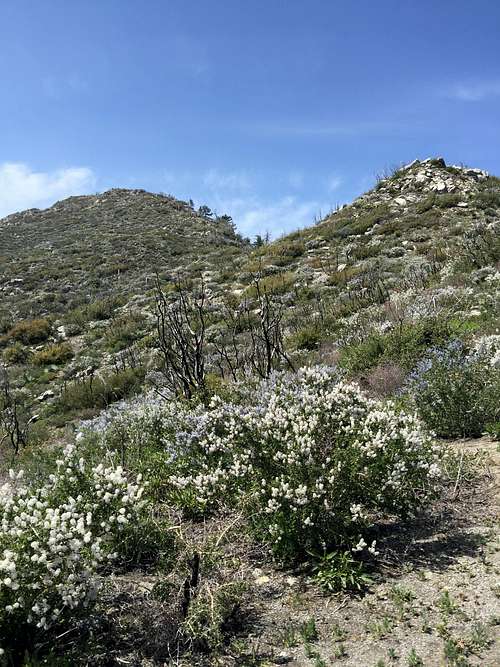
The difficulty was alleviated, however, by the beautiful views in all directions. The mountainside remained covered with wildflowers. The entire mountain was in full bloom. By nothing more than luck, I apparently picked the best time of year to climb the peak.
![Wildflowers Below East Face of Strawberry Peak]() Wildflowers Below East Face of Strawberry Peak
Wildflowers Below East Face of Strawberry Peak![Wildflowers along east ridge of Strawberry Peak]() Wildflowers along east ridge of Strawberry Peak
Wildflowers along east ridge of Strawberry Peak
![Wildflowers below Strawberry Peak]() Wildflowers below Strawberry Peak
Wildflowers below Strawberry Peak
![Nearing the Summit]() Nearing the Summit
Nearing the Summit
![Strawberry Peak]() Strawberry Peak
Strawberry Peak![San Gabriel Mountains, Front Range]() San Gabriel Mountains, Front Range
San Gabriel Mountains, Front Range
![View NE from East Ridge of Strawberry Peak]() View NE from East Ridge of Strawberry Peak
View NE from East Ridge of Strawberry Peak
![View to the North on the East Ridge of Strawberry Peak]() View to the North on the East Ridge of Strawberry Peak
View to the North on the East Ridge of Strawberry Peak
![Mt. Lawlor, North Face]() Mt. Lawlor, North Face
Mt. Lawlor, North Face
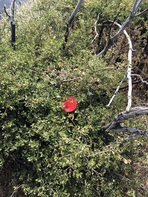
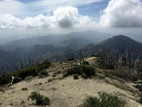
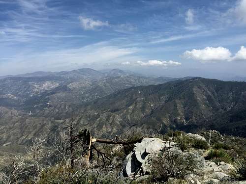
Eventually, after much huffing and puffing, I made the summit. I did not locate a trail register, but did find a bright red dot. I think red marks the spot on this mountain. The views in all directions were spectacular.
![Red marks the spot]() Red marks the spot
Red marks the spot
![Strawberry Peak]() On Summit of Strawberry Peak, Looking West
On Summit of Strawberry Peak, Looking West
![Waterman and Twins Peak from Summit of Strawberry Peak]() Waterman and Twins Peak from Summit of Strawberry Peak
Waterman and Twins Peak from Summit of Strawberry Peak
I was beat, though, after a much more difficult climb than I had anticipated. There was no longer any chance of my climbing Lawlor that day. I would have to save it for another day.