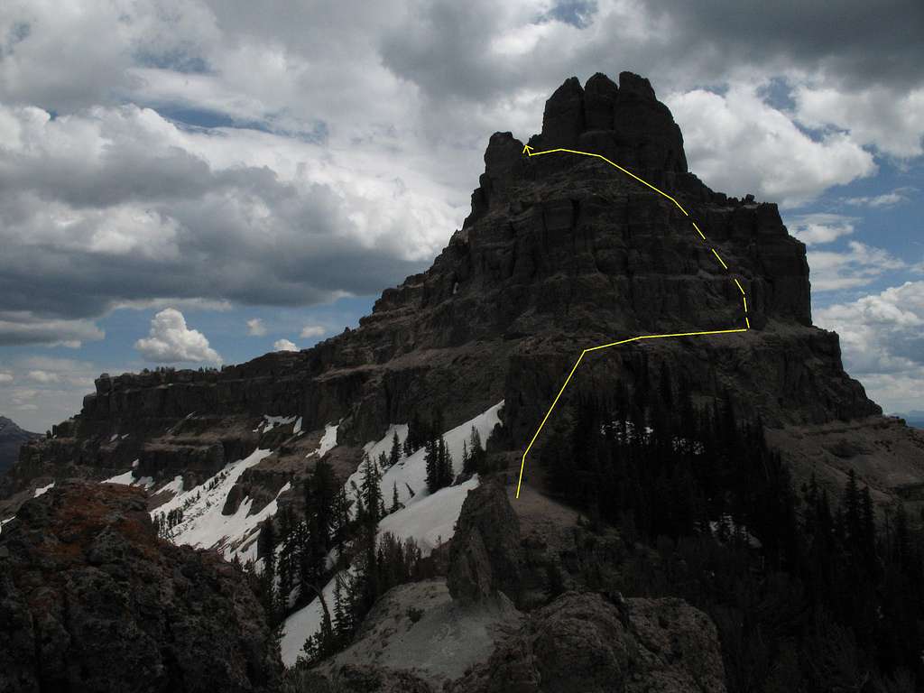
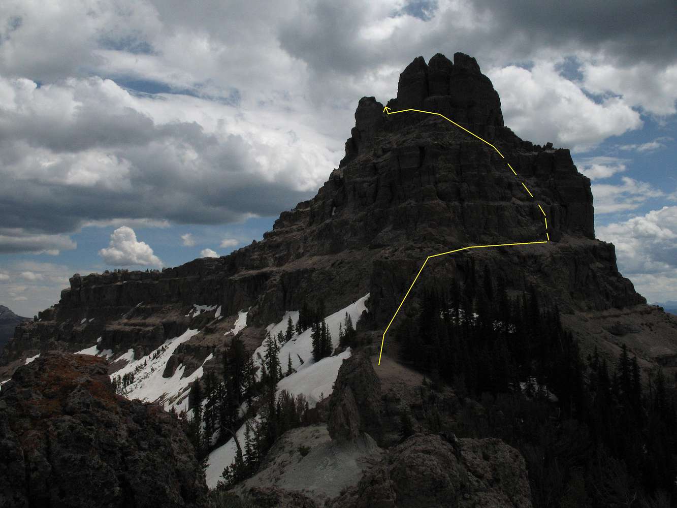
Sublette Peak-- Route Diagram
View in Orig for better detail.
This is the approximate route I took up. Where the line is solid, it is pretty much exactly along the course. Where it is broken, it is more approximate. In that section, I had to change course several times, sometimes downclimbing, climbing something else, downclimbing again, and climbing yet more before finding something that worked.
The climb outlined only covers about 400 vertical feet, but it is a nasty 400 feet that features bad exposure in places and worse rock everywhere. It is probably the worst rock I have ever been on and literally crumbles or pulls out all over the place. Forget about trying to protect this route.
The moves I did were in the Class 4-5.2 range. Climbing more directly puts you into 5.3-5.4 situations, and they're not so bad, but you have to remember the awful rock quality. Eventually, climbing the harder stuff begins to feel insane as the holds disappear as you grab hold of them. It's been done, but it's not recommended.
You may be tempted to think that a direct route would be facilitated by short traverses along those terraces, but don't count on it. Those terraces slope steeply and consist of hard-packed dirt and scree that offers about no purchase for the feet. Crawling sometimes works, but not always. A few are moderate enough to traverse, but most are not, as will be apparent once you reach them.
There is a walk-off route on the other side of the mountain.
Absaroka Range, WY-- July 2007


