
-
 3353 Hits
-
 71.06% Score
-
 1 Votes
|
|
Route |
|---|---|
|
|
46.22608°N / 13.86204°E |
|
|
Skiing |
|
|
Spring, Winter |
|
|
Half a day |
|
|
Medium (PD+/PD) |
|
|
Introduction
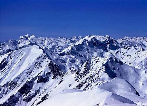
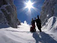
The tour on Rodica from the NW is one of the classics on Bohinj mountains. It's so nice that once each year even an organised event is kept there - with guides, security etc. Even if the tour planning is all with us, we can choose among several variants - two general approaches and a few tour courses of different difficulties. The panorama from the summit of Rodica is also splendid.
Grading the Tour
On the map below and in the descriptions to follow, the difficulties of ski tours are graded on the Swiss Ski Tours Grading Scale.
- General. The overall grading of these tours on Rodica would be "Less difficult" (peu difficile - PD). But there are some steep slopes and there are also slopes prone to avalanches. That's why some sections are graded PD+.
- Effort (ascent). From the valley 1400 m (4 h), using cableways 400 m (2 h to 2 h 30 min).
- Slopes orientation. West (in the summit part) and north.
- Gear. In good conditions only the usual ski touring equipment is enough. But it's quite rare that at least some slopes are not covered with hard snow (or even ice). So, having on the tour also an ice axe and crampons is a good idea.
- Orientation. In general it's not demanding, especially in good visibility. In poor visibility some variants are difficult to find. If the approach road is not cleaned high enough, you may also have some difficulties in the woods. The below interactive map is absolutely useful, as long as you have satelite connection. Just in case, have it also off-line on your phone!
Interactive map
Explore the map to get some more information. Unfortunately detailed descriptions on the map are only in Slovenian language. But they are anyway below on this page.
On the left side the map shows the ordinary ski terrains of Vogel. In the middle is the Suha meadow and its ascents on Rodica. On the right side are the terrains further to the east of Rodica. Ski tours are in blue color.
Points of Departure
There are two general points of departure:
1. From Vogel ordinary ski resort. It's a great option, payable, but it has one big disadvantage: Waiting in long queues in the morning. If you also return from Rodica on the ordinary ski terrains of Vogel, then you will ski down till your car. If not, you will have to either walk good 6 km along the Bohinj lake or take a bus to the lower station of cable way (they go hourly). So, take cableway to the upper station, Visoki Orlov rob, 1800 m. There the tour on Rodica starts with the initial ski descent.
2. From the road below Suha meadow. Having your own car, you can drive up by a forest road till the altitude of 1053 m (Javorje) - if the road is cleaned. If the road is not cleaned at all, then you must start the tour down in the valley of Bohinj - either in Ribčev Laz, 531 m, (by the lake) or in Laški rovt, 525 m. If the road is partially cleaned (the most common case) just drive up as high as you can. On descent you will do that anyway on skis.
Route Variants Descriptions
1. Orlov rob - Rodica
This is the easiest and shortest ascent. As you will very likely ski down elsewhere, it's described only as the ascent route - even if it starts with a short downhill.
From the highest ski lift station on Orlov rob, 1800 m ski down below the main ridge towards the SE, till a small saddle on 1781 m. There turn left and continue skiing by a nice valley, which runs paralelly with the main ridge of South Bohinj Mouintains.
(Variant: If it happens that you take only the ski lift to Kratki plaz, or ever that you came walking up by the ordinary ski terrains, you can also traverse the E slopes of Orlov rob and reach that valley.)
If conditions are good, skiing down from the saddle 1781 m, observe the slopes of the main ridge on your right. If you decide, you can ascend them by the first suitable passage. That's very steep and avalanche prone, but the shortest option. Further on to the summit of Rodica it's all easy.
Usually people continue skiing down by the valley and only when around a side ridge, they start ascending up to the right. That passage is also a bit steep and brings you on the main ridge exactly on the Čez Suho (pass), 1769 m - the lowest ridge point there.
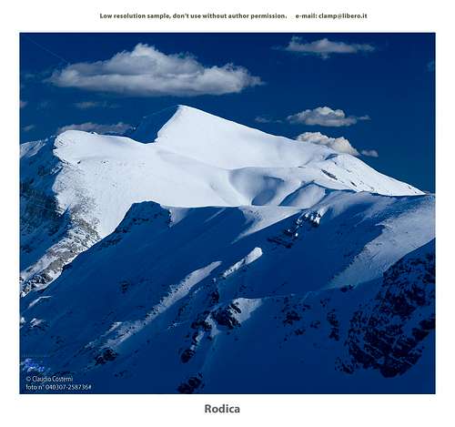
By the flat and gentle main ridge continue comfortably towards the E, later E-SE. When reaching till below the beautiful W face of Rodica, on 1821 m, turn to the left, towards the saddle between the main summit and Mala Rodica. Then by the NW ridge to the highest point. (From 1821 m you could also continue on the highest point by the southern variant). For this ascent count 2 h - 2 h 30 min.
2. Javorje parking 1053 m - Planina Suha
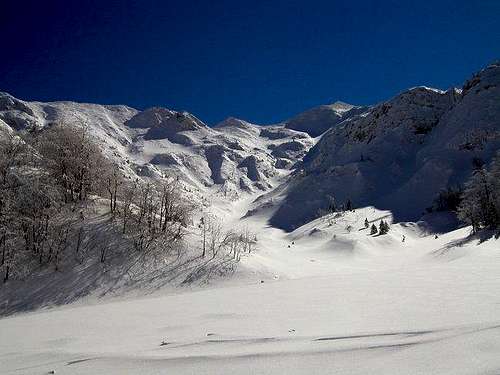
This is the ascent route, but also the route of skiing down. In Javorje the main forest road makes a big turn, but we deter from it, continuing at first by a cart-road towards the south. Soon the valley (Bukovska dolina) narrows and we follow the marked summer path - all the time in the SW direction. 1 h. When skiing down there, we can below the Suha meadow detour the steep valley step by the right side.
3. Planina Suha - Rodica
Suha alpine meadow, 1385 m, is abandoned in times of ski touring. So, from the hut you just continue southwards, on the upper part the two ascent variants are branching:
A. Over the Čez Suho saddle, 1769 m. By the valley we simply continue towards the SW. Terrains are broad, but we have some steeper sections to overcome. In 1 h 15 min we reach the broad saddle on the main ridge, where we turn left and ascend the summit of Rodica as described in the section #1 (40 min more). Altogether from Suha 2 h, from Javorje parking 3 h.
B. On the upper part of Suha meadow turn to the left (S) and enter a very steep couloir (some 40 degrees), not seen from the lower parts of Suha. You ascend it on foot, if snow is hard or icy use crampons and ice axe! The valley above the couloir is called Za Ulcam. You continue by it towards the S-SE and reach a broader plateau. Just continue by it towards the S, leaving the summit of Mala Rodica on your left. Higher a valley forms again. It brings you into the nice, broader area, called Lepa Suha. There you turn left and in the SE direction ascend till below the W face of Rodica. As under #1 keep left and ascend the highest point by the NW ridge.
Skiing Down From Rodica
There are several options, the majority and most attractive of them we know already. First you ski down the wonderful W face (wherever you want). Then you continue:
- Via the Čez Suho saddle (described in 3A).
- Via the Lepa Suha, Za Ulcam and the steep couloir (described in 3B).
So you reach Suha meadow. From there you can complete the tour:
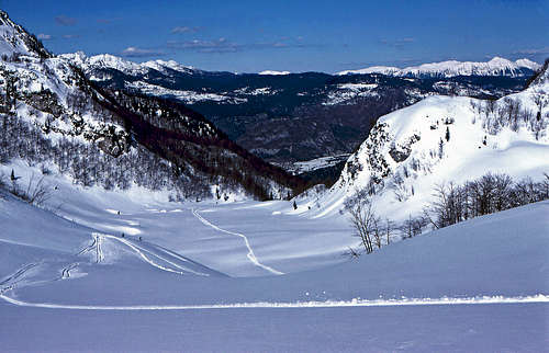
- By skiing by the valley further down towards the N-NE - till the road and, if needed, further down by it. In the past, when the road was not yet made or was not cleaned, we were skiing further down by the Bukovska dolina (valley).
- If there's not enough snow, or we have car at the lower station of cable way, we can from Suha ascend again on Vogel ski resort. Just from the meadow towards the W-NW a ravine ascends. In some 1 h 15 min it can bring us up on the ordinary ski terrains. Then we ski down by the Žagarjev graben piste or we simply take cable way down from Rjava skala.
Extensions: If you want to add to Rodica some other summit, you can ski along the NW ridge only till the saddle between the main summit and Mala Rodica, cross it and choose other goals depicted on the map above. You can see on the map that from those tours some 3-4 descents bring you also down on Suha meadow.
Other Rodica ski tours: There's also the southern tour, which brings you on the completely different side of the South Bohinj Range.