Viewing: 1-1 of 1

mrwsierra - Apr 19, 2006 9:17 pm - Hasn't voted
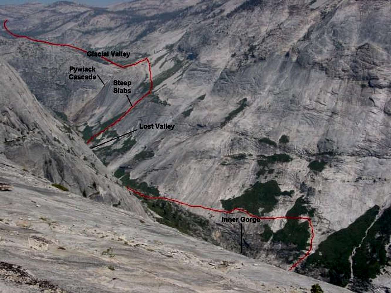
Great...overview of the approach to the Inner Gorge.
Viewing: 1-1 of 1
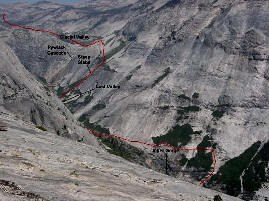

overview of the approach to the Inner Gorge.


Comments
Post a Comment