


-
 1855 Hits
-
 78.27% Score
-
 9 Votes
|
|
Mountain/Rock |
|---|---|
|
|
45.63140°N / 7.44532°E |
|
|
Aosta Valley Cogne Municipality |
|
|
Hiking |
|
|
Summer, Fall |
|
|
9482 ft / 2890 m |
|
|
Note
|
La montagna chiama i suoi figli, ed essi rispondono fedelmente al suo appello… Osvaldo Cardellina, Diario alpinistico, 1964-65 Page texts: @ OsvaldoCardellina "Osva", passed away on May 2, 2022. Page owners: Christian Cardellina e Osvaldo Cardellina. Any updates from September 12, 2022: Antonio Giani, page administrator, friend and climbing companion. Testi della pagina: @ OsvaldoCardellina "Osva", scomparso il 2 maggio 2022. Proprietari pagina: Christian Cardellina e Osvaldo Cardellina. Eventuali aggiornamenti dal 12 settembre 2022: Antonio Giani, amministratore della pagina, amico e compagno di salite. |
Overview
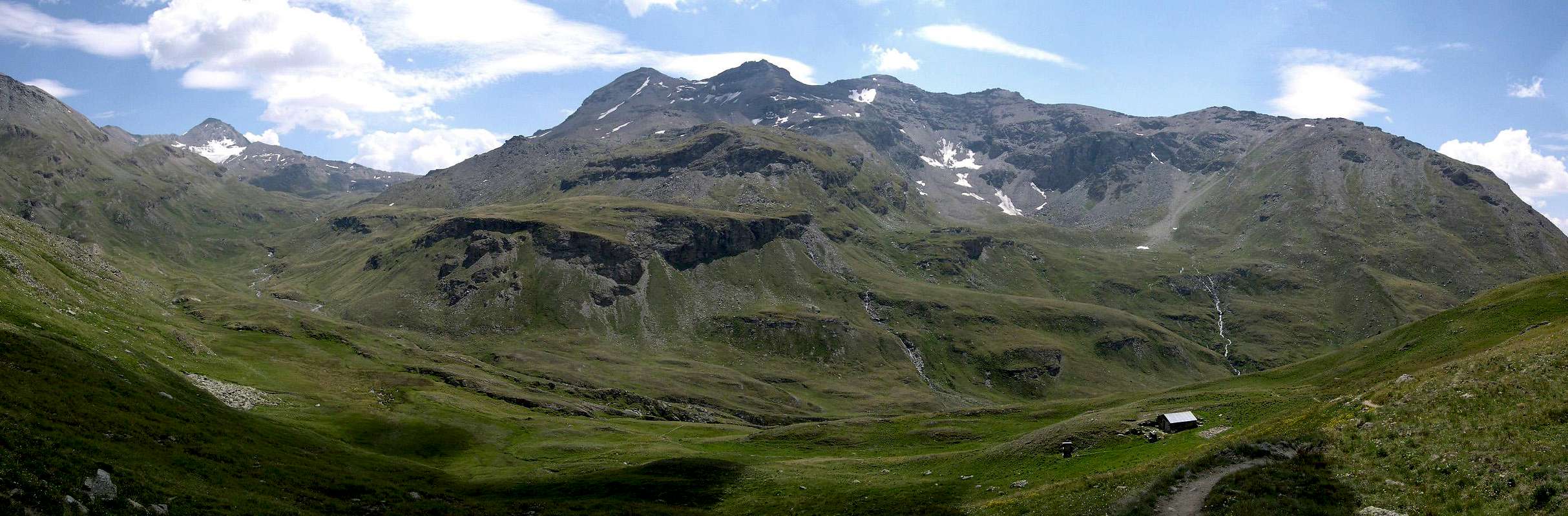
This small Summit is located amidst Punta del Tessonet (3.266m) and Punta Tersiva (3.515m) and front to the two Penne Blanche East West (3.248m, 3.205m). More precisely, it is located between an unnamed torrent that comes from the West to Punta Jean Vert (3.150m), the stream of Erveillères the valley and to Doreire East, coming down from Punta del Tessonet (3.266m) and from the glacier lying the Western slopes of the Punta Tersiva. It is "curled up" at the foot of Crête du Tessonet (Tessonet's Ridge), just before this latest digradi towards Pontonnet Colletto (3.050m), designed to divide the Vallone of Grauson/Doreire from that of Saint Marcel to the North. On the South side it has steep grassy slopes down to South-southwest over the Alpe di Erveilleres (2.515m), at the junction of the Torrents of Grauson and Erveillères. The same is interrupted by a small wall, formed by steep rocky walls and debris, while in the West the same are lined with a gully, which in the start to the season has small water sources. Surely little known and even less visited, except by hunters or poachers, he presents shots an eye West unusual n the whole Vallone Tessonet/Doreire and the distant reaches of the Southern Group of Emilius.The direct ascent is not advisable, for the reasons given above, while it is just the one with the longest ride on the Northeast side. Certainly easier and safer. With snowshoes, you have to lend much attention to the slopes. In fact, being the same totally turned to the South, can become really dangerous with poorly transformed snow. But if ye are true lovers & you love particular features, the view stretched over three Doreire Lakes, just down below in distance, towards Grauson's Tower ...
![]()
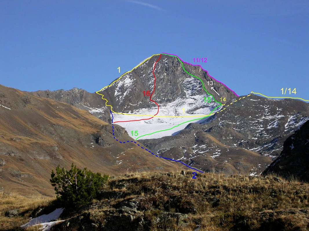
![]()
Tête Doreire under the last stretch dashed in blue, by Antonio & traced by Osw 2009
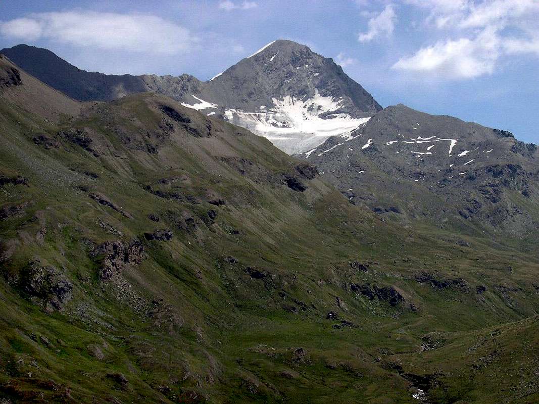
Questa piccola Sommità é collocata tra la Punta del Tessonet (3.266 m) e Punta Tersiva (3.515 m) nonché frontalmente ai Penne Blanche (3.248 m, 3.205 m). Più precisamente é situata tra un torrentello innominato ad Ovest che proviene dalla Punta Jean Vert (3.150 m), il Torrente di Erveillères sul fondovalle e quello di Doreire ad Est, che scende dalla Punta del Tessonet (3.266 m) nonché dall'omonimo ghiacciaio disteso alle falde Occidentali della Punta Tersiva. Si trova "rannicchiata" proprio ai piedi della Crête du Tessonet appena prima che questa ultima digradi verso il Colletto Pontonnet (3.050 m), atto a dividere il Vallone del Grauson/Doreire da quello di Saint Marcel verso Nord. Sul lato Meridionale presenta ripidi pendii erbosi che scendono verso Sud-sudovest al di sopra dell'Alpe di Erveillères (2.515 m), presso la congiunzione dei Torrenti di Grauson e di Erveillères. I medesimi sono interrotti da una piccola parete, formata da fasce rocciose ripide e con detrito, mentre ad Ovest le medesime vengono fiancheggiate da un canalone, che in inizio di stagione presenta delle piccole sorgenti d'acqua. Poco conosciuta ed ancor meno frequentata, se non da cacciatori o bracconieri, presenta colpi d'occhio perlomeno inusuali sull'intero Vallone di Tessonet/Doreire e sulle lontane propaggini Meridionali del Gruppo del Monte Emilius. La salita diretta non é consigliabile, per i motivi sopra esposti, mentre risulta appena più lunga quella con giro sul Versante Nordest. Certamente più facile e sicura. Con racchette da neve, bisogna prestar molta attenzione ai pendii nevosi ... Ma se siete proprio veri amanti delle peculiarietà, allungate la vista sopra ai tre splendidi Laghi Doreire e, laggiù in fondo, Erveillères e la Torre del Grauson ...
Getting There towards Dzimiglian or Gimillan
BY CAR:- From Torino, Milano, etc: Motorway A5. Exit in Aosta Ovest. Drive to the near Aymavilles. Follow in the direction of Valle di Cogne.
- From Switzerland: through the Grand St. Bernard Tunnel or the homonym Pass). Drive to Aosta, then follow Courmayeur direction on SS.26. Just after Sarre, turn to the left, in the direction of Valle di Cogne.
- From France: through Mont Blanc Tunnel or Petit St. Bernard Pass). It isn't necessary to enter in Motorway A5, you can drive through SS.26 Aosta direction. Before arriving at the Village of Sarre, follow the sign and turn right towards Valle di Cogne.
- Aeroporto "Corrado Gex" Saint Christophe (Aosta).
Specific Itinerary Road
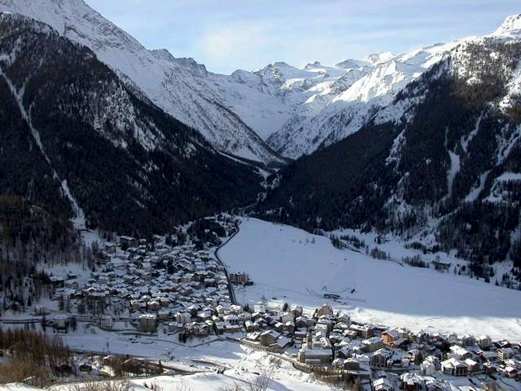
- After Aymavilles, the Regional Road n°47 crosses the Hamlets of Vieyes, Epinel and Cretaz and after about 25 Km. arrives at Cogne (1.534m).Follow the road signs, with East direction, for Gimillan and Lillaz. Arrived at a round-about, recently built in proximity of the St. Anthony Chapel, leaving East the main road towards Lillaz Hamlet (7,500 Km.) go left along the scenic route leading to the Village of Montroz and the Hamlet of Gimillan or Dzèmi(e)llan (1.787m), 3 Km. after Cogne. Usually no parking problem, either in the center of the village in the parking lot at the church as the road next to the Dzèmillan Torrent, as well highlights the photos (better).
Approach & Route
 |
 |
 |
 |
 |
The ascent of this Summit requires starting from Gimillan path with initial part of Grauson Valley. Abandoning the branch that continue towards Lussert Valley.
The same with its four splendid Lakes. So you have to fit in to the East to Doreire-Tessonet, then reaching the two following Alps of Pralognan and Erveillères /2.515m) (E/F; 3h'00/3h'30 from Gimillan's small bridge). From this last climb alp it is easy but requires some care (EE/F o F+; 1h'15/1h'30; 4/5h'00 altogether.
 |
 |
 |
 |
 |
La salita di questa Sommità richiede la partenza da Gimillan con percorso della parte iniziale del Vallone di Grauson. Abbandonando il ramo dei tre Laghi Lussert.
Quindi bisogna inserirsi ad Est in quello di Doreire-Tessonet, per poi raggiungere i due Alpeggi successivi di Pralognan ed Erveillères /2.515m) (E/F; 3h'00/3h'30 dal ponticello di Gimillan). Da questa ultima alpe la salita é facile ma richiede qualche precauzione (EE/F o F+; 1h'15/1h'30; 4/5h'00 complessivamemente dalla partenza.
 |
 |
 |
 |
 |
Campings
Remember that free camping is forbidden (except for emergency reasons, over 2.500m, from darkness until dawn).Mountain Conditions
- You can get meteo information at the official site of the Regione Valle d'Aosta:
- Valle d'Aosta Meteo
Books and Maps
- "Guida delle Alpi Occidentali" di Giovanni Bobba e Luigi Vaccarone C.A.I. Sezione di Torino Volume II (parte II), 25 Maggio 1896.
- "Guida dei Monti d'Italia – Emilius Rosa dei Banchi-Parco del Mont Avic" di Giulio Berutto e Lino Fornelli - Club Alpino Italiano/Touring Club Italiano, Marzo 2005.
- "Diari Alpinistici" di Osvaldo Cardellina e Indice Generale accompagnato da Schedario Relazioni Ascensioni 1964-2019 (inediti).
 |
 |
 |
- Ingenia "Parco Naturale del Mont Avic" Carta dei sentieri 1:25.000.
- Enrico Editori Ivrea "Carta turistica del Canavese" 1:100.000
- Enrico Editore Ivrea-Aosta "Gruppo del Gran Paradiso" 1:50.000.
- L'Escursionista editore "Valle di Champorcher Parco Mont Avic" Carta dei Sentieri (n° 11) 1:25.000.
- L'Escursionista "Valle di Cogne" Carta dei Sentieri 1:25.000.
- Carta Hapax Escursionistica della Comunità Monte Emilius, 2° Edizione 2008 1:25.000.
- I.G.C. di Torino "Ivrea Biella Bassa Valle d'Aosta" Carta dei sentieri e rifugi n° 9 1:50.000.
![One-week trip / B Epinel Steeple in Cogne Valley 2015]()
![Cogne and Gran Paradiso Group...]()
![Crètaz Church in Cogne Valley...]()

Important Information
- REGIONE AUTONOMA VALLE D'AOSTA the official site.
- FONDAZIONE MONTAGNA SICURA Villa Cameron, località Villard de la Palud n° 1 Courmayeur (AO) Tel: 39 0165 897602 - Fax: 39 0165 897647.
- SOCIETA' GUIDE ALPINE DI COGNE Tel. 347/9473526 – 328/1373728.
- A.I.NE.VA. (Associazione Interregionale Neve e Valanghe).
- A.IA.T. Cogne Gran Paradis via Bourgeois n° 34 Tel. 0165-74040. E-mail: aiat@cogne.org
- Ezio Sport articoli sportivi - via Bourgeois n° 64 Tel. 0165-74204.
Useful Numbers
- Soccorso Alpino Cogne (SAR) Tel. 3482685406.
- Protezione Civile Valdostana località Aeroporto n° 7/A Saint Christophe (Ao) Tel. 0165-238222.
- Bollettino Meteo (weather info) Tel. 0165-44113.
- Unità Operativa di Soccorso Sanitario Tel. 118.