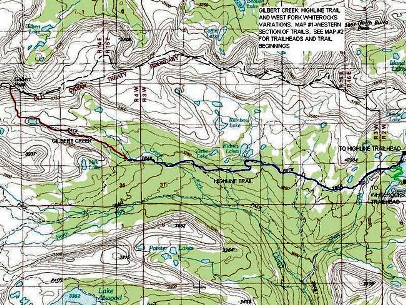
The Gilbert Creek Route (Whiterocks Variation) and the Gilbert Creek Route (Highline Trail Variation). Section shown on the map is from Fox Lake where the trails combine west to the summit of Gilbert Peak. The portions east of this map will be included on a seperate map.
Red = Gilbert Creek Route (no trail)
Blue = Highline Trail
Green = (far east portion of map) West Fork White Rocks Trail
Credit: Topozone


