
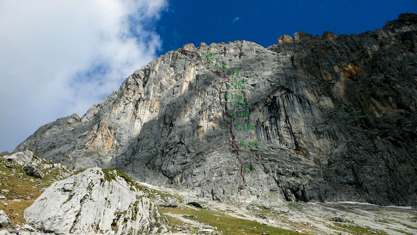
The Peters/Haringer Route, with UIAA topo
The Peters/Haringer route on the Southeast Face of the Schüsselkarspitze is marked in red. The green dots mark belay stations. The pitches are notated in the YDS grading system, and graded according to Richard Goedeke's topo in his book "Bayerische Alpen Nordtirol."


