Toggle navigation
Mountains
Routes
Images
Trip Reports
Forum
What's New
People
Areas & Ranges
Articles
Trailheads
Canyons
Huts & Campgrounds
Albums
Logistical Centers
Fact Sheets
Lists
Custom Objects
Gear
Plans & Partners
WELCOME TO SUMMITPOST
SIGN IN
REGISTER
Williams Fork Mountains
Additional Parents
Image
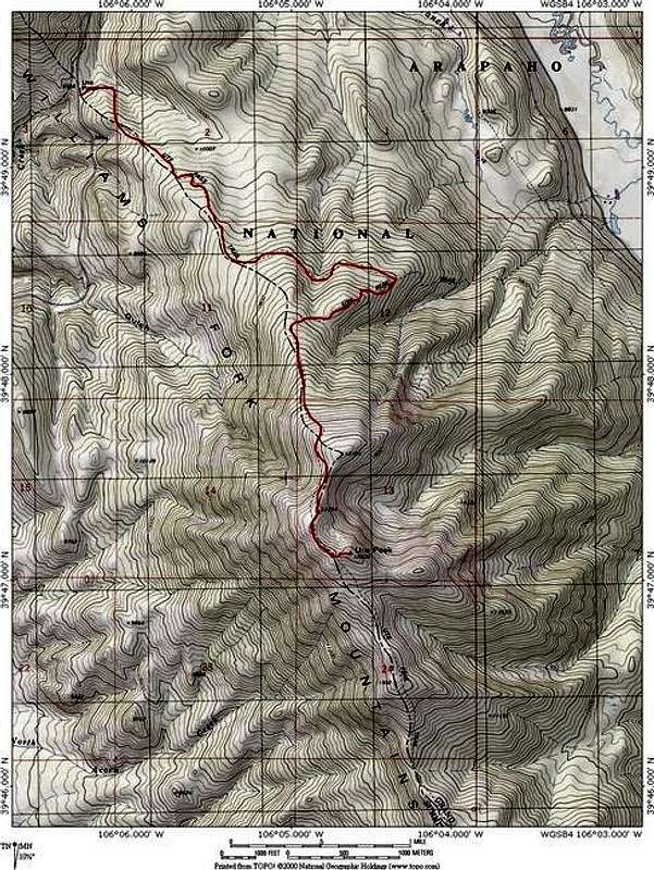
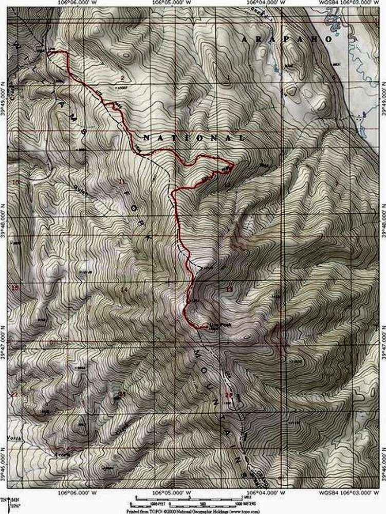
The route on Ute Peak from...
View High-Resolution Image
The route on Ute Peak from...
The route on
Ute Peak
from
Ute Pass
in red. It follows the Ute Peak trail all the way to the summit in 4.85 miles (9.7 roundtrip) with 2,700 feet elevation gain. Software by Topo!. Jon Bradford
« PREV
NEXT »
JonBradford
on
Nov 17, 2004 7:58 pm
Comments & voting
Other parents
Lat/Lon:
39.49400°N / 106.635°W
Image ID:
78595
3786 Hits
74.92
% Score
5
Votes
Log in to vote
Comments
No comments posted yet.
to post!
Don't have an account?
Williams Fork Mountains
(Area/Range)
« PREV
Viewing
#14 of 34
GALLERY
NEXT »
JonBradford's Image Gallery
« PREV
Viewing
#661 of 1444
GALLERY
NEXT »
×
You need to login in order to vote!
User Name
Password
Remember me
Forgot your password?
Log me out when I close my browser.
Keep me logged in all the time.
sign in as a user
Don't have an account?
Register now for FREE
Rating available
Suggested routes for you
People who climb the same things as you
Comments Available
Create Albums
Register Here


