Foreword.
Wake up, its 4 AM. You've had 4 hours of sleep. Fill your nalgenes with hot water so they won't freeze before you can drink them. Throw a 20 lb pack in the trunk of your car along with an additional 10 lbs of extra crap you have to put on at the trailhead. Make sure to wear your puffy during the 2 hour drive because ambient temperature will be 10 degrees Fahrenheit when you get there. Don't forget your headlamp because you will be leaving before dawn and coming back after dusk. Clear your schedule for tomorrow, because you will be busy recovering from today. NEVER forget your camera. Welcome to winter mountaineering in Colorado.
Though the Spring and Summer months have come and gone, my fascination with and tendency toward expeditions to the Gores has not died. So when a stellar weather forecast came along it was really a no brainer. When selecting a peak for the weekend, Sarah and I opted for a heavy dose of solitude, a walk-up with a moderate amount of elevation gain, and as she has coined it, "fluffy" conditions. Enter the South Face of Red Peak.
We accessed Red Peak's South Face via the Ryan Gulch Trailhead and Gore Range Trail from Willow Creek. This route looks good on paper, with only ~10 miles round trip length and ~4000 feet of elevation gain, but as with most winter routes in the Gores it should be expected to be an epic.
Getting to treeline = most of a day.
We departed the Ryan Gulch Trailhead at 7:20 AM, fairly late for the season. We initially headed west following a packed trail, but eventually decided that this trail was going too far south and gaining too much elevation to be of any use to us. At 10,400' we broke from the trail and headed north before dropping to around 9,800' in South Willow Creek Basin. Here we intersected the only useful trail we found all day and followed it west along the base of Buffalo Mountain. Near the base of the Silver Couloir (aka North Chute) the trail disappeared and we broke a trail 6-18" deep through the "fluffy conditions” to some trees around 10,200'. Here we entered the trees once again and bushwhacked through dead fall and other assorted Gore treacheries for a mile before finding easier terrain on the north side of Willow Creek.
![Silver Couloir]() Silver Couloir
Silver Couloir![Fluffy Conditions]() "Fluffy Conditions"
"Fluffy Conditions"![Gore bushwhacking]() Gore Bushwhacking
Gore Bushwhacking
Near 10,300' we crossed a few meadows and found the sun for the first time, as it had been blocked by Buffalo Mountain during the first 4 hours of the day. The variation in temperature was fantastic, 15 degrees F in the shade and 45 degrees F in the sun. What followed can only be described as tropical winter base-layer hiking at its best. The snow depth had not relented throughout the day and the spike in temperature only served to make it more unruly. Our original plan was to access the South Ridge of Red Peak from Red Buffalo Pass, but with a quick evaluation of snow conditions and time commitment, decided it would be best to ascend a more direct line on Red Peak's South Face if we wanted a chance at a summit. Near 10,900' we turned directly uphill and headed for the entrance to the easternmost couloir on the South Face. It was 12:30, and we were finally above treeline.
![Demming Mountain]() Demming Mountain
Demming Mountain![South Face Couloir]() South Face Couloir
South Face CouloirGive the mountain all you've got. Then give it a little more.
At 12:30 we stopped at the base of the couloir and took a break on a large block, in an attempt to try and convince ourselves to turn around. I ran the numbers in my head and estimated we would summit at around 3:00 PM if we were to continue. If this were the case we would hike out for at least 3 hours in the dark. Sarah had not brought her headlamp, though I had brought mine. With one headlamp between the two of us we agreed it would be a good idea to head down. We both sat there for a while, trying to make the connection in our brains that we had just put in 5 hours of trail breaking for a failed attempt. This would be Sarah's first summit in nearly two months and my first Gore peak of the winter season. Our collective desire to continue was strong. Moments later we unanimously decided that there was no way we would be going back without a summit.
The sun sets on Red Peak.
After our 30 minute lunch at the base of the gully we made fast progress up the 30-35 degree snow and tundra slope. We stayed to climbers right on the ascent, which allowed faster and safer travel up thin snow with minimal avalanche danger. Near 12,200' we emerged onto the crest of a south facing spur from the summit and cached our snowshoes. Here we also had our first views of Red Peak's East Ridge. We had to take a moment. This view is worthy of the climb altogether. From here the summit was in view and it was only a matter of time.
![Red Peak East Ridge]() Red Peak East Ridge
Red Peak East Ridge![Bluebird day.]() Bluebird Day
Bluebird Day![Red Peak west summit.]() Red Peak West Summit
Red Peak West Summit
We summitted at 3:20 PM. Almost simultaneously, the batteries in Sarah's GPS died. On the summit there was a light breeze and the afternoon sun was fading into the horizon. We layered up, congratulated each other, and fired off as many photos as is humanly possible with numb fingers.
![Afternoon summit.]() Afternoon Summit
Afternoon Summit![Gore winter summit badassery.]() Gore Winter Summit Badassery
Gore Winter Summit Badassery![Gore Range]() Gore Range
Gore Range![Mount Silverthorne.]() Mount Silverthorne
Mount Silverthorne
Descending, we stowed our trekking poles and pulled our ice axes for the first time of the day. We made good time plunge stepping down patches of deep snow, stopping a few times for a nagging gaiter malfunction. At the cache we picked up our snowshoes and continued plunge stepping down our ascent couloir. Looking down from the top there is one slope that is especially prone to avalanche, as it is convex and unsupported, but it was easily avoided by our line of ascent. We continued our descent and at the base sat down on our previous block to strap on snowshoes. We watched the sun set from here and at 5 PM began our hike out in the twilight.
![The sun sets on Red Peak]() The Sun Sets on Red Peak
The Sun Sets on Red Peak![Couloir descent.]() Couloir Descent
Couloir Descent![Rock buttress.]() Rock Buttress
Rock Buttress![Demming Mountain]() Demming Mountain
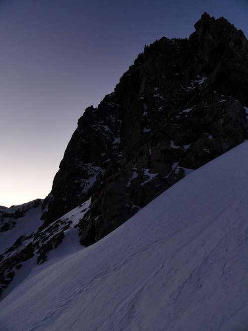
Demming Mountain![Evening silhouettes]() Evening Silhouettes
Evening SilhouettesGuiding light.
After 30 minutes of snowshoeing we caught a yellow shimmer through the trees and immediately realized that it was the full moon rising. Soon enough it was high in the sky and it illuminated the peaks around us. Passing through the meadows we were bathed in its light and at times I turned off my headlamp to walk by the moonlight. Throughout the day we had debated on whether to retrace our own tracks or to attempt to follow a faint ski and boot track down into the basin. Surely this other track would yield an easier route. I had visions in my head of it becoming something along the lines of the South East Slopes route on Bierstadt. We managed to follow the tracks for a while until they cliffed out. The remaining tracks looked confused and finally disappeared onto a rocky slope on the wrong side of the basin. We looked out across the basin and saw multiple cliff bands that we had avoided in the morning by staying close to Buffalo Mountain. Wondering if the night was ever going to end, we abandoned the trail and retraced our tracks back to our line of ascent. It was 730 PM when we finally rejoined our previous track and began the bushwhack back to the good trail we had found in the morning. We followed this trail east until it turned immediately up-slope. This section was steep but eventually leveled off at around 10,000'. Engulfed by the trees, we followed the faint trail as it winded in and out of deadfall. The winding trail made it difficult to monitor our heading, but it appeared that we were headed in the right direction. Before long we came to a signed junction and breathed a sigh of relief. 15 minutes later we made it back to the trailhead. It was 9 PM, putting our car to car time at 13:40 and bringing to an end yet another fine day in the Gores.


Comments
Post a Comment