Introduction
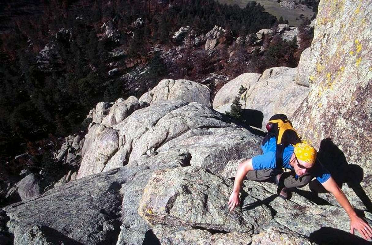
![]() Andy climbing The Weenie Route
Andy climbing The Weenie Route
![photo_id=89420]() | The Weenie Route follows an improbable line that begins on the west face of Greyrock Mountain. At first glance you might expect anything on the granite slabs to be a 5th class roped climb, but with careful routefinding Greyrock provides 500 feet of exciting and fun 4th class scrambling.
|
The name "Weenie Route" was coined by a member of the Colorado Mountain Club who has a tradition of climbing the route with a portable barbecue grill, then having a cookout on the summit. For those not fluent in American slang, "weenie", among other things, is slang for an American culinary icon, the hot dog. I know of no other names for this route, and it is better than "West Face".
|
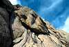
Class 4?
![photo_id=89423]() | The nebulous Class 4 rating sometimes needs clarification. To me it means that all the holds you need are there, but not necessarily obvious. They must be searched out, and the correct position and balance is needed to make the move. Basic rock climbing techniques such as stemming, mantling, and underclinging are required. You might be able to retreat the way you came without a rope, but continuing upward may be the best choice.
|
For the record, I think 5.6 is very hard and I would strut around like a peacock if I ever climbed 5.9. One climber's Class 4 is another's cake walk.
|
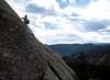
Approach
![photo_id=89417]() | The Greyrock Meadow trail is recommended because the entire start of the route, which includes the crux, is visible as you approach the rock. This is also an enjoyable and aesthetic hike with more than 2000 feet of elevation gain in 3 miles, so you will be nicely warmed up. The views west up Poudre Canyon towards Cameron Pass are an added plus.
|
To reach Greyrock Meadow follow Andy's directions in the main page Getting There section. At 0.75 miles from the trailhead you arrive at a trail junction. Take the left (west) branch for Greyrock Meadow.
|
When you are in the Meadow it's a good idea to pause and study the face rising to 800 feet above you. There are lines of weakness in the steep slabs that drape the mountain, and you will see that it may be possible to connect some of these lines.
|
Route Description
![photo_id=89422]() | The climb starts in an obvious gully that ends (as of May, 2004) at a large dead tree. This tree should be standing for at least a few more years. Reaching the tree involves no routefinding other than finding the gully, but there are a few surprising 4th class moves along the way, a taste of what is coming.
|
The decision you make at this tree is perhaps the crux of the day. I believe only one of the options in front of you is correct. If you studied the face from Greyrock Meadow, then you should have an idea of where you want to end up. But which choice will actually get you there? Since routefinding is such a fun and integral part of the day I won't spill the beans. (They go so well with weenies, after all). Of course, I could be wrong about only one choice being correct. There may be more than one way to skin a weenie.
|
![photo_id=89419]() | We used a non-obvious crack that splits one of the exposed slabs. This crack is not visible from the dead tree, and is not even obvious when you have climbed close to it. But when we found it, we know it was the key.
|
![photo_id=89421]() | Above this crack the routefinding is perhaps clearer and is an exercise in slab avoidance. But the climbing is a bit more difficult and sustained, and fun! We were pleased to wind up right where we thought we should from Greyrock Meadow. Then you turn a corner into unseen territory. Now and again there is a move that might give you pause, but it all works out.
|
It took us an hour and a half from the time we started up the first gully to reach the summit. This included stopping several times to enjoy our perch, and a bit of scouting at the dead tree to be sure that our first inclination was correct.
|
![photo_id=89418]() | We did not barbecue any weenies on the summit. |
Essential Gear
Basic hiking gear, comfortable climbing shoes. There is no drinking water along the trail. Be prepared for wind. A helmet is advisable, but I confess we carried ours but never felt the need to put them on, probably an unwise choice.