Toggle navigation
Mountains
Routes
Images
Trip Reports
Forum
What's New
People
Areas & Ranges
Articles
Trailheads
Canyons
Huts & Campgrounds
Albums
Logistical Centers
Fact Sheets
Lists
Custom Objects
Gear
Plans & Partners
WELCOME TO SUMMITPOST
SIGN IN
REGISTER
Summit Creek
Additional Parents
Image
This is the topo map and...
View High-Resolution Image
This is the topo map and...
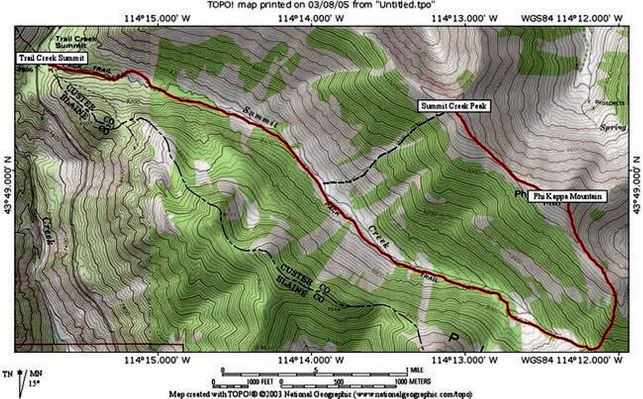
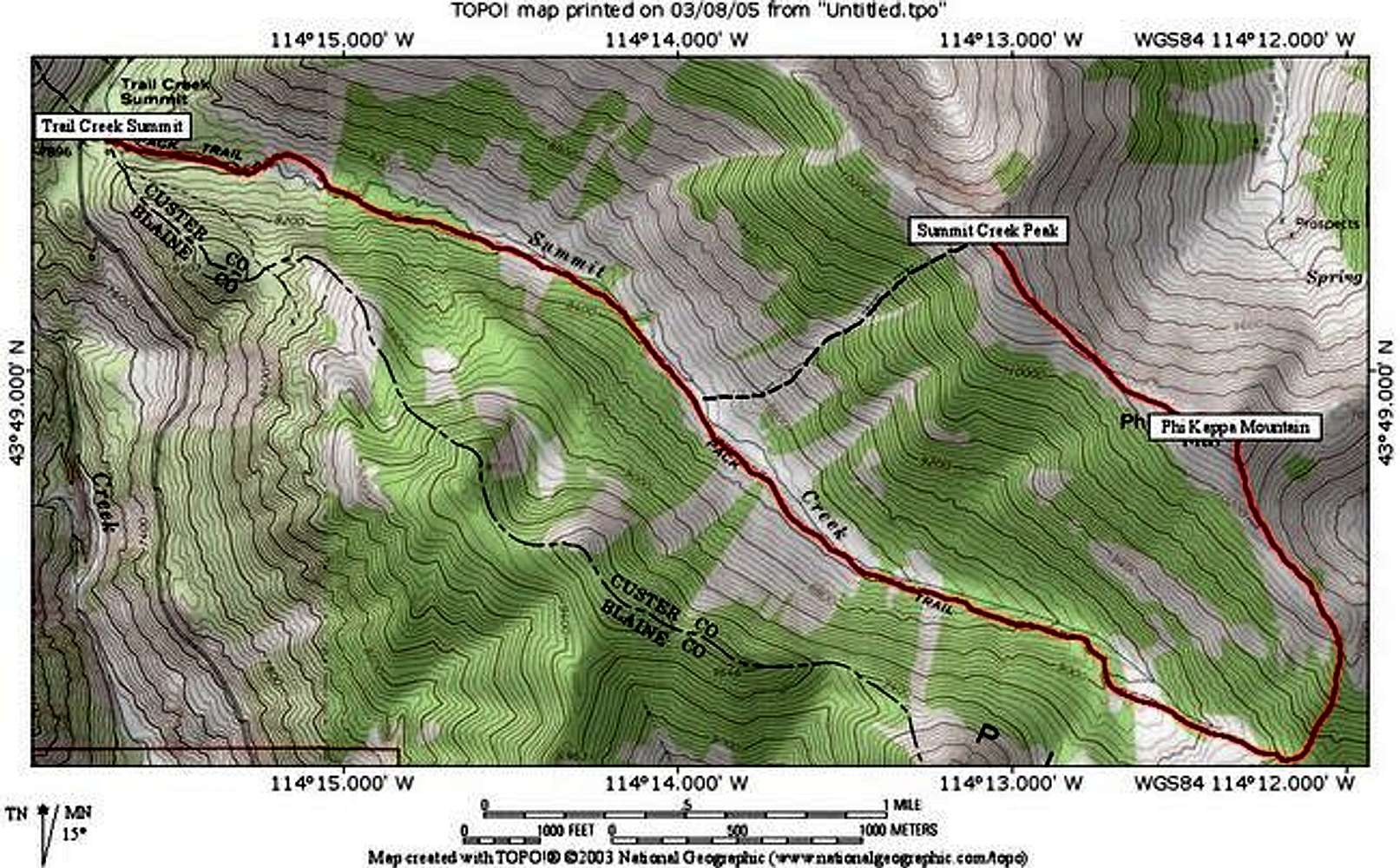
This is the topo map and route for the area. One way including the summit of Phi Kappa to Summit Creek Peak is a little more than 5 miles. The dotted black line is the recommended return descent, this will obviously save you miles.
« PREV
NEXT »
IdahoKid
on
Mar 8, 2005 1:58 pm
Comments & voting
Other parents
Lat/Lon:
43.81470°N / 114.2053°W
Image ID:
93874
3840 Hits
71.06
% Score
1
Votes
Log in to vote
Comments
No comments posted yet.
to post!
Don't have an account?
Summit Creek
(Route)
You are at
the First
Image
Viewing
#1 of 1
GALLERY
You are at
the Last
Image
IdahoKid's Image Gallery
« PREV
Viewing
#735 of 782
GALLERY
NEXT »
Phi Kappa/Summit Creek Peak
(Mountain/Rock)
Loading....
×
You need to login in order to vote!
User Name
Password
Remember me
Forgot your password?
Log me out when I close my browser.
Keep me logged in all the time.
sign in as a user
Don't have an account?
Register now for FREE
Rating available
Suggested routes for you
People who climb the same things as you
Comments Available
Create Albums
Register Here


