
-
 14788 Hits
-
 75.81% Score
-
 6 Votes
|
|
Route |
|---|---|
|
|
39.26000°N / 107.1708°W |
|
|
Mountaineering, Skiing |
|
|
Spring, Winter |
|
|
Half a day |
|
|
Overview
Mount Sopris is considered the "Gateway to the Elk Range". It towers above Carbondale, and one gets an impression it must be a fourteener. The mountain does not reach even 13,000 feet, but it is very prominent - it rises 6000 vertical feet out of the valley floor. The views from its summit are amazing.The mountain was named after Denver mayor Richard Sopris, who was responsible for leading a survey party through the Roaring Fork Valley in the 1860s. There was a petition in 2011 to rename the peak John Denver Peak after the famous singer/songwriter, but the idea was tossed out.
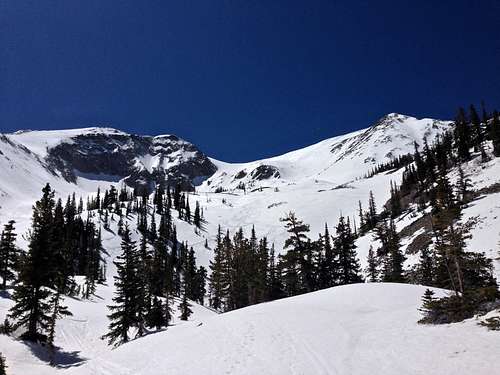
Sopris is a popular ski mountaineering destination. The ski descent is relatively easy (comparable with a black diamond run at the ski resorts with a more variable and unpredictable snow), the slope degree is about 35/30 degrees. There are more difficult ski descents on the mountain, but the most popular route - Thomas Lakes Bowl, is known for its gentle and relatively safe tours.
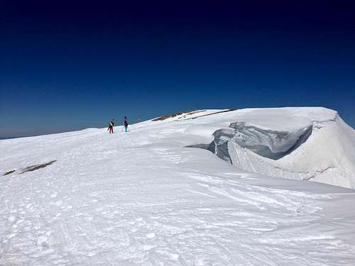
Summit of Mount Sopris
Guidebooks: Wild Snow by Louis W. Dawson
Getting There
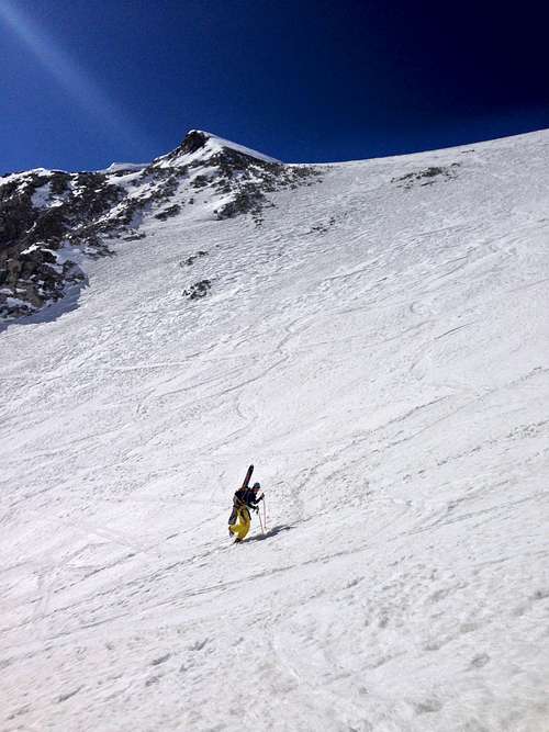
Thomas Lakes Bowl
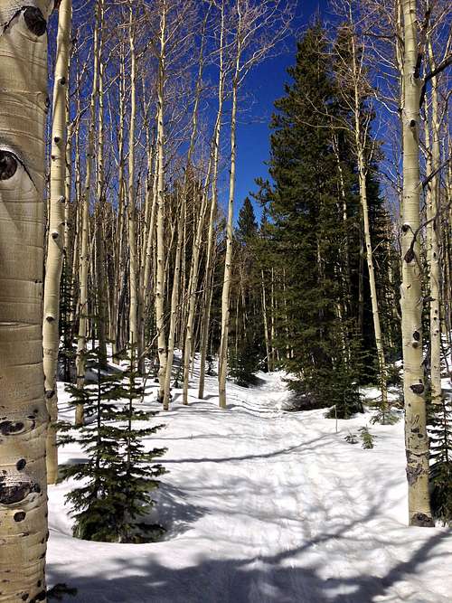
Trail to Thomas Lakes
Follow directions to the town of Carbondale: from I-70 try off on exit 116 in Glenwood Springs (a nice place to soak after your ski mountaineering). Drive 12 miles to Carbondale and take a right onto CO 133 (towards Redstone). Drive south through town of Carbondale and take a left onto Prince Creek Road. Drive ~ 9 miles, initially on a paved road, which will later change into a good dirt road. The road will be passing through some private property, but eventually you will see signs for Thomas Lake Trail/Mt.Sopris. There is a large parking lot with a vault toilet. The trailhead is obvious. There was camping along this road.
I am not sure when the road opens, but it does get plenty of sun, and I found it open mid April 2014 and easily drivable even with 2 WD vehicles.
Route Description
Elevation at the trailhead: 8,600 feetMt. Sopris elevation: 12,953 feet
Elevation Gain: 4,600 feet
Distance: 12 miles round trip
Maximum angle: 35 degrees
Best time of the year: January to mid-June
Thomas Lakes Bowl
Follow the trail (standard summer trail) marked with the trailhead sign and a nice bench to rest on, south and slightly east for a couple hundred meters. There was an obvious skin track, which I followed in am (it followed the summer trail most of the way to about 9,500 feet). The snow was frozen in early morning, so I just carried my skis and boots and moved fast in my running shoes. The trail is mostly inside the forest, there is an opening around 9,200 feet, and you finally start to get views of Mt. Sopris around 9,500 feet. Re-enter the forest again and head to the south southeast towards Thomas Lakes. If you loose your trail, find Prince Creek and it will bring you the northern Thomas lake. You will get a nice view of the wide open Thomas Lakes Bowl. The bowl is skin friendly, although many people were kicking steps in and carried their skis up. The terrains is consistently in the low 30s in steepness, perfect for throwing a few switchbacks. Eventually you will reach the summit ridge between East summit of Sopris and Point 12,453 feet. When gaining the ridge, be aware of cornices which form here, find a weakness and gain the ridge. Once on the ridge, continue on an easier slope for another 500 feet to gain the summit. Don't walk on the edge of the ridge since there is often an large cornice. The views from the summit are outstanding in 360 degrees.
(The standard summer route would continue somewhere to the east of the bowl following a ridge. It was not obvious at all in snow covered conditions).
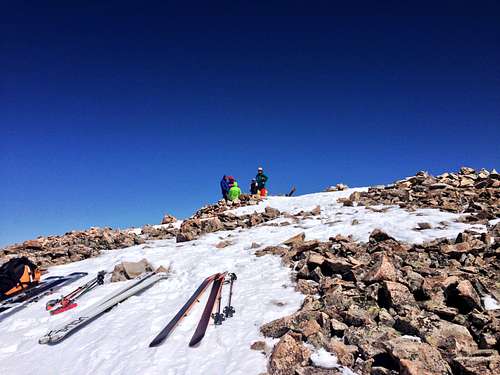
Summit party
Ski descent: Wait on the summit for the snow to soften up if it was frozen (common later in the season) on your way up. Then simply retrace your skin tracks and choose your way down. The bowl is wide and really skier's friendly. The skier's right offers a slightly steeper version, the skier's left is a little bit easier. Enjoy 3,000 feet of turns down to the lakes. When you are finished skiing the bowl, the lakes are a nice place to take a quick break and enjoy the scenery. The descent here to the parking lot is easy, much easier slopes. I was able to ski within a couple hundred of meters of my car in mid April, and 2015 was a poor snow fall year. I did have to carry my skis at a couple of places where the trail was bare of snow.
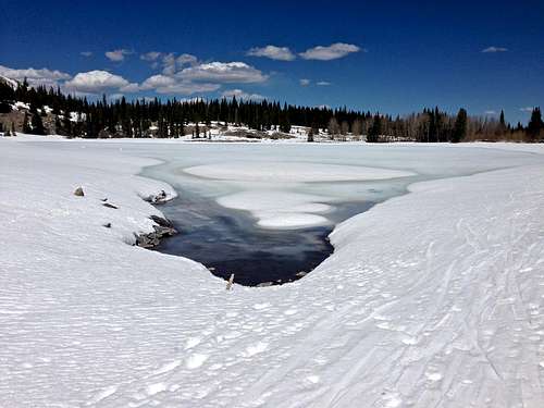
Thomas Lake
The small dark dots on the Thomas Lakes Bowl appeared so tiny, I initially thought those are trees, but then those trees were moving…then I realized there were many skiers going up the bowl, and I would have to share the mountain with many. There was a little party going on on the summit. What a day!
Essential Gear
Skis: backcountry skis (or a snowboard), you could carry up your resort skis as well. Poles. Skins for skinning up the hills, but many people boot up the hill. Consider ski crampons in icy conditions.Avalanche gear: shovel, probe and beacon