TOP OF NORTH AMERICA II-MOUNT MCKINLEY (20,320

TOP OF NORTH AMERICA II-MOUNT MCKINLEY (20,320")

In this image of the summit area of Mount Mckinley (20,320'), taken from our Cessna in july, 2007, we can see the entire "football field", Archdeacon's Tower, the North Summit (on the right), as well as the rounded true Summit (on the left). For those climbers who have climbed the peak, I am sure that you will find this 'reverse'(from your viewpoint) view interesting. Our thanks to Talkeetna Air Taxi and pilot Bill Post for some great flying.
Bernard I. Negrin
on Jun 4, 2009 2:10 pm
Image Type(s): Scenery
Image ID: 518636

Comments

Post a Comment
Viewing: 1-1 of 1
eldoradolocal

eldoradolocal - Jan 3, 2013 10:13 pm - Hasn't voted
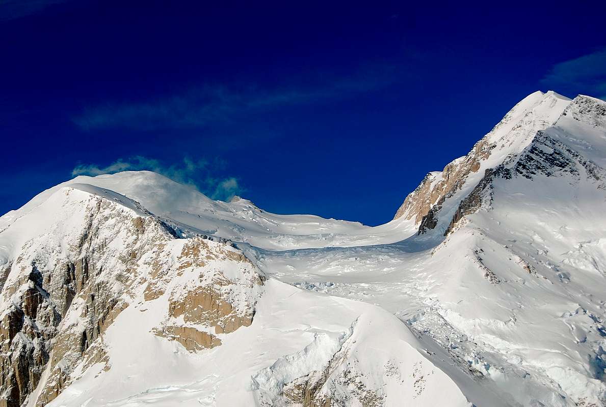
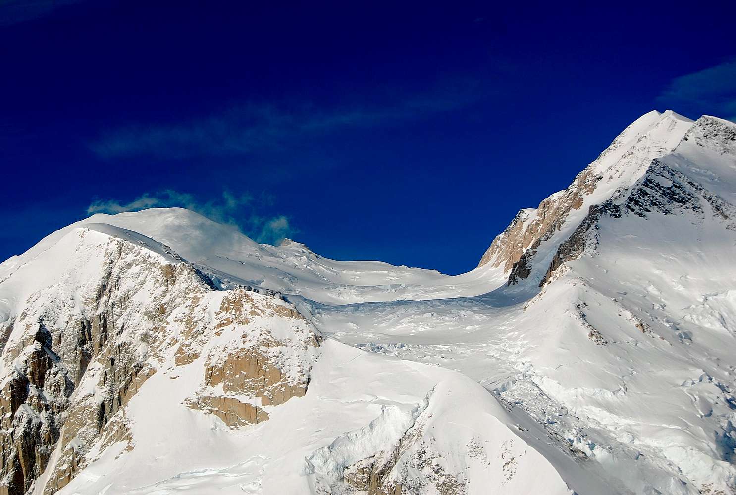
McKinley from the east

This image shows the Harper Glacier between the North Peak on the right and the South Peak on the left, with Denali Pass in the middle. The 'Football Field' is out of sight behind the South Peak. The rocky knob in the foreground is Brown's Tower, the usual site of a camp on the Muldrow Route.

Viewing: 1-1 of 1