Toggle navigation
Mountains
Routes
Images
Trip Reports
Forum
What's New
People
Areas & Ranges
Articles
Trailheads
Canyons
Huts & Campgrounds
Albums
Logistical Centers
Fact Sheets
Lists
Custom Objects
Gear
Plans & Partners
WELCOME TO SUMMITPOST
SIGN IN
REGISTER
Mount Williamson
Additional Parents
Southeast Ridge
Image
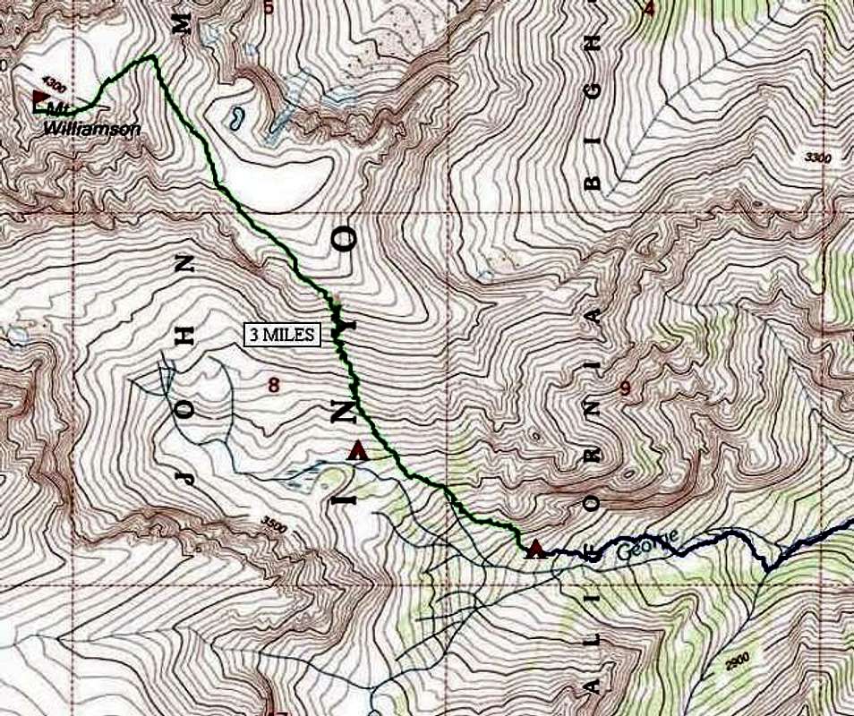
Topo Map of Southeast Ridge...
View High-Resolution Image
Topo Map of Southeast Ridge...
Topo Map of Southeast Ridge climb of Mt. Williamson. Blue line is approach, green line was summit day. The location of two excellent camp sites are shown.
« PREV
NEXT »
phomchick
on
May 18, 2002 10:50 pm
Comments & voting
Other parents
Lat/Lon:
36.65610°N / 118.3103°W
Image ID:
7196
8271 Hits
71.06
% Score
1
Votes
Log in to vote
Comments
No comments posted yet.
to post!
Don't have an account?
Mount Williamson
(Mountain/Rock)
« PREV
Viewing
#204 of 259
GALLERY
NEXT »
phomchick's Image Gallery
« PREV
Viewing
#15 of 21
GALLERY
NEXT »
Southeast Ridge
(Route)
Loading....
×
You need to login in order to vote!
User Name
Password
Remember me
Forgot your password?
Log me out when I close my browser.
Keep me logged in all the time.
sign in as a user
Don't have an account?
Register now for FREE
Rating available
Suggested routes for you
People who climb the same things as you
Comments Available
Create Albums
Register Here


