Toggle navigation
Mountains
Routes
Images
Trip Reports
Forum
What's New
People
Areas & Ranges
Articles
Trailheads
Canyons
Huts & Campgrounds
Albums
Logistical Centers
Fact Sheets
Lists
Custom Objects
Gear
Plans & Partners
WELCOME TO SUMMITPOST
SIGN IN
REGISTER
Peak X
Additional Parents
Image
Topographic map of Usable...
View High-Resolution Image
Topographic map of Usable...
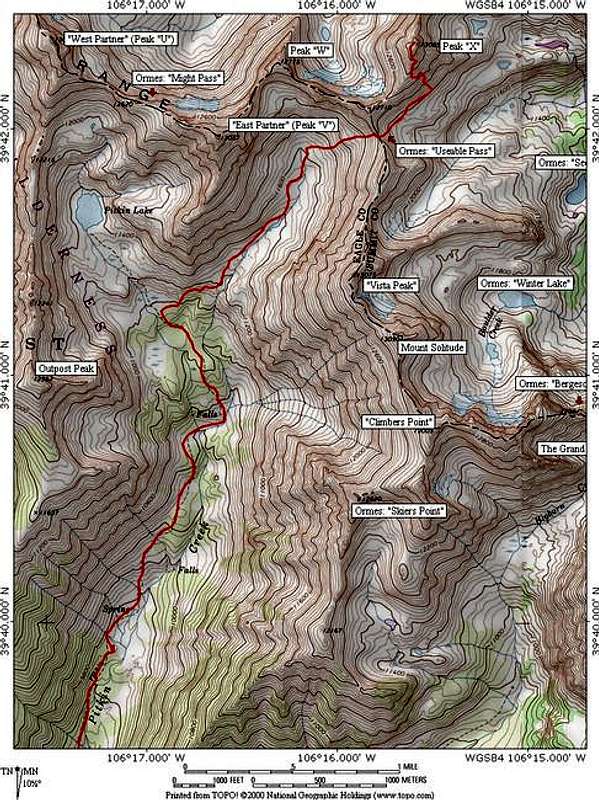
Topographic map of
Usable Pass Route
on
Peak X
. 12.8 miles roundtrip, 4,530 ft elevation gain (including a 300 ft loss on the east side of Usable Pass). Class 3. Software by National Geographic.
« PREV
NEXT »
JonBradford
on
Sep 29, 2005 7:25 pm
Comments & voting
Other parents
Lat/Lon:
39.70560°N / 106.2599°W
Image ID:
128720
3352 Hits
74.01
% Score
4
Votes
Log in to vote
Comments
No comments posted yet.
to post!
Don't have an account?
Peak X
(Mountain/Rock)
« PREV
Viewing
#16 of 22
GALLERY
NEXT »
JonBradford's Image Gallery
« PREV
Viewing
#898 of 1444
GALLERY
NEXT »
×
You need to login in order to vote!
User Name
Password
Remember me
Forgot your password?
Log me out when I close my browser.
Keep me logged in all the time.
sign in as a user
Don't have an account?
Register now for FREE
Rating available
Suggested routes for you
People who climb the same things as you
Comments Available
Create Albums
Register Here


