
|
|
Mountain/Rock |
|---|---|
|
|
40.32133°N / 7.61301°W |
|
|
Hiking, Skiing |
|
|
Spring, Summer, Fall, Winter |
|
|
6539 ft / 1993 m |
|
|
Overview
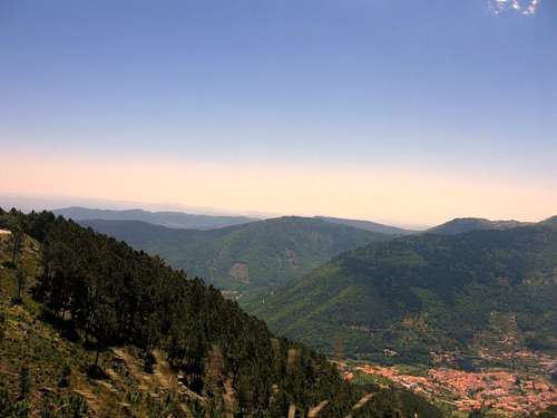
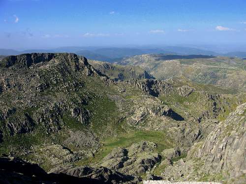 View from the highest point of Continental Portugal towards the North View from the highest point of Continental Portugal towards the North |
Torre Mountain is the highest peak on the mainland of Portugal and the second highest peak of the ‘complete’ country. Only Picos Mountain (2351m), which is located on the Azores islands, is higher. With its 1993 meters in altitude, it just fails the 2000 meter barrier (that is considered magical from a Portuguese point of view). Dom João VI was therefore unsatisfied with its height, and built a tower here in the early 19th century in order to extend the mountain to a more acceptable 2000 meters! Torre literally means Tower and is named after the Dom João Tower on the summit. Views from Torre are quite spectacular. On bright days it is possible to see the Atlantic Ocean, over 100 miles in the distance.
Torre is located in the National Park of Serra da Estrela, and is the highest point of the Serra da Estrela range, which consists of all the highest mountains on Portugal’s mainland. Torre is surrounded by some other noticeable mountains like Poios Brancos (1706m), Cantaro Raso and the steep Cantaro Magro (1926m). The summit of Torre is actually a plateau, with an area of tens of square meters.
Furthermore, there are two sad parts to be noted: First, Torre is home to the countries only ski facility, which is located on the edge of the mountain. Secondly, a paved road leads up to the summit of Torre, all the way from the village of Manteigas. Therefore, the highest point on the mainland of Portugal, can be reached by car. Although accessible by car, there are some nice hiking routes up and around the mountain, which makes visiting Torre after all a worthwhile effort.
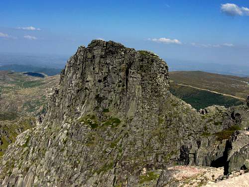 View of Cantaro Magro (1926m) from Torre View of Cantaro Magro (1926m) from Torre |
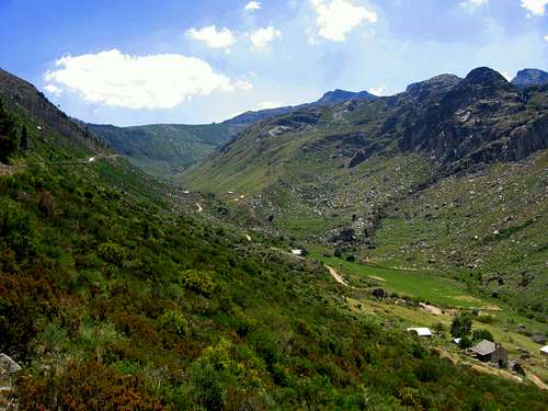 Zezere valley with Torre at right Zezere valley with Torre at right |
 View of Torre from Poios brancos View of Torre from Poios brancos |
Getting to the Summit

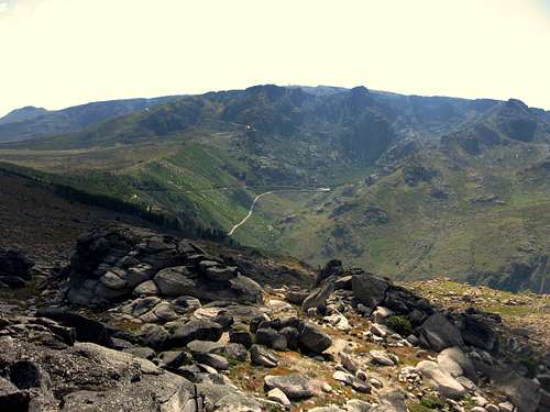
Torre view towards the East

Torre view towards the North
First of all you have to access one of the main roads towards the summit of Torre. This road is called the N339 and is accessible from both sides of the Estrela National Park, namely from the north (Seia) and south (Manteigas and Covilha). To get to these places go the ‘How to get there’ section.
When you are following this N339 road you will eventually spot the Covão do Meio Lake (point ‘2’ on the Map below). Park your car somewhere close to the lake and walk towards it. From here there are two routes up to Torre, as also can be seen on the map below.
The path can be easily followed because ‘stone-men’ (piles of stones) are along the trail, marked with red paint. A suggestion is to take the western route up, and eastern route down (or the other way around). Climbing gear is not needed for this trip. It is easy hiking in the T2 grade. Still, some good mountain shoes are recommended.
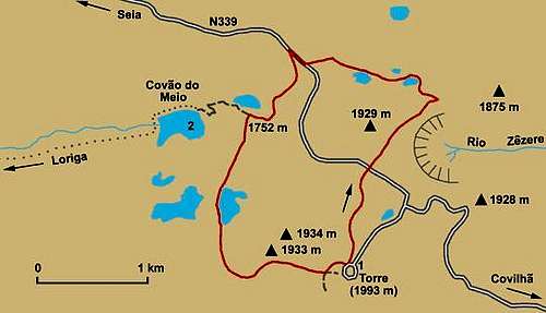 Route Map Route Map |
Maps and Practical Information

Covao do Meio
1:50.000 Carta Turistica Serra da Estrela
Other options are:
-->1:50,000 Gouveia 17D,
-->Guarda 18C and/or Covilha 20C maps,
-->1:10,000 Viseu Fl17, Guarda Fl18, Covilha fl20,
-->1:200,000 Beiras Fl14 maps.
These are available from the Instituto Geografico e Cadastral in Lisbon or regional offices in Porto, Castelo Branco and Coimbra.
Manteigas
Manteigas
Manteigas is the village closest to Torre. It is possible to visit this nice town to eat or drink something, or to spend the night.
Some info on Manteigas:
It is located inside the Estrela Park and therefore closer to the mountains. It is located at an altitude of 700 meters at the end of the famous Zezere valley, which is an ancient glacial valley. From this mountain town you have great views over the Estrela mountains. Especially the view towards Poios Brancos and the mighty Cantaro Magro are beautiful.The history of Manteigas dates from the pre-Christian era, but its first charter was granted in 1188 by King Sancho I. Obvious Typical shepherds jackets, wood carvings, tin work, sheep-skin items and granite carving are also among handicrafts that are a reflection of the past. Other flavors from the past and the mountains can be savored in the roast kid, mountain style stew, bean stew trout, smoked sausages, whey cheese, Serra cheese, milk cakes and Crista cakes, "cavacas" (a kind of hard, sweet cake or biscuit) and "queijadas" (a type of cheese-cake).
Although somewhat further away: Seia and Covilha are also good destinations when planning a trip to Torre.
![Portugal Map]()
Access Map Portugal
![Google MAP of Torre Region]()
Overview MAP
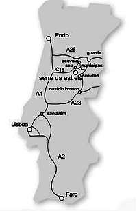
The main access routes by car are: (See Map at left)
Although somewhat further away: Seia and Covilha are also good destinations when planning a trip to Torre.
How to get there
Access Map Portugal

Overview MAP
The main access routes by car are: (See Map at left)
The A25 highway when you are coming from Porto
THe A1 and IC 16 when you are coming from Lisbon
The A2 and A23 when you are coming from Faro
The A23 when you are coming from Spain
Distances:
Lisboa – Manteigas: 315 km (3h45)
Porto – Manteigas: 200 km (2h50)
Coimbra - Manteigas: 131 Km (2h10)
Faro – Manteigas: 548 km (5h45)
Vilar Formoso - Manteigas: 105 Km (1h30)
Visitors Centers
1)Rua 1º de Maio, 2
6260-101 MANTEIGASTel.: (351) 275 980060/1
Fax: (351) 275 980069
e-mail: pnse@icn.pt
2)Pr. da República, 28
6270-496 SEIATel.: (351) 238 310 440
Fax. (351) 238 310 441
3)Casa da Torre, Av. Bombeiros Voluntários, 8
6290-520 GOUVEIATel.: (351) 238 492 411
Fax. (351) 238 494 183
4)R. D. Sancho I, 3
6300-548 GUARDATel.: (351) 271 225 454
Camping/ Hotels

Torre
The following links are of two nearby campgrounds:
Camping Cegonhas
Camping Quintadacera
There are some hotels in the area, especially in Covilha. (www.booking.com)