Toggle navigation
Mountains
Routes
Images
Trip Reports
Forum
What's New
People
Areas & Ranges
Articles
Trailheads
Canyons
Huts & Campgrounds
Albums
Logistical Centers
Fact Sheets
Lists
Custom Objects
Gear
Plans & Partners
WELCOME TO SUMMITPOST
SIGN IN
REGISTER
Thunderhead Mountain
Additional Parents
Image
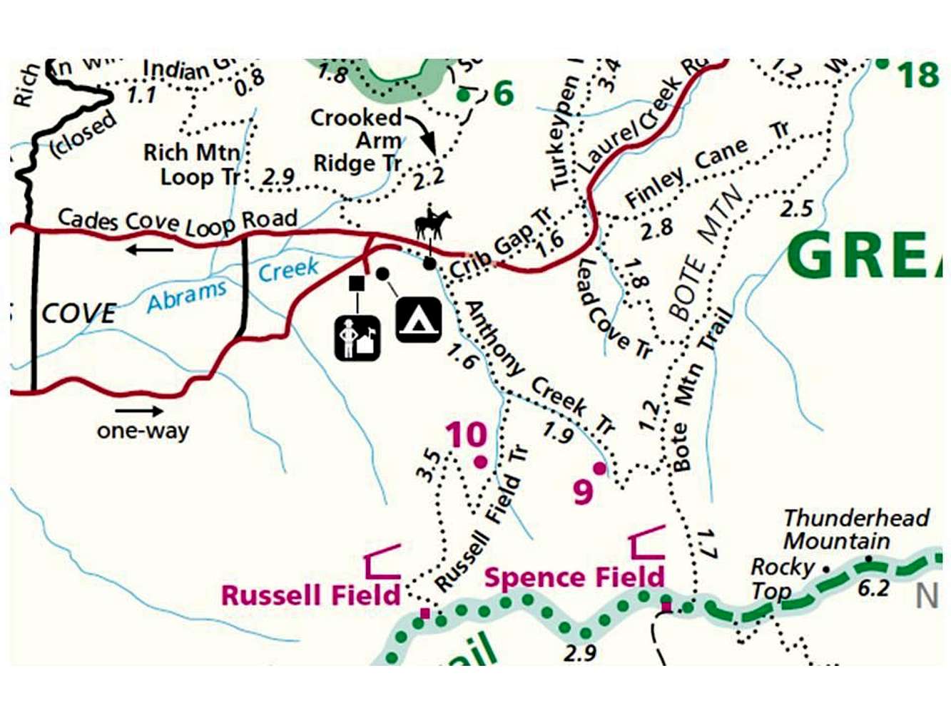
Trail Map for Thunderhead Mountain
View High-Resolution Image
Trail Map for Thunderhead Mountain
This map shows the series of connecting trails for reaching Thunderhead Mountain from Cades Cove: Anthony Creek Trail to Bote Mountain Trail to the Appalachian Trail. Copied from the NPS Great Smoky Mountains National Park Hiking Map.
« PREV
NEXT »
MarkDidier
on
Oct 24, 2010 1:39 pm
Comments & voting
Other parents
Image Type(s):
Topo/Diagram
Image ID:
673855
8339 Hits
74.01
% Score
4
Votes
Log in to vote
Comments
No comments posted yet.
to post!
Don't have an account?
Thunderhead Mountain
(Mountain/Rock)
« PREV
Viewing
#8 of 15
GALLERY
NEXT »
MarkDidier's Image Gallery
« PREV
Viewing
#346 of 1718
GALLERY
NEXT »
×
You need to login in order to vote!
User Name
Password
Remember me
Forgot your password?
Log me out when I close my browser.
Keep me logged in all the time.
sign in as a user
Don't have an account?
Register now for FREE
Rating available
Suggested routes for you
People who climb the same things as you
Comments Available
Create Albums
Register Here


